
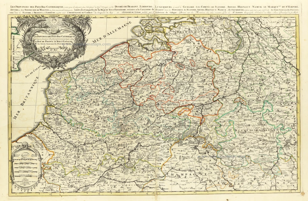
Southern Netherlands (Zuidelijke Nederlanden) by Nicolas Sanson, published by Giovanni Giacomo de Rossi. 1677

de Rossi Family
Seventeenth-century Rome was home to the famous publishing house of de Rossi. Two branches of the family used the addresses in Piazza Navona and Piazza della Pace; the latter was the more important house. Giuseppe de Rossi founded the house in 1613 and continued until he died in 1639. Giovanni Giacomo de Rossi flourished from 1649 to 1691. In 1677, he published a folio atlas titled Mercurio Geografico. It was drawn almost entirely from the cartography of the Sanson family in Paris. Whether it was with their permission or simple plagiarism is unknown, but they are credited. (Burden)
Giuseppe Rossi (flourished 1613-1639), Publisher at 'Piazza della Pace'.
Giovanni Giacomo de Rossi (1627-1691), Printer and publisher at 'Alla Pace all'insegna di Parigi', Rome.
Domenico de Rossi (flourished c. 1691-c. 1720), Successor to Giovanni Giacomo Rossi.
Lorenzo Filippo Rossi (flourished c. 1720-1738). Successor to Domenico.
In 1738, the Rossi plates were sold to the government of the Papal States.
SANSON FAMILY
Nicolas Sanson (1600-1667) - Guillaume Sanson (1633-1703) - Pierre Moullart-Sanson (? -1730)
Originally from Abbeville, Nicolas I Sanson showed a keen interest in historical geography. He was still very young; he published a map of ancient Gaul and two treatises, Britannia and Portus Itius on Abbeville and Boulogne's origins. His meeting with Melchior Tavernier was decisive: it prompted him to give up his duties as a military engineer in Picardy and devote himself to engraved cartography.
At the same time, Sanson had drawn up the outline of modern France. He got the help of Tavernier, who encouraged him to compete with the Dutch map publishers. Tavernier contacted other French cartographers whose works he published.
From 1643, N. Sanson obtained a privilege to publish a work personally, the Princes souverains de l'Italie. Then, in 1644 and 1645, he had his famous geographical tables printed, which significantly contributed to his fame. He also published a series of atlases in quarto of the four continents.
In 1648, N. Sanson associated himself with Mariette to publish atlases. From then on, specific maps bore his name and others Mariette's. N. Sanson and Mariette worked together for more than 20 years. After the death of N. Sanson, Mariette acquired the entire fund. Since Mariette only wanted to publish complete atlases, individual maps were no longer sold, and some army generals complained to the king.
The disagreement between the Sanson family and Pierre II Mariette culminated in 1671 when Guillaume Sanson took the case to court. There was no longer any question of collaboration: Guillaume Sanson started working for another publisher, Alexis-Hubert Jaillot.
The Sanson family faced financial difficulties, and in 1692, their cousin, Pierre Moullart-Sanson, bought the entire geographic fund from his uncles and aunt. Pierre Moullart-Sanson was the son of Françoise Sanson (third child of Nicolas) and Pierre Moullart. He restarted the publishing of Sanson's world atlas, and in 1704 he acquired a privilege for publishing all the works of Nicolas and Guillaume Sanson, which continued to be published until 1730.
Provincie Meridionali de Paesi Bassi, Intese sotto nome di Fiandra ouero Li Paesi Bassi Cattolici, con li confini di Francia, di Allemagna, e di Hollandia.
Item Number: 32903 Authenticity Guarantee
Category: Antique maps > Europe > Belgium
Southern Netherlands (Zuidelijke Nederlanden) by Nicolas Sanson, published by Giovanni Giacomo de Rossi.
Title: Provincie Meridionali de Paesi Bassi, Intese sotto nome di Fiandra ouero Li Paesi Bassi Cattolici, con li confini di Francia, di Allemagna, e di Hollandia.
Descritte da Nicolo Sansone Geografo del Rè Christ.mo e nuovamente intagliate da Giorgio Widman.
Stampate con diligenza, e cura da Gio. Giacomo Rossi in Roma, alla Pace, con licenza de Superiori. 1672
Engraver: Georgio Widman.
Date: 1677.
Date on map: 1672.
Copper engraving, printed on paper.
Image size: 365 x 505mm (14¼ x 20 inches).
Sheet size: 475 x 605mm (18¾ x 23¾ inches).
Verso: Blank.
Condition: Original coloured in outline, some stains.
Condition Rating: A+
From: Mercurio Geografico overo Guida Geografica in Tutte le Parti di Mondo Conforme le Tavoile Geogrfiche del Sansone Baudrand e Cantelli. Data in luce con direttione, e cura di G.G. de Rossi. Rome, 1677.
de Rossi Family
Seventeenth-century Rome was home to the famous publishing house of de Rossi. Two branches of the family used the addresses in Piazza Navona and Piazza della Pace; the latter was the more important house. Giuseppe de Rossi founded the house in 1613 and continued until he died in 1639. Giovanni Giacomo de Rossi flourished from 1649 to 1691. In 1677, he published a folio atlas titled Mercurio Geografico. It was drawn almost entirely from the cartography of the Sanson family in Paris. Whether it was with their permission or simple plagiarism is unknown, but they are credited. (Burden)
Giuseppe Rossi (flourished 1613-1639), Publisher at 'Piazza della Pace'.
Giovanni Giacomo de Rossi (1627-1691), Printer and publisher at 'Alla Pace all'insegna di Parigi', Rome.
Domenico de Rossi (flourished c. 1691-c. 1720), Successor to Giovanni Giacomo Rossi.
Lorenzo Filippo Rossi (flourished c. 1720-1738). Successor to Domenico.
In 1738, the Rossi plates were sold to the government of the Papal States.
SANSON FAMILY
Nicolas Sanson (1600-1667) - Guillaume Sanson (1633-1703) - Pierre Moullart-Sanson (? -1730)
Originally from Abbeville, Nicolas I Sanson showed a keen interest in historical geography. He was still very young; he published a map of ancient Gaul and two treatises, Britannia and Portus Itius on Abbeville and Boulogne's origins. His meeting with Melchior Tavernier was decisive: it prompted him to give up his duties as a military engineer in Picardy and devote himself to engraved cartography.
At the same time, Sanson had drawn up the outline of modern France. He got the help of Tavernier, who encouraged him to compete with the Dutch map publishers. Tavernier contacted other French cartographers whose works he published.
From 1643, N. Sanson obtained a privilege to publish a work personally, the Princes souverains de l'Italie. Then, in 1644 and 1645, he had his famous geographical tables printed, which significantly contributed to his fame. He also published a series of atlases in quarto of the four continents.
In 1648, N. Sanson associated himself with Mariette to publish atlases. From then on, specific maps bore his name and others Mariette's. N. Sanson and Mariette worked together for more than 20 years. After the death of N. Sanson, Mariette acquired the entire fund. Since Mariette only wanted to publish complete atlases, individual maps were no longer sold, and some army generals complained to the king.
The disagreement between the Sanson family and Pierre II Mariette culminated in 1671 when Guillaume Sanson took the case to court. There was no longer any question of collaboration: Guillaume Sanson started working for another publisher, Alexis-Hubert Jaillot.
The Sanson family faced financial difficulties, and in 1692, their cousin, Pierre Moullart-Sanson, bought the entire geographic fund from his uncles and aunt. Pierre Moullart-Sanson was the son of Françoise Sanson (third child of Nicolas) and Pierre Moullart. He restarted the publishing of Sanson's world atlas, and in 1704 he acquired a privilege for publishing all the works of Nicolas and Guillaume Sanson, which continued to be published until 1730.
Related items

Europae (Ae) Bellonae Theatrum Magnum et Fere Perpetuum continens Brabantiam, Flandriam, Namurcum finitimasque Praefecturas ac Toparchias. c. 1730-1760
Southern Netherlands, by Petrus Schenk.
[Item number: 28008]

Carte des Pays Bas Catholiques. [Title above map:] Belgium Regium Accuratissime divisum. &c. ad usum serenissimi Burgundiae Ducis. Aythore G. De L'Isle, Geographe. ca. 1730.
Southern Netherlands by G. De L'Isle, published by Covens & Mortier.
[Item number: 28338]

Belgii Regii accuratissima Tabula. c. 1678
Southern Netherlands (Zuidelijke Nederlanden) by Nicolaes Visscher I.
[Item number: 28518]
Les provinces des Pays Bas Catholiques distinguées suivant qu'elles sont présentement partagées entre le Roy de France, le Roy d'Espagne et les Estats Genereaux des Provinces-Unies. 1692
The Southern Netherlands, by N. Sanson, so-called published by Hubert Jaillot. (Pirated edition by Pierre Mortier).
[Item number: 31720]

Li Paesi Bassi Austriaci, che comprendono Parte delle Fiandre, del Haynault, e del Brabante. 1779-1785
Austrian Netherlands, by Antonio Zatta.
[Item number: 31811]
Rare first state
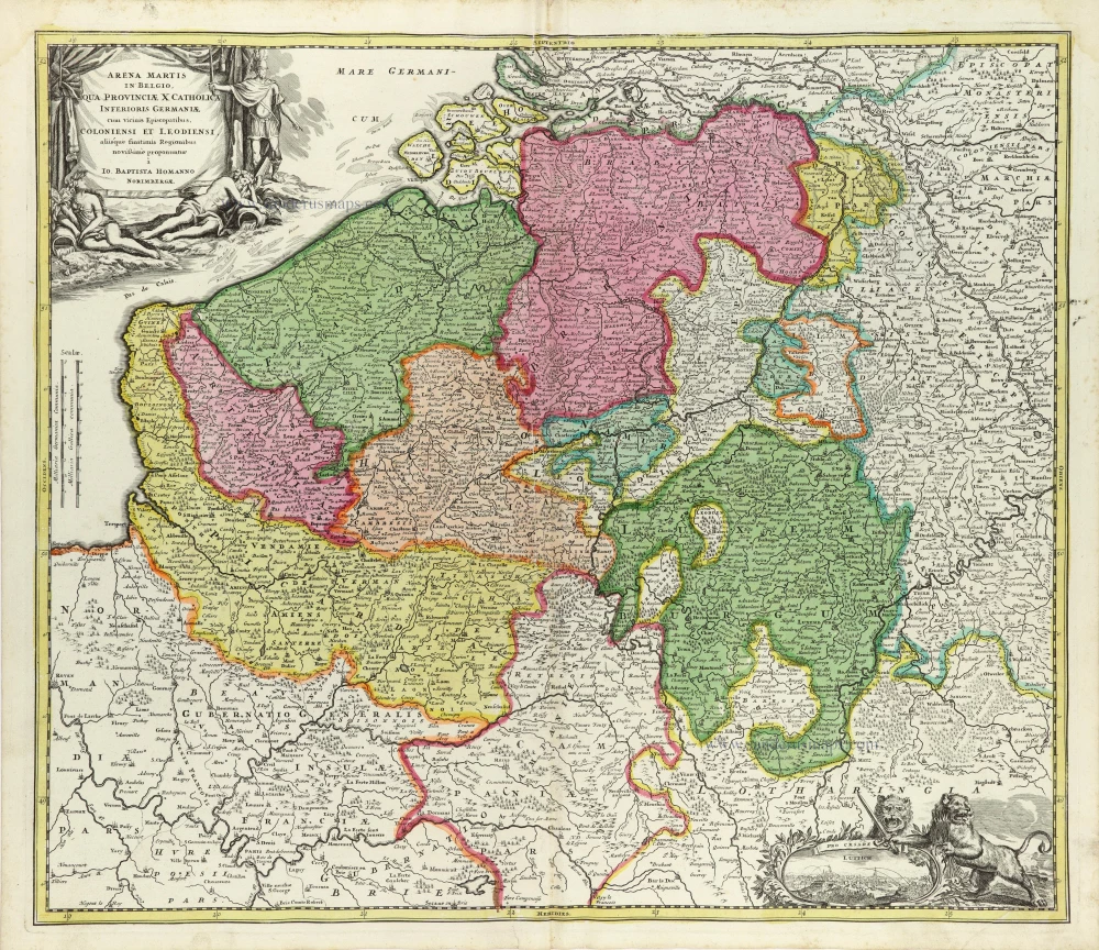
Arena Martis in Belgio, qua Provinciae X Catholica Inferioris Germaniae cum vicinis Episcopatibus, Coloniensi et Leodiensi, aliisque finitimis Regionibus novißimme proponuntue 1707
Southern Netherlands, by J.B. Homann.
[Item number: 32465]