
Austrian Netherlands, by Antonio Zatta. 1779-1785

Antonio Zatta (ca. 1722-1804)
Antonio Zatta was an influential Italian cartographer and publisher based in Venice during the 18th century. As one of the last great mapmakers of the Italian Enlightenment, Zatta played a crucial role in preserving and advancing the art of cartography at a time when Venice's status as a centre for mapmaking was in decline.
Little is known about his early life, but Zatta established himself as a prolific publisher and printer, producing a wide range of works including atlases, city plans, and historical maps. His most celebrated achievement is the Atlante Novissimo, published between 1775 and 1785. This monumental four-volume atlas is considered one of the finest Italian cartographic productions of its time. It combined contemporary geographical knowledge with elegant artistry, featuring detailed hand-coloured maps, elaborate title cartouches, and decorative embellishments characteristic of the late Baroque style.
Zatta’s work is notable for incorporating the latest geographical discoveries alongside classical and historical information, reflecting the Enlightenment's emphasis on reason, exploration, and empirical knowledge. He published maps covering all parts of the known world, including detailed representations of Europe, the Americas, and Asia, often updating older cartographic models with new data from explorers and diplomats.
Among his notable contributions is one of the earliest printed maps depicting the newly independent United States after the American Revolutionary War. Zatta's 1778 map, "Gli Stati Uniti della America Settentrionale," adapted English and French sources, marking a significant moment in the cartographic recognition of the United States.
Antonio Zatta's legacy endures through the beauty and precision of his maps, which continue to be prized by collectors and historians alike for their artistic merit and historical value. His works offer a window into the geographical understanding and visual culture of the 18th century, securing his place among the notable figures of cartographic history.
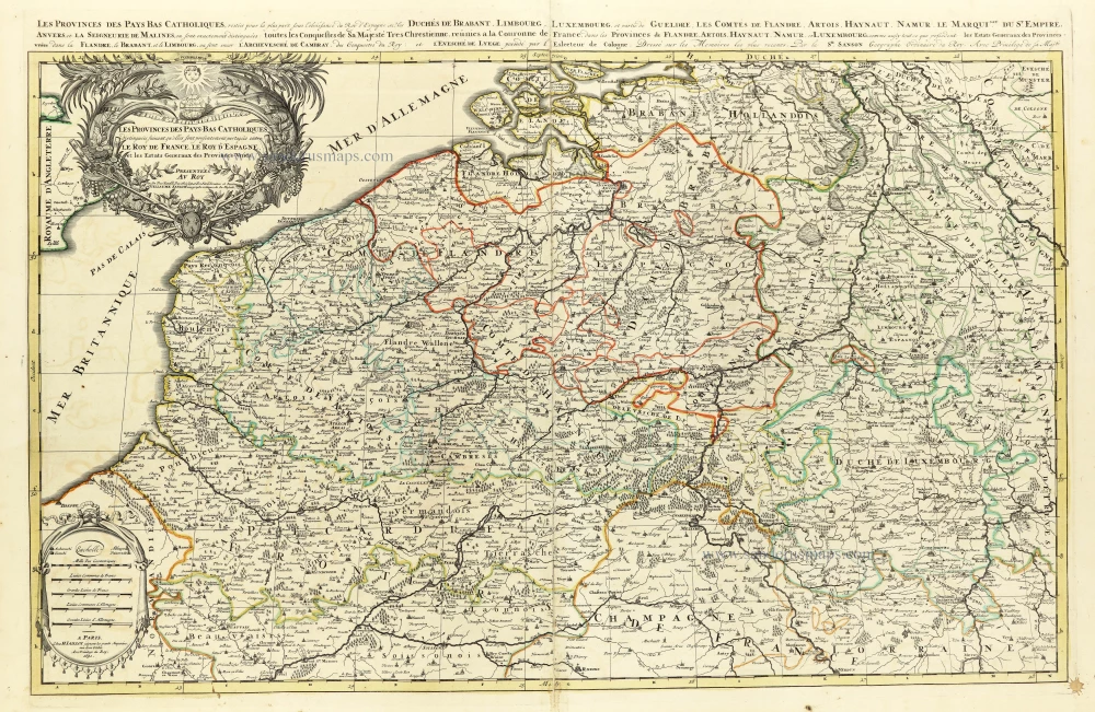
Li Paesi Bassi Austriaci, che comprendono Parte delle Fiandre, del Haynault, e del Brabante.
Item Number: 31811 Authenticity Guarantee
Category: Antique maps > Europe > Belgium
Austrian Netherlands, by Antonio Zatta.
Title: Li Paesi Bassi Austriaci, che comprendono Parte delle Fiandre, del Haynault, e del Brabante.
Di Nuova Projezione.
Venezia 1780 | Presso Antonio Zatta.
Con Privilegio dell' Eccmo Senato.
G. Zuliani inc. G. Pitteri scri.
Engravers: Giuliano Zuliani & Giovanni Pitteri.
Date of the first edition: 1779-1785.
Date of this map: 1779-1785.
Date on map: 1780.
Copper engraving, printed on paper.
Image size: 320 x 415mm (12½ x 16¼ inches).
Sheet size: 385 x 500mm (15¼ x 19¾ inches).
Verso: Blank.
Condition: Original coloured, excellent.
Condition Rating: A+.
From: Atlante novissimo, illustrato ed accresciuto sulle osservazioni, e scoperte fatte dai più celebri e più recenti geografi, che ora per la prima volta si produce. Venice, Antonio Zatta, 1779-1785.
Antonio Zatta (ca. 1722-1804)
Antonio Zatta was an influential Italian cartographer and publisher based in Venice during the 18th century. As one of the last great mapmakers of the Italian Enlightenment, Zatta played a crucial role in preserving and advancing the art of cartography at a time when Venice's status as a centre for mapmaking was in decline.
Little is known about his early life, but Zatta established himself as a prolific publisher and printer, producing a wide range of works including atlases, city plans, and historical maps. His most celebrated achievement is the Atlante Novissimo, published between 1775 and 1785. This monumental four-volume atlas is considered one of the finest Italian cartographic productions of its time. It combined contemporary geographical knowledge with elegant artistry, featuring detailed hand-coloured maps, elaborate title cartouches, and decorative embellishments characteristic of the late Baroque style.
Zatta’s work is notable for incorporating the latest geographical discoveries alongside classical and historical information, reflecting the Enlightenment's emphasis on reason, exploration, and empirical knowledge. He published maps covering all parts of the known world, including detailed representations of Europe, the Americas, and Asia, often updating older cartographic models with new data from explorers and diplomats.
Among his notable contributions is one of the earliest printed maps depicting the newly independent United States after the American Revolutionary War. Zatta's 1778 map, "Gli Stati Uniti della America Settentrionale," adapted English and French sources, marking a significant moment in the cartographic recognition of the United States.
Antonio Zatta's legacy endures through the beauty and precision of his maps, which continue to be prized by collectors and historians alike for their artistic merit and historical value. His works offer a window into the geographical understanding and visual culture of the 18th century, securing his place among the notable figures of cartographic history.
Related items

Europae (Ae) Bellonae Theatrum Magnum et Fere Perpetuum continens Brabantiam, Flandriam, Namurcum finitimasque Praefecturas ac Toparchias. c. 1730-1760
Southern Netherlands, by Petrus Schenk.
[Item number: 28008]

Carte des Pays Bas Catholiques. [Title above map:] Belgium Regium Accuratissime divisum. &c. ad usum serenissimi Burgundiae Ducis. Aythore G. De L'Isle, Geographe. ca. 1730.
Southern Netherlands by G. De L'Isle, published by Covens & Mortier.
[Item number: 28338]

Belgii Regii accuratissima Tabula. c. 1678
Southern Netherlands (Zuidelijke Nederlanden) by Nicolaes Visscher I.
[Item number: 28518]

Belgica in Provincias Quatuor, et Populos viginti, aut circiter distincta: et in ea Romana Iteneraria ex Tabula Peutingeriana et ex Antonino accuratè descripta. 1676
Ancient Belgium by Nicolas Sanson.
[Item number: 30032]
Les provinces des Pays Bas Catholiques distinguées suivant qu'elles sont présentement partagées entre le Roy de France, le Roy d'Espagne et les Estats Genereaux des Provinces-Unies. 1692
The Southern Netherlands, by N. Sanson, so-called published by Hubert Jaillot. (Pirated edition by Pierre Mortier).
[Item number: 31720]

Provincie Meridionali de Paesi Bassi, Intese sotto nome di Fiandra ouero Li Paesi Bassi Cattolici, con li confini di Francia, di Allemagna, e di Hollandia. 1677
Southern Netherlands (Zuidelijke Nederlanden) by Nicolas Sanson, published by Giovanni Giacomo de Rossi.
[Item number: 32903]