
Antique map of Gent by Seutter M. 1780

Matthäus Seutter (Augsburg, 1678 - 1757)
Matthäus Seutter was an engraver, globe maker and map publisher in Augsburg. He apprenticed as an engraver to publisher J.B. Homann in Nuremberg in 1697. He returned to Augsburg c. 1707 and set up his own map publishing house, which became a primary competitor of the Homann company. As a result, most of Seutter's maps were based upon, if not copies, earlier work done by the Homann and Delisle firms.
Karl VI awarded him the title of Imperial Geographer in 1731.
Nouveau et exact dessein de la Ville de Gent
Item Number: 23531 Authenticity Guarantee
Category: Antique maps > Europe > Belgium
Bird's-eye view plan of Gent (above), and panoramic prospect (below) by Seutter M.
Title: Nouveau et exact dessein de la Ville de Gent
Cartographer: J.M. Probst.
Date: 1780.
Copper engraving, printed on paper.
Size (not including margins): 520 x 560mm (20.47 x 22.05 inches).
Verso: Blank.
Condition: Old coloured, panoramic view later coloured.
Condition Rating: A.
From: Atlas Novus. Augsburg, c. 1780.
Matthäus Seutter (Augsburg, 1678 - 1757)
Matthäus Seutter was an engraver, globe maker and map publisher in Augsburg. He apprenticed as an engraver to publisher J.B. Homann in Nuremberg in 1697. He returned to Augsburg c. 1707 and set up his own map publishing house, which became a primary competitor of the Homann company. As a result, most of Seutter's maps were based upon, if not copies, earlier work done by the Homann and Delisle firms.
Karl VI awarded him the title of Imperial Geographer in 1731.
Related items
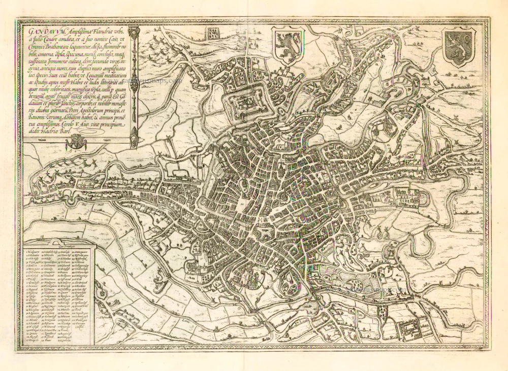
Gandavum, Amplißima Flandria Urbs ... 1657
Ghent (Gent) by Georg Braun & Frans Hogenberg, published by Johannes Janssonius.
[Item number: 2687]
With 'Gravensteen'.
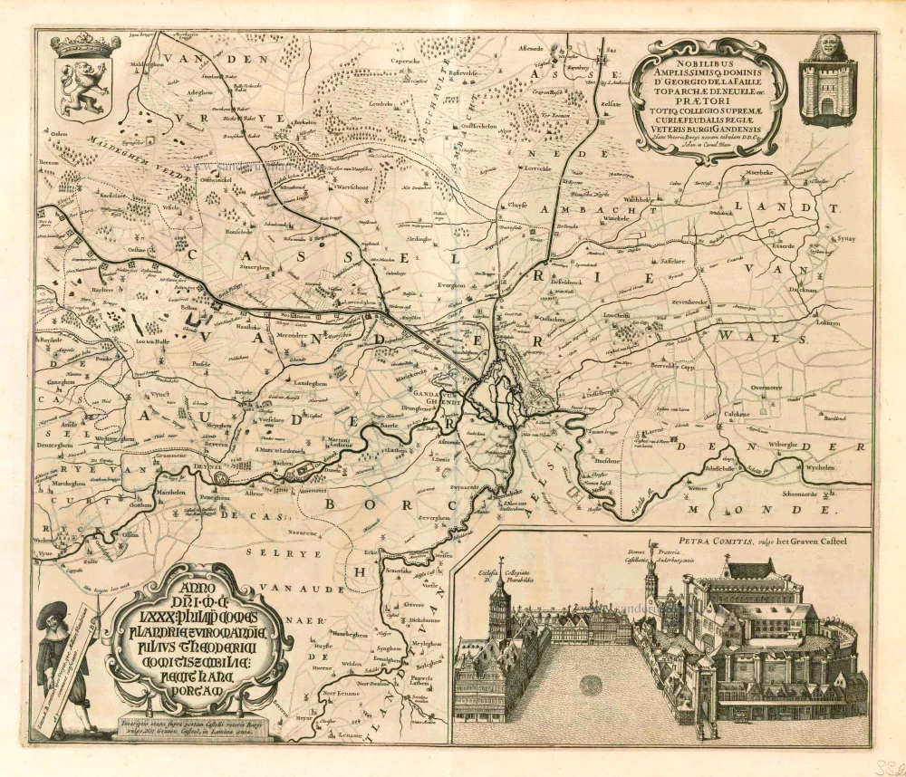
Hanc Veteris Burgis novam tabulam. 1641-1644
Ghent (Gent), by A. Sanderus.
[Item number: 5533]
Rare.
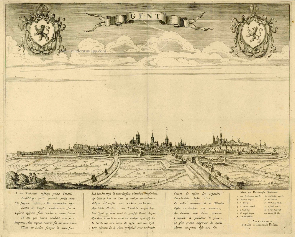
Gent. c. 1660
Gent, by Focken Hendrick
[Item number: 21312]

Rare.
Gent ca. 1650
Gent by Schnitzer Lucas
[Item number: 21998]
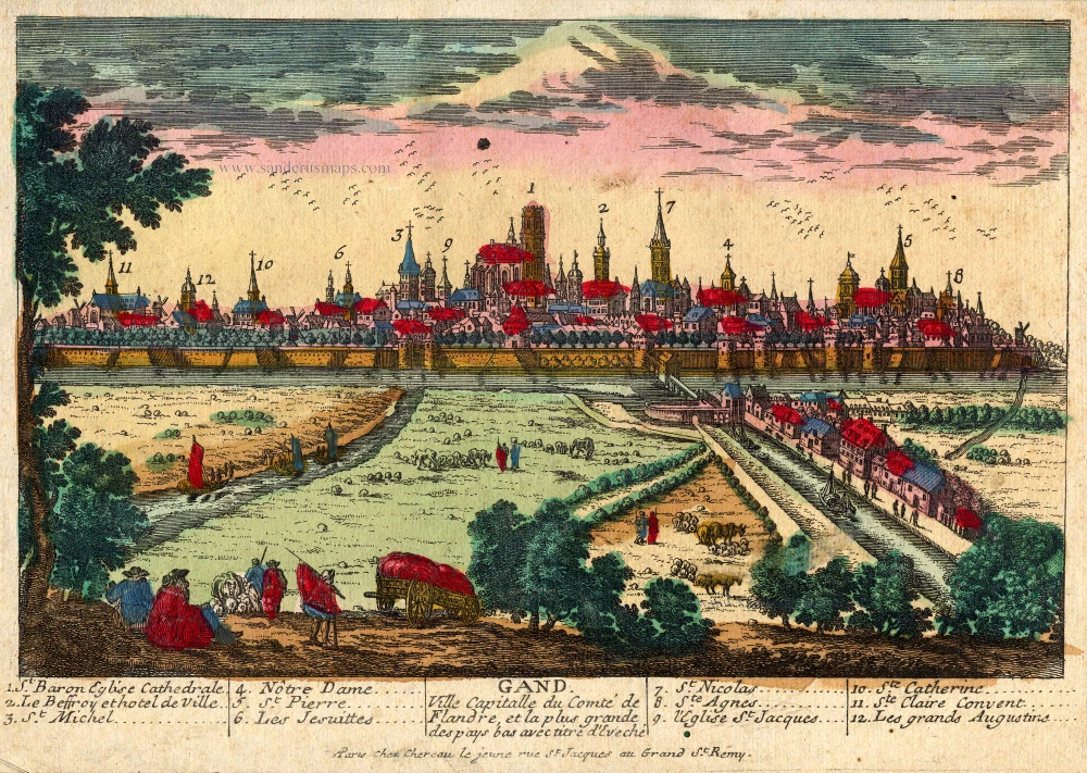
Gand. Ville Capitalle du Comté de Flandre, et la plus grande des pays bas avec titre d'Eveché c. 1720
Gent, by Chéreau.
[Item number: 22537]