
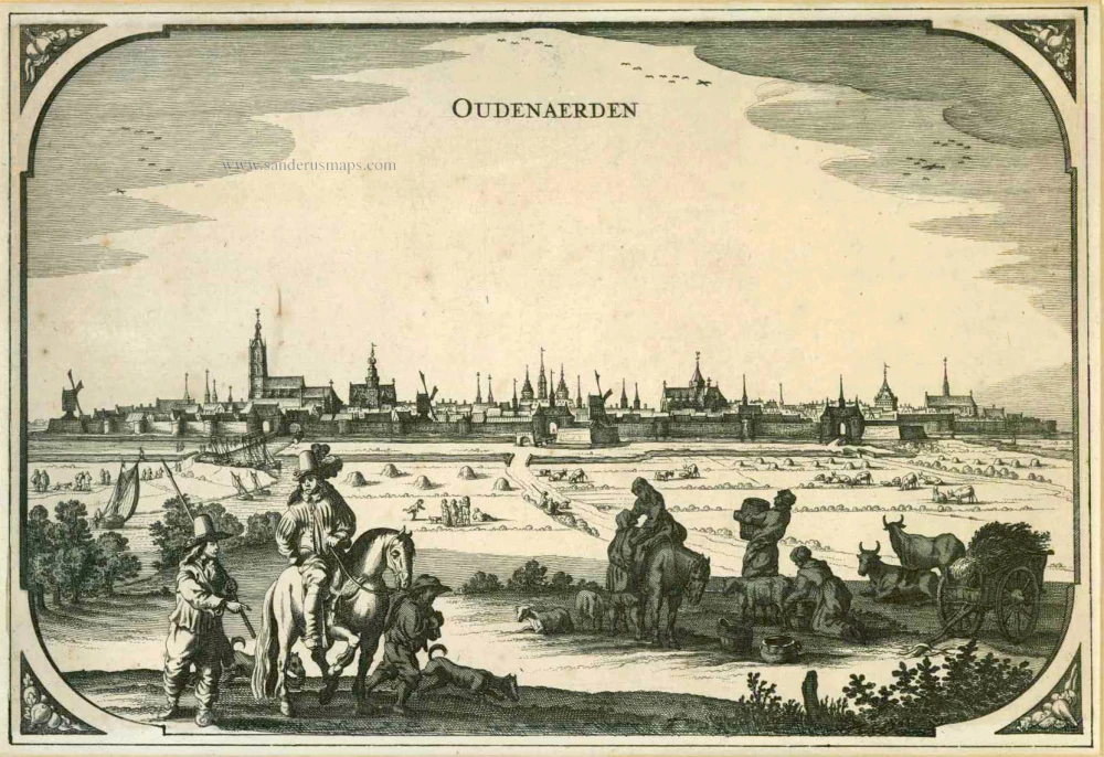
Oudenaarde by Eugène Fricx. 1712

Fricx Eugène (1644-c.1740)
The bookseller and printer Eugène Henri Fricx was one of the most crucial map publishers of the Southern Netherlands in the 18th century. He lived in Brussels, where he had his shop on the Rue de la Madeleine. His activities in this field began in 1706 with the production of military plans of battles and sieges during the War of Succession. In the same year, he also began publishing the map of the Southern Netherlands in 24 sheets; it was finished in 1712, except for the sheet of Luxembourg, which was engraved in 1727. He employed Jean Harrewijn of Brussels as an engraver and Cornelis Marke of Middelburg as a contractor for the 'enluminators'. Although he had children, his business was not continued after his death.
Plan de la Bataille d'Oudenaerde du 11 Juillet 1708.
Item Number: 29585 Authenticity Guarantee
Category: Antique maps > Europe > Belgium
Old, antique map of the Battle of Oudenaarde by Eugène Fricx.
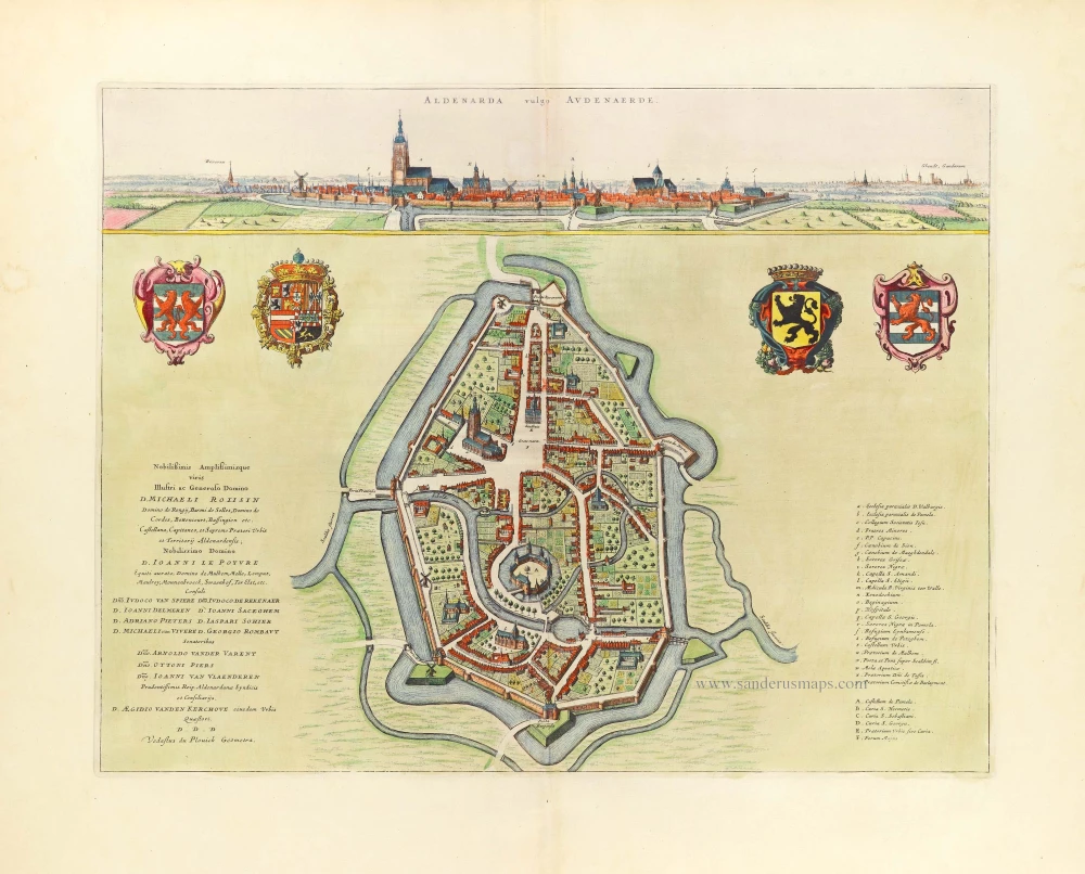
Title: Plan de la Bataille d'Oudenaerde du 11 Juillet 1708.
Levé sur lieu par G.L. Mosburger Ingénieur.
A Bruxelles, Chez Eugene Henry Fricx, Rue de la Madeleine.
Harrewyn fecit.
Cartographer: G.L. Mosburger.
Engraver: Jacques Harrewyn.
Date: 1712.
Copper engraving, printed on paper.
Map size: 495 x 600mm (19.49 x 23.62 inches).
Sheet size: 510 x 620mm (20.08 x 24.41 inches).
Verso: Blank.
Condition: Excellent, folds as issued.
Condition Rating: A+.
From: Table des cartes des Pays Bas et des Frontières de France, Avec un recueil des plans des villes, sièges et battailles données entre les Hauts Alliés et la France. Bruxelles, H. Fricx, 1712. (Koeman II, p. 109 (Fri 1)
Fricx Eugène (1644-c.1740)
The bookseller and printer Eugène Henri Fricx was one of the most crucial map publishers of the Southern Netherlands in the 18th century. He lived in Brussels, where he had his shop on the Rue de la Madeleine. His activities in this field began in 1706 with the production of military plans of battles and sieges during the War of Succession. In the same year, he also began publishing the map of the Southern Netherlands in 24 sheets; it was finished in 1712, except for the sheet of Luxembourg, which was engraved in 1727. He employed Jean Harrewijn of Brussels as an engraver and Cornelis Marke of Middelburg as a contractor for the 'enluminators'. Although he had children, his business was not continued after his death.
Related items

Audenaerde. 1659
Oudenaarde, by Matthäus Merian & Martin Zeiller.
[Item number: 2239]

Audenarde. 1726
Oudenaarde by Fassmann
[Item number: 5958]
Oudenaerden. 1656
Oudenaarde, by N. Visscher & P.H. Schut.
[Item number: 6998]

Glorieuse Batalye by Oudenaarden voorgevalletussen de Geallieerde en Franse Legers op den 11 Juli 1708. 1708
Military plan of Oudenaarde
[Item number: 25304]

Castellum de Pamele. 1652
Oudenaarde - Pamele Castle, by Joan Blaeu.
[Item number: 25576]

Spectacular view of the Siege.
Veuë de la Ville et du Siege d'Oudenarde, ou le Roy commande en personne, en lannée 1667. - Aldenardae a Rege obsessae prospectus, anno 1667. 1685
Oudenaarde by Frans Vander Meulen
[Item number: 25797]

Plan du Champ de Bataille, prés d'Oudenaerde l'11. Juillet 1708. - Plaen van de Bataille, by Oudenaerde, den 11 July 1708. c. 1709
The vicinity of Oudenaarde, by Pieter Husson.
[Item number: 27525]
Aldenarda vulgo Audenaerde. 1652
Oudenaarde by Joan Blaeu.
[Item number: 29017]

Oudenarde. - Carte du Gouvernement d'Oudenarde. - Plan de la Ville d'Oudenarde. ca. 1668
Oudenaarde by Sr. S. de Beaulieu - three plates.
[Item number: 30300]

Beverwaen [on sheet with:] Castellum de Nokere 1732
Views of the castles of Beveren-Oudenaarde & Nokere by Antonius Sanderus.
[Item number: 30760]

Castellania Aldenardensis. 1732
Casselrij Oudenaarde by Antonius Sanderus.
[Item number: 30766]

Aldenarda vulgo Audenaerde. 1732
Panoramic view and plan of Oudenaarde by Antonius Sanderus.
[Item number: 30767]

Rare Dutch text edition
Aldenarda vulgo Audenaerde. 1652
Oudenaarde by Joan Blaeu.
[Item number: 30810]

Aldenarda vulgo Audenaerde. 1652
Oudenaarde by Antonius Sanderus, published by Joan Blaeu.
[Item number: 31179]

Eglise de Pamele à Audenarde. 1823
Oudenaarde - Pamele, lithograph by Dewasme, after Séraphin Vermote.
[Item number: 32808]

Hôtel de ville d'Audenarde. 1823
Oudenaarde, lithograph by Dewasme, after Séraphin Vermote
[Item number: 33143]