
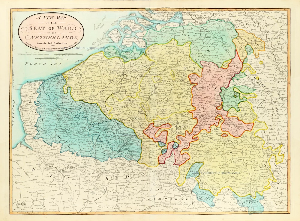
Southern Netherlands (Belgium) by Laurie & Whittle. 1796
Laurie & Whittle (flourished 1794-1812)
The Laurie family were chart, map and print publishers in London.
Robert Laurie (1755-1836) apprenticed to Robert Sayer as a mezzotint engraver. Around 1790, when the company became known as Robert Sayer & Co, he was recorded as becoming his assistant along with James Whittle. When Sayer died in 1794, Robert Laurie and James Whittle succeeded in his business interest by buying the entire stock from Sayer's son James. Robert continued with Laurie and Whittle until 1812.
Laurie & Whittle re-issued many of the Sayer publications under their own imprint; however, with the help of cartographer Louis Delarochette, hydrographer John Purdy, and others, the company also produced several new sets of maps and charts.
A New Map of the Seat of War in the Netherlands.
Item Number: 30527 Authenticity Guarantee
Category: Antique maps > Europe > Belgium
Southern Netherlands (Belgium) by Laurie & Whittle.
Title: A New Map of the Seat of War in the Netherlands.
from the best Authorities.
Published 12th May, 1794, by Laurie & Whittle N° 53 Fleet Street, London.
Date of the first edition: 1796.
Date of this map: 1796.
Date on map: 1794.
Copper engraving, printed on paper.
Image size: 475 x 645mm (18.7 x 25.39 inches).
Sheet size: 510 x 715mm (20.08 x 28.15 inches).
Verso: Blank.
Condition: Hand coloured, excellent.
Condition Rating: A+.
From: Laurie R. & Whittle J., A New Universal Atlas, Exhibiting all the Empires, Kingdoms, States, Republics, &c. in the Whole world. London, 1796. (Shirley, Brit. Lib., I, p. 647, T.LAU-1a)
Laurie & Whittle (flourished 1794-1812)
The Laurie family were chart, map and print publishers in London.
Robert Laurie (1755-1836) apprenticed to Robert Sayer as a mezzotint engraver. Around 1790, when the company became known as Robert Sayer & Co, he was recorded as becoming his assistant along with James Whittle. When Sayer died in 1794, Robert Laurie and James Whittle succeeded in his business interest by buying the entire stock from Sayer's son James. Robert continued with Laurie and Whittle until 1812.
Laurie & Whittle re-issued many of the Sayer publications under their own imprint; however, with the help of cartographer Louis Delarochette, hydrographer John Purdy, and others, the company also produced several new sets of maps and charts.
Related items
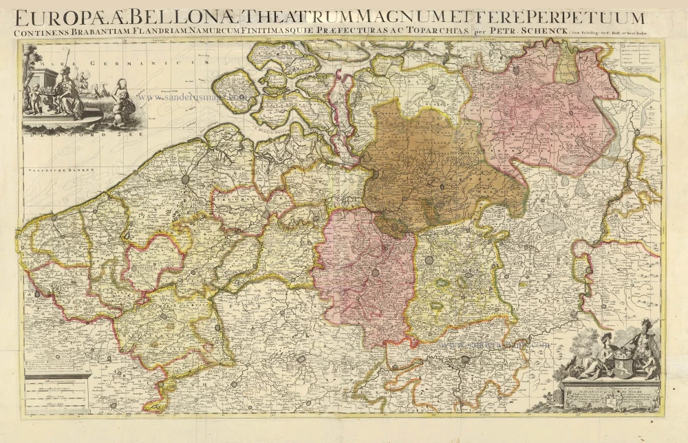
Europae (Ae) Bellonae Theatrum Magnum et Fere Perpetuum continens Brabantiam, Flandriam, Namurcum finitimasque Praefecturas ac Toparchias. c. 1730-1760
Southern Netherlands, by Petrus Schenk.
[Item number: 28008]
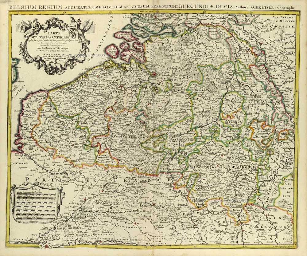
Carte des Pays Bas Catholiques. [Title above map:] Belgium Regium Accuratissime divisum. &c. ad usum serenissimi Burgundiae Ducis. Aythore G. De L'Isle, Geographe. ca. 1730.
Southern Netherlands by G. De L'Isle, published by Covens & Mortier.
[Item number: 28338]
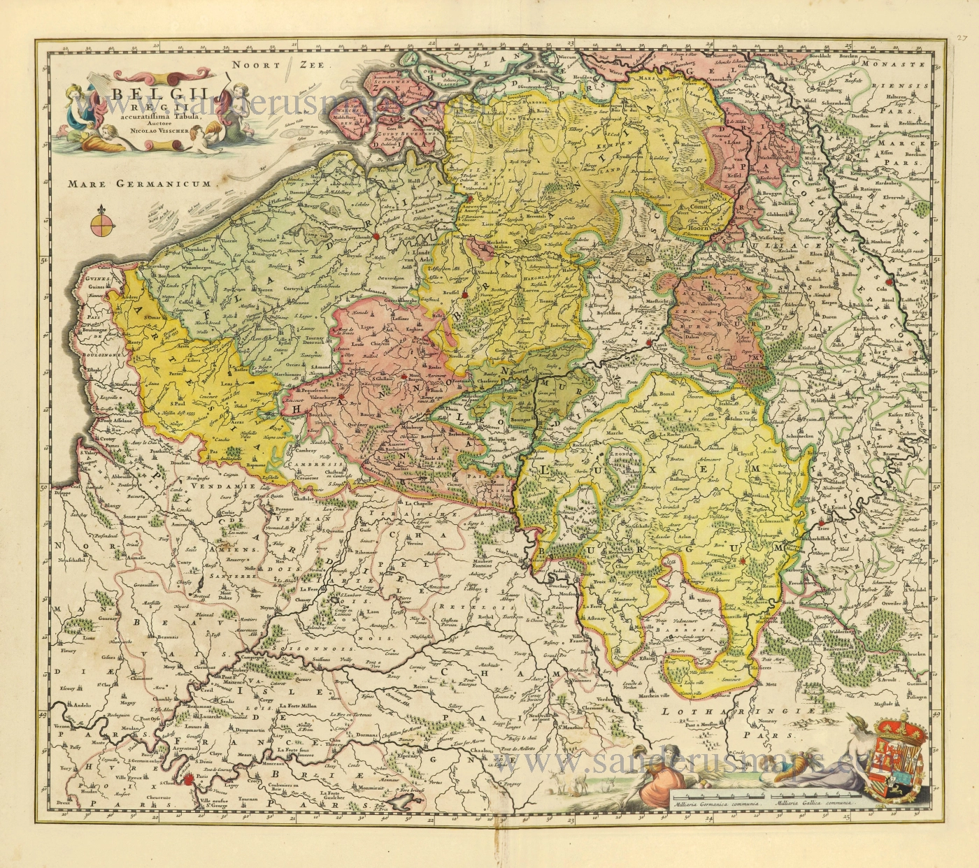
Belgii Regii accuratissima Tabula. c. 1678
Southern Netherlands (Zuidelijke Nederlanden) by Nicolaes Visscher I.
[Item number: 28518]
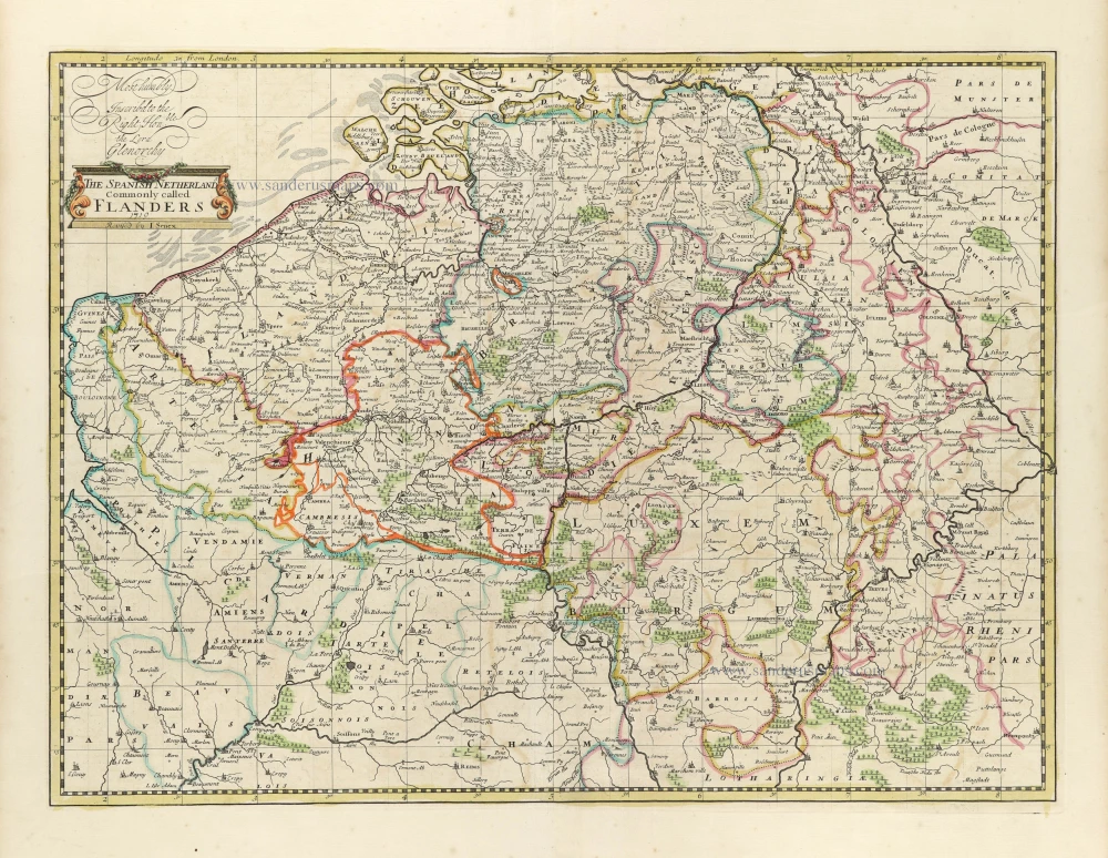
The Spanish Netherlands Commonly called Flanders. 1721
Spanish Netherlands (= Belgium) by John Senex.
[Item number: 30521]