
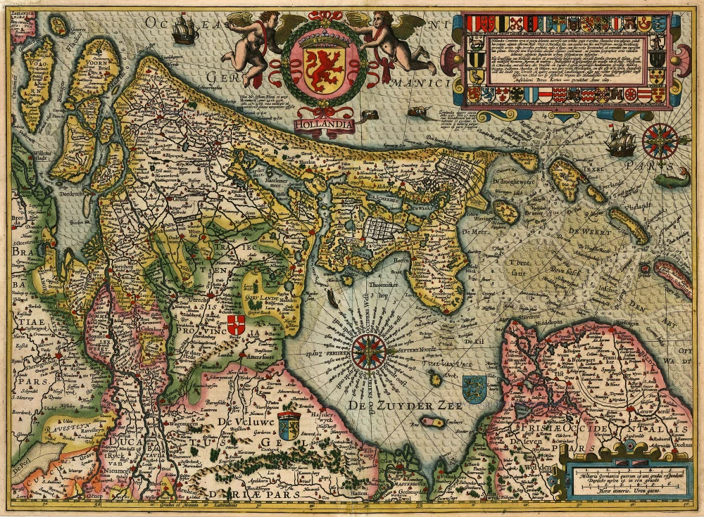
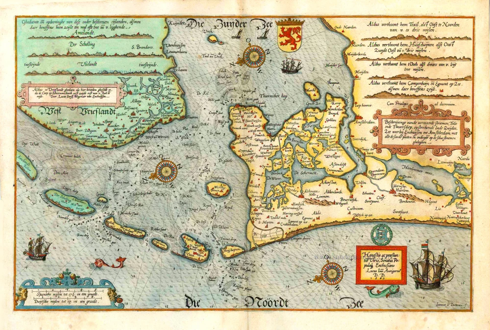
Holland by Kaerius P. 1617
The item displayed on this page has been sold. However, we have a similar map in stock:
Holland by Petrus Kaerius (Pieter Van den Keere). 1617
Hollandia.
[Item number: 30257]


Pieter Van den Keere (Petrus Kaerius) (1571-c.1650)
Pieter van den Keere was born in Ghent in 1571 as the son of the type-founder, Hendrik van den Keere. In 1584 he moved with his family for religious reasons to London. There, Van den Keere received training as an engraver from Jodocus Hondius, his brother-in-law. Not only the companionship with Jodocus Hondius but also the acquaintanceship with Pieter van den Berghe (Petrus Montanus) author of the text of the Germania Inferior originates from the years of refuge in London.
In 1593, both Keere and Hondius settled in Amsterdam. There, one of the first big enterprises was the large wall map of Europe, dated 1595: Nova totius Europae descriptio.
In 1610 he set up a workshop in the Kalverstraat that he called ‘In den onseeckeren tijd’ (In the uncertain time). In this period, he made numerous copperplates, including for maps for his atlas of the Netherlands and the Atlas Minor published by Jodocus Hondius.
The Germania Inferior (1617) is the first original atlas of the Netherlands published in folio size. The text for the atlas, both in Dutch and in French, was written by Petrus Montanus. After 1623, Claes Jansz. Visscher bought the plates and substituted his name for that of Kaerius’s. In 1634, Visscher included many of these maps in his Germana Inferior.
The fame of Kaerius is not only based on his atlas of the Netherlands. He is even better known as an engraver of many loose-leaf maps and as a collaborator of book publishers. His maps are found, i.a., in the Caert thresoor (Barent Langenes, 1598), Licht der Zeevaert (Blaeu, 1608), Atlas Minor (Hondius, 1628), and Caertboeck vande Midellandsche Zee (Barents, 1595).
Hollandia
Item Number: 24479 Authenticity Guarantee
Category: Antique maps > Europe > The Netherlands
Antique map of Holland by P. Kaerius (Van der Keere), oriented to the West
Date of the first edition: 1617
Date of this map: 1617
Copper engraving
Size: 38 x 52.5cm (14.8 x 20.4 inches)
Verso text: Latin
Condition: Old coloured, excellent.
Condition Rating: A
References: Blonk D.I., 39 State 1, Van der Krogt 3, 3400:364.
From: Petri Kaerii Germania Inferior id est, XVII Provinciarum ejus novae et exactae Tabulae Geographicae, cum Luculentis Singularum descriptionibus additis. à Petro Montano. Amsterdam, Pieter van den Keere, 1617.
Pieter Van den Keere (Petrus Kaerius) (1571-c.1650)
Pieter van den Keere was born in Ghent in 1571 as the son of the type-founder, Hendrik van den Keere. In 1584 he moved with his family for religious reasons to London. There, Van den Keere received training as an engraver from Jodocus Hondius, his brother-in-law. Not only the companionship with Jodocus Hondius but also the acquaintanceship with Pieter van den Berghe (Petrus Montanus) author of the text of the Germania Inferior originates from the years of refuge in London.
In 1593, both Keere and Hondius settled in Amsterdam. There, one of the first big enterprises was the large wall map of Europe, dated 1595: Nova totius Europae descriptio.
In 1610 he set up a workshop in the Kalverstraat that he called ‘In den onseeckeren tijd’ (In the uncertain time). In this period, he made numerous copperplates, including for maps for his atlas of the Netherlands and the Atlas Minor published by Jodocus Hondius.
The Germania Inferior (1617) is the first original atlas of the Netherlands published in folio size. The text for the atlas, both in Dutch and in French, was written by Petrus Montanus. After 1623, Claes Jansz. Visscher bought the plates and substituted his name for that of Kaerius’s. In 1634, Visscher included many of these maps in his Germana Inferior.
The fame of Kaerius is not only based on his atlas of the Netherlands. He is even better known as an engraver of many loose-leaf maps and as a collaborator of book publishers. His maps are found, i.a., in the Caert thresoor (Barent Langenes, 1598), Licht der Zeevaert (Blaeu, 1608), Atlas Minor (Hondius, 1628), and Caertboeck vande Midellandsche Zee (Barents, 1595).
Related items
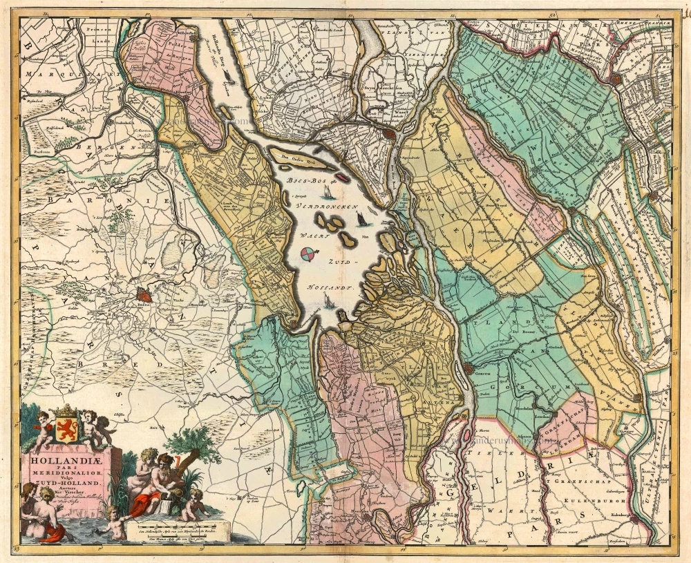
Hollandiae pars Meridionalis, vulgo Zuyd-Holland 1683-1696
Holland (South), by N. Visscher.
[Item number: 10962]
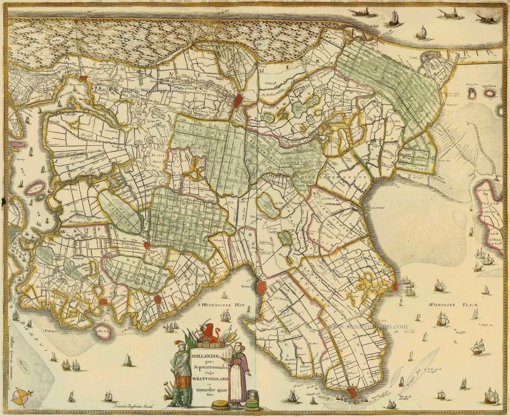
Hollandiae pars Septentrionalis, vulgo Westvriesland en 'tnoorder Quartier 1652-53
Holland (North) by Janssonius J. - Hondius H.
[Item number: 13205]
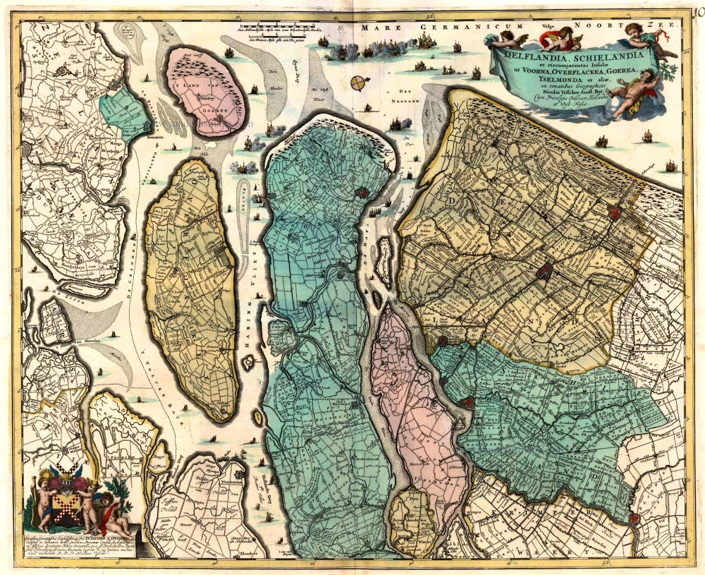
Delflandia, Schielandia et circumjacentes Insulae ... 1680-1710
Holland, by N. Visscher
[Item number: 24417]
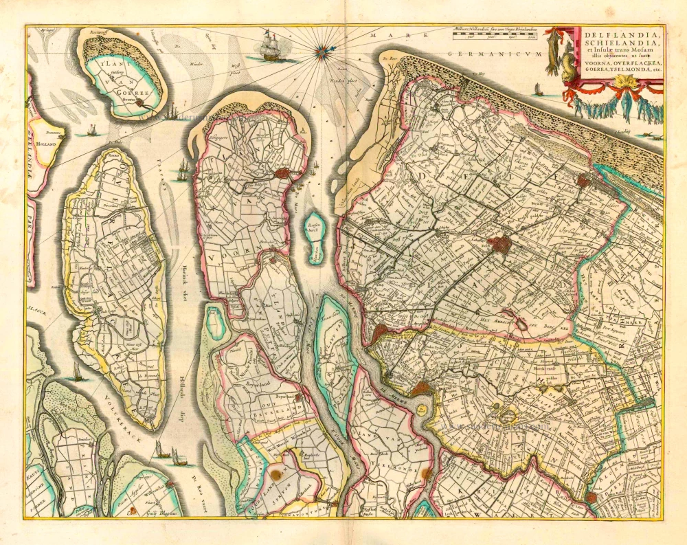
Delflandia, Schielandia et Insulae trans Mosam et Insulae trans Mosam illis objacentes ut sunt Voorna, Overflackea, Goerea, Yselmonda, etc. 1635
Holland (Southwest), by Willem Blaeu.
[Item number: 25352]
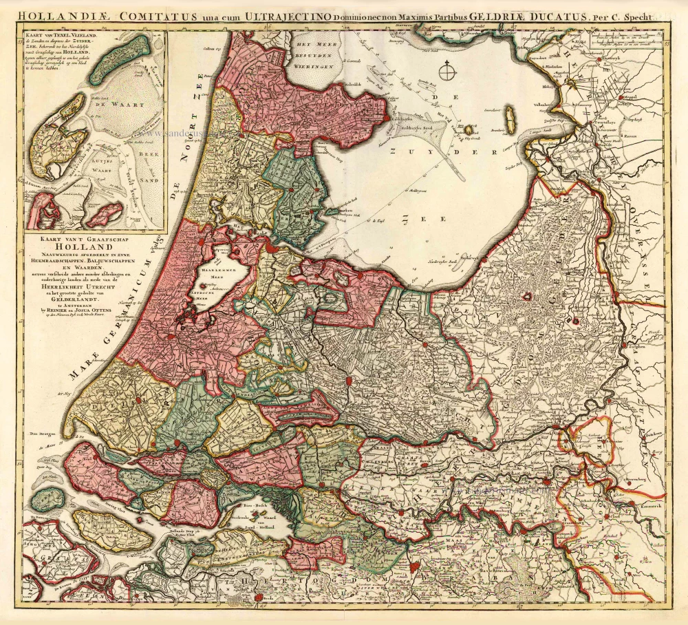
Kaart van 't Graafschap Holland Naauwkeurig Afgedeelt in zyne Heemraadschappen, Baljuwschappen en Waarden, 1730-45
Holland by C. Specht, published by R. & J. Ottens.
[Item number: 25706]
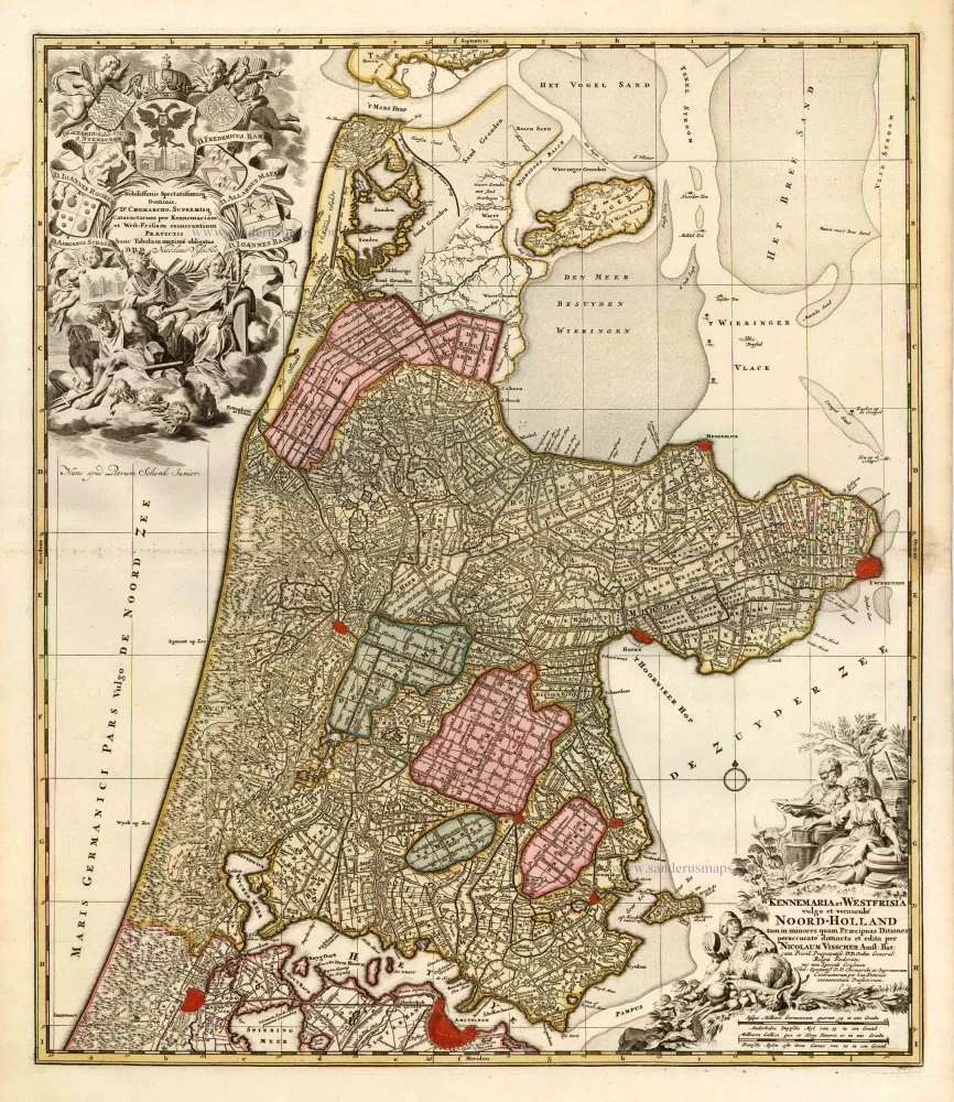
Kennemaria et Westfrisia vulgo et vernaculé Noord-Holland. c. 1700
Noord Holland by Nicolaas Visscher I, published by Petrus Schenk.
[Item number: 25707]
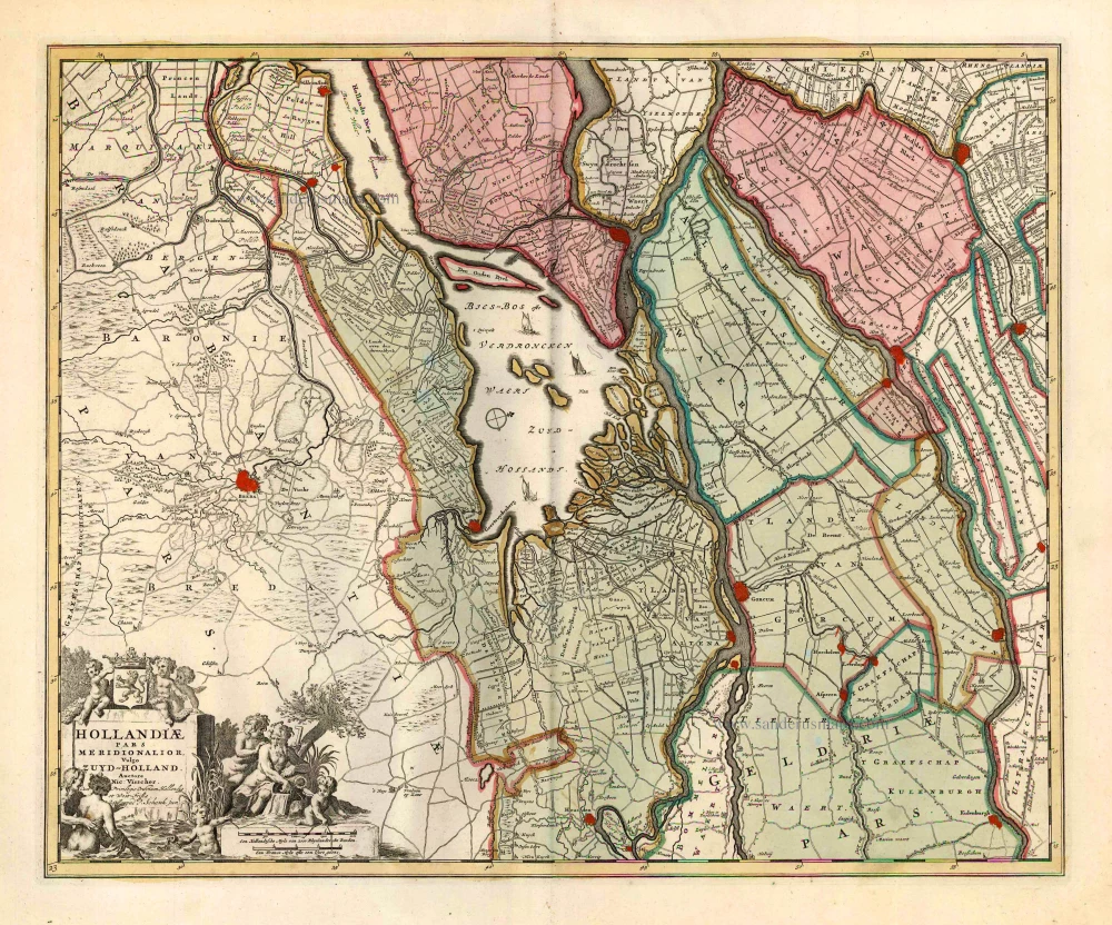
Hollandiae Pars Meridionalior, Vulgo Zuyd-Holland. c. 1740
Southern Holland by Nicolaas Visscher II, published by Petrus Schenk.
[Item number: 25721]
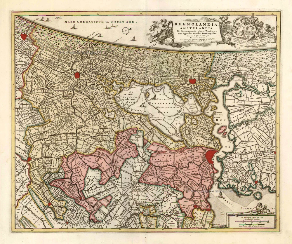
Rhenolandia, Amstelandia et Circumjacentia aliquot Territoria, cum Aggeribus omnibus, Terminiqz fuis. c. 1740
Central Holland by Nicolaas Visscher II, published by Petrus Schenk.
[Item number: 25722]
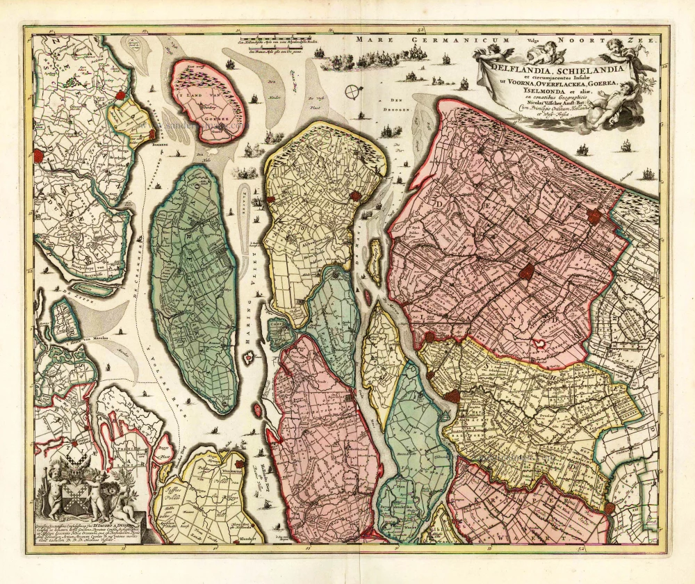
Delflandia, Schielandia et circumjacentes Insulae et circumjacentes Insulae ut Voorna, Overflackea, Goerea, Yselmonda et aliae, 1683-1696
Southwest Holland by Nicolaas Visscher II.
[Item number: 25729]
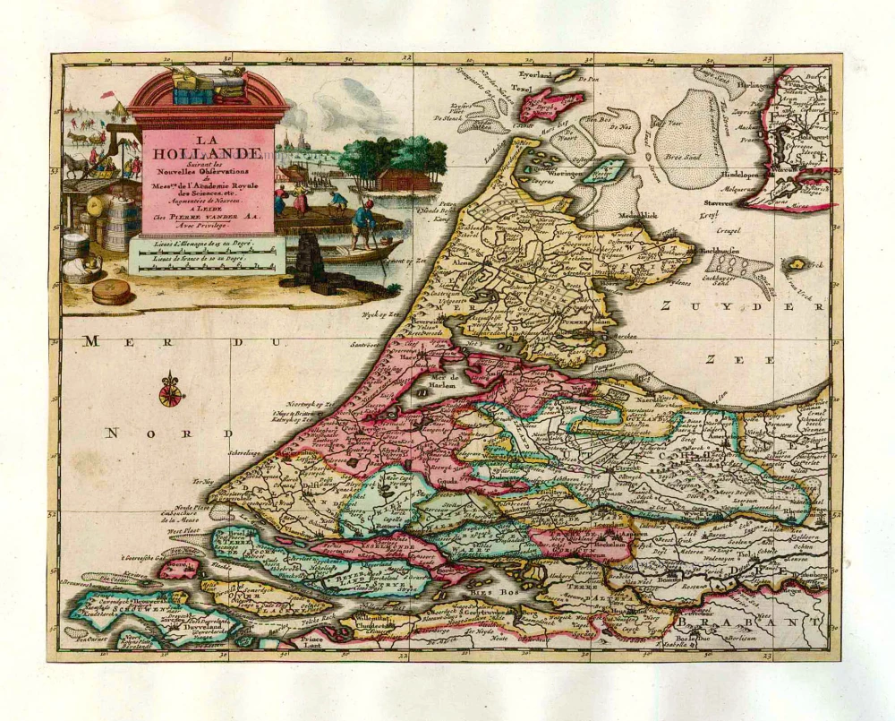
La Hollande. 1713
Holland by Pieter Van der Aa.
[Item number: 26059]
First edition, first state. Dutch text. Important map!
Beschrijvinge vande vermaerde stroemen, Tvlie ende Tmaersdiep; opstreckende Inde Zuijder Zee voerbij Enchuijsen tot Amstelredam, met alle de sande plaeten eñ ondiepte op de selve stroemen gheleghen. 1584
Lucas Janszoon Waghenaer, Holland.
[Item number: 27007]
Big and spectacular map
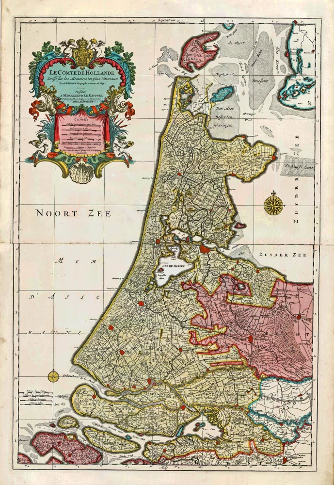
Le Comté de Hollande. c. 1705
Holland, by Pieter Mortier.
[Item number: 27807]