
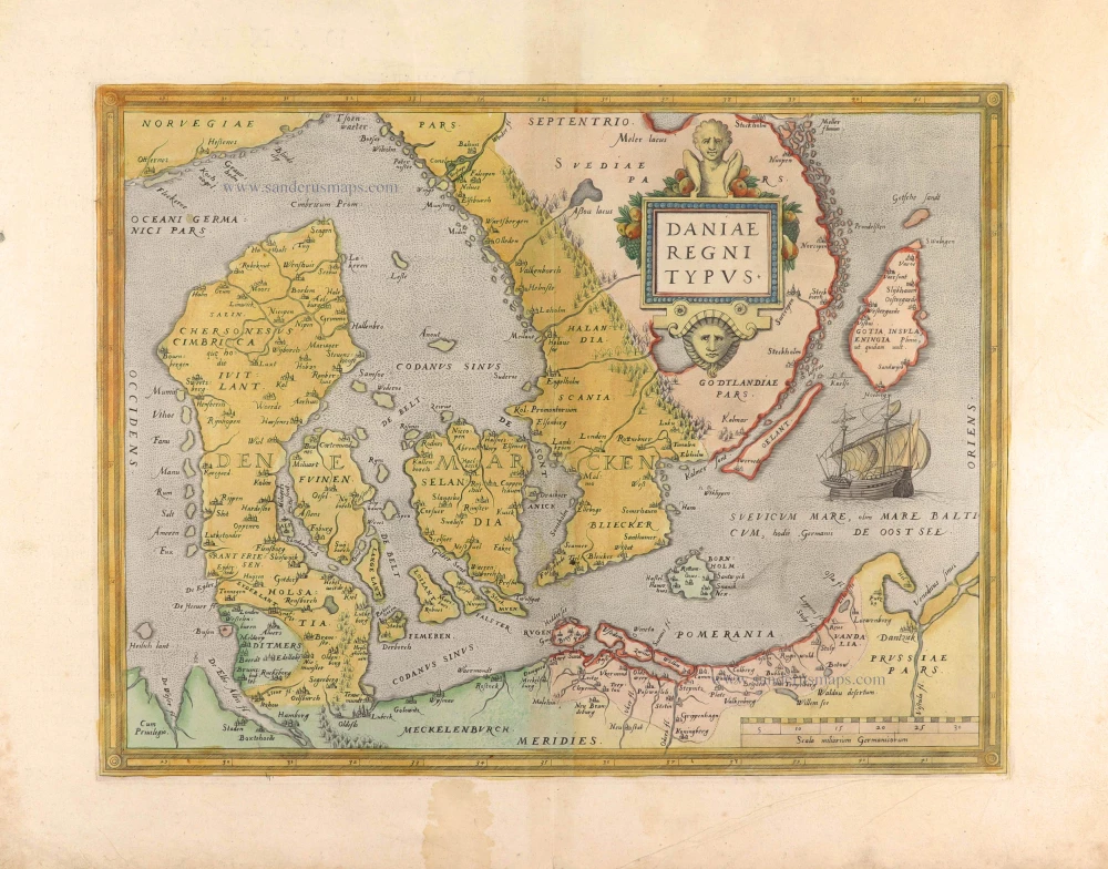
First edition of this famous map of Denmark by Marcus Jordan
Denmark, by Georg Braun & Frans Hogenberg. 1588
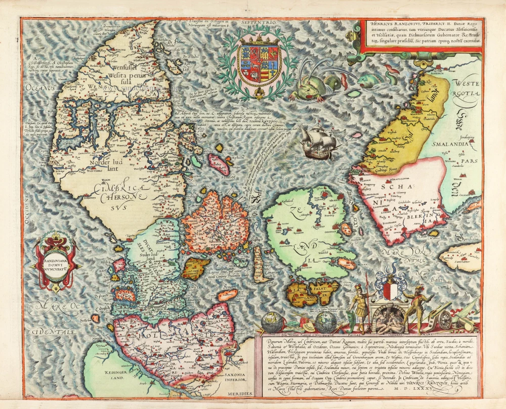


The oldest preserved map of Denmark of Danish origin. Marcus Jordan drew them at the request of Duke Heinrich Rantzau, viceroy of Schleswig-Holstein.
TRANSLATION OF CARTOUCHE TEXT TOP RIGHT: Heinrich Rantzau, privy counsellor to King Frederick II of Denmark, governor of the two Duchies of Schleswig and Holstein and of Dithmarschen, and singular protector of scholars, herewith adorned his country and our work.
CARTOUCHE BOTTOM RIGHT: Denmark, or Cimbria, or Kingdom of Denmark, divided into its many parts by sounds and inlets, is bordered in the east by Sweden, in the south by Saxony and Westphalia, in the west by the North Sea (German Sea), in the north by Norway.
It has the provinces Scania, Halland, and Blekinge on the Swedish border. This area is pleasant, fertile and well-populated. This is where Helsingborg is located, from which a narrow sound leads to the Island of Zealand, on which lies the famous toll station near the fortress of Kronborg and the royal residence of Hafnia, or Copenhagen. Laland, Falster, and some smaller islands are south of Zealand, and Langeland is further west. The Fyn is a separate Danish island but smaller than Zealand; 37 smaller islands surround it. From Fyn, a comfortable sea crossing leads to Schleswig, joined by the Cimbrian Peninsula, northern Jutland. From there, Wenslia, a peninsula, stretches in a wedge shape towards Norway as far as the town of Skagen, the outermost tip of Cimbria. Cimbria is accessible from Saxony via Holstein, with Wagrien, Storman and Dithmarschen. These are duchies that are happily subject to the Danish King. They are under the administration of the gracious, noble Count H. Rantzau, a figure renowned in the fine arts and the art of warfare, whose influence reverberates through Danish history. 1585.
COMMENTARY BY BRAUN: "Denmark, the continent's outermost territory in the north, consists of distinct areas that are connected and joined up. The country is dotted with many bodies of water and varies according to the shapes of the straits. Its most elegant territories are the Duchy of Holstein, Dithmarschen, Schleswig, Scania, Halland, Blekinge and Jutland. There are also many wonderful islands. Scania is superior in size and wealth to the other provinces of the kingdom. [...] It is the most beautiful territory in Denmark. It has brave men, is rich in grain, and is brimming with trade goods. It has churches, noble palaces, administrative buildings, manor houses, and monasteries. The capital is Lund, and it is three miles from Malmö."
This map of Denmark, unique in the Civitates, provides a comprehensive geographical overview. It is the only real geographical map in a work expressly intended as a city atlas. The editors offer it as an overview of the cities that are presented subsequently. The map shows that present-day southern Sweden was originally Danish; it passed to Sweden only in 1658. The engraving pays homage to Count Heinrich von Rantzau, the Danish governor in Schleswig-Holstein. This is clear from his coat of arms flanked by Athena and Ares in the lower right-hand corner in honour of the wise politician and strategist. This influential personality had a friendly relationship with Georg Braun and provided him with many documents with views of the northern cities. Rantzau took this opportunity to erect a memorial to himself and his family. (Taschen)
Braun G. & Hogenberg F. and the Civitates Orbis Terrarum.
The Civitates Orbis Terrarum, also known as the 'Braun & Hogenberg', is a six-volume town atlas and the most excellent book of town views and plans ever published: 363 engravings, sometimes beautifully coloured. It was one of the best-selling works in the last quarter of the 16th century. Georg Braun, a skilled writer, wrote the text accompanying the plans and views on the verso. Many plates were engraved after the original drawings of a professional artist, Joris Hoefnagel (1542-1600). The first volume was published in Latin in 1572 and the sixth in 1617. Frans Hogenberg, a talented engraver, created the tables for volumes I through IV, and Simon van den Neuwel made those for volumes V and VI. Other contributors were cartographers Daniel Freese and Heinrich Rantzau, who provided valuable geographical information. Works by Jacob van Deventer, Sebastian Münster, and Johannes Stumpf were also used as references. Translations appeared in German and French, making the atlas accessible to a wider audience.
Since its original publication of volume 1 in 1572, the Civitates Orbis Terrarum has left an indelible mark on the history of cartography. The first volume was followed by seven more editions in 1575, 1577, 1582, 1588, 1593, 1599, and 1612. Vol.2, initially released in 1575, saw subsequent editions in 1597 and 1612. The subsequent volumes, each a treasure trove of historical insights, graced the world in 1581, 1588, 1593, 1599, and 1606. The German translation of the first volume, a testament to its widespread appeal, debuted in 1574, followed by the French edition in 1575.
Several printers were involved: Theodor Graminaeus, Heinrich von Aich, Gottfried von Kempen, Johannis Sinniger, Bertram Buchholtz, and Peter von Brachel, all of whom worked in Cologne.
Georg Braun (1541-1622)
Georg Braun, the author of the text accompanying the plans and views in the Civitates Orbis Terrarum, was born in Cologne in 1541. After his studies in Cologne, he entered the Jesuit Order as a novice, indicating his commitment to learning and intellectual pursuits. In 1561, he obtained his bachelor's degree; in 1562, he received his Magister Artium, further demonstrating his academic achievements. Although he left the Jesuit Order, he continued his studies in theology, gaining a licentiate in theology. His theological background likely influenced the content and tone of the text in the Civitates Orbis Terrarum, adding a unique perspective to the work.
Frans Hogenberg (1535-1590)
Frans Hogenberg was a Flemish and German painter, engraver, and mapmaker. He was born in Mechelen as the son of Nicolaas Hogenberg.
By the end of the 1560s, Frans Hogenberg was employed upon Abraham Ortelius's Theatrum Orbis Terrarum, published in 1570; he is named an engraver of numerous maps. In 1568, he was banned from Antwerp by the Duke of Alva and travelled to London, where he stayed a few years before emigrating to Cologne. He immediately embarked on his two most important works, the Civitates, published in 1572 and the Geschichtsblätter, which appeared in several series from 1569 until about 1587.
Thanks to large-scale projects like the Geschichtsblätter and the Civitates, Hogenberg's social circumstances improved with each passing year. He died as a wealthy man in Cologne in 1590.
Danorum Marca, vel Cimbricum, aut Daniae Regnum ...
Item Number: 30175 Authenticity Guarantee
Category: Antique maps > Europe > Northern Europe
Old, antique map of Denmark, by Georg Braun & Frans Hogenberg.
Title: Danorum Marca, vel Cimbricum, aut Daniae Regnum ...
M.D.LXXXV.
Cartographer: Marcus Jordan.
Date of the first edition: 1588.
Date of this map: 1588.
Date on map: 1585.
Copper engraving, printed on paper.
Map size: 385 x 465mm (15.16 x 18.31 inches).
Sheet size: 395 x 525mm (15.55 x 20.67 inches).
Verso: Latin text.
Condition: Excellent, original coloured, short upper and lower margins.
Condition Rating: A+
From: Liber Quartus Urbium Praecipuarum Totius Mundi. Cologne, 1588. (Koeman, B&H4, Van der Krogt 4, 41:1.4)
The oldest preserved map of Denmark of Danish origin. Marcus Jordan drew them at the request of Duke Heinrich Rantzau, viceroy of Schleswig-Holstein.
TRANSLATION OF CARTOUCHE TEXT TOP RIGHT: Heinrich Rantzau, privy counsellor to King Frederick II of Denmark, governor of the two Duchies of Schleswig and Holstein and of Dithmarschen, and singular protector of scholars, herewith adorned his country and our work.
CARTOUCHE BOTTOM RIGHT: Denmark, or Cimbria, or Kingdom of Denmark, divided into its many parts by sounds and inlets, is bordered in the east by Sweden, in the south by Saxony and Westphalia, in the west by the North Sea (German Sea), in the north by Norway.
It has the provinces Scania, Halland, and Blekinge on the Swedish border. This area is pleasant, fertile and well-populated. This is where Helsingborg is located, from which a narrow sound leads to the Island of Zealand, on which lies the famous toll station near the fortress of Kronborg and the royal residence of Hafnia, or Copenhagen. Laland, Falster, and some smaller islands are south of Zealand, and Langeland is further west. The Fyn is a separate Danish island but smaller than Zealand; 37 smaller islands surround it. From Fyn, a comfortable sea crossing leads to Schleswig, joined by the Cimbrian Peninsula, northern Jutland. From there, Wenslia, a peninsula, stretches in a wedge shape towards Norway as far as the town of Skagen, the outermost tip of Cimbria. Cimbria is accessible from Saxony via Holstein, with Wagrien, Storman and Dithmarschen. These are duchies that are happily subject to the Danish King. They are under the administration of the gracious, noble Count H. Rantzau, a figure renowned in the fine arts and the art of warfare, whose influence reverberates through Danish history. 1585.
COMMENTARY BY BRAUN: "Denmark, the continent's outermost territory in the north, consists of distinct areas that are connected and joined up. The country is dotted with many bodies of water and varies according to the shapes of the straits. Its most elegant territories are the Duchy of Holstein, Dithmarschen, Schleswig, Scania, Halland, Blekinge and Jutland. There are also many wonderful islands. Scania is superior in size and wealth to the other provinces of the kingdom. [...] It is the most beautiful territory in Denmark. It has brave men, is rich in grain, and is brimming with trade goods. It has churches, noble palaces, administrative buildings, manor houses, and monasteries. The capital is Lund, and it is three miles from Malmö."
This map of Denmark, unique in the Civitates, provides a comprehensive geographical overview. It is the only real geographical map in a work expressly intended as a city atlas. The editors offer it as an overview of the cities that are presented subsequently. The map shows that present-day southern Sweden was originally Danish; it passed to Sweden only in 1658. The engraving pays homage to Count Heinrich von Rantzau, the Danish governor in Schleswig-Holstein. This is clear from his coat of arms flanked by Athena and Ares in the lower right-hand corner in honour of the wise politician and strategist. This influential personality had a friendly relationship with Georg Braun and provided him with many documents with views of the northern cities. Rantzau took this opportunity to erect a memorial to himself and his family. (Taschen)
Braun G. & Hogenberg F. and the Civitates Orbis Terrarum.
The Civitates Orbis Terrarum, also known as the 'Braun & Hogenberg', is a six-volume town atlas and the most excellent book of town views and plans ever published: 363 engravings, sometimes beautifully coloured. It was one of the best-selling works in the last quarter of the 16th century. Georg Braun, a skilled writer, wrote the text accompanying the plans and views on the verso. Many plates were engraved after the original drawings of a professional artist, Joris Hoefnagel (1542-1600). The first volume was published in Latin in 1572 and the sixth in 1617. Frans Hogenberg, a talented engraver, created the tables for volumes I through IV, and Simon van den Neuwel made those for volumes V and VI. Other contributors were cartographers Daniel Freese and Heinrich Rantzau, who provided valuable geographical information. Works by Jacob van Deventer, Sebastian Münster, and Johannes Stumpf were also used as references. Translations appeared in German and French, making the atlas accessible to a wider audience.
Since its original publication of volume 1 in 1572, the Civitates Orbis Terrarum has left an indelible mark on the history of cartography. The first volume was followed by seven more editions in 1575, 1577, 1582, 1588, 1593, 1599, and 1612. Vol.2, initially released in 1575, saw subsequent editions in 1597 and 1612. The subsequent volumes, each a treasure trove of historical insights, graced the world in 1581, 1588, 1593, 1599, and 1606. The German translation of the first volume, a testament to its widespread appeal, debuted in 1574, followed by the French edition in 1575.
Several printers were involved: Theodor Graminaeus, Heinrich von Aich, Gottfried von Kempen, Johannis Sinniger, Bertram Buchholtz, and Peter von Brachel, all of whom worked in Cologne.
Georg Braun (1541-1622)
Georg Braun, the author of the text accompanying the plans and views in the Civitates Orbis Terrarum, was born in Cologne in 1541. After his studies in Cologne, he entered the Jesuit Order as a novice, indicating his commitment to learning and intellectual pursuits. In 1561, he obtained his bachelor's degree; in 1562, he received his Magister Artium, further demonstrating his academic achievements. Although he left the Jesuit Order, he continued his studies in theology, gaining a licentiate in theology. His theological background likely influenced the content and tone of the text in the Civitates Orbis Terrarum, adding a unique perspective to the work.
Frans Hogenberg (1535-1590)
Frans Hogenberg was a Flemish and German painter, engraver, and mapmaker. He was born in Mechelen as the son of Nicolaas Hogenberg.
By the end of the 1560s, Frans Hogenberg was employed upon Abraham Ortelius's Theatrum Orbis Terrarum, published in 1570; he is named an engraver of numerous maps. In 1568, he was banned from Antwerp by the Duke of Alva and travelled to London, where he stayed a few years before emigrating to Cologne. He immediately embarked on his two most important works, the Civitates, published in 1572 and the Geschichtsblätter, which appeared in several series from 1569 until about 1587.
Thanks to large-scale projects like the Geschichtsblätter and the Civitates, Hogenberg's social circumstances improved with each passing year. He died as a wealthy man in Cologne in 1590.
Related items
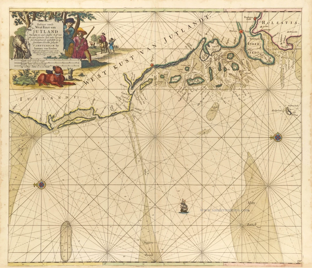
Paskaart vande West Kust van Jutland van Busem tot aen 't Jutsche Riff met Alle syn Eylanden daer onder Begrepen. 1697-1709
Sea chart of Denmark (Westcoast of Jutland), by J. Van Keulen.
[Item number: 13449]

Nouvelle Carte Géographique du Royaume de Dannemarck avec une Table des Villes les plus remarquables. 1714
Denmark, by Zacharias Châtelain.
[Item number: 21341]
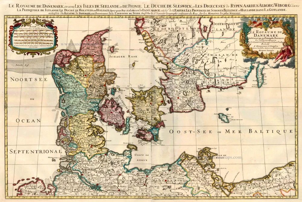
Le Royaume de Danemark Subdivisé en ses Principales Provinces. 1710
Denmark by Sanson - Covens & Mortier.
[Item number: 23736]
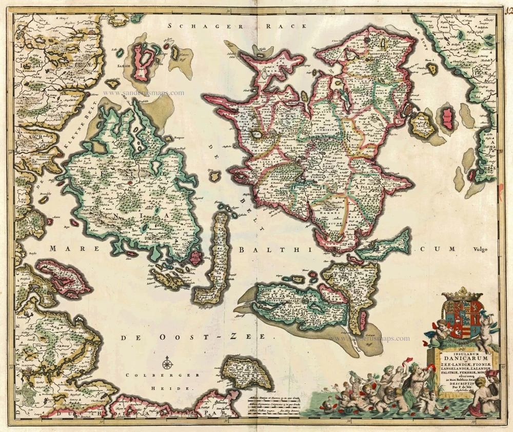
Insularum Danicarum ut Zee-Landiae, Fioniae, Langelandiae, Lalandiae, Falstriae, Fembriae, Mona aliarumq in Mari Balthico Sitar Descriptio. c. 1682-86
Danish Islands by de Wit F.
[Item number: 24504]
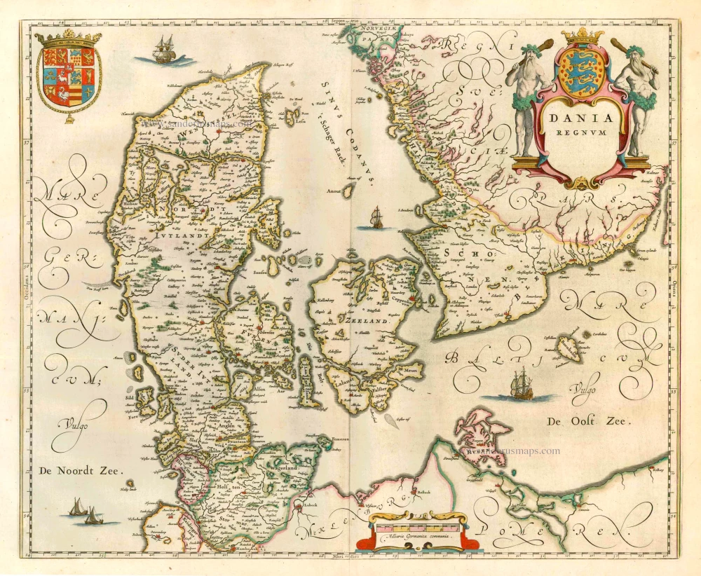
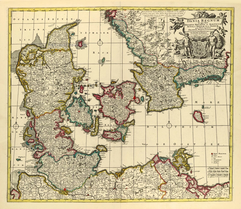
Dania Regnum. 1649-55
Denmark, by W. & J. Blaeu.
[Item number: 25266]
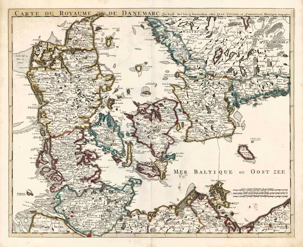
Carte du Royaume de Danemarc. 1730
Denmark by Guillaume Delisle, published by Covens & Mortier.
[Item number: 25900]
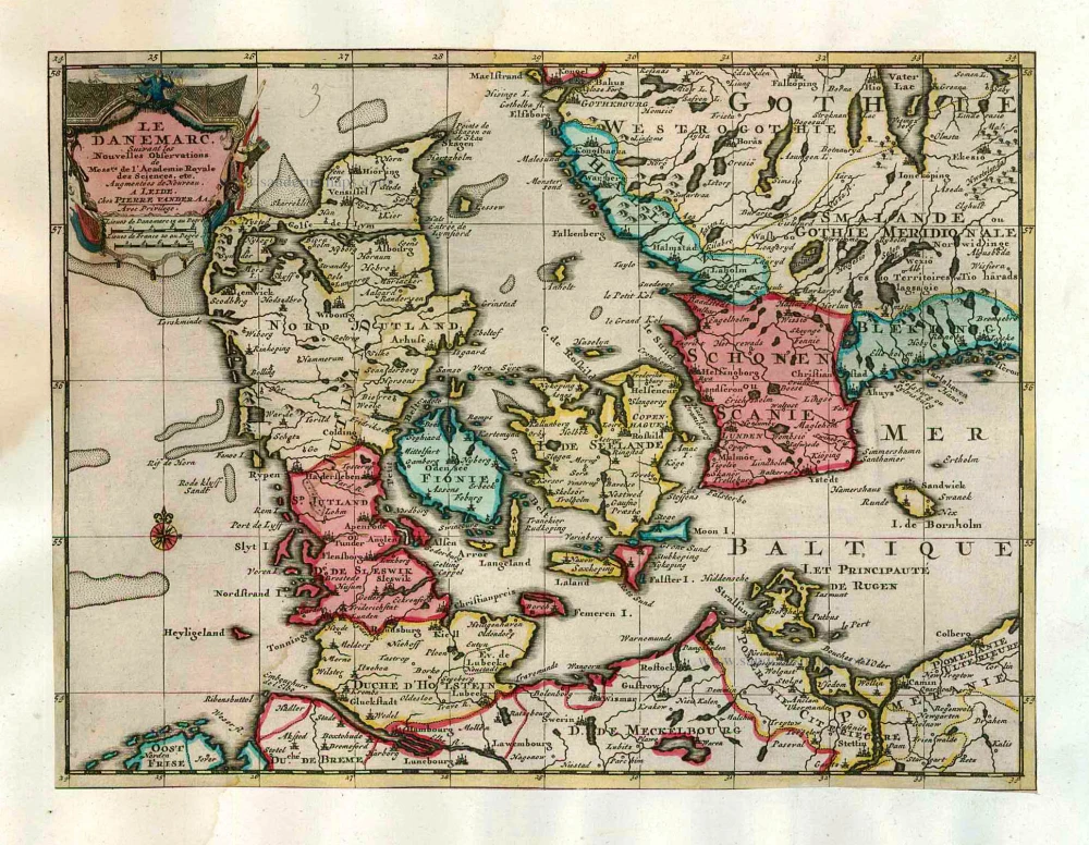
Le Danemarc, Suivant les Nouvelles Observations de Mess.rs de L'Academie Royale des Sciences, etc. 1713
Denmark, by Pieter van der Aa
[Item number: 26044]
Dania Regnum In quo sunt Ducatus Holsatia et Slesvicum Iutia, et Insulae, dictae Danicae, quae Nuncupantur Zelandia, Fionia, Lalandia, Falstria, Langelandia Bornholmia etc. after 1721
Denmark by Frederik de Wit, published by Covens & Mortier.
[Item number: 28268]
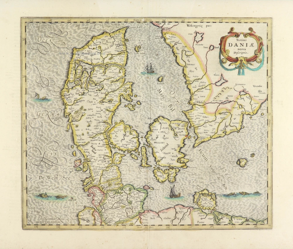
Totius Daniae nova descriptio. 1639-42
Denmark by Henricus Hondius.
[Item number: 28699]
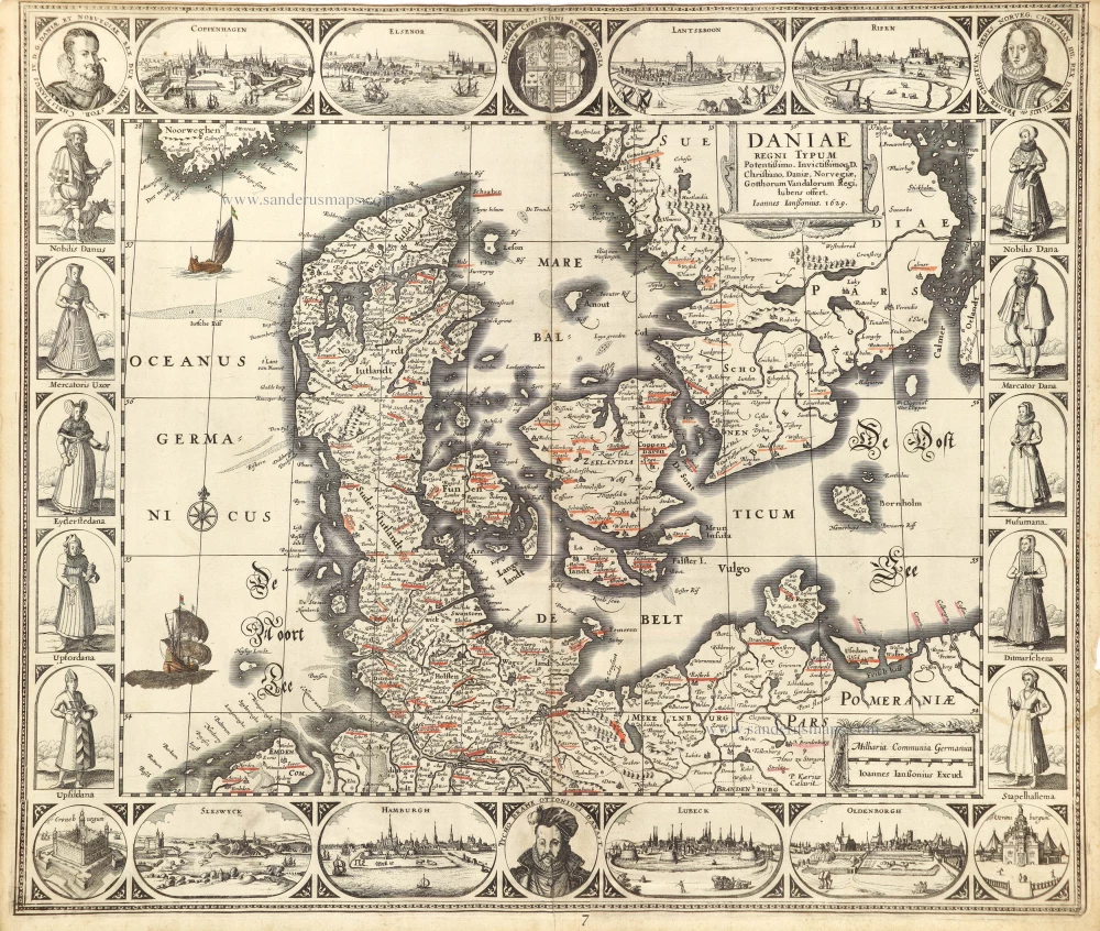
Rare and decorative map from Janssonius' 'Appendix'. Strong impression.
Daniae Regni Typum. 1630
Denmark by Joannes Janssonius.
[Item number: 28950]
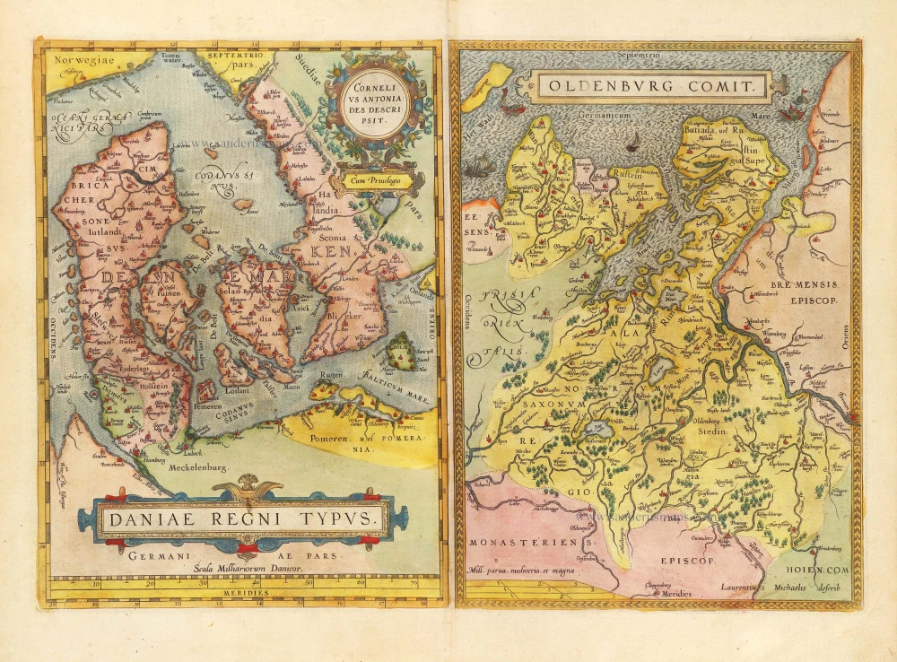
Daniae Regni Typus Cornelius Antoniades Descripsit; [On sheet with:] Oldenburg Comit. 1584
Denmark and Jutland by Abraham Ortelius.
[Item number: 29133]

Nouvelle Carte Géographique du Royaume de Dannemarck avec une Table des Villes les plus remarquables. 1714
Denmark by Zacharias Châtelain.
[Item number: 29430]
Le Royaume de Danemark, Divisé en ses Provinces. c. 1709
Denmark by Hubert Jaillot.
[Item number: 29589]
Important map
Daniae Regni Typus. 1574
Denmark by Abraham Ortelius.
[Item number: 29601]
Rare
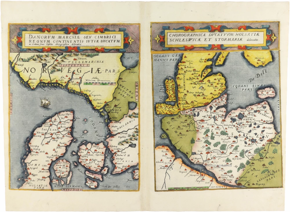
Danorum Marchiae seu Cimbrici Regnum Continentis Iutiae Ducatum [on sheet with] Chorographica Ducatum Holstatiae Schleswicae et Stormariae 1593
Norway - Denmark by Gerard de Jode
[Item number: 30947]