
Early map of the North Atlantic
Northern Atlantic Ocean by Girolamo Ruscelli. 1574
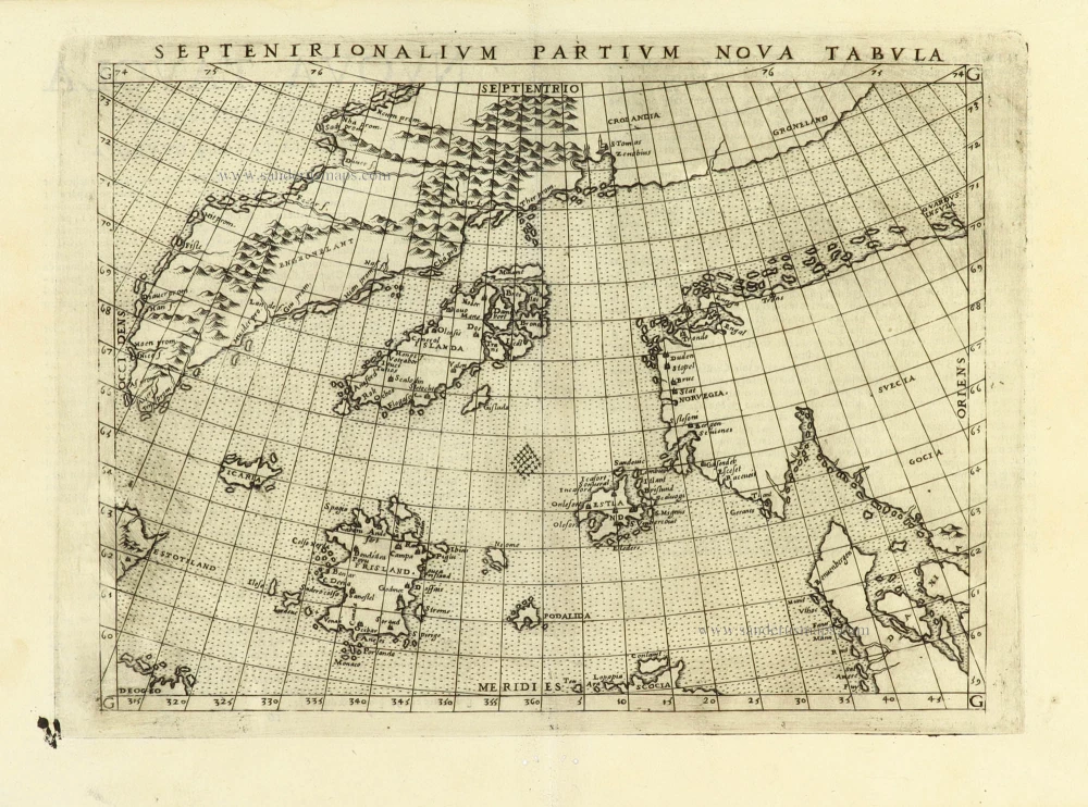
Girolamo Ruscelli (1504 (1518?) -1566)
Girolamo Ruscelli was an Italian mathematician and cartographer who worked in Venice in the early 16th century. He was also an alchemist who wrote pseudonymously as Alessio Piemontese.
He published a translation of the Geografia of Ptolemy, printed in Venice by Vincenzo Valgrisi in 1561. It was a quarto edition with Ptolemaic and modern maps. The engravers may have been the brothers Giulio and Livio Sanuto. Among the 69 copperplate maps were 40 based on maps by Giacomo Gastaldi. The maps were re-issued in 1562, 1564, 1574 and 1598.
Septenirionalium Partium Nova Tabula.
Item Number: 32185 Authenticity Guarantee
Category: Antique maps > Europe > Northern Europe
Northern Atlantic Ocean by Girolamo Ruscelli.
Title: Septenirionalium Partium Nova Tabula.
Cartographer: Nicolo Zeno.
Date of the first edition: 1561.
Date of this map: 1574.
Copper engraving, printed on paper.
Image size: 190 x 245mm (7½ x 9¾ inches).
Sheet size: 225 x 310mm (8¾ x 12¼ inches).
Verso: Italian text.
Condition: Excellent.
Condition Rating: A+.
La Geografia di Claudio Tolomeo Alessandrino, Nuovamente tradotta di Greco in Italiano da Girolamo Ruscelli. Venice, Vincenzo Valgrisi, 1574. (Karrow, p. 222 30/C.1)
Girolamo Ruscelli (1504 (1518?) -1566)
Girolamo Ruscelli was an Italian mathematician and cartographer who worked in Venice in the early 16th century. He was also an alchemist who wrote pseudonymously as Alessio Piemontese.
He published a translation of the Geografia of Ptolemy, printed in Venice by Vincenzo Valgrisi in 1561. It was a quarto edition with Ptolemaic and modern maps. The engravers may have been the brothers Giulio and Livio Sanuto. Among the 69 copperplate maps were 40 based on maps by Giacomo Gastaldi. The maps were re-issued in 1562, 1564, 1574 and 1598.
Related items
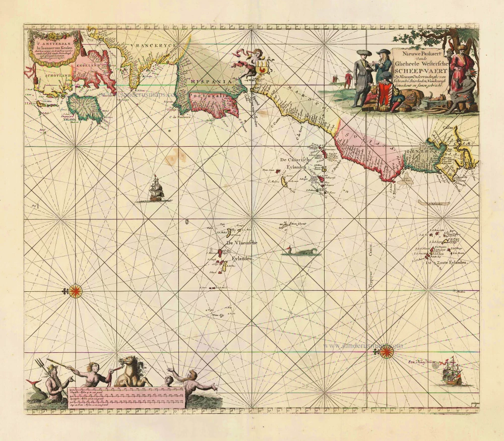
Nieuwe Paskaert vande Gheheele Westersche Scheep-Vaert, op Nieus uyt Ondervindinghe van Schrandre Stierlieden Naaukeurigh Geteeckent en Samen Gebracht. 1697-1709
The Atlantic Ocean, by J. Van Keulen.
[Item number: 11218]
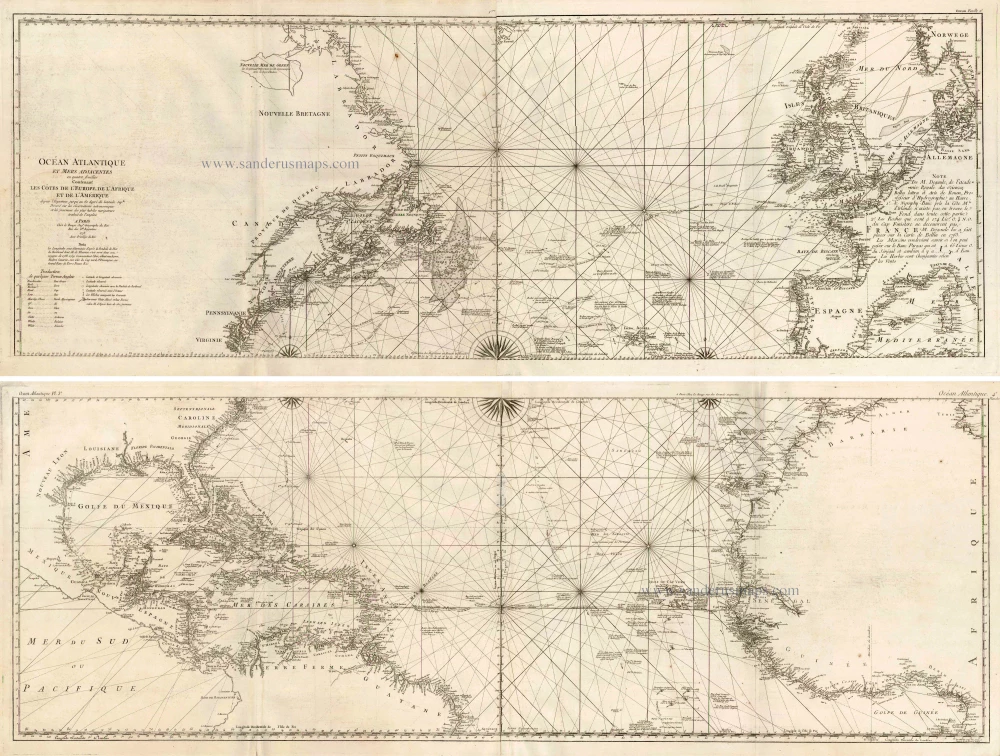
Ocean Atlantique et Mers Adjacentes en Quatre Feuilles Contenant les Cotes de l'Europe, de l'Afrique et de l'Amerique ... 1778
The Atlantic Ocean, by G.L. Le Rouge.
[Item number: 14086]

The first sea chart - wall map - relating to North America to use the Mercator projection
West-Indische Paskaert waer in de graden der breedde over wederzijden vande middellijn wassende so vergrooten dat die geproportioneert sijn tegen hunne nevenstaende graden der lengde; ... c. 1680
Atlantic Ocean. by P. Goos - J. Van Keulen
[Item number: 25938]
Rare.
[No title] c. 1575
Europe, Africa, Arabia & Canada
[Item number: 27086]

California as an island
Atlantis Insula. 1692
The Americas by Guillaume Sanson.
[Item number: 28376]

One of the most elaborately engraved maps ever published.
Carte tres Curieuse de la Mer du Sud, Contenant des Remarques Nouvelles et tres Utiles non Seulement sur les Ports et Iles de cette Mer, 1719
Pacific by Zacharias Châtelain after Nicolas de Fer.
[Item number: 29466]

Heightened in gold and silver
[No title] 1599
Atlantic Ocean by Theodore De Bry, Great Voyages,
[Item number: 30730]