
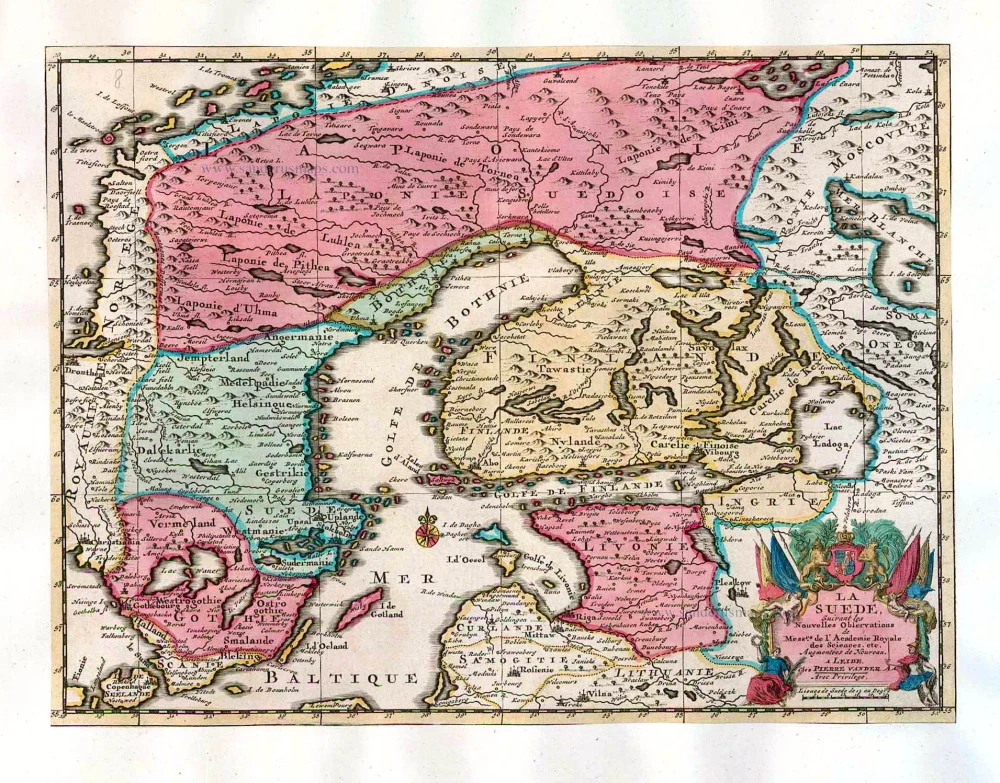
Old antique map of Sweden, Finland and Latvia, by Pieter van der Aa. 1713
Pieter van der Aa (Leiden, 1659-1733)
Pieter van der Aa was already in 1682 owner of a bookshop and auction house. During his life, he has published an enormous amount of printed material.
After 1700, van der Aa increasingly specialised in books on geography and travel.
He published composite atlases, a series of geographical descriptions of European countries, and some very spectacular works. Between 1706 and 1708 he published the Naauweurige versameling der gedenkwaardigste zee- en land-reysen, in 28 volumes.
Many of Van der Aa’s publications are richly illustrated with maps and plates. He took over many copperplates and prints from other publishers such as Carel Allard and Frederik De Wit. The composite atlases that appeared from his workshop contain a curious mixture of his own material, copies of maps from other publishers, and reprints made from old copper plates, now with his own imprint.
The Galérie agréable du monde, was completed in 1729, and comprised 66 parts, bound in 27 volumes. Van der Aa presented it as a good investment; after publication, the antiquarian value of the work would double, the more so since it was printed in a limited edition of only one hundred copies.
La Suede, Suivant les Nouvelles Observations de Mess.rs de l'Academie Royale des Sciences, etc.
Item Number: 26056 Authenticity Guarantee
Category: Antique maps > Europe > Northern Europe
Old, antique map of Sweden and Finland, by P. Van der Aa.
Date of the first edition: 1713
Date of this map: 1713
Copper engraving, printed on paper.
Size (not including margins): 22 x 29.5cm (8.6 x 11.4 inches)
Verso: Blank
Condition: Original body colour, trimmed to neatline and mounted on heavy paper at an early time.
Condition Rating: A
References: Van der Krogt A, 43:32; Koeman, Aa7 (17).
From: Nouvel Atlas, très exact et fort commode pour toutes sortes de personnes, Contenant Les Principales cartes géographiques. Leiden, P. Van der Aa, n.d. (1713) (Koeman, Aa7).
Van der Aa maps are rarely found in original colouring.
Pieter van der Aa (Leiden, 1659-1733)
Pieter van der Aa was already in 1682 owner of a bookshop and auction house. During his life, he has published an enormous amount of printed material.
After 1700, van der Aa increasingly specialised in books on geography and travel.
He published composite atlases, a series of geographical descriptions of European countries, and some very spectacular works. Between 1706 and 1708 he published the Naauweurige versameling der gedenkwaardigste zee- en land-reysen, in 28 volumes.
Many of Van der Aa’s publications are richly illustrated with maps and plates. He took over many copperplates and prints from other publishers such as Carel Allard and Frederik De Wit. The composite atlases that appeared from his workshop contain a curious mixture of his own material, copies of maps from other publishers, and reprints made from old copper plates, now with his own imprint.
The Galérie agréable du monde, was completed in 1729, and comprised 66 parts, bound in 27 volumes. Van der Aa presented it as a good investment; after publication, the antiquarian value of the work would double, the more so since it was printed in a limited edition of only one hundred copies.
Related items
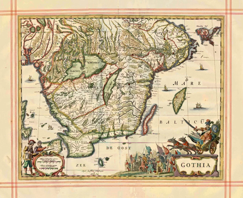
Gothia 1680
Sweden - Götaland, by J. Janssonius, published by Pitt Moses & J. Janssonius-Waesberge.
[Item number: 1290]

Nieuwe Paskaert van het Stockholmse Liet 1697-1709
Sweden - Stockholm, by Johannes Van Keulen.
[Item number: 12460]
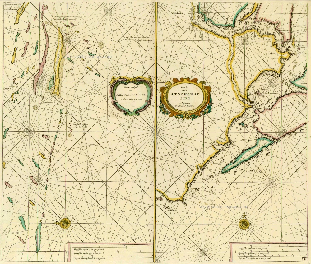
Caarte van 't gat van Abbo, ofte Uttoy. [on sheet with] Caarte van 't Stochomse Liet. 1686
Sea chart of Finland - Sweden, by Doncker H.
[Item number: 14593]

Carte de la Maison du Roy, des Etats, des Conseils et du Gouvernement Civil, Ecclesiastique, et militaire de Suède. 1713-1719
Sweden - Stockholm, by Zacharias Châtelain.
[Item number: 21340]
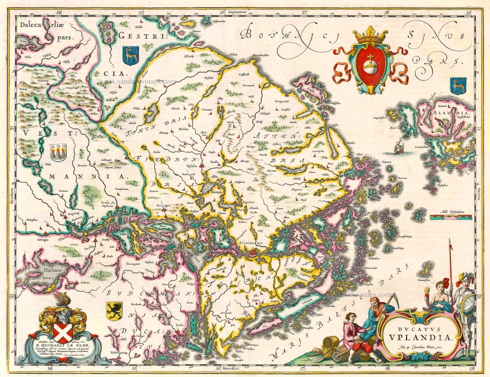
Ducatus Uplandia 1644
Uppland (Sweden), by Joan Blaeu.
[Item number: 21398]
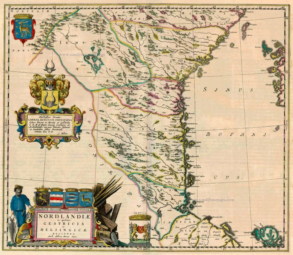
Nordlandiae et quibies Gestricia et Helsingicae 1662
Sweden - Norrland by Blaeu J.
[Item number: 23141]
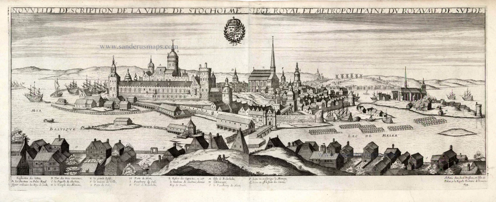
Nouvelle Description de la Ville de Stockholme Siege Royal et Metropolitaine du Royaume de Suede. 1648
Stockholm by Jean Boisseau
[Item number: 25690]

Regni Sueciae Tabula Generalis, divisa in Sueciae, Gotiae Regna Finniae Ducatum Lapponiam, Livoniam Nordlandiam Ingriam et in omnes subiacentes provincias. c. 1715
Finland & Sweden by Frederik de Wit, published by Covens & Mortier.
[Item number: 28267]
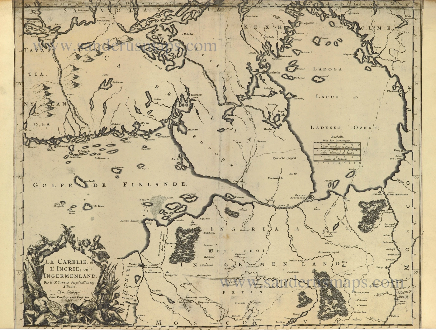
La Carelie, et l'Ingrie, ou Ingermenland. 1703
Finland and Estonia by Guillaume Sanson.
[Item number: 28500]
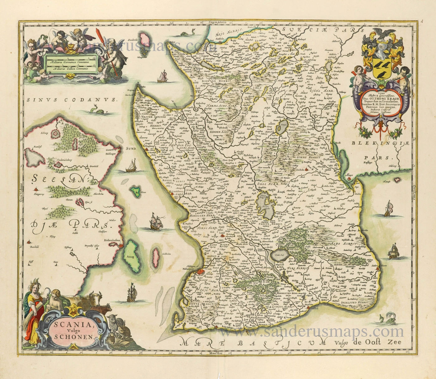
Scania, Vulgo Schonen. c. 1678
Scania (Skåne) by Johannes Janssonius.
[Item number: 28520]
Nouvelle Carte du Comté de Flandre. 1706
Flanders (Vlaanderen) by Daniel De la Feuille.
[Item number: 29889]