
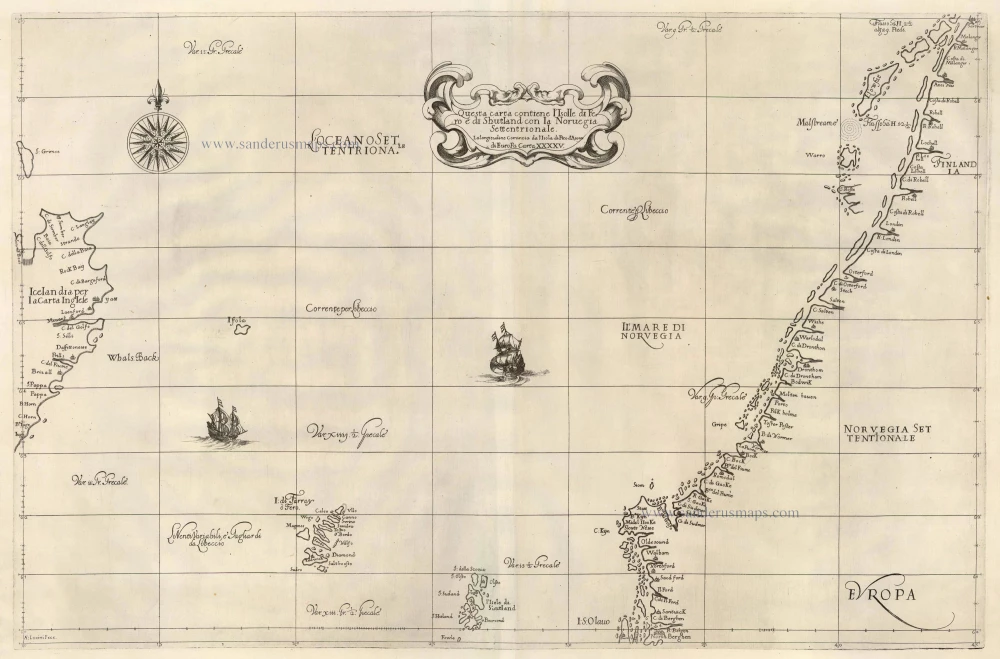
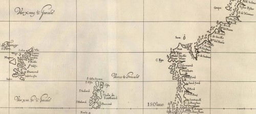
Old, antique map of North Atlantic Ocean by Dudley, Sir Robert 1646-47


Sir Robert Dudley (1573-1649), self-styled Duke of Northumberland and Earl of Warwick, was an illegitimate son of the Earl of Leicester, the favourite of Queen Elizabeth, and brother-in-law of the circumnavigator Thomas Cavendish. Through the latter he became a close friend of the sea captains John Davies and Abraham Kendall, both expert mariners. In 1594 and 1595 he sailed to the West Indies, attacking the Spanish and exploring the Guiana coasts. He was a skilled mathematician and navigator himself, and this great work, the Arcano del Mare, one of the greatest atlases of the world, was in part compiled from first-hand experience. On his return to England he took part on Essex' raid on Cadiz in 1596, after which he was knighted. However martimonial difficulties lost him favour at court, and drove him into permanent exile. In 1605 he settled in Florence, became a Roman Catholic, and entered the service of Cosimo II, Grand Duke of Tuscany. He started preparing the Arcano del Mare and employed Antonio Francesco Lucini to engrave the plates. The Arcano del Mare appeared in 1646-47, published in Florence by Francesco Onofri. it was a 6-volume work including 2 volumes of maps and charts and 4 volumes covering the whole field of navigation, astronomical tables, shipbuilding, etc. It was re-issued in 1661 by Guiseppe Cicchini. The cartouches of all but 24 charts in the 1661 edition carry the cypher 'L°6°'.
Questa carta contiene l'Isolle di Ferro è di Shutland con la Norvegia Settentriontale . . . Di Europa Carta XXXXV.
Item Number: 19873 Authenticity Guarantee
Category: Antique maps > Oceans
Old map of the North Atlantic Ocean by Dudley, Sir Robert.
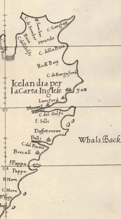
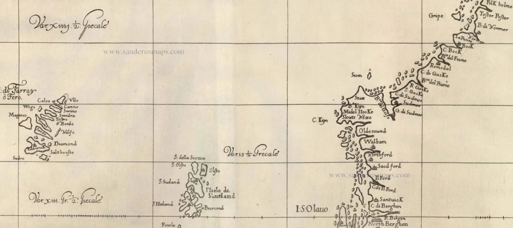
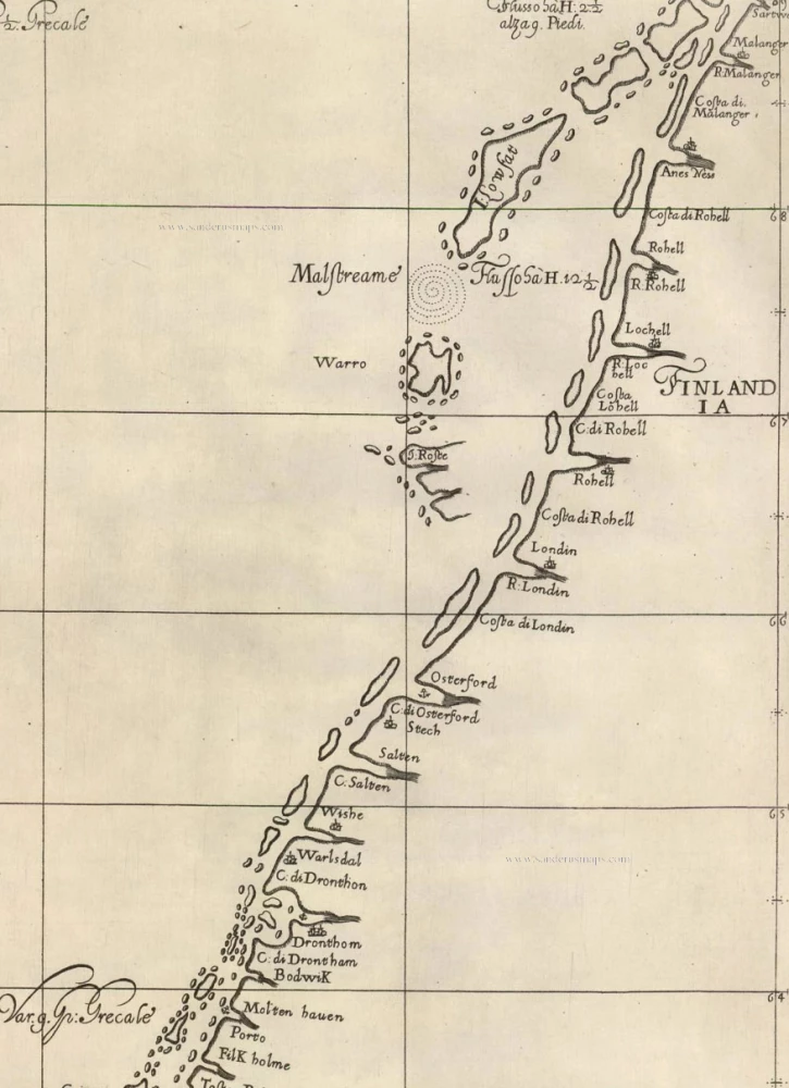
This sea chart covers a part of the North Atlantic Ocean, with the coast of Norway, a part of Iceland, the Faroe Islands and the Shetland Islands.
Two sheets joined, copper engravings, beautifully engraved by Antonio Lucini.
Size: 48.5 x 74cm (18.9 x 28.9 inches)
Verso: Blank
Condition: Excellent.
References: Shirley (Brit.Lib.), M.Dud-1a, 64.
From: Dell' Arcano Del Mare, di D. Ruberto Dudleo Duca di Nortumbria e Conte di Warwich . . . libri sei . . . In Firenze, Nella Stamperia di Francesco Onofri. 1646. (Shirley (Brit.Lib.), M.Dud-1a)
The Arcano del mare ("Mystery of the Sea"), is "ONE OF THE GREATEST ATLASES OF THE WORLD and one of the most complex ever produced: it is the first sea-atlas of the whole world; the first with all the charts constructed using Mercator's new projection, as corrected by Edward Wright; the first to give magnetic declination; the first to give prevailing winds and currents; later to be further expanded by Maury and J.T. Towson in the nineteenth century; the first to expound the advantages of 'Great Circle Sailing'; and the first sea-atlas to be compiled by an Englishman, albeit abroad in Italy: that is if one excludes the Marinors Mirrour of 1588, wholly English in execution but a slavish copy of the Dutch Spieghel der Zeevaerdt by Lucas Janszoon Waghenaer 1584-85, the first ever sea atlas" (Lord Wardington, "Sir Robert Dudley", The Book Collector, 52 (2003)).
Dudley broke completely with the contemporary style of charts. He showed lines of latitude and longitude and omitted all compass lines. In doing so, his purpose was more intellectual than practical: techniques for determining longitude at sea were not refined until more than two centuries later.
The maps are by English and other pilots and it is generally accepted that the work was both scientific and accurate for the time. Dudley used the original charts of Henry Hudson, and for the Pacific Coast of America used Cavendish's observations. "Abraham Kendall, the master of Dudley's flagship in the expedition of 1594-95 to explore the 'Eldorador', left notes and plans embodied by Dudley [and] the work of another of this group of famous navigators is represented in a portolano covering the voyage of John Davis to India in 1601" (Phillips, Atlases)
When the first edition appeared, Dudley was seventy-three years old. The work consisted of three volumes in different formats; some of the charts had to be folded down several times to make them fit the size of the volumes. This "shortcoming" (as it is called in the Avvertimento to the second edition) was repaired by enlarging the work to two volumes of uniform atlas size.
The Arcano de Mare was a monumental and totally original task, the charts, representations of instruments and diagrams all engraved on huge quantities of copper over many years with an exactitude incorporating the minutest detail and printed on the best possible paper. The whole surpassed anything published before and was not equalled in quantity until fifty years later in France under Louis XIV.
Antonio Francesco Lucini, the engraver, was born in Florence c. 1610. He was a pupil of Callot and a friend of Stefano della Bella. Before being employed by Sir Robert Dudley, he had already published engraved views of Florence and scenes of the Turkish Wars. Lucini put the stamp of his personality on the finished work as well as did the author; the delicacy and strength of the engraving, the embellishments of the lettering "alla cancellaresca", make it a true example of Italian Baroque art. In a printed introductory leaf found in one copy in the British Library, Lucini states that he worked on the plates in seclusion for twelve years in an obscure Tuscan village, using up to no less than 5,000 lbs (2,268 kg) of copper. According to the engraver, the Arcano del Mare took forty years to prepare and twelve to execute. (Sotheby's Catalogue, Wardington Sale, 2005)
Sir Robert Dudley (1573-1649), self-styled Duke of Northumberland and Earl of Warwick, was an illegitimate son of the Earl of Leicester, the favourite of Queen Elizabeth, and brother-in-law of the circumnavigator Thomas Cavendish. Through the latter he became a close friend of the sea captains John Davies and Abraham Kendall, both expert mariners. In 1594 and 1595 he sailed to the West Indies, attacking the Spanish and exploring the Guiana coasts. He was a skilled mathematician and navigator himself, and this great work, the Arcano del Mare, one of the greatest atlases of the world, was in part compiled from first-hand experience. On his return to England he took part on Essex' raid on Cadiz in 1596, after which he was knighted. However martimonial difficulties lost him favour at court, and drove him into permanent exile. In 1605 he settled in Florence, became a Roman Catholic, and entered the service of Cosimo II, Grand Duke of Tuscany. He started preparing the Arcano del Mare and employed Antonio Francesco Lucini to engrave the plates. The Arcano del Mare appeared in 1646-47, published in Florence by Francesco Onofri. it was a 6-volume work including 2 volumes of maps and charts and 4 volumes covering the whole field of navigation, astronomical tables, shipbuilding, etc. It was re-issued in 1661 by Guiseppe Cicchini. The cartouches of all but 24 charts in the 1661 edition carry the cypher 'L°6°'.
Related items
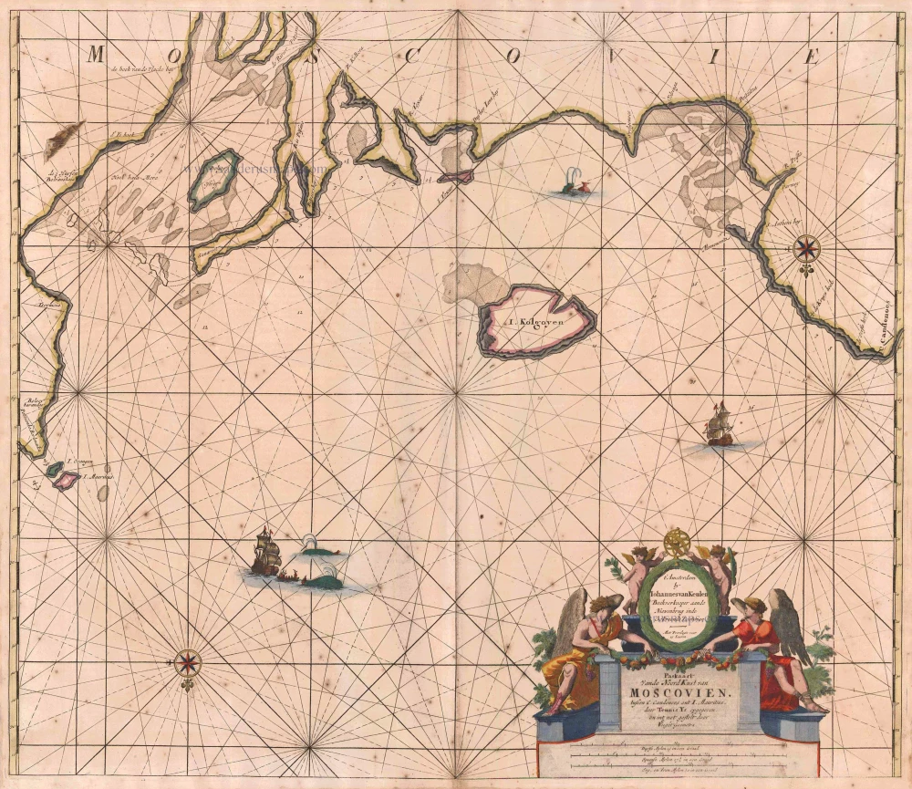
Paskaart vande NoordKust van Moscovien. tussen C. Candenoes ent I. Mauritius. door Teunis Ys opgegeven en int net gestelt door C J Vooght Geometra. 1697-1709
Barents Sea - Russia, by Van Keulen Johannes.
[Item number: 5792]
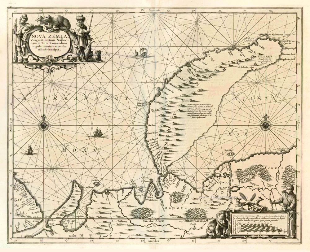
Nova Zemla, Waygats, Fretum Nassovicum, et Terra Samoiedum ... 1650
Chart of Novaya Zemlya, by J. Janssonius
[Item number: 6435]
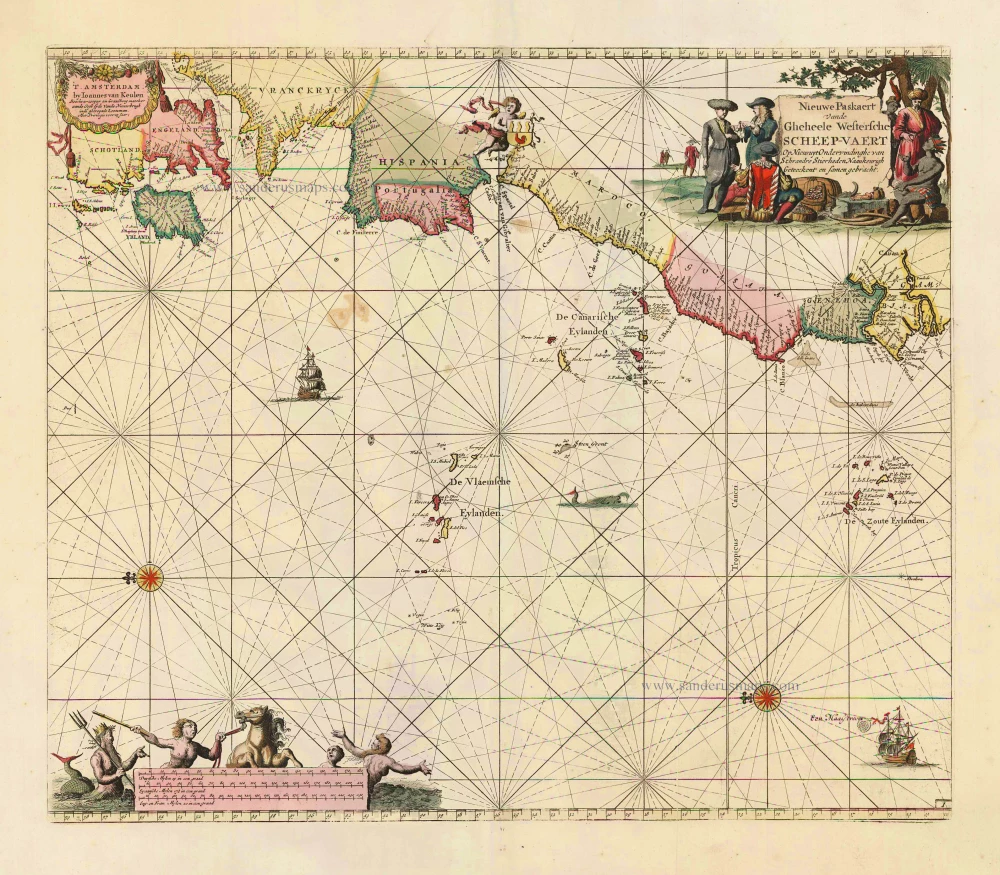
Nieuwe Paskaert vande Gheheele Westersche Scheep-Vaert, op Nieus uyt Ondervindinghe van Schrandre Stierlieden Naaukeurigh Geteeckent en Samen Gebracht. 1697-1709
The Atlantic Ocean, by J. Van Keulen.
[Item number: 11218]

Ocean Atlantique et Mers Adjacentes en Quatre Feuilles Contenant les Cotes de l'Europe, de l'Afrique et de l'Amerique ... 1778
The Atlantic Ocean, by G.L. Le Rouge.
[Item number: 14086]
Heightened in gold
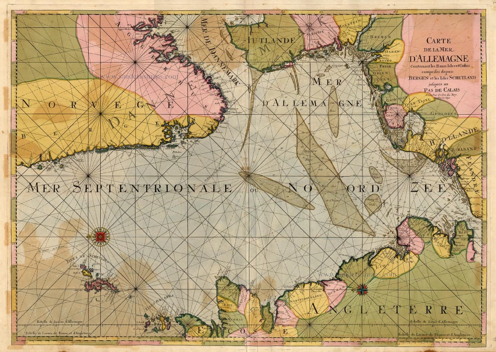
Carte de la Mer d'Allemagne ... 1693
The North Sea by P. Mortier.
[Item number: 15485]
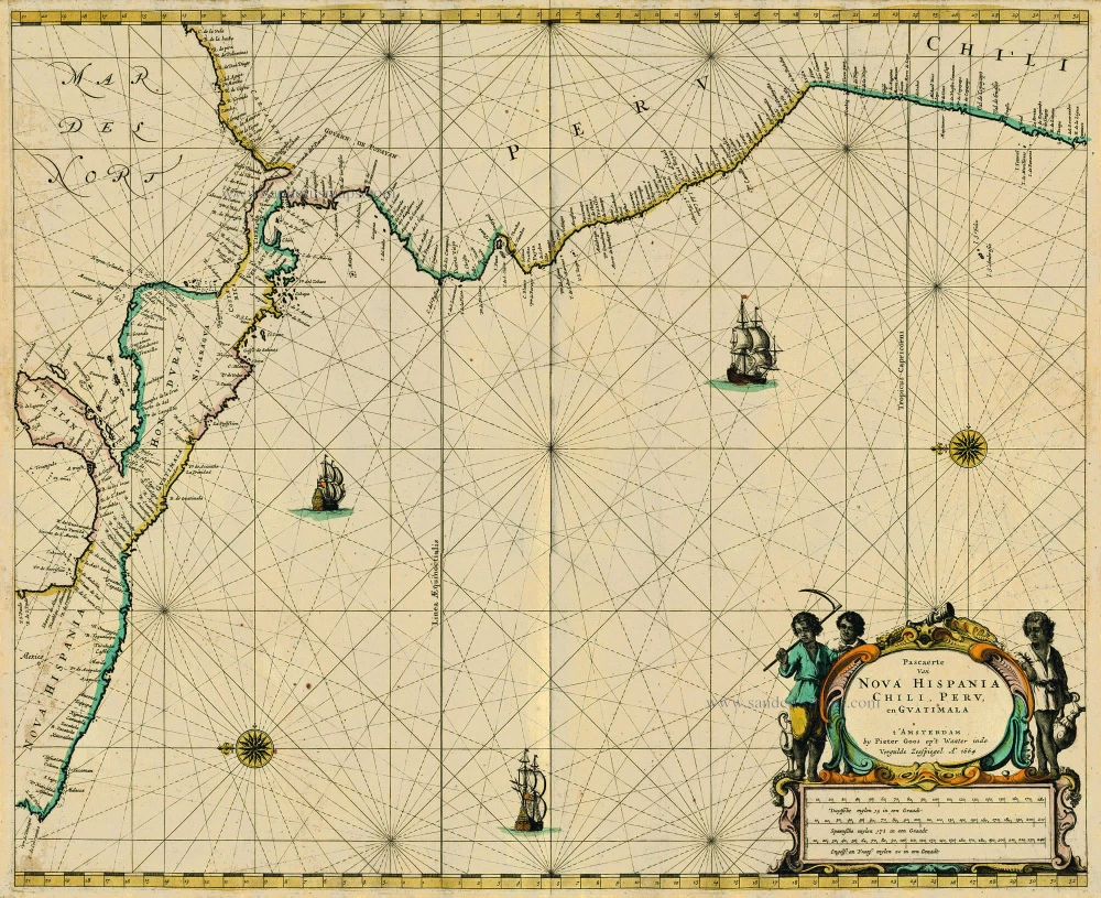
Pascaerte van Nova Hispania Chili, Peru, en Guatimala 1667
Central America, by Pieter Goos.
[Item number: 19031]
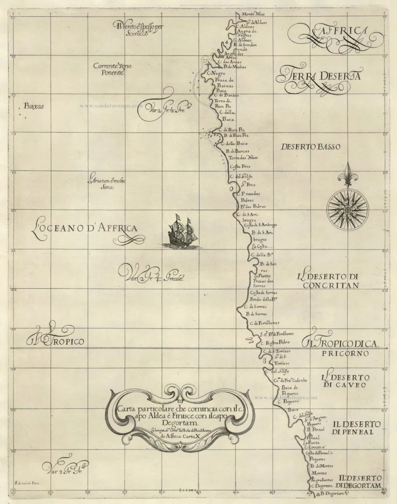
Carta particolare che comincia con il capo Aldea è Finisce con il capo Degortam . . . di Affrica Carta X. 1646-47
The Southwest Coast of Africa, by Sir Robert Dudley.
[Item number: 19843]

Caerte van de zeylage van Jacob le Maire over de Zuydzee, vertonende de Eylanden ende Landen aldaer by hem ghesien ende aenghedaen. / Tabula, ductum navigationis, quem in Mari Australi tenuit Iacobus Le Maire ... 1622
Rare chart showing the route taken by Schouten and le Maire from South America to New Guinea, by Michiel Colijn.
[Item number: 25104]

The first sea chart - wall map - relating to North America to use the Mercator projection
West-Indische Paskaert waer in de graden der breedde over wederzijden vande middellijn wassende so vergrooten dat die geproportioneert sijn tegen hunne nevenstaende graden der lengde; ... c. 1680
Atlantic Ocean. by P. Goos - J. Van Keulen
[Item number: 25938]