
Odense, by Georg Braun and Frans Hogenberg. 1596-1640
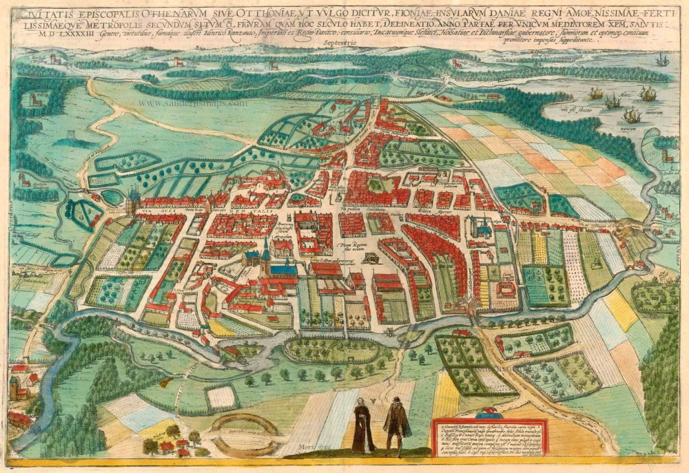
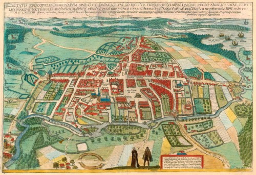


TRANSLATION OF CAPTION: The picture shows the present location and shape of the episcopal city of Othenarum or Odense in the vernacular, the capital of Funen, the loveliest and most fertile island in the Kingdom of Denmark. In the year of grace 1593. Heinrich Rantzau, known for his high birth, virtue and fame, counsellor to the Danish royal court, lord of the Duchies of Schleswig, Holstein and Dithmarschen and a patron of grand and splendid endeavours, bore the costs.
COMMENTARY BY BRAUN (on verso): "Odense is the capital of Funen, the loveliest and most fertile island in the Kingdom of Denmark. It is distinguished by magnificent buildings and splendid churches, of which the noblest is the basilica of the King of Denmark, St Canute. There is also a St John's monastery within the city, but since all the monks have died, it now houses the royal town hall. The city has a large, wide market in which tribunals are also held, and fish is sold."
The Danish city of Odense is presented in a sweeping panorama in a bird's-eye view from the south. The River Odense winding its way across the landscape, flows into the fjord in the top right-hand corner. It is noticeable that, in place of the ramparts present in most other cities, Odense is surrounded simply by a wooden fence. The city's numerous churches include, in the lower half of the picture on the left, the Sankt Knuds Kirke, or cathedral of St Canute, associated initially with a monastery and one of Denmark's largest and most important works of sacred architecture. In 1086, during a popular uprising, the Danish king Canute IV was murdered with several of his supporters in the wooden church that preceded the present building. Odense ("Odin's shrine") is mentioned for the first time in AD 988, in the Viking context of the cult of Odin. In the 11th century, it became an episcopal see, and in the mid-14th century was granted the rights of a trading city. Part of the royal court moved here c. 1500, stimulating growth both in the city and trade. Around 1600 the town had 6,000 inhabitants. (Taschen)
Braun G. & Hogenberg F. and the Civitates Orbis Terrarum.
The Civitates Orbis Terrarum, or the "Braun & Hogenberg", is a six-volume town atlas and the most excellent book of town views and plans ever published: 363 engravings, sometimes beautifully coloured. It was one of the best-selling works in the last quarter of the 16th century. Georg Braun wrote the text accompanying the plans and views on the verso. Many plates were engraved after the original drawings of a professional artist, a professional artist, Joris Hoefnagel (1542-1600). The first volume was published in Latin in 1572, and the sixth in 1617. Frans Hogenberg created the tables for volumes I through IV, and Simon van den Neuwel made those for volumes V and VI. Other contributors were cartographers Daniel Freese and Heinrich Rantzau. Works by Jacob van Deventer, Sebastian Münster, and Johannes Stumpf were also used. Translations appeared in German and French.
Following the original publication of Volume 1 of the Civitates in 1572, seven further editions of 1575, 1577, 1582, 1588, 1593, 1599 and 1612 can be identified. Vol.2, first issued in 1575, was followed by further editions in 1597 and 1612. The subsequent volumes appeared in 1581, 1588, 1593, 1599 and 1606. The German translation of the first volume appeared from 1574 on, and the French edition from 1575 on.
Several printers were involved: Theodor Graminaeus, Heinrich von Aich, Gottfried von Kempen, Johannis Sinniger, Bertram Buchholtz and Peter von Brachel, who all worked in Cologne.
Georg Braun (1541-1622)
Georg Braun was born in Cologne in 1541. After his studies in Cologne, he entered the Jesuit Order as a novice. 1561, he obtained his bachelor's degree, and in 1562, he received his Magister Artium. Although he left the Jesuit Order, he studied theology, gaining a licentiate in theology.
Frans Hogenberg (1535-1590)
Frans Hogenberg was a Flemish and German painter, engraver, and mapmaker. He was born in Mechelen as the son of Nicolaas Hogenberg.
By the end of the 1560s, Frans Hogenberg was employed upon Abraham Ortelius's Theatrum Orbis Terrarum, published in 1570; he is named an engraver of numerous maps. In 1568, he was banned from Antwerp by the Duke of Alva and travelled to London, where he stayed a few years before emigrating to Cologne. He immediately embarked on his two most important works, the Civitates, published in 1572 and the Geschichtsblätter, which appeared in several series from 1569 until about 1587.
Thanks to large-scale projects like the Geschichtsblätter and the Civitates, Hogenberg's social circumstances improved with each passing year. He died as a wealthy man in Cologne in 1590.
Civitates Episcopalis Othenarum sive Otthoniae, ut vulgo Dicitur, Fioniae ...
Item Number: 23372 Authenticity Guarantee
Category: Antique maps > Europe > Northern Europe
Antique map - Bird'seye plan of Odense by Georg Braun and Frans Hogenberg.
Title: Civitates Episcopalis Othenarum sive Otthoniae, ut vulgo Dicitur, Fioniae ...
Date of the first edition: 1596.
Date of this map: 1596-1640.
Copper engraving, printed on paper.
Size (not including margins): 325 x 475mm (12.8 x 18.7 inches).
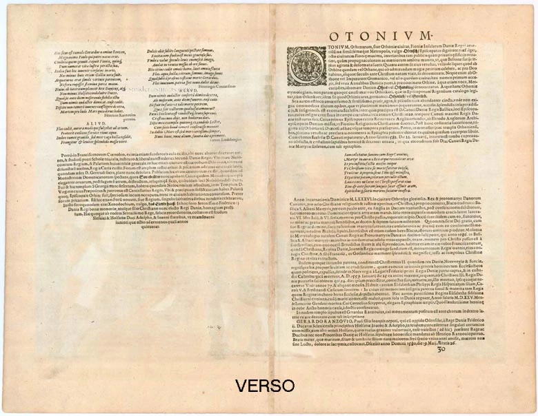
Verso: Latin text.
Condition: Excellent, superb old colour.
Condition Rating: A+.
From: Civitates Orbis Terrarum, ... Part 5. Köln, 1596-1640.
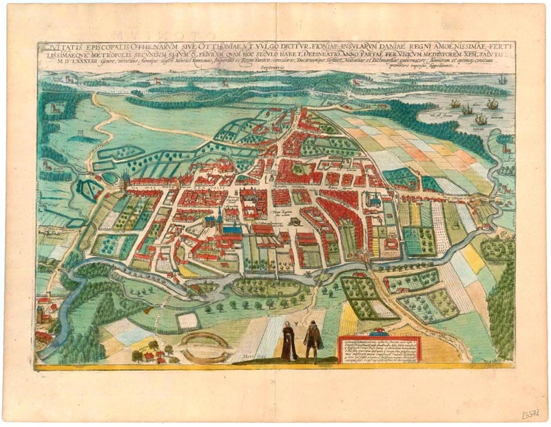
TRANSLATION OF CAPTION: The picture shows the present location and shape of the episcopal city of Othenarum or Odense in the vernacular, the capital of Funen, the loveliest and most fertile island in the Kingdom of Denmark. In the year of grace 1593. Heinrich Rantzau, known for his high birth, virtue and fame, counsellor to the Danish royal court, lord of the Duchies of Schleswig, Holstein and Dithmarschen and a patron of grand and splendid endeavours, bore the costs.
COMMENTARY BY BRAUN (on verso): "Odense is the capital of Funen, the loveliest and most fertile island in the Kingdom of Denmark. It is distinguished by magnificent buildings and splendid churches, of which the noblest is the basilica of the King of Denmark, St Canute. There is also a St John's monastery within the city, but since all the monks have died, it now houses the royal town hall. The city has a large, wide market in which tribunals are also held, and fish is sold."
The Danish city of Odense is presented in a sweeping panorama in a bird's-eye view from the south. The River Odense winding its way across the landscape, flows into the fjord in the top right-hand corner. It is noticeable that, in place of the ramparts present in most other cities, Odense is surrounded simply by a wooden fence. The city's numerous churches include, in the lower half of the picture on the left, the Sankt Knuds Kirke, or cathedral of St Canute, associated initially with a monastery and one of Denmark's largest and most important works of sacred architecture. In 1086, during a popular uprising, the Danish king Canute IV was murdered with several of his supporters in the wooden church that preceded the present building. Odense ("Odin's shrine") is mentioned for the first time in AD 988, in the Viking context of the cult of Odin. In the 11th century, it became an episcopal see, and in the mid-14th century was granted the rights of a trading city. Part of the royal court moved here c. 1500, stimulating growth both in the city and trade. Around 1600 the town had 6,000 inhabitants. (Taschen)
Braun G. & Hogenberg F. and the Civitates Orbis Terrarum.
The Civitates Orbis Terrarum, or the "Braun & Hogenberg", is a six-volume town atlas and the most excellent book of town views and plans ever published: 363 engravings, sometimes beautifully coloured. It was one of the best-selling works in the last quarter of the 16th century. Georg Braun wrote the text accompanying the plans and views on the verso. Many plates were engraved after the original drawings of a professional artist, a professional artist, Joris Hoefnagel (1542-1600). The first volume was published in Latin in 1572, and the sixth in 1617. Frans Hogenberg created the tables for volumes I through IV, and Simon van den Neuwel made those for volumes V and VI. Other contributors were cartographers Daniel Freese and Heinrich Rantzau. Works by Jacob van Deventer, Sebastian Münster, and Johannes Stumpf were also used. Translations appeared in German and French.
Following the original publication of Volume 1 of the Civitates in 1572, seven further editions of 1575, 1577, 1582, 1588, 1593, 1599 and 1612 can be identified. Vol.2, first issued in 1575, was followed by further editions in 1597 and 1612. The subsequent volumes appeared in 1581, 1588, 1593, 1599 and 1606. The German translation of the first volume appeared from 1574 on, and the French edition from 1575 on.
Several printers were involved: Theodor Graminaeus, Heinrich von Aich, Gottfried von Kempen, Johannis Sinniger, Bertram Buchholtz and Peter von Brachel, who all worked in Cologne.
Georg Braun (1541-1622)
Georg Braun was born in Cologne in 1541. After his studies in Cologne, he entered the Jesuit Order as a novice. 1561, he obtained his bachelor's degree, and in 1562, he received his Magister Artium. Although he left the Jesuit Order, he studied theology, gaining a licentiate in theology.
Frans Hogenberg (1535-1590)
Frans Hogenberg was a Flemish and German painter, engraver, and mapmaker. He was born in Mechelen as the son of Nicolaas Hogenberg.
By the end of the 1560s, Frans Hogenberg was employed upon Abraham Ortelius's Theatrum Orbis Terrarum, published in 1570; he is named an engraver of numerous maps. In 1568, he was banned from Antwerp by the Duke of Alva and travelled to London, where he stayed a few years before emigrating to Cologne. He immediately embarked on his two most important works, the Civitates, published in 1572 and the Geschichtsblätter, which appeared in several series from 1569 until about 1587.
Thanks to large-scale projects like the Geschichtsblätter and the Civitates, Hogenberg's social circumstances improved with each passing year. He died as a wealthy man in Cologne in 1590.
Related items
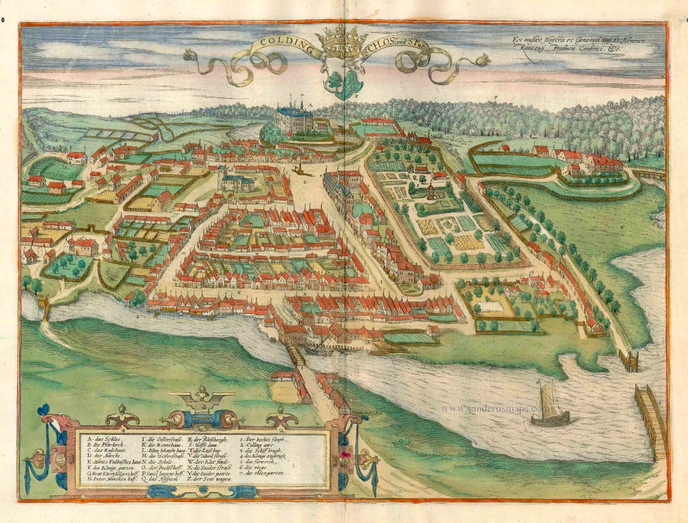
Colding Schloss und Stat c. 1610
Kolding, by Georg Braun and Frans Hogenberg.
[Item number: 16693]

Carte de l'Etat du Royaume de Dannemarck et diverses observations pour conduire à l'Intelligence de l'Histoire et du Gouvernement de ce Royaume. 1714
Denmark - Copenhagen, by Zacharias Châtelain.
[Item number: 21339]
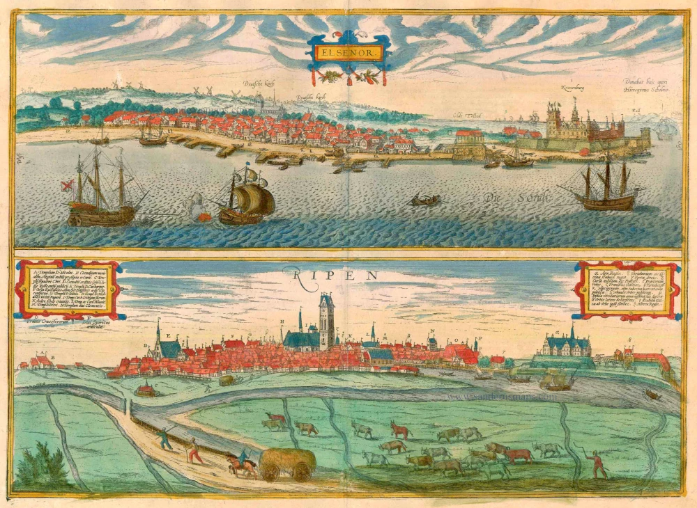
Elsenor [on sheet with] Ripen 1596-1640
Helsingør (Sjaelland) & Ribe (Jutland), by Georg Braun and Frans Hogenberg.
[Item number: 23375]
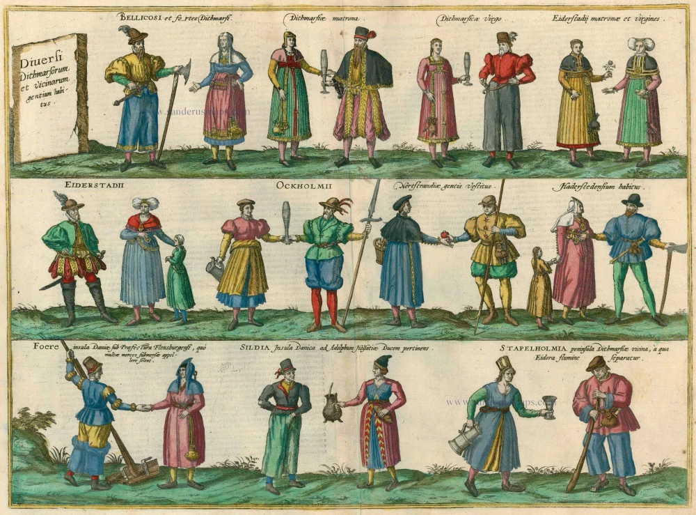
Diversi Dithmarsorum et vicinarum gentium habitus. 1596
Costumes from Dithmarschen, by Georg Braun and Frans Hogenberg.
[Item number: 24169]
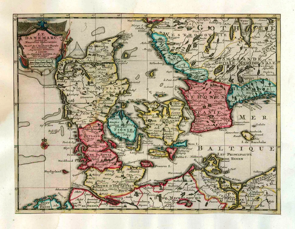
Le Danemarc, Suivant les Nouvelles Observations de Mess.rs de L'Academie Royale des Sciences, etc. 1713
Denmark, by Pieter van der Aa
[Item number: 26044]
First edition
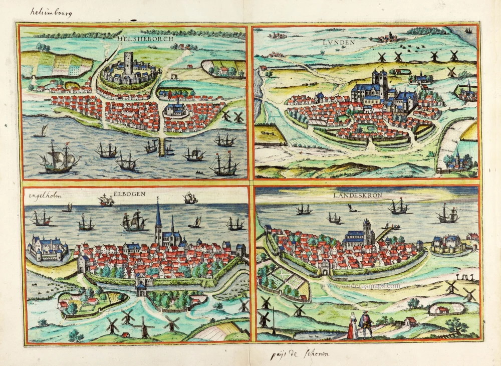
Helsheborch [on sheet with] Lunden [and] Elbogen [and] Landeskron. 1588
Braun and Hogenberg : Malmö, Helsingborg, Lund, Landskrona.
[Item number: 30136]