
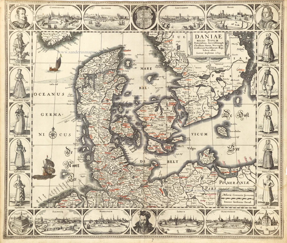
Rare and decorative map from Janssonius' 'Appendix'. Strong impression.
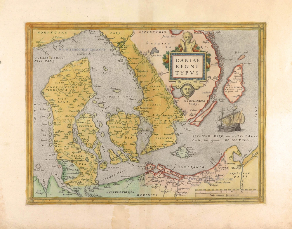
Denmark by Joannes Janssonius. 1630
The Janssonius Family
Joannes Janssonius (Arnhem, 1588-1664), son of the Arnhem publisher Jan Janssen, married Elisabeth Hondius, daughter of Jodocus Hondius, in Amsterdam in 1612. After his marriage, he settled down in this town as a bookseller and publisher of cartographic material. In 1618, he established himself in Amsterdam next door to Blaeu’s bookshop. He entered into serious competition with Willem Jansz. Blaeu when copying Blaeu’s Licht der Zeevaert after the expiration of the privilege in 1620. His activities concerned the publication of atlases, books, single maps, and an extensive book trade with branches in Frankfurt, Danzig, Stockholm, Copenhagen, Berlin, Koningsbergen, Geneva, and Lyon. In 1631, he began publishing atlases together with Henricus Hondius.
In the early 1640s, Henricus Hondius left the atlas publishing business to Janssonius. Competition with Joan Blaeu, Willem’s son and successor, in atlas production, prompted Janssonius to enlarge his Atlas Novus finally into a work of six volumes, into which a sea atlas and an atlas of the Old World were inserted. Other atlases published by Janssonius are Mercator’s Atlas Minor, Hornius’s historical atlas (1652), the townbooks in eight volumes (1657), Cellarius’s Atlas Coelestis and several sea atlases and pilot guides.
After the death of Joannes Janssonius, the shop and publishing firm were continued by the heirs under the direction of Johannes van Waesbergen (c. 1616-1681), son-in-law of Joannes Janssonius. Van Waesbergen added Janssonius's name to his own.
In 1676, Joannes Janssonius’s heirs sold by auction “all the remaining Atlases in Latin, French, High and Low German, as well as the Stedeboecken in Latin, in 8 volumes, bound and unbound, maps, plates belonging to the Atlas and Stedeboecken.” The copperplates from Janssonius’s atlases were afterwards sold to Schenk and Valck.
Daniae Regni Typum.
Item Number: 28950 Authenticity Guarantee
Category: Antique maps > Europe > Northern Europe
Old, antique map of Denmark by Joannes Janssonius.
The map is surrounded by decorative borders. In the centre of the top border is a coat of arms, flanked on each side by a portrait and two town views. In the centre of the bottom border, the portrait of Tycho Brahe is shown, framed on each side by a small view of a castle and two larger town views. Each of the side borders consists of five costumed figures.
Title: Daniae Regni Typum.
Potentißimo. Invictißimoq. D. Christiano, Daniae, Norvegiae, Gotthorum Vandalorum Regi lubens offert. Ioannes Ianßonius, 1629.
Ioannes Ianßonius Excud.
Date of the first edition: 1630.
Date of this map: 1630.
Copper engraving, printed on paper.
Map size: 450 x 540mm (17.72 x 21.26 inches).
Sheet size: 475 x 570mm (18.7 x 22.44 inches).
Verso: Blank.
Condition: Upper margin trimmed to neatline, upper right corner reinstated (1 cm), some city names underlined in red.
Condition Rating: A
From: Atlantis Maioris Appendix, sive Pars Altera, ... Amsterdam, J. Janssonius, 1630. (Van der Krogt 1, 1:202)
The Janssonius Family
Joannes Janssonius (Arnhem, 1588-1664), son of the Arnhem publisher Jan Janssen, married Elisabeth Hondius, daughter of Jodocus Hondius, in Amsterdam in 1612. After his marriage, he settled down in this town as a bookseller and publisher of cartographic material. In 1618, he established himself in Amsterdam next door to Blaeu’s bookshop. He entered into serious competition with Willem Jansz. Blaeu when copying Blaeu’s Licht der Zeevaert after the expiration of the privilege in 1620. His activities concerned the publication of atlases, books, single maps, and an extensive book trade with branches in Frankfurt, Danzig, Stockholm, Copenhagen, Berlin, Koningsbergen, Geneva, and Lyon. In 1631, he began publishing atlases together with Henricus Hondius.
In the early 1640s, Henricus Hondius left the atlas publishing business to Janssonius. Competition with Joan Blaeu, Willem’s son and successor, in atlas production, prompted Janssonius to enlarge his Atlas Novus finally into a work of six volumes, into which a sea atlas and an atlas of the Old World were inserted. Other atlases published by Janssonius are Mercator’s Atlas Minor, Hornius’s historical atlas (1652), the townbooks in eight volumes (1657), Cellarius’s Atlas Coelestis and several sea atlases and pilot guides.
After the death of Joannes Janssonius, the shop and publishing firm were continued by the heirs under the direction of Johannes van Waesbergen (c. 1616-1681), son-in-law of Joannes Janssonius. Van Waesbergen added Janssonius's name to his own.
In 1676, Joannes Janssonius’s heirs sold by auction “all the remaining Atlases in Latin, French, High and Low German, as well as the Stedeboecken in Latin, in 8 volumes, bound and unbound, maps, plates belonging to the Atlas and Stedeboecken.” The copperplates from Janssonius’s atlases were afterwards sold to Schenk and Valck.
Related items
Insularum Danicarum ut Zee-landiae, Fioniae, Langelandiae, Lalandiae, Falstriae, Fembriae, Monae aliarumq. in Mari Balthico Sitar. 1721-41
Antique map of the Danish Islands by F. de Wit, published by Covens & Mortier.
[Item number: 8492]
Insularum Danicarum ut Zee-Landiae, Fioniae, Langelandiae, Lalandiae, Falstriae, Fembriae, Mona aliarumq in Mari Balthico Sitar Descriptio. c. 1682-86
Danish Islands by de Wit F.
[Item number: 24504]
Daniae Regni Typus Cornelius Antoniades Descripsit; [On sheet with:] Oldenburg Comit. 1584
Denmark and Jutland by Abraham Ortelius.
[Item number: 29133]

Nouvelle Carte Géographique du Royaume de Dannemarck avec une Table des Villes les plus remarquables. 1714
Denmark by Zacharias Châtelain.
[Item number: 29430]
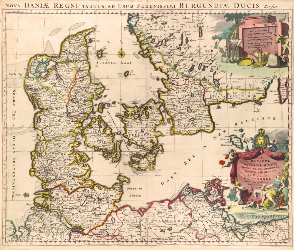
Le Royaume de Danemark, Divisé en ses Provinces. c. 1709
Denmark by Hubert Jaillot.
[Item number: 29589]
Daniae Regni Typus. 1574
Denmark by Abraham Ortelius.
[Item number: 29601]
First edition, first state of this famous map of Denmark by Marcus Jordan, published by Braun & Hogenberg.
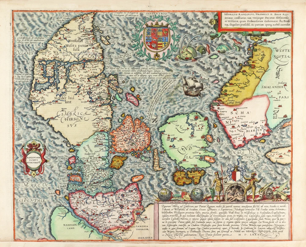
Danorum Marca, vel Cimbricum, aut Daniae Regnum ... 1588
Denmark, by Georg Braun & Frans Hogenberg.
[Item number: 30175]