
Ukraine, by Johannes Janssonius. 1666
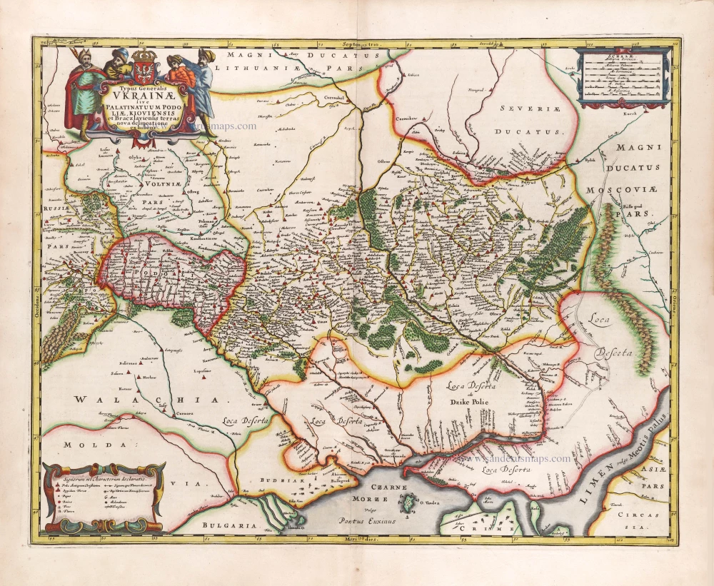


Based on Guillaume La Vasseur de Beauplan's map of the region published in "Description d'Ukraine". It was one of the earliest printed maps to include the name Ukraine in the title.
While preparing this map for printing, Jan Janszoon slightly changed it by adding references to Loyevska (1649) and Berestetska battles (1651). Also, the proportions are slightly modified, as noted by some experts, for the level of engraving skills of Gerard Valk were significantly lower than William Gondia's, the engraver Beauplan worked with. The map almost totally repeats the vast information collected by Beauplan: together with a large number of geographical names, it contains historical references to famous battles and some unexpected things, such as the location of the Cossack treasury (Scabnica woyskowa Kosasky). As for the Dnieper maps, the rapids and most of the islands are depicted. The author did specify the three Major Tatar crossings over the Dnieper (Wielka Przeprawa Tatarska) the way Beauplan did. (www.ukraina.com)
The Janssonius Family
Joannes Janssonius (Arnhem, 1588-1664), son of the Arnhem publisher Jan Janssen, married Elisabeth Hondius, daughter of Jodocus Hondius, in Amsterdam in 1612. After his marriage, he settled down in this town as a bookseller and publisher of cartographic material. In 1618, he established himself in Amsterdam next door to Blaeu’s bookshop. He entered into serious competition with Willem Jansz. Blaeu when copying Blaeu’s Licht der Zeevaert after the expiration of the privilege in 1620. His activities concerned the publication of atlases, books, single maps, and an extensive book trade with branches in Frankfurt, Danzig, Stockholm, Copenhagen, Berlin, Koningsbergen, Geneva, and Lyon. In 1631, he began publishing atlases together with Henricus Hondius.
In the early 1640s, Henricus Hondius left the atlas publishing business to Janssonius. Competition with Joan Blaeu, Willem’s son and successor, in atlas production, prompted Janssonius to enlarge his Atlas Novus finally into a work of six volumes, into which a sea atlas and an atlas of the Old World were inserted. Other atlases published by Janssonius are Mercator’s Atlas Minor, Hornius’s historical atlas (1652), the townbooks in eight volumes (1657), Cellarius’s Atlas Coelestis and several sea atlases and pilot guides.
After the death of Joannes Janssonius, the shop and publishing firm were continued by the heirs under the direction of Johannes van Waesbergen (c. 1616-1681), son-in-law of Joannes Janssonius. Van Waesbergen added Janssonius's name to his own.
In 1676, Joannes Janssonius’s heirs sold by auction “all the remaining Atlases in Latin, French, High and Low German, as well as the Stedeboecken in Latin, in 8 volumes, bound and unbound, maps, plates belonging to the Atlas and Stedeboecken.” The copperplates from Janssonius’s atlases were afterwards sold to Schenk and Valck.
Typus Generalis Ukrainae sive Palatinatuum Podoliae, Kioviensis et Braczlaviensis Terras Nova Delineatione Exhibens.
Item Number: 29957 Authenticity Guarantee
Category: Antique maps > Europe > Eastern Europe
Old, antique map of Ukraine, by Johannes Janssonius.
Title: Typus Generalis Ukrainae sive Palatinatuum Podoliae, Kioviensis et Braczlaviensis Terras Nova Delineatione Exhibens.
Cartographer: La Vasseur de Beauplan.
RARE.
Date of the first edition: 1666.
Date of this map: 1666.
Copper engraving, printed on paper.
Image size: 425 x 545mm (16.73 x 21.46 inches).
Sheet size: 520 x 605mm (20.47 x 23.82 inches).
Verso: Latin text.
Condition: Original coloured, excellent.
Condition Rating: A+.
From: Joannis Janssonii Atlas Contractus, sive Atlantis Majoris Compendium, . . . Amsterdam, Janssonius Heirs, 1666. (Van der Krogt, 1:407)
Based on Guillaume La Vasseur de Beauplan's map of the region published in "Description d'Ukraine". It was one of the earliest printed maps to include the name Ukraine in the title.
While preparing this map for printing, Jan Janszoon slightly changed it by adding references to Loyevska (1649) and Berestetska battles (1651). Also, the proportions are slightly modified, as noted by some experts, for the level of engraving skills of Gerard Valk were significantly lower than William Gondia's, the engraver Beauplan worked with. The map almost totally repeats the vast information collected by Beauplan: together with a large number of geographical names, it contains historical references to famous battles and some unexpected things, such as the location of the Cossack treasury (Scabnica woyskowa Kosasky). As for the Dnieper maps, the rapids and most of the islands are depicted. The author did specify the three Major Tatar crossings over the Dnieper (Wielka Przeprawa Tatarska) the way Beauplan did. (www.ukraina.com)
The Janssonius Family
Joannes Janssonius (Arnhem, 1588-1664), son of the Arnhem publisher Jan Janssen, married Elisabeth Hondius, daughter of Jodocus Hondius, in Amsterdam in 1612. After his marriage, he settled down in this town as a bookseller and publisher of cartographic material. In 1618, he established himself in Amsterdam next door to Blaeu’s bookshop. He entered into serious competition with Willem Jansz. Blaeu when copying Blaeu’s Licht der Zeevaert after the expiration of the privilege in 1620. His activities concerned the publication of atlases, books, single maps, and an extensive book trade with branches in Frankfurt, Danzig, Stockholm, Copenhagen, Berlin, Koningsbergen, Geneva, and Lyon. In 1631, he began publishing atlases together with Henricus Hondius.
In the early 1640s, Henricus Hondius left the atlas publishing business to Janssonius. Competition with Joan Blaeu, Willem’s son and successor, in atlas production, prompted Janssonius to enlarge his Atlas Novus finally into a work of six volumes, into which a sea atlas and an atlas of the Old World were inserted. Other atlases published by Janssonius are Mercator’s Atlas Minor, Hornius’s historical atlas (1652), the townbooks in eight volumes (1657), Cellarius’s Atlas Coelestis and several sea atlases and pilot guides.
After the death of Joannes Janssonius, the shop and publishing firm were continued by the heirs under the direction of Johannes van Waesbergen (c. 1616-1681), son-in-law of Joannes Janssonius. Van Waesbergen added Janssonius's name to his own.
In 1676, Joannes Janssonius’s heirs sold by auction “all the remaining Atlases in Latin, French, High and Low German, as well as the Stedeboecken in Latin, in 8 volumes, bound and unbound, maps, plates belonging to the Atlas and Stedeboecken.” The copperplates from Janssonius’s atlases were afterwards sold to Schenk and Valck.
Related items
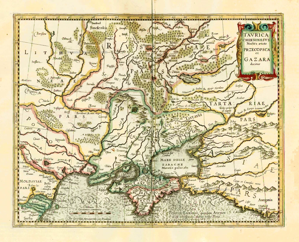
Taurica Chersonesus VS. nostra Aetate Przecopsca et Gazara Dicitur. 1641
Ukraine - Crimea by Henricus Hondius.
[Item number: 26264]

Carte de la Lithuanie Russienne qui Comprend les Palatinats de Livonie, de Witepsk, de Miscislaw, et une Partie de ceux de Polock et de Minsk Cédés par la Pologne a la Russie. 1776-79
Bellarus and parts of Lithuania and Ukraine, by Francesco Santini.
[Item number: 26969]
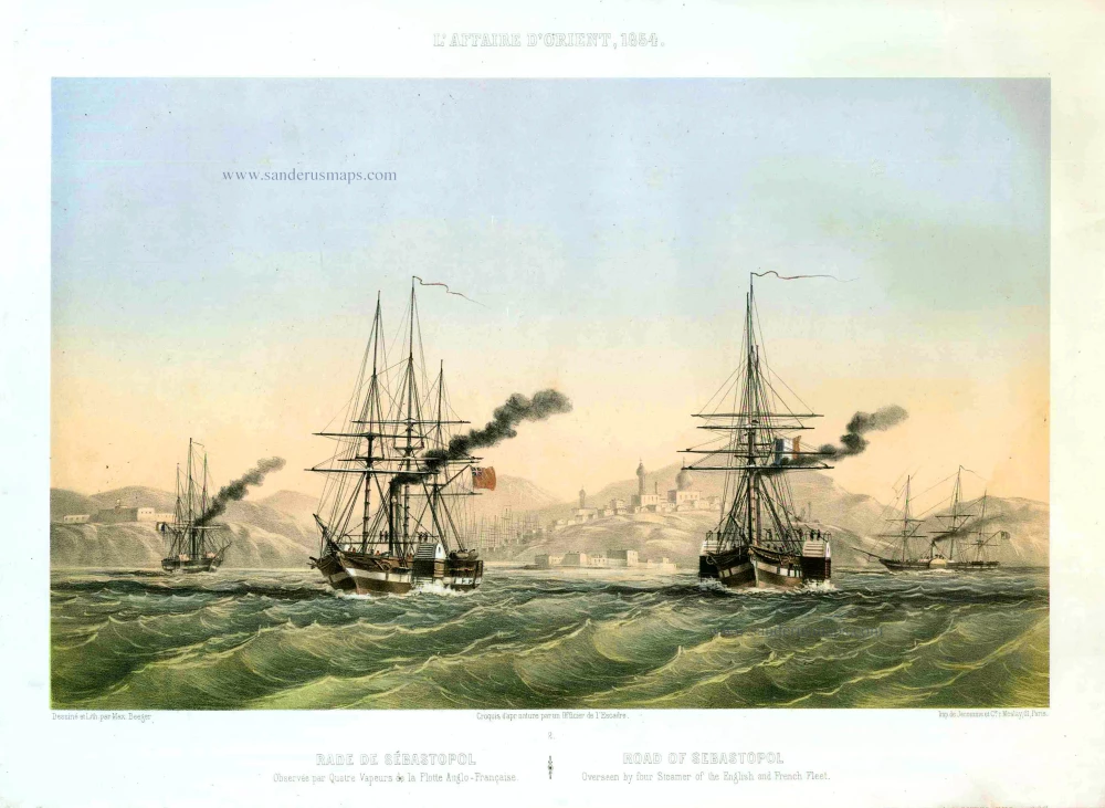
Rade de Sébastopol. Observée par quatre Vapeurs de la Flotte Anglo-Française. / Road of Sebastopol. Overseen by four Steamer of the English and French Fleet. 1854
Sebastopol (Ukraine), by Max Beeger.
[Item number: 27436]
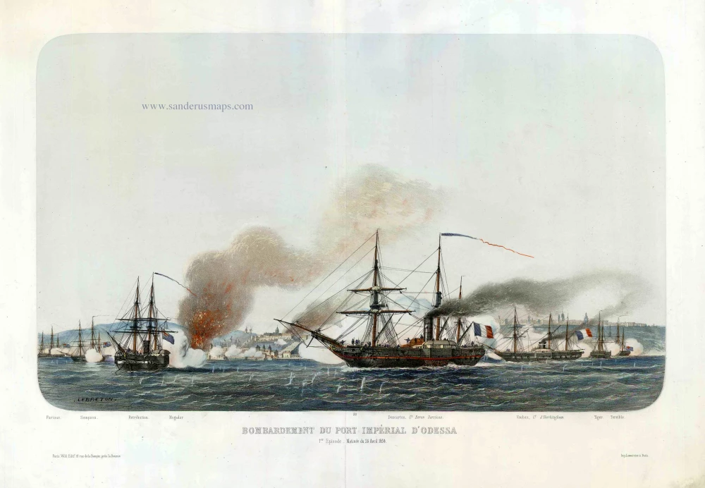
Bombardement du Port Impérial d'Odessa. c.1854
Odessa (Ukraine), by Louis Le Breton.
[Item number: 27443]
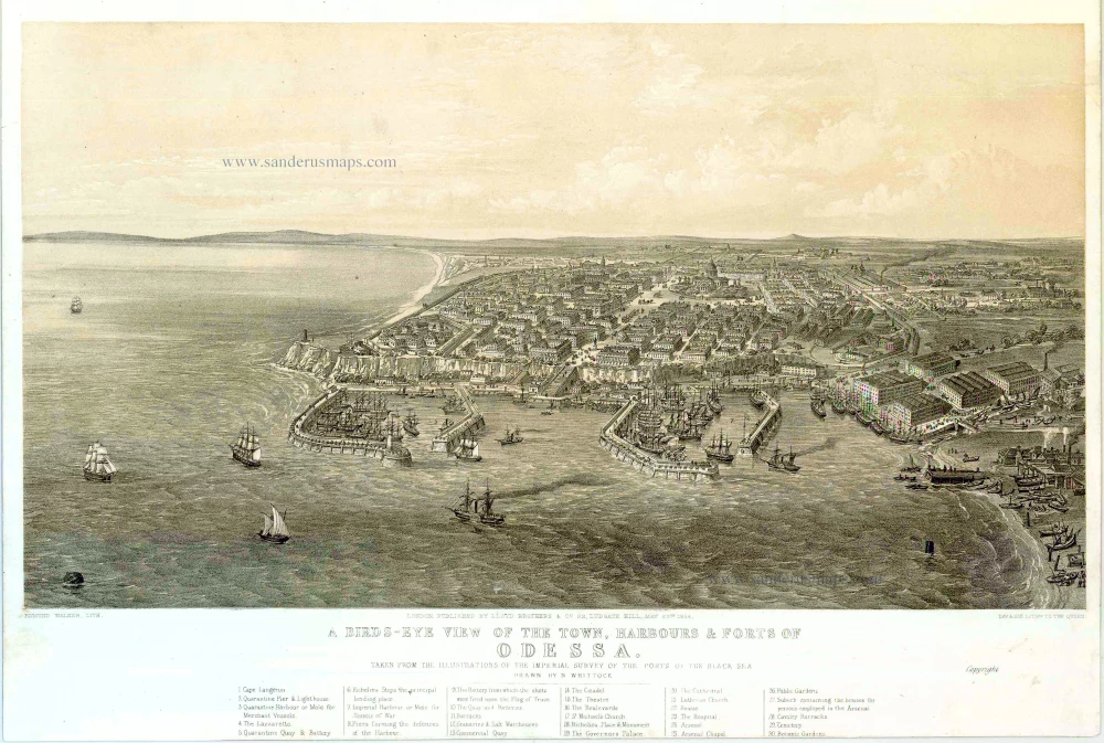
A bird's-eye view of the Town, Harbours & Forts of Odessa. 1854
Odessa (Ukraine), by H. Whittock.
[Item number: 27448]
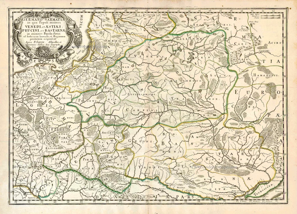
Germano-Sarmatia in qua populi maiores Venedi et Aestiaei Peucini et Bastarnae in minores populos divisi ad hodiernam locorum et regionum positionem respondent. 1658
Poland, Lithuania, Ukraine, Latvia, by Nicolas Sanson.
[Item number: 27918]

Cimmeria quae Postea Scythia Europaea Seu Parua Scythia. 1665
Ukraine, by Nicolas Sanson.
[Item number: 27919]
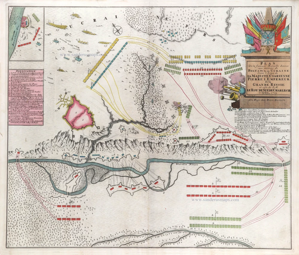
Plan de la fameuse Bataille donnee aux environs de Poltawa en Ucraine Entre l'Armee de sa Majesté Csarienne Pierre I. Empereur de la Grande Russie et celle de S.M. le Roy de Suede Charles XII. me 27 Juin -8 Jullet 1709. c. 1709
Map of the Battle of Poltawa (Ukraine) in 1709, by Pierre Husson.
[Item number: 29587]
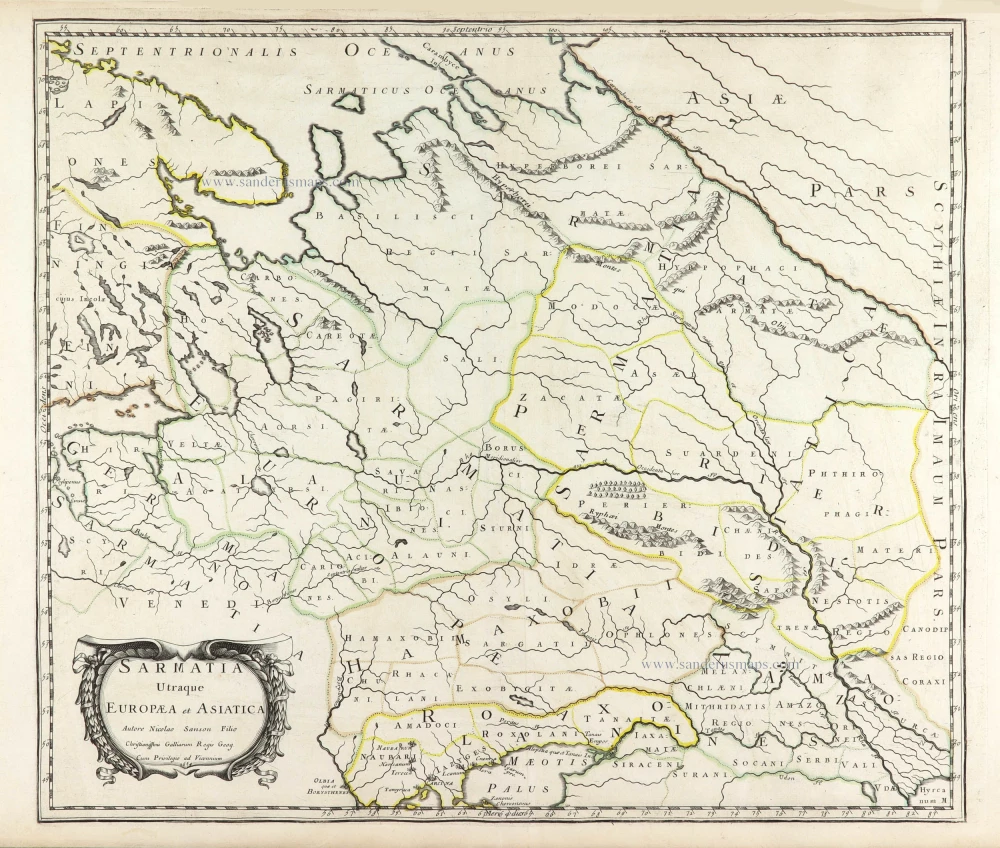
Sarmatia Utraque Europaea et Asiatica. 1659
European Russia and Ukraine by Nicolas Sanson.
[Item number: 29717]
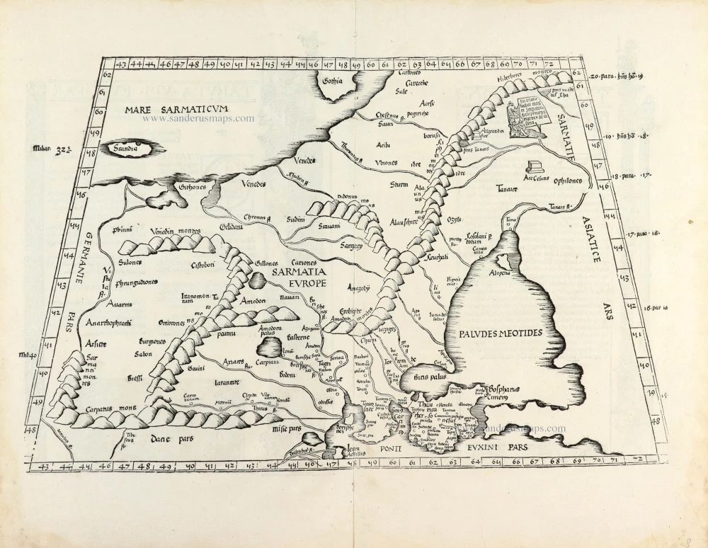
[Title on verso:] Tabula .VIII. Europae. 1525
Eastern Europe, Ukraine - Russia, by Lorenz Fries.
[Item number: 30369]