
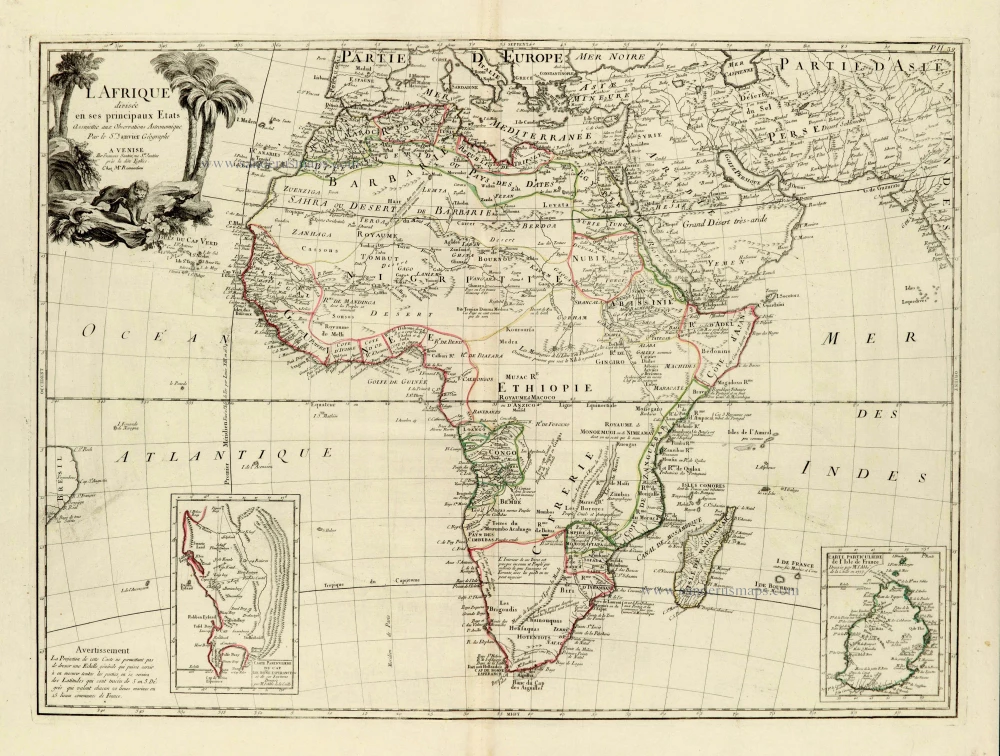
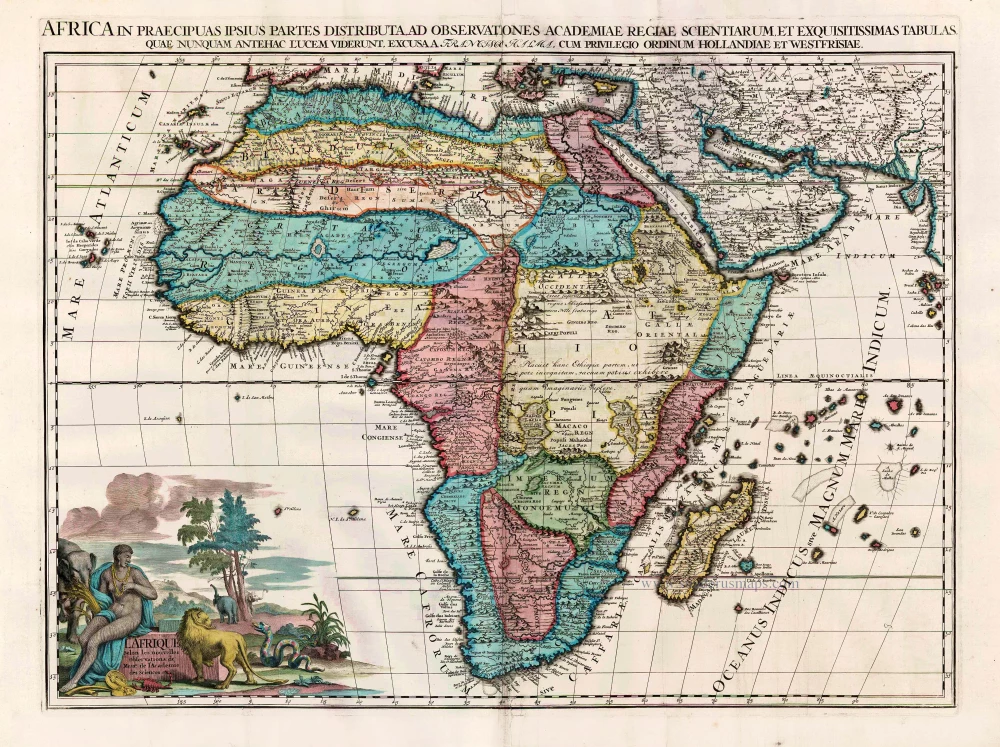
Africa, by Francesco Santini. 1776-79
Francesco and Paolo Santini (c.1729-1793)
Francesco Santini, a Venetian publisher, acquired the printing plates of Vaugondy’s Atlas Universel …, a commercial and cartographic success, with widespread influence on mapmakers throughout Europe. Together with his brother Paolo, he commissioned a new set of plates and reissued the atlas in 1776. The following year, Paolo Santini assigned all his publication rights to M. Remondini, who in 1777 reissued the same atlas but with his name.
L'Afrique divisée en ses principaux Etats.
Item Number: 28097 Authenticity Guarantee
Category: Antique maps > Africa
Old, antique map of Africa, by Francesco Santini.
Title: L'Afrique divisée en ses principaux Etats.
Assujettie aux Observations Astronomique.
Par le Sr. Janvier Géographe.
A Venise | Par François Santini, rue Ste Justine près la dite Eglise.
Chez Mr. Remondini.
With two inset maps:
- Carte Particulière du Cap de Bon(n)e Espérance et de ses environs. Dressée par M. l'Abbé de la Caille.
- Carte Particulière de l'Isle de France. Dressée par Mr. l'Abbé de la Caille en 1753.
Cartographer: Sr. Janvier Jean Denis [Robert].
Copper engraving, printed on paper.
Size (not including margins): 475 x 640mm (18.7 x 25.2 inches).
Verso: Blank.
Condition: Original coloured in outline, excellent.
Condition Rating: A+.
From: Atlas Universel dressé sur les meilleures cartes modernes. Venice, Remondini, 1776-79.
Francesco and Paolo Santini (c.1729-1793)
Francesco Santini, a Venetian publisher, acquired the printing plates of Vaugondy’s Atlas Universel …, a commercial and cartographic success, with widespread influence on mapmakers throughout Europe. Together with his brother Paolo, he commissioned a new set of plates and reissued the atlas in 1776. The following year, Paolo Santini assigned all his publication rights to M. Remondini, who in 1777 reissued the same atlas but with his name.
Related items
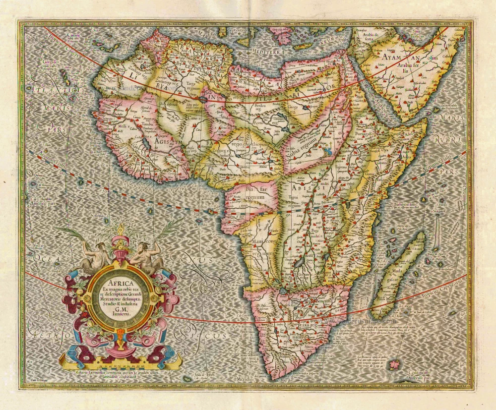
Africa Ex magna orbis terre 1633
Africa, by G. Mercator.
[Item number: 1452]
Scarce
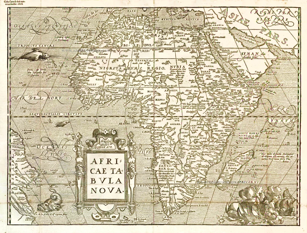
Africae Tabula Nova. 1575
Africa, by François de Belleforest.
[Item number: 27380]
Affricae Tabula Nova. 1598
Africa, by Sebastian Münster.
[Item number: 27416]
Big and beautiful map.
L'Afrique Selon les Nouvelles Observations de Messrs. de l'Academie des Sciences, etc. Before 1713
Africa, by François Halma.
[Item number: 27853]
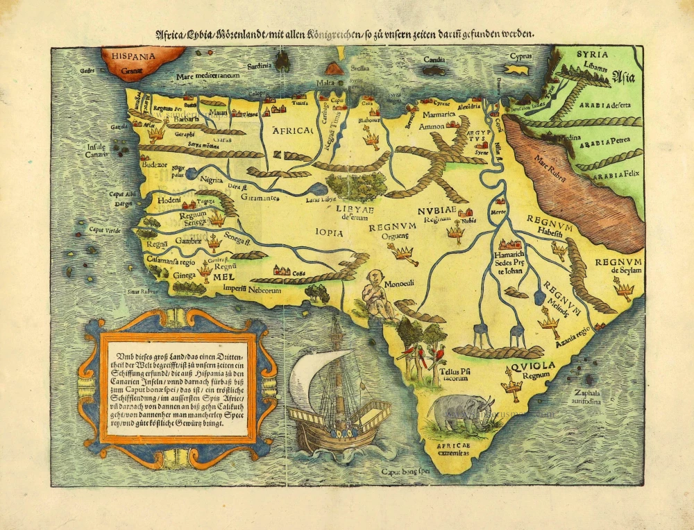
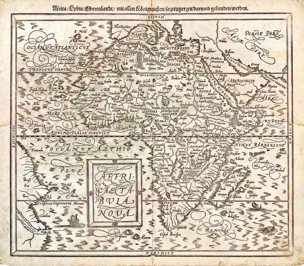
Africa / Lybia / Morenland / mit allen Künigreichen / so zu unsern zeiten darin gefunden werden. 1572
Africa by Sebastian Münster.
[Item number: 28142]
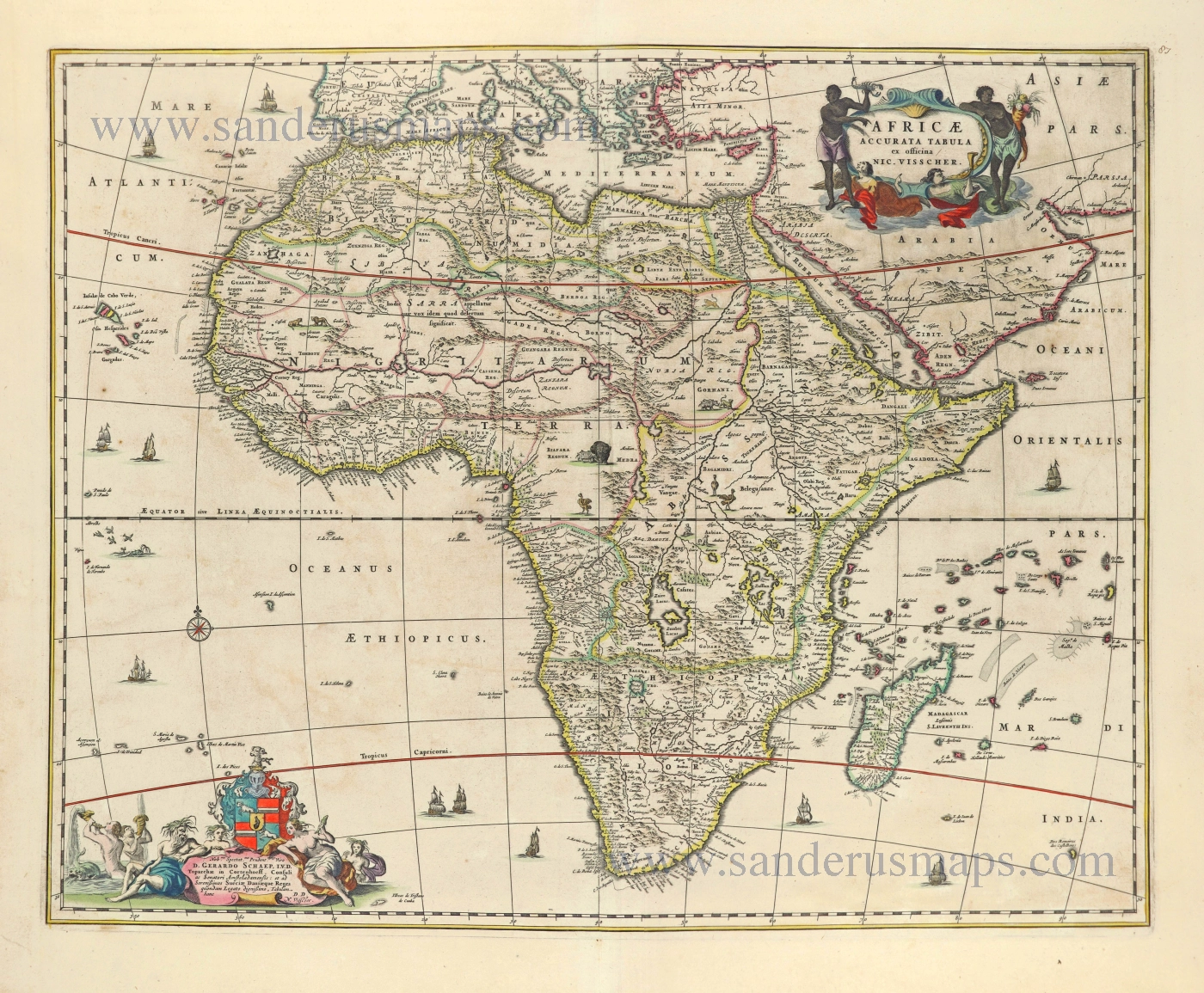
Africae Accurata Tabula. 1656-77
Africa by Nicolaes Visscher I.
[Item number: 28551]
Important map
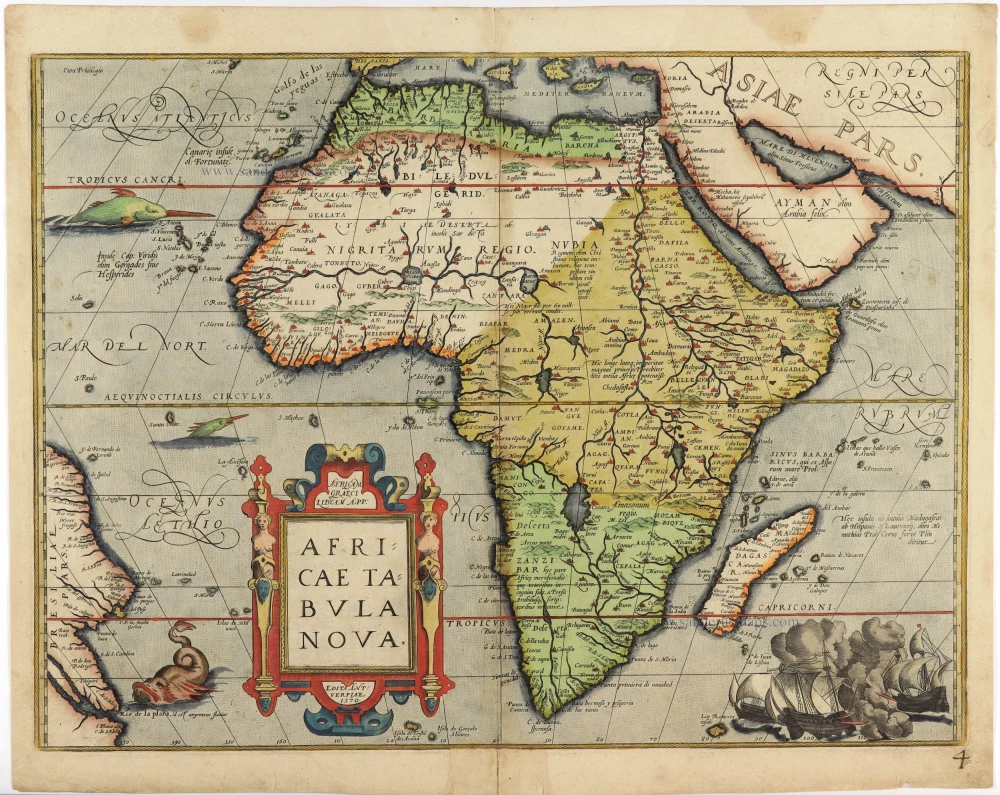
Africae Tabula Nova. 1575
Africa by Abraham Ortelius
[Item number: 30948]