
Beautiful
Ptolemy map of Africa by Martin Waldseemüller 1513



The Strasbourg Ptolemy is the most important edition of the Geographia. Preparatory work was begun in about 1505 by Martin Waldseemüller, scholar-geographer of the small town of St. Dié in Lorraine, together with his associate Mathias Ringmann. Waldseemüller is believed to have incised many of the maps himself; all are firm, distinctive woodcuts. By 1507, much progress had been made, but the project was delayed and was not completed until 1513 under the editorship of Jacob Eszler and Georg Ubelin. The printer was Johann Schott, and the work, the first modern atlas, bears a dedication to Emperor Maximilian.
Martin Waldseemüller (Ilacomilus) (c. 1473-1519)
Martin Walseemüller and his collaborator, Matthias Ringmann, are credited with the first recorded usage of the word America to name the New World in honour of the Italian explorer Amerigo Vespucci.
He was born about 1475, most probably in the village of Wolfenweiler near Freiburg in Breisgau (southern Germany). He studied at the University of Freiburg, where he met Johann Scott, the future printer of Waldseemüller’s edition of Ptolemy and Matthias Ringman, a poet who wrote Waldseemüller’s texts. Gregor Reisch was their tutor. He was noted for his philosophical work, Margaretha Philosophica (1503), a widely read book that included a world map in Ptolemaic form. He undoubtedly aroused the students’ interest in cosmography.
At the beginning of the 16th century, Walseemüller moved to St.Dié in the Vosges. He Hellenized his name to Ilacomilus and worked on an edition of Ptolemy. He learned the printing trade in Basle and became a professor of cosmography under the patronage of René II, Duke of Lorraine.
Together with a group of scholars, among them were Nicholas Lud and Matthias Ringmann, they installed a printing press in St. Dié. The first book appeared in 1507: Cosmographiae Introductio… Few books have generated as much interest and speculation as this book because it suggested that the new continent is named America in honour of Amerigo Vespucci, whose letters about his American “discoveries” form a large part of the book. Great interest was also attached to the two maps on the title page constituting part of the Cosmographiae Introductio: a large 12-panel wall map of the world and a set of globe gores. The map and globe were notable for showing the New World as a continent separate from Asia and naming the southern landmass America.
Ringmann wrote the Cosmographiae Introductio's text, using the name ‘America’. He died in 1511, and by then, Waldseemüller was having doubts about the name they had coined.
In 1511, Walseemüller published the Carta Itineraria Europae, a road map of Europe that showed essential trade routes and pilgrim routes from central Europe to Santiago de Compostela, Spain. It was the first printed wall map of Europe.
After Ringmann’s death, Waldseemüller concentrated on the new version of Ptolemy’s Geographia. Johannes Scott finally printed the new edition in 1513 in Strasbourg, and it is now regarded as the most important. Waldseemüller included twenty modern maps in the new Geographia as a separate appendix.
The 1507 wall map was lost for a long time, but Joseph Fischer found a copy in Schloss Wolfegg in southern Germany in 1901. It is the only known copy purchased by the United States Library of Congress in May 2003.
Claudius Ptolemy (c.100 – c.170 AD)
Tabula Quarta Africae
Item Number: 31187 Authenticity Guarantee
Category: Antique maps > Africa
Ptolemy map of Africa by Martin Waldseemüller.
Title: Tabula Quarta Africae
Cartographer: Claudius Ptolemy.
Date of the first edition: 1513.
Date of this map: 1513.
Woodcut, printed on paper.
Sheet size: 460 x 640mm (18.11 x 25.2 inches).
Verso: Blank.
Condition: Original coloured, excellent.
Condition Rating: A+.
From: Claudii Ptolemei viri Alexandrini Mathematice discipline Philosophi dictissimi Geographiae opus novissima . . . Strassburg, J. Schott, 1513.
The Strasbourg Ptolemy is the most important edition of the Geographia. Preparatory work was begun in about 1505 by Martin Waldseemüller, scholar-geographer of the small town of St. Dié in Lorraine, together with his associate Mathias Ringmann. Waldseemüller is believed to have incised many of the maps himself; all are firm, distinctive woodcuts. By 1507, much progress had been made, but the project was delayed and was not completed until 1513 under the editorship of Jacob Eszler and Georg Ubelin. The printer was Johann Schott, and the work, the first modern atlas, bears a dedication to Emperor Maximilian.
Martin Waldseemüller (Ilacomilus) (c. 1473-1519)
Martin Walseemüller and his collaborator, Matthias Ringmann, are credited with the first recorded usage of the word America to name the New World in honour of the Italian explorer Amerigo Vespucci.
He was born about 1475, most probably in the village of Wolfenweiler near Freiburg in Breisgau (southern Germany). He studied at the University of Freiburg, where he met Johann Scott, the future printer of Waldseemüller’s edition of Ptolemy and Matthias Ringman, a poet who wrote Waldseemüller’s texts. Gregor Reisch was their tutor. He was noted for his philosophical work, Margaretha Philosophica (1503), a widely read book that included a world map in Ptolemaic form. He undoubtedly aroused the students’ interest in cosmography.
At the beginning of the 16th century, Walseemüller moved to St.Dié in the Vosges. He Hellenized his name to Ilacomilus and worked on an edition of Ptolemy. He learned the printing trade in Basle and became a professor of cosmography under the patronage of René II, Duke of Lorraine.
Together with a group of scholars, among them were Nicholas Lud and Matthias Ringmann, they installed a printing press in St. Dié. The first book appeared in 1507: Cosmographiae Introductio… Few books have generated as much interest and speculation as this book because it suggested that the new continent is named America in honour of Amerigo Vespucci, whose letters about his American “discoveries” form a large part of the book. Great interest was also attached to the two maps on the title page constituting part of the Cosmographiae Introductio: a large 12-panel wall map of the world and a set of globe gores. The map and globe were notable for showing the New World as a continent separate from Asia and naming the southern landmass America.
Ringmann wrote the Cosmographiae Introductio's text, using the name ‘America’. He died in 1511, and by then, Waldseemüller was having doubts about the name they had coined.
In 1511, Walseemüller published the Carta Itineraria Europae, a road map of Europe that showed essential trade routes and pilgrim routes from central Europe to Santiago de Compostela, Spain. It was the first printed wall map of Europe.
After Ringmann’s death, Waldseemüller concentrated on the new version of Ptolemy’s Geographia. Johannes Scott finally printed the new edition in 1513 in Strasbourg, and it is now regarded as the most important. Waldseemüller included twenty modern maps in the new Geographia as a separate appendix.
The 1507 wall map was lost for a long time, but Joseph Fischer found a copy in Schloss Wolfegg in southern Germany in 1901. It is the only known copy purchased by the United States Library of Congress in May 2003.
Claudius Ptolemy (c.100 – c.170 AD)
Related items

Ptolemaic map of the African continent
[Title on verso:] Tabula .IIII. Aphricae. 1525
Africa, by Lorenz Fries,
[Item number: 27976]

With rare old colour
Secunda Asiae Tabula. 1513
Russia and Caucasus by Martin Waldseemüller.
[Item number: 28794]
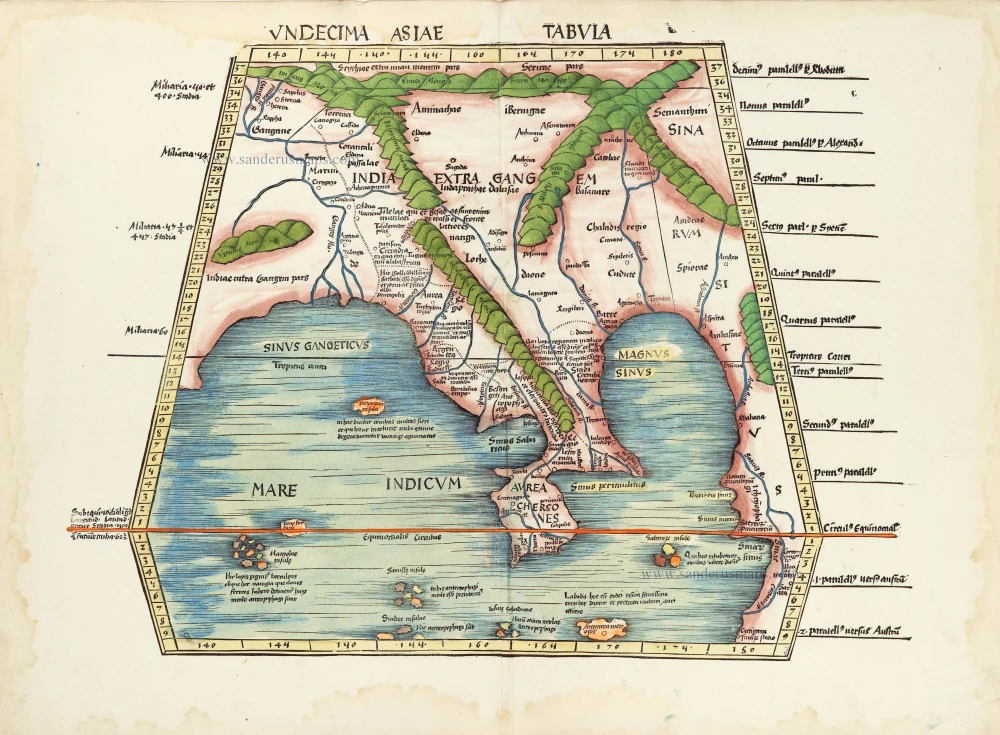
In rare original colour.
Undecima Asiae Tabula. 1513
South Asia by Waldseemüller Martin
[Item number: 29249]

Africae nova descriptio. 1640
Africa by Willem Blaeu.
[Item number: 31334]

Totius Africae Accuratissima Tabula Authore I. Danckerts Amstelodami 1683-1690
Africa by Justus Danckerts.
[Item number: 31787]

Africa. 1618
Africa by Petrus Bertius, published by Jodocus Hondius II.
[Item number: 32060]

Totius Africae Nova Repraesentatio qua Practer Diversos in ea Status et Regiones, etiam Origo Nili 1712
Africa by Homann J.B.
[Item number: 32097]

Novissima et Perfectissima Africae 1696-1713
Africa by Danckerts J.
[Item number: 32459]
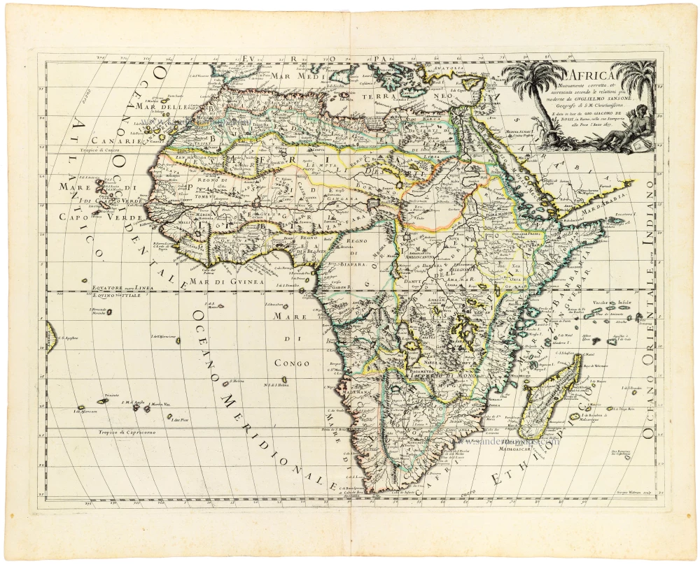
L' Africa. 1677
Africa by Giovanni De Rossi, after Nicolas Sanson.
[Item number: 32888]

L'Afrique divisée en ses principaux Etats. 1762
Africa by Jean Denis Janvier, published by Jean Lattré.
[Item number: 33071]

Afrique. 1659
Africa by Nicolas Sanson.
[Item number: 33215]
new
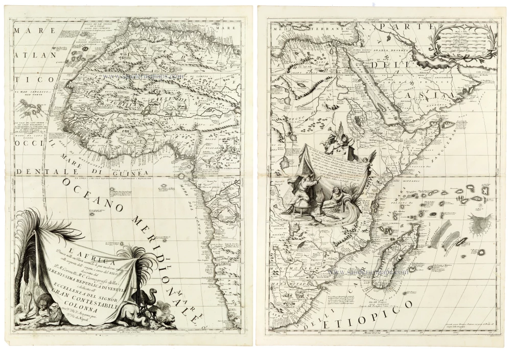
An outstanding example of late seventeenth-century Italian cartography
L'Africa Divisa nelle sue Parti Secondo le Piu Moderne Relationi colle scoperte dell' origine, e corso del Nilo, 1691
Africa by Coronelli V.M.
[Item number: 33307]
new