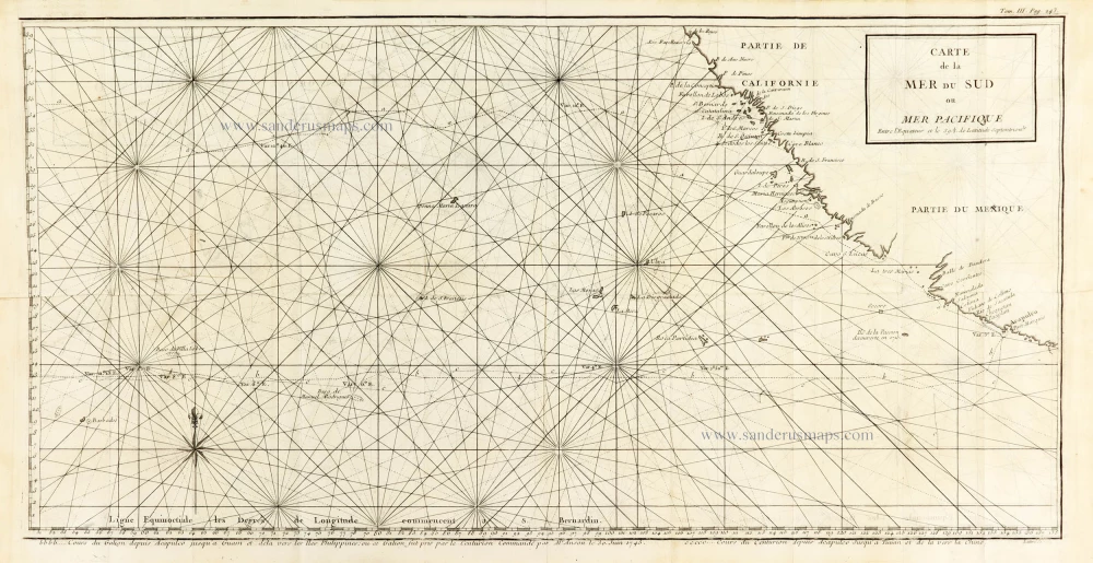
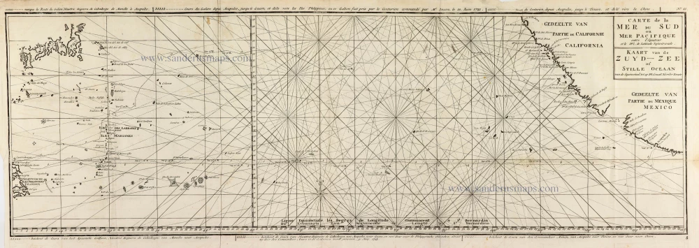
Map of the southern Pacific, showing a part of the path of George Anson's voyage around the world. 1748
Captain George Anson (1697-1762)
Circumnavigator in 1740-44. Later Admiral of the Fleet.
Captain George Anson led a squadron of eight ships on a mission to disrupt or capture the Pacific Ocean possessions of the Spanish Empire. He left Hampshire, England, in 1740 and returned to Britain in 1744 through China, thus completing a circumnavigation of the globe.
Carte de la Mer du Sud ou Mer Pacifique. Entre l'Equateur et le 39.5 de Latitude septentrion.le.
Item Number: 30330 Authenticity Guarantee
Category: Antique maps > America > North America
Map of the southern Pacific, showing a part of the path of George Anson's voyage around the world.
Title: Carte de la Mer du Sud ou Mer Pacifique. Entre l'Euateur et le 39.5 de Latitude septentrion.le.
Cours du Galion depuis Acapulco Jusquà Guam et dela vers les Iles Philippines, ou ce Galon fut pris par le Centurion Commandé par Mr Anson le 30. Juin 1743.
... Cours du Centrurion depuis Acapulco Jusqu'à Tinian et de la vers la Chine.
Latré Sc.
Engraver: Jean Lattré.
Date: 1748.
Copper engraving, printed on paper.
Image size: 430 x 410mm (16.93 x 16.14 inches).
Sheet size: 450 x 435mm (17.72 x 17.13 inches).
Verso: Blank.
Condition: Folds as issued.
Condition Rating: A+.
From: Anson G. Voyage autour du monde. Paris, 1748.
Captain George Anson (1697-1762)
Circumnavigator in 1740-44. Later Admiral of the Fleet.
Captain George Anson led a squadron of eight ships on a mission to disrupt or capture the Pacific Ocean possessions of the Spanish Empire. He left Hampshire, England, in 1740 and returned to Britain in 1744 through China, thus completing a circumnavigation of the globe.


