
Map of the southern Pacific, showing a part of the path of George Anson's voyage around the world. 1751
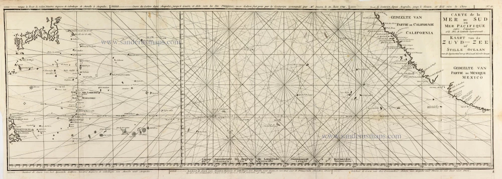
Captain George Anson (1697-1762)
Circumnavigator in 1740-44. Later Admiral of the Fleet.
Captain George Anson led a squadron of eight ships on a mission to disrupt or capture the Pacific Ocean possessions of the Spanish Empire. He left Hampshire, England, in 1740 and returned to Britain in 1744 through China, thus completing a circumnavigation of the globe.
Carte de la Mer du Sud ou Mer Pacifique entre l'Equateur et le 39.5 de Latitude Septentrionale. - Kaart van de Zuyd-Zee of Stille Oceaan ...
Item Number: 30609 Authenticity Guarantee
Category: Antique maps > America > North America
Map of the southern Pacific, showing part of George Anson's voyage around the world. The chart shows the width of the ocean at 39.5° of latitude, flanked by the coasts of California and Mexico to the east and the Philippines and Japan to the west.
Title: Carte de la Mer du Sud ou Mer Pacifique entre l'Equateur et le 39.5 de Latitude Septentrionale. - Kaart van de Zuyd-Zee of Stille Oceaan ...
marque la Route du Galion Nuestra Seignora de Cabadongo de Manille à Acapulco.
Cours du Galion depuis Acapulco Jusquà Guam et dela vers les Iles Philippines, ou ce Galon fut pris par le Centurion Commandé par Mr Anson le 30. Juin 1743.
... Cours du Centrurion depuis Acapulco Jusqu'à Tinian et de la vers la Chine.
Date: 1748.
Copper engraving, printed on paper.
Image size: 300 x 880mm (11.81 x 34.65 inches).
Sheet size: 330 x 905mm (12.99 x 35.63 inches).
Verso: Blank.
Condition: Folds as issued.
Condition Rating: A.
From: Anson G. Reize rondom de wereld. Amsterdam, 1751.
Captain George Anson (1697-1762)
Circumnavigator in 1740-44. Later Admiral of the Fleet.
Captain George Anson led a squadron of eight ships on a mission to disrupt or capture the Pacific Ocean possessions of the Spanish Empire. He left Hampshire, England, in 1740 and returned to Britain in 1744 through China, thus completing a circumnavigation of the globe.
Related items

Carte du Canal des Iles Philippines par lequel Passe le Galion de Manille et les Iles Voisines de ce Canal. 1749
Philippines by Bonne Rigobert
[Item number: 26611]
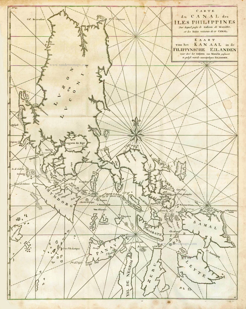
Carte du Canal des Iles Philippines par lequel Passe le Galion de Manille et les Iles Voisines de ce Canal. - Kaart van het Kanaal in de Filippynsche Eilanden waar door het Galjoen van Manilla passeert, tegelijk met de naast gelegen Eilanden. 1748
The Philippines, by George Anson.
[Item number: 27036]

Lucon of Luconia. 1726
Philippines, by Valentyn François
[Item number: 27895]
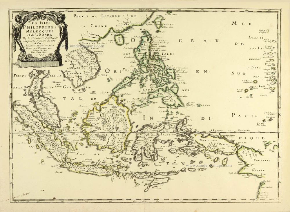
Les Isles Philippines Molucques et de la Sonde. 1658
Southeast Asia par Nicolas Sanson.
[Item number: 28378]

Novae Hispaniae, Chili, Peruviae, et Guatimalae Littorae. ca. 1680
Pacific Coast of America, by Frederick de Wit.
[Item number: 29177]

One of the most elaborately engraved maps ever published.
Carte tres Curieuse de la Mer du Sud, Contenant des Remarques Nouvelles et tres Utiles non Seulement sur les Ports et Iles de cette Mer, 1719
Pacific by Zacharias Châtelain after Nicolas de Fer.
[Item number: 29466]
Rare
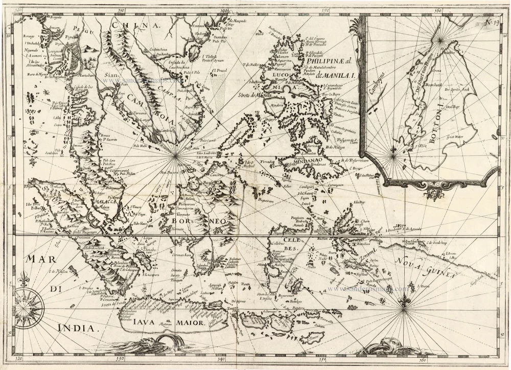
[No title] - 'Mar di India'. 1645
East Indies by van Spilbergen Joris.
[Item number: 30057]

Carte de la Mer du Sud ou Mer Pacifique. Entre l'Equateur et le 39.5 de Latitude septentrion.le. 1748
Map of the southern Pacific, showing a part of the path of George Anson's voyage around the world.
[Item number: 30330]

An Essay of a New and Compact Map, containing the known parts of the Terrestrial Globe. 1750
World map by Jacques-Nicolas Bellin, published by A.F. Prévost.
[Item number: 31883]

Important map
Maris Pacifici, (quod vulgo Mar del Zur) cum regionibus circumiacentibus, insulisque in codem passim sparsis, novissima descriptio. 1603
Pacific Ocean by Abraham Ortelius.
[Item number: 33069]
new