
Rare
East Indies by van Spilbergen Joris. 1645
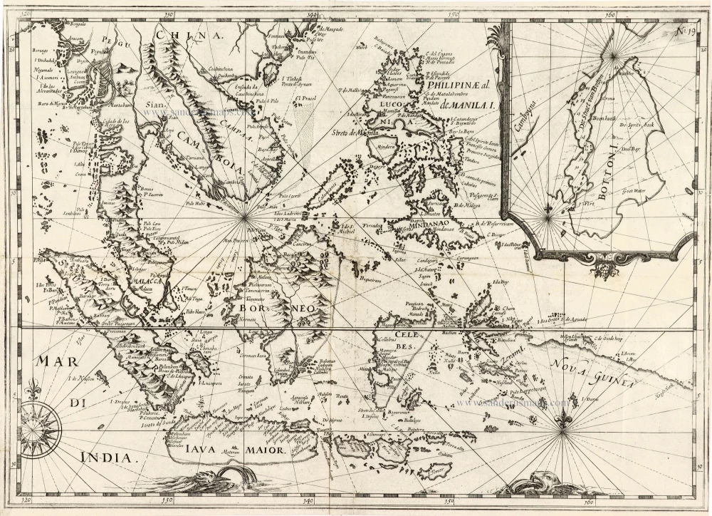
This untitled map of the East Indies and the Philippines is copied from the one published in 1619 in De Bry's Grand Voyages. The map is called 'Mar Di India', after this text in the bottom left corner. The map now has an inset map of Buton Island in the upper right corner. The inclusion of this little known Island, seemingly at the expense of the actual Spice Islands of Ternate, Tidoe and the Banda Islands group further to the northeast and east, seems strange on a chart specifically designed to show the route to the Moluccas unless this channel was an important, if somewhat dangerous part of the route to the actual Spice Islands. The island produced no spices but was frequently mentioned in seventeenth-century European accounts of the East Indies. It was an essential stop for VOC ships en route from their headquarters at Batavia and Makassar to the Moluccan Sice Islands.
Joris van Spilbergen (1568-1620)
Dutch admiral and circumnavigator. One of the first Dutch voyagers to the East, undertaking a voyage to Ceylon and Bantam 1601-1604 and a circumnavigation journey 1614-1617.
[No title] - 'Mar di India'.
Item Number: 30057 Authenticity Guarantee
Category: Antique maps > Asia > Southeast Asia
Old, antique map of Southeast Asia by Joris van Spilbergen.
[No title] - 'Mar di India'.
Date of the first edition: 1645.
Date of this map: 1645.
Copper engraving, printed on paper.
Image size: 320 x 445mm (12.6 x 17.52 inches).
Sheet size: 325 x 450mm (12.8 x 17.72 inches).
Verso: Blank.
Condition: Folds as issued, very good condition
Condition Rating: A+
From: Begin ende Voortgangh, Van De Vereenighde Nederlantsche Geoctroyeerde Oost-indische Compagnie. Amstedam, J. Janssonius, 1645.
This untitled map of the East Indies and the Philippines is copied from the one published in 1619 in De Bry's Grand Voyages. The map is called 'Mar Di India', after this text in the bottom left corner. The map now has an inset map of Buton Island in the upper right corner. The inclusion of this little known Island, seemingly at the expense of the actual Spice Islands of Ternate, Tidoe and the Banda Islands group further to the northeast and east, seems strange on a chart specifically designed to show the route to the Moluccas unless this channel was an important, if somewhat dangerous part of the route to the actual Spice Islands. The island produced no spices but was frequently mentioned in seventeenth-century European accounts of the East Indies. It was an essential stop for VOC ships en route from their headquarters at Batavia and Makassar to the Moluccan Sice Islands.
Joris van Spilbergen (1568-1620)
Dutch admiral and circumnavigator. One of the first Dutch voyagers to the East, undertaking a voyage to Ceylon and Bantam 1601-1604 and a circumnavigation journey 1614-1617.
Related items

Archipel des Indes Orientales qui Comprend les Isles de la Sonde, Moluques et Philippines. c. 1757
Southeast Asia, par Robert de Vaugondy.
[Item number: 4751]

The most accurate and one of the most elegant 17th c. maps of the East Indies
Indiae Orientalis Nova Descriptio. 1644-58
Southeast Asia by Janssonius, Johannes
[Item number: 10013]

India Orientalis. 1607
Southeast Asia, by G. Mercator - J. Hondius (small)
[Item number: 25186]

From the Cloppenburg edition
Insulae Indiae Orientalis. 1630
Southeast Asia, by G. Mercator - J. Hondius.
[Item number: 25234]

Le Royaume de Siam avec les Royaumes qui luy sont Tributaires, et les Isles de Sumatra, Andemaon, etc. et les Isles Voisine. c. 1700
Southeast Asia, by J. Ottens.
[Item number: 25716]

Indiae Orientalis nec non Insularum Adiacentium Nova Descriptio. c. 1740
Southeast Asia by Nicolaes Visscher, published by Petrus Schenk.
[Item number: 25718]
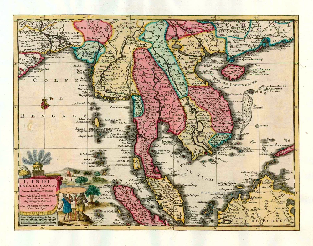
L'Inde de la le Gange, 1713
Southeast Asia, by Pieter van der Aa.
[Item number: 26097]

India Orientalis. 1597
Southeast Asia, by Giovanni Magini.
[Item number: 26521]
This map has the first accurate depiction of the Philippines
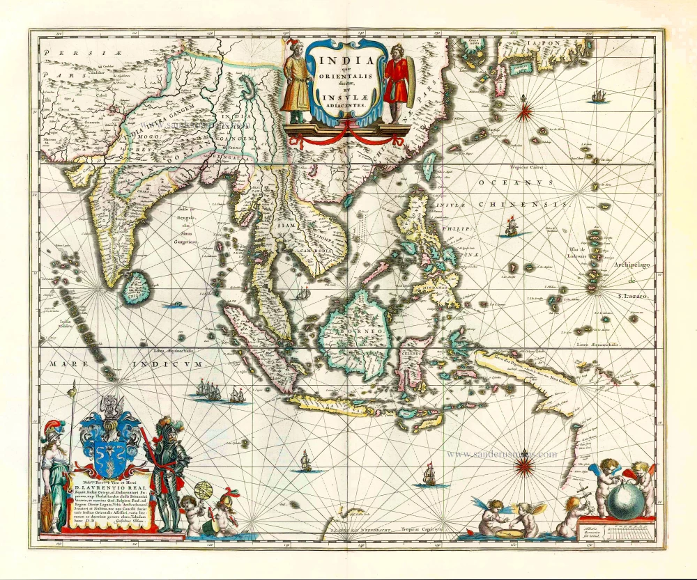
India quae Orientalis dicitur et Insulae Adiacentes. 1640-43
Southeast Asia by Willem & Joan Blaeu
[Item number: 26566]

Archipel des Indes Orientales qui comprend les Isles de la Sonde, Moluques et Philippines. 1776-79
Southeast Asia, by Francesco Santini.
[Item number: 26977]

Seconde Partie de la Carte d'Asie Contenant la Chine et Partie de la Tartarie, l'Inde au Deca du Gange, les Isles Sumatra, Java, Borneo, Moluques, Philippines, et du Japo 1746-53
Southeast Asia, by J.B. d'Anville.
[Item number: 27401]

A New and Accurate Map of the East India Islands. 1747
Southeast Asia, by Emanuel Bowen.
[Item number: 28012]

Suite de L'Ocean Oriental Contenant Les Isles de la Sonde Les Costes de Tunquin et de la Chine Les Isles du Japon les Philippines Moluques. 1747
Southeast Asia by Jacques Nicolas Bellin.
[Item number: 28189]

Carte des Indes en deçà et au dela du Gange; avec les Isles de la Sonde, Borneo, les Moluques et les Philippines. Partie Orientale. 1690
Southeast Asia by Rigobert Bonne.
[Item number: 28304]

Scarce
Tabula Asiae XI. 1548
Southeast Asia by Giacomo Gastaldi / Ptolemy.
[Item number: 28362]

Indiae Orientalis nec non Insularum Adiacentium Nova Descriptio. 1678
Southeast Asia by Nicolaes Visscher I.
[Item number: 28555]

Isole dell'Indie, Divise in Filippine, Molucche, e della Sonda. 1696
Southeast Asia and Northwest Australia by Vincenzo Coronelli.
[Item number: 28670]

Indiae Orientalis nec non Insularum Adiacentium. c. 1691-97
Southeast Asia - Australia by Frederick de Wit.
[Item number: 29091]
In rare original colour.
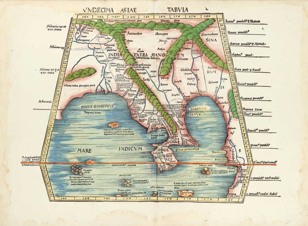
Undecima Asiae Tabula. 1513
South Asia by Waldseemüller Martin
[Item number: 29249]

Isole Molucche.- [Above map :] Descrittione del l'Isole Molucche. 1590
Southeast Asia by Tommaso Porcacchi.
[Item number: 29788]

Two early modern maps of Southeast Asia by L. Fries and M. Waldseemüller
Tabu. Moder. Indiae [together with] India Orien talis. 1535
South Asia by Lorens Fries
[Item number: 30141]
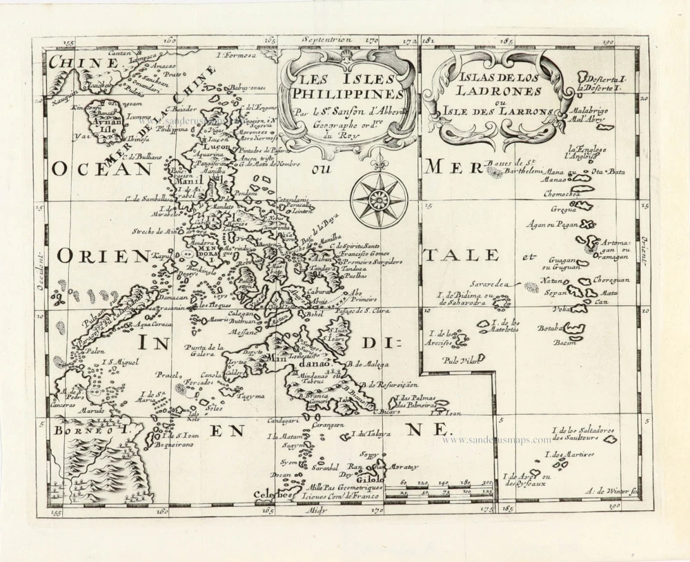
Les Isles Philippines [on sheet with] Islas de los Ladrones ou Isle des Larrons. 1747-74
Philippines, by Nicolas Sanson, published by Prevost d'Exiles.
[Item number: 30304]

Very rare first 1570 A edition.
Indiae Orientalis Insularumque Adiacientium Typus. 1570
Southeast Asia, by Abraham Ortelius.
[Item number: 30592]
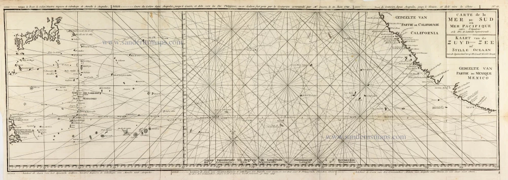
Carte de la Mer du Sud ou Mer Pacifique entre l'Equateur et le 39.5 de Latitude Septentrionale. - Kaart van de Zuyd-Zee of Stille Oceaan ... 1751
Map of the southern Pacific, showing a part of the path of George Anson's voyage around the world.
[Item number: 30609]

Scarce
D'Indize kusten van Bengale, Pegu, Malacca en Siam tot in China, met d'Eylanden Sumatra, Iava, Borneo, Moluccos en andere. [with:] De vaste kusten en eylanden van Indien, van Pegu en Malacca af, tot aan de Moluccos, etc. 1714
Southeast Asia by Pieter Vander Aa, two maps.
[Item number: 31123]
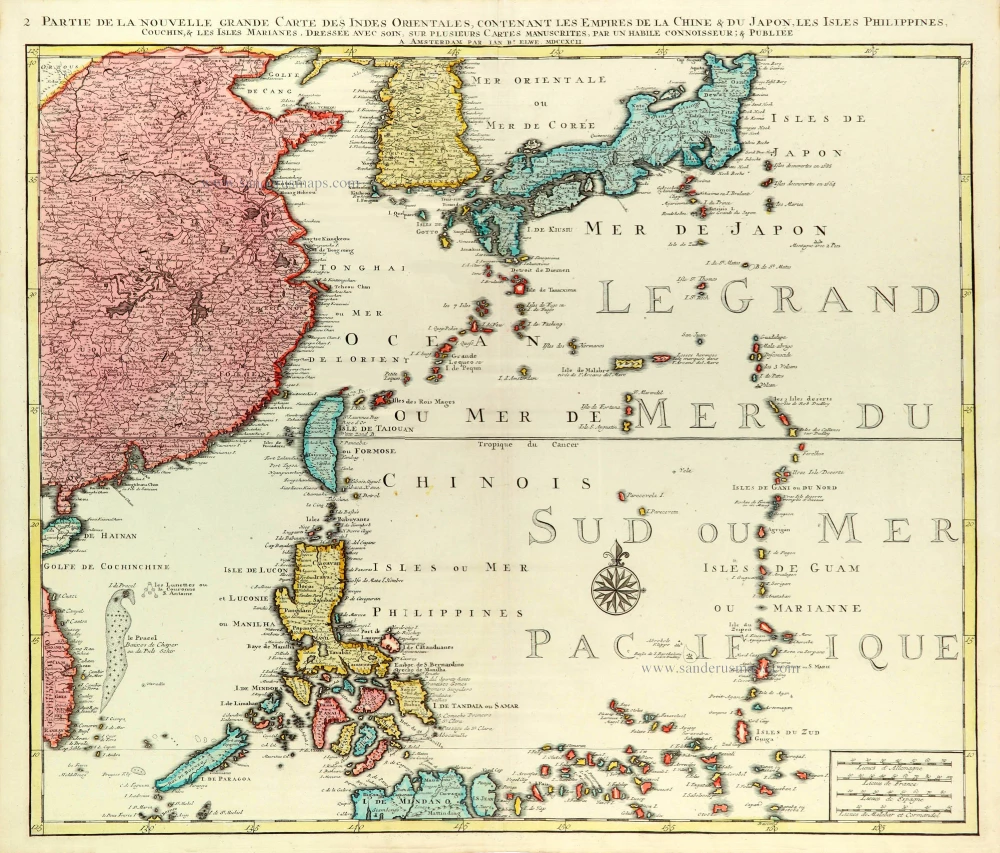
Partie de la Nouvelle Grande Carte des Indes Orientales Contenant les Empires de la Chine, du Japon, les Isles Philippines, Couchin, & les Isles Marianes, 1792
East Asia (Japan - Philippines) by J.B. Elwe.
[Item number: 31803]

Carte des Isles Philippines Celebes et Moluqes. 1747
Philippines, Moluccas, Borneo, and Sulawesi after J.N. Bellin, published by A.F. Prévost.
[Item number: 31881]
India Orien. c. 1600
Southeast Asia by Barent Langenes.
[Item number: 32298]

Scarce
Zee-togt van Alfonso d'Albuquerque na de Roode Zee, d'Arabize en Persize kusten, met die van Ormus, Guzaratte, Goa, Malacca en Verder Indien tot aan't Eiland Iava. 1707
Indian Ocean & Southeast Asia by Pieter Van der Aa.
[Item number: 32321]

Scarce
De Kusten van Guzaratte, Malabar, Bengale en Malacca met die van't Magtig Koninkryk Siam, tot aan China bestevend. 1707
Indian Ocean, India, Thailand, and Siam by Pieter Van der Aa.
[Item number: 32323]

Rare
Manual del viajero en Filipinas. 1875
Philippines, travel book by Ramon Gonzalez Fernandez & Federico Moreno y Jeréz
[Item number: 32605]

Beautiful example of this important map
Indiae Orientalis Insularumque Adiacientium Typus. 1587
Southeast Asia, by Abraham Ortelius.
[Item number: 32831]

An extremely decorative sea chart (Norwhich)
Nieuwe Pascaert van Oost Indien Verthoonende hen van C. De Bona Esperanca tot aen het Landt van Eso. 1683
Indian Ocean - Southeast Asia - Australia by Johannes Van Keulen
[Item number: 33150]
new