
Scarce
Southeast Asia by Giacomo Gastaldi / Ptolemy. 1548

Giacomo Gastaldi (c. 1500 – 1566)
Giacomo Gastaldi was born in Villafranca, in Piedmont, to a wealthy family. Although he is considered one of the greatest cartographers of the sixteenth century, the events of his life and his professional training in the field of cartography are unknown to us until he arrives in Venice, where, in 1539, he obtained a perpetual printing privilege from the Venetian Senate.
One of the first Venetian contacts took place with the geographer and humanist Giovanni Battista Ramusio, with whom he collaborated. At the beginning of the 1540s, Gastaldi was already an established cartographer and began to work on a series of maps first published separately and then included in the Italian edition of Ptolemy's Geography of 1548 and others made from scratch.
By the 1540s, he had developed his distinctive style of copper engraving for his increasingly prolific output of maps. His maps were used as a source by many mapmakers, including Camocio, Bertelli, Forlani, Ramusio, Cock, Luchini and Ortelius.
With the support of his influential friendships, Gastaldi also obtained public positions: in 1549, the Council of Ten commissioned him to make a large map of Africa, for a wall from the armoury in the Doge's Palace and, again for the same room, one map of Asia and one of North America.
It is difficult to quantify the number of maps he produced; more than a hundred have been attributed to him.
Paolo Forlani collaborated for a long time with Gastaldi and published numerous counterfeits and not authorized editions.
Gastaldi died in Venice on 14 October 1566.
Tabula Asiae XI.
Item Number: 28362 Authenticity Guarantee
Category: Antique maps > Asia > Southeast Asia
Old, antique map of Southeast Asia, by Giacomo Gastaldi.
Title: Tabula Asiae XI.
Date of the first edition: 1548.
Date of this map: 1548.
Copper engraving, printed on paper.
Size (not including margins): 130 x 170mm (5.12 x 6.69 inches).
Sheet size: 170 x 205mm (6.69 x 8.07 inches).
Verso: Italian text.
Condition: Excellent.
Condition Rating: A+.
References: Karrow, 30/39
From: Ptolomeo. La Geografia di Claudio Ptolemeo Alessandrino, Con alcuni comenti & aggiunte fat teui da Sebastiano munstero Alamanno, ... In Venetia, per Gioà Baptista Pedrezano. ... M.D.XLVIII.
Giacomo Gastaldi (c. 1500 – 1566)
Giacomo Gastaldi was born in Villafranca, in Piedmont, to a wealthy family. Although he is considered one of the greatest cartographers of the sixteenth century, the events of his life and his professional training in the field of cartography are unknown to us until he arrives in Venice, where, in 1539, he obtained a perpetual printing privilege from the Venetian Senate.
One of the first Venetian contacts took place with the geographer and humanist Giovanni Battista Ramusio, with whom he collaborated. At the beginning of the 1540s, Gastaldi was already an established cartographer and began to work on a series of maps first published separately and then included in the Italian edition of Ptolemy's Geography of 1548 and others made from scratch.
By the 1540s, he had developed his distinctive style of copper engraving for his increasingly prolific output of maps. His maps were used as a source by many mapmakers, including Camocio, Bertelli, Forlani, Ramusio, Cock, Luchini and Ortelius.
With the support of his influential friendships, Gastaldi also obtained public positions: in 1549, the Council of Ten commissioned him to make a large map of Africa, for a wall from the armoury in the Doge's Palace and, again for the same room, one map of Asia and one of North America.
It is difficult to quantify the number of maps he produced; more than a hundred have been attributed to him.
Paolo Forlani collaborated for a long time with Gastaldi and published numerous counterfeits and not authorized editions.
Gastaldi died in Venice on 14 October 1566.
Related items

Archipel des Indes Orientales qui Comprend les Isles de la Sonde, Moluques et Philippines. c. 1757
Southeast Asia, par Robert de Vaugondy.
[Item number: 4751]

The most accurate and one of the most elegant 17th c. maps of the East Indies
Indiae Orientalis Nova Descriptio. 1644-58
Southeast Asia by Janssonius, Johannes
[Item number: 10013]

India Orientalis. 1607
Southeast Asia, by G. Mercator - J. Hondius (small)
[Item number: 25186]

From the Cloppenburg edition
Insulae Indiae Orientalis. 1630
Southeast Asia, by G. Mercator - J. Hondius.
[Item number: 25234]

Le Royaume de Siam avec les Royaumes qui luy sont Tributaires, et les Isles de Sumatra, Andemaon, etc. et les Isles Voisine. c. 1700
Southeast Asia, by J. Ottens.
[Item number: 25716]

Indiae Orientalis nec non Insularum Adiacentium Nova Descriptio. c. 1740
Southeast Asia by Nicolaes Visscher, published by Petrus Schenk.
[Item number: 25718]
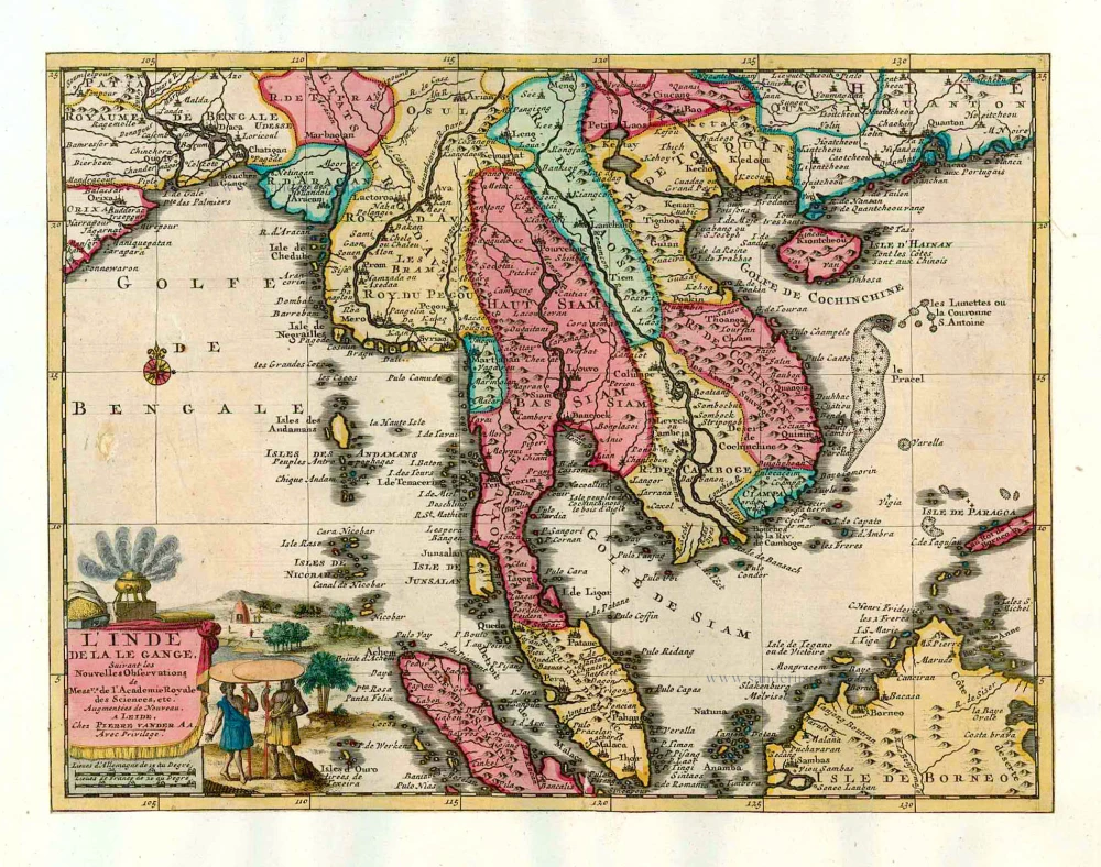
L'Inde de la le Gange, 1713
Southeast Asia, by Pieter van der Aa.
[Item number: 26097]

India Orientalis. 1597
Southeast Asia, by Giovanni Magini.
[Item number: 26521]
This map has the first accurate depiction of the Philippines
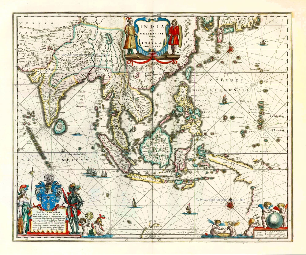
India quae Orientalis dicitur et Insulae Adiacentes. 1640-43
Southeast Asia by Willem & Joan Blaeu
[Item number: 26566]

Archipel des Indes Orientales qui comprend les Isles de la Sonde, Moluques et Philippines. 1776-79
Southeast Asia, by Francesco Santini.
[Item number: 26977]

Seconde Partie de la Carte d'Asie Contenant la Chine et Partie de la Tartarie, l'Inde au Deca du Gange, les Isles Sumatra, Java, Borneo, Moluques, Philippines, et du Japo 1746-53
Southeast Asia, by J.B. d'Anville.
[Item number: 27401]

A New and Accurate Map of the East India Islands. 1747
Southeast Asia, by Emanuel Bowen.
[Item number: 28012]

Suite de L'Ocean Oriental Contenant Les Isles de la Sonde Les Costes de Tunquin et de la Chine Les Isles du Japon les Philippines Moluques. 1747
Southeast Asia by Jacques Nicolas Bellin.
[Item number: 28189]

Carte des Indes en deçà et au dela du Gange; avec les Isles de la Sonde, Borneo, les Moluques et les Philippines. Partie Orientale. 1690
Southeast Asia by Rigobert Bonne.
[Item number: 28304]

Penisola Dell India di la dal Gange Divisa ne i Regni, che in essasi contengono et accresciuta di varie notizie. 1692
Indochina by Cantelli da Vignola, published by Giovanni Giacomo de Rossi.
[Item number: 28371]

Indiae Orientalis nec non Insularum Adiacentium Nova Descriptio. 1678
Southeast Asia by Nicolaes Visscher I.
[Item number: 28555]

Le Royaume de Siam avec les Royaumes qui luy sont Tributaires et les Isles de Sumatra Andemaon etc. et les isles voisines. 1719
Antique map of Southeast Asia by Châtelain
[Item number: 29372]
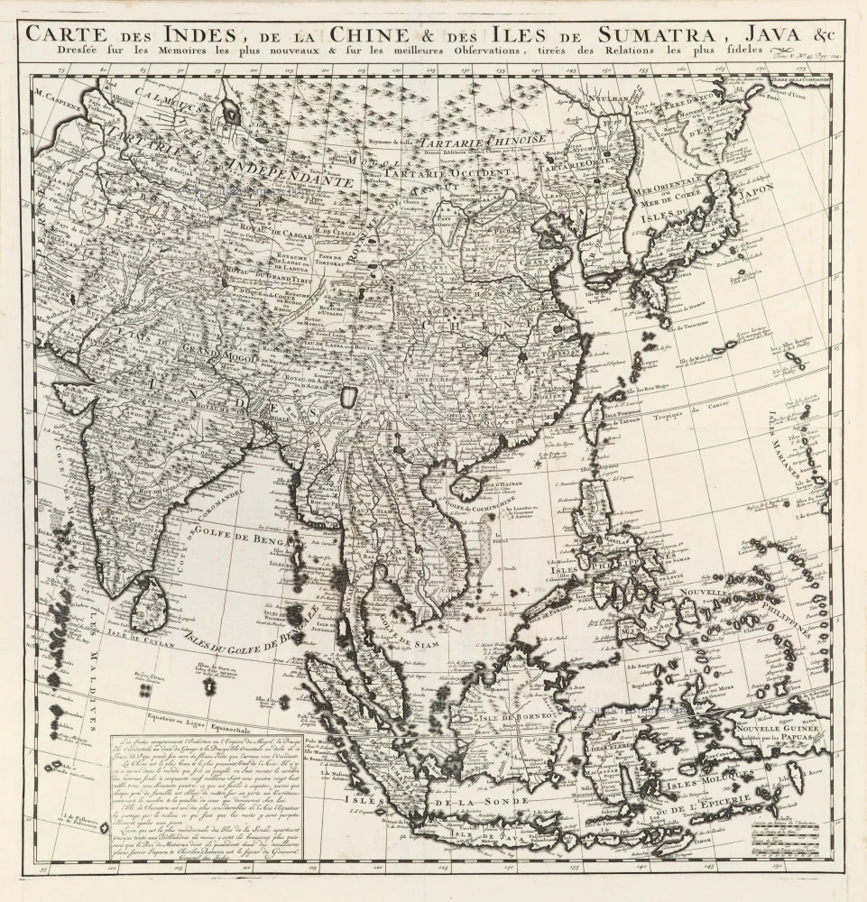
Carte des Indes, de la Chine & des Iles de Sumatra, Java &c. 1719
Southeast Asia, by Z. Châtelain.
[Item number: 29376]

Isole Molucche.- [Above map :] Descrittione del l'Isole Molucche. 1590
Southeast Asia by Tommaso Porcacchi.
[Item number: 29788]
The most elegant and decorative map of the region
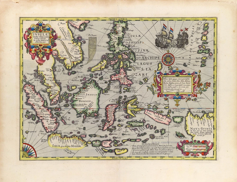
Insulae Indiae Orientalis Praecipuae, in quibus Moluccae celeberrimae sunt. 1630
East Indian Archipelago by Jodocus Hondius.
[Item number: 29863]
Rare
[No title] - 'Mar di India'. 1645
East Indies by van Spilbergen Joris.
[Item number: 30057]

Two early modern maps of Southeast Asia by L. Fries and M. Waldseemüller
Tabu. Moder. Indiae [together with] India Orien talis. 1535
South Asia by Lorens Fries
[Item number: 30141]

Very rare first 1570 A edition.
Indiae Orientalis Insularumque Adiacientium Typus. 1570
Southeast Asia, by Abraham Ortelius.
[Item number: 30592]

Scarce
D'Indize kusten van Bengale, Pegu, Malacca en Siam tot in China, met d'Eylanden Sumatra, Iava, Borneo, Moluccos en andere. [with:] De vaste kusten en eylanden van Indien, van Pegu en Malacca af, tot aan de Moluccos, etc. 1714
Southeast Asia by Pieter Vander Aa, two maps.
[Item number: 31123]
India Orien. c. 1600
Southeast Asia by Barent Langenes.
[Item number: 32298]

Beautiful example of this important map
Indiae Orientalis Insularumque Adiacientium Typus. 1587
Southeast Asia, by Abraham Ortelius.
[Item number: 32831]