
Scarce
Southeast Asia by Pieter Vander Aa, two maps. 1714


Pieter van der Aa (Leiden, 1659-1733)
Pieter van der Aa was already in 1682 owner of a bookshop and auction house. During his life, he has published an enormous amount of printed material.
After 1700, van der Aa increasingly specialised in books on geography and travel.
He published composite atlases, a series of geographical descriptions of European countries, and some very spectacular works. Between 1706 and 1708 he published the Naauweurige versameling der gedenkwaardigste zee- en land-reysen, in 28 volumes.
Many of Van der Aa’s publications are richly illustrated with maps and plates. He took over many copperplates and prints from other publishers such as Carel Allard and Frederik De Wit. The composite atlases that appeared from his workshop contain a curious mixture of his own material, copies of maps from other publishers, and reprints made from old copper plates, now with his own imprint.
The Galérie agréable du monde, was completed in 1729, and comprised 66 parts, bound in 27 volumes. Van der Aa presented it as a good investment; after publication, the antiquarian value of the work would double, the more so since it was printed in a limited edition of only one hundred copies.
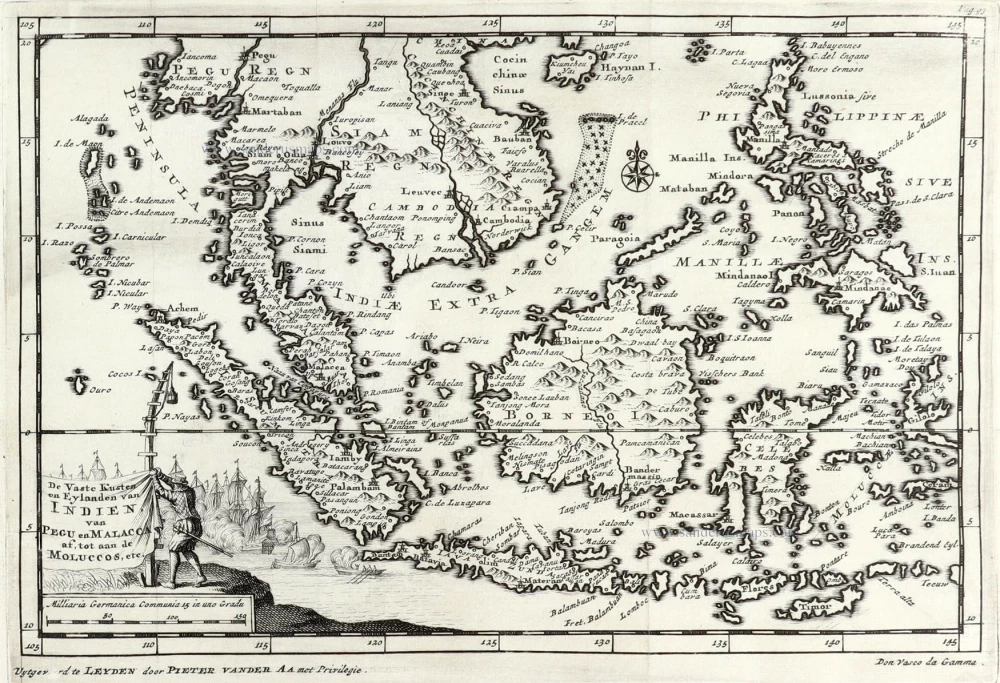
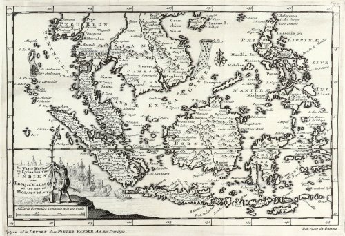
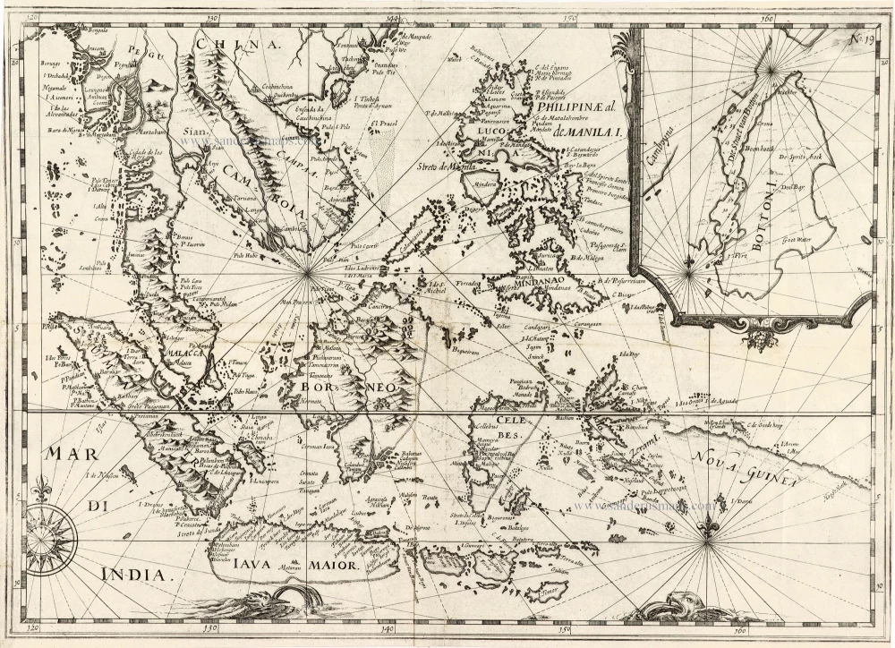
D'Indize kusten van Bengale, Pegu, Malacca en Siam tot in China, met d'Eylanden Sumatra, Iava, Borneo, Moluccos en andere. [with:] De vaste kusten en eylanden van Indien, van Pegu en Malacca af, tot aan de Moluccos, etc.
Item Number: 31123 Authenticity Guarantee
Category: Antique maps > Asia > Southeast Asia
Two maps of Southeast Asia by Pieter Vander Aa.
Title: D'Indize kusten van Bengale, Pegu, Malacca en Siam tot in China, met d'Eylanden Sumatra, Iava, Borneo, Moluccos en andere. [with:] De vaste kusten en eylanden van Indien, van Pegu en Malacca af, tot aan de Moluccos, etc.
Uytgevoerd to Leyden door Pieter vander Aa met Privilegie.
Date of the first edition: 1714.
Date of this map: 1714.
Copper engraving, printed on paper.
Image size each: 155 x 220mm (6.1 x 8.66 inches).
Sheet size each: 165 x 235mm (6.5 x 9.25 inches).
Verso: Blank.
Condition: Excellent.
Condition Rating: A+.
From: Atlas Nouveau Et Curieux Des Plus Celebres Itineraires, Ou, Recueil de Nouvelles Cartes Geographiques des Voiages modernes de long-courss, .... Leiden, P. Van der Aa, n.d. (1714) (Koeman, Aa2).
Pieter van der Aa (Leiden, 1659-1733)
Pieter van der Aa was already in 1682 owner of a bookshop and auction house. During his life, he has published an enormous amount of printed material.
After 1700, van der Aa increasingly specialised in books on geography and travel.
He published composite atlases, a series of geographical descriptions of European countries, and some very spectacular works. Between 1706 and 1708 he published the Naauweurige versameling der gedenkwaardigste zee- en land-reysen, in 28 volumes.
Many of Van der Aa’s publications are richly illustrated with maps and plates. He took over many copperplates and prints from other publishers such as Carel Allard and Frederik De Wit. The composite atlases that appeared from his workshop contain a curious mixture of his own material, copies of maps from other publishers, and reprints made from old copper plates, now with his own imprint.
The Galérie agréable du monde, was completed in 1729, and comprised 66 parts, bound in 27 volumes. Van der Aa presented it as a good investment; after publication, the antiquarian value of the work would double, the more so since it was printed in a limited edition of only one hundred copies.
Related items

Archipel des Indes Orientales qui Comprend les Isles de la Sonde, Moluques et Philippines. c. 1757
Southeast Asia, par Robert de Vaugondy.
[Item number: 4751]

The most accurate and one of the most elegant 17th c. maps of the East Indies
Indiae Orientalis Nova Descriptio. 1644-58
Southeast Asia by Janssonius, Johannes
[Item number: 10013]

India Orientalis. 1607
Southeast Asia, by G. Mercator - J. Hondius (small)
[Item number: 25186]

From the Cloppenburg edition
Insulae Indiae Orientalis. 1630
Southeast Asia, by G. Mercator - J. Hondius.
[Item number: 25234]

Le Royaume de Siam avec les Royaumes qui luy sont Tributaires, et les Isles de Sumatra, Andemaon, etc. et les Isles Voisine. c. 1700
Southeast Asia, by J. Ottens.
[Item number: 25716]

Indiae Orientalis nec non Insularum Adiacentium Nova Descriptio. c. 1740
Southeast Asia by Nicolaes Visscher, published by Petrus Schenk.
[Item number: 25718]
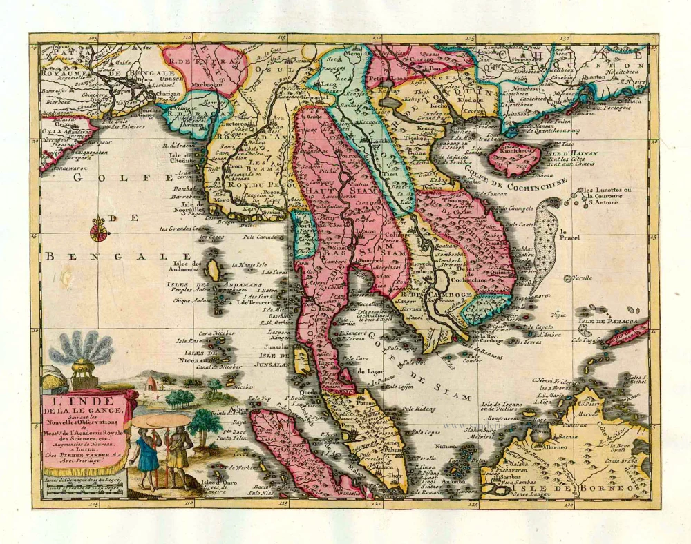
L'Inde de la le Gange, 1713
Southeast Asia, by Pieter van der Aa.
[Item number: 26097]

India Orientalis. 1597
Southeast Asia, by Giovanni Magini.
[Item number: 26521]
This map has the first accurate depiction of the Philippines
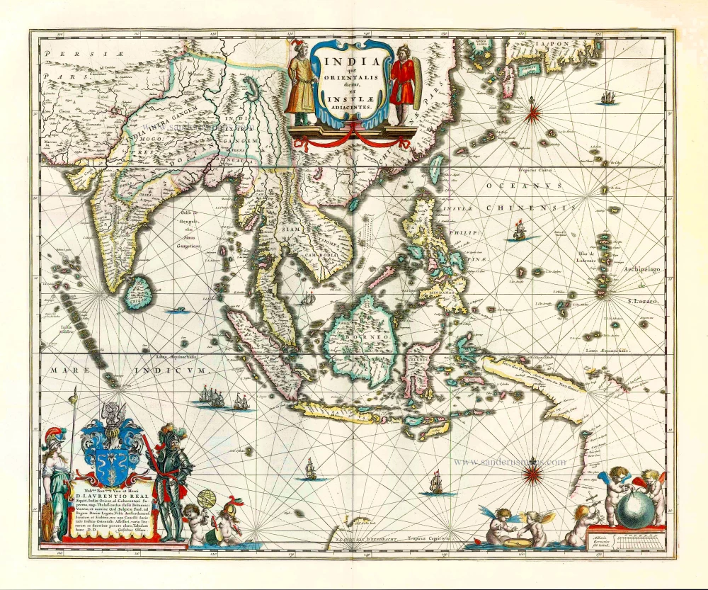
India quae Orientalis dicitur et Insulae Adiacentes. 1640-43
Southeast Asia by Willem & Joan Blaeu
[Item number: 26566]

Archipel des Indes Orientales qui comprend les Isles de la Sonde, Moluques et Philippines. 1776-79
Southeast Asia, by Francesco Santini.
[Item number: 26977]

Seconde Partie de la Carte d'Asie Contenant la Chine et Partie de la Tartarie, l'Inde au Deca du Gange, les Isles Sumatra, Java, Borneo, Moluques, Philippines, et du Japo 1746-53
Southeast Asia, by J.B. d'Anville.
[Item number: 27401]

Suite de L'Ocean Oriental Contenant Les Isles de la Sonde Les Costes de Tunquin et de la Chine Les Isles du Japon les Philippines Moluques. 1747
Southeast Asia by Jacques Nicolas Bellin.
[Item number: 28189]

Carte des Indes en deçà et au dela du Gange; avec les Isles de la Sonde, Borneo, les Moluques et les Philippines. Partie Orientale. 1690
Southeast Asia by Rigobert Bonne.
[Item number: 28304]

Scarce
Tabula Asiae XI. 1548
Southeast Asia by Giacomo Gastaldi / Ptolemy.
[Item number: 28362]

Indiae Orientalis nec non Insularum Adiacentium Nova Descriptio. 1678
Southeast Asia by Nicolaes Visscher I.
[Item number: 28555]

Isole dell'Indie, Divise in Filippine, Molucche, e della Sonda. 1696
Southeast Asia and Northwest Australia by Vincenzo Coronelli.
[Item number: 28670]

Indiae Orientalis nec non Insularum Adiacentium. c. 1691-97
Southeast Asia - Australia by Frederick de Wit.
[Item number: 29091]
In rare original colour.
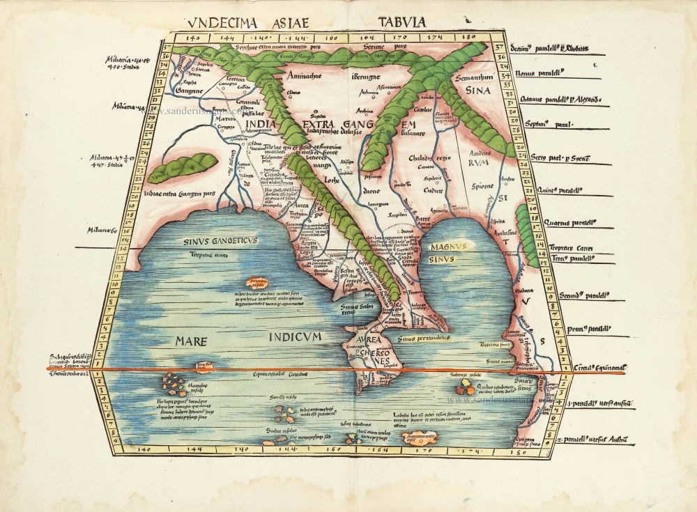
Undecima Asiae Tabula. 1513
South Asia by Waldseemüller Martin
[Item number: 29249]

Le Royaume de Siam avec les Royaumes qui luy sont Tributaires et les Isles de Sumatra Andemaon etc. et les isles voisines. 1719
Antique map of Southeast Asia by Châtelain
[Item number: 29372]
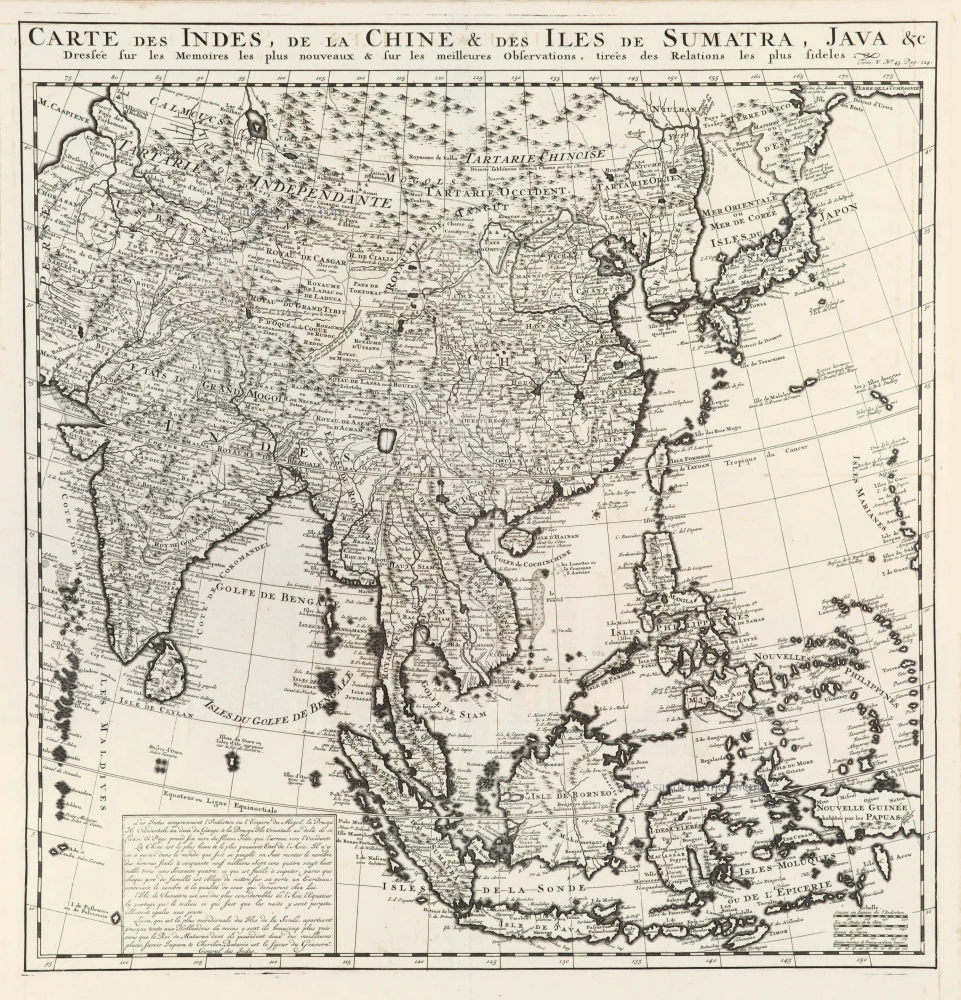
Carte des Indes, de la Chine & des Iles de Sumatra, Java &c. 1719
Southeast Asia, by Z. Châtelain.
[Item number: 29376]

Isole Molucche.- [Above map :] Descrittione del l'Isole Molucche. 1590
Southeast Asia by Tommaso Porcacchi.
[Item number: 29788]
Rare
[No title] - 'Mar di India'. 1645
East Indies by van Spilbergen Joris.
[Item number: 30057]

Two early modern maps of Southeast Asia by L. Fries and M. Waldseemüller
Tabu. Moder. Indiae [together with] India Orien talis. 1535
South Asia by Lorens Fries
[Item number: 30141]

Very rare first 1570 A edition.
Indiae Orientalis Insularumque Adiacientium Typus. 1570
Southeast Asia, by Abraham Ortelius.
[Item number: 30592]
Rare 1525 edition in nice old colour.
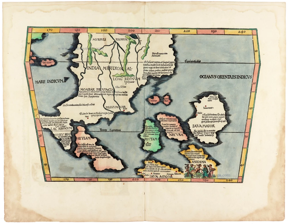
[No title - on verso:] Tabula Moder. Indiae Orientalis. 1525
Ptolemy map of Southeast Asia by Lorenz Fries, after Martin Waldseemüller.
[Item number: 30658]
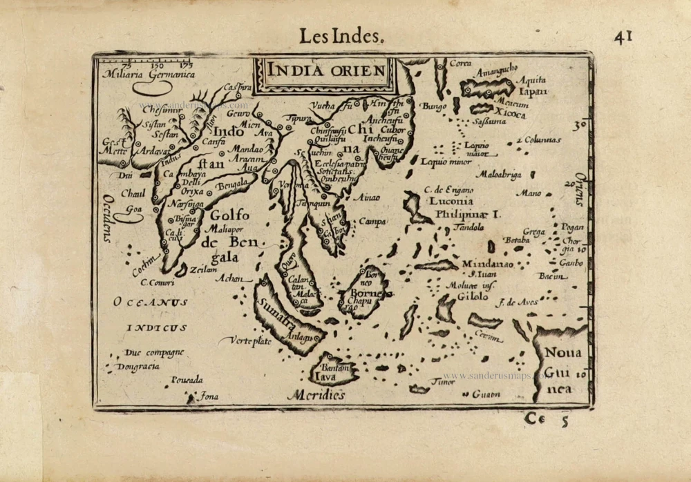
India Orien. c. 1600
Southeast Asia by Barent Langenes.
[Item number: 32298]

Scarce
Zee-togt van Alfonso d'Albuquerque na de Roode Zee, d'Arabize en Persize kusten, met die van Ormus, Guzaratte, Goa, Malacca en Verder Indien tot aan't Eiland Iava. 1707
Indian Ocean & Southeast Asia by Pieter Van der Aa.
[Item number: 32321]

Scarce
De Kusten van Guzaratte, Malabar, Bengale en Malacca met die van't Magtig Koninkryk Siam, tot aan China bestevend. 1707
Indian Ocean, India, Thailand, and Siam by Pieter Van der Aa.
[Item number: 32323]

An extremely decorative sea chart (Norwhich)
Nieuwe Pascaert van Oost Indien Verthoonende hen van C. De Bona Esperanca tot aen het Landt van Eso. 1683
Indian Ocean - Southeast Asia - Australia by Johannes Van Keulen
[Item number: 33150]
new