
Two early modern maps of Southeast Asia by L. Fries and M. Waldseemüller
South Asia by Lorens Fries 1535

Claudius Ptolemy (c.100 – c.170 AD)
Lorenz Fries* (c. 1485 – 1532)
Lorenz Fries, a physician, astrologer, and cartographic editor, was a native Alsatian. Nothing is known about his youth and early schooling. His university education in philosophy and medicine has been acquired at several schools. He probably attended Vienna, Montpellier, Piacenza, and Pavia. He obtained a Doctor of Arts degree at one of these institutions.
His first professional position was in Sélestat, near Strasbourg. He practised medicine in Colmar from 1514 to 1518. He wrote several medical works, including a practice entitled Spiegel der Artzny (Mirror of Medicine), a trendy book with seven editions up to 1546. After 1519, he moved to Strasbourg, where he stayed until about 1527.
In 1520, Fries became involved in publishing new editions of maps by Martin Waldseemüller. He collaborated with Peter Apian to publish a much-reduced version of Waldseemüller's map of 1507.
In the meantime, Fries was preparing a new edition of Ptolemy's Geographia. The book was printed in 1522 by Johannes Grüninger, an esteemed printer from Strasbourg who had previously published the Waldseemüller. It was based on Waldseemüller's editions of 1513 and 1520. Fries says in a note to the reader: "…, we declare that Martin Waldseemüller, piously deceased, originally constructed these maps and that they have been drawn in a format smaller than they ever had". The book sold well, and new editions would follow, printed with the same woodblocks.
In 1525, Willibald Pirkheimer, the Nuremberg humanist, published a new edition with Grüninger. The volume was published jointly with the Nuremberg printer Johannes Koberger. It included the same fifty Waldseemüller/Fries maps as the 1522 edition.
Michael Servetus (= Michael Villanovus) printed two more editions in Lyon in 1535 and 1541. Servetus was tried for heresy in 1553. One of the allegations was that he had written a statement on the verso of the map of the Holy Land describing it as primarily infertile. The idea originated in Fries's edition in 1522. Servetus was burned at the stake, and at Calvin's orders, many copies of Servetus's books followed him into the flames.
Fries also published other books on astrology and medicine. In addition, he undertook a reduction of Waldseemüller's large map of 1516, the Carta Marina Navigatoria, which he translated into German simultaneously. The map was published in 1525, but no copy of this edition survived. The earliest copy known is dated 1530.
In 1525, Strasbourg had become a thoroughly reformed city, and the Roman church's adherents found themselves increasingly unwelcome. For this reason, Fries probably renounced his citizenship and moved to Metz. During this period, he published his last two medical works.
*He should be distinct from the historian Lorenz Fries of Mergentheim (1491-1550).
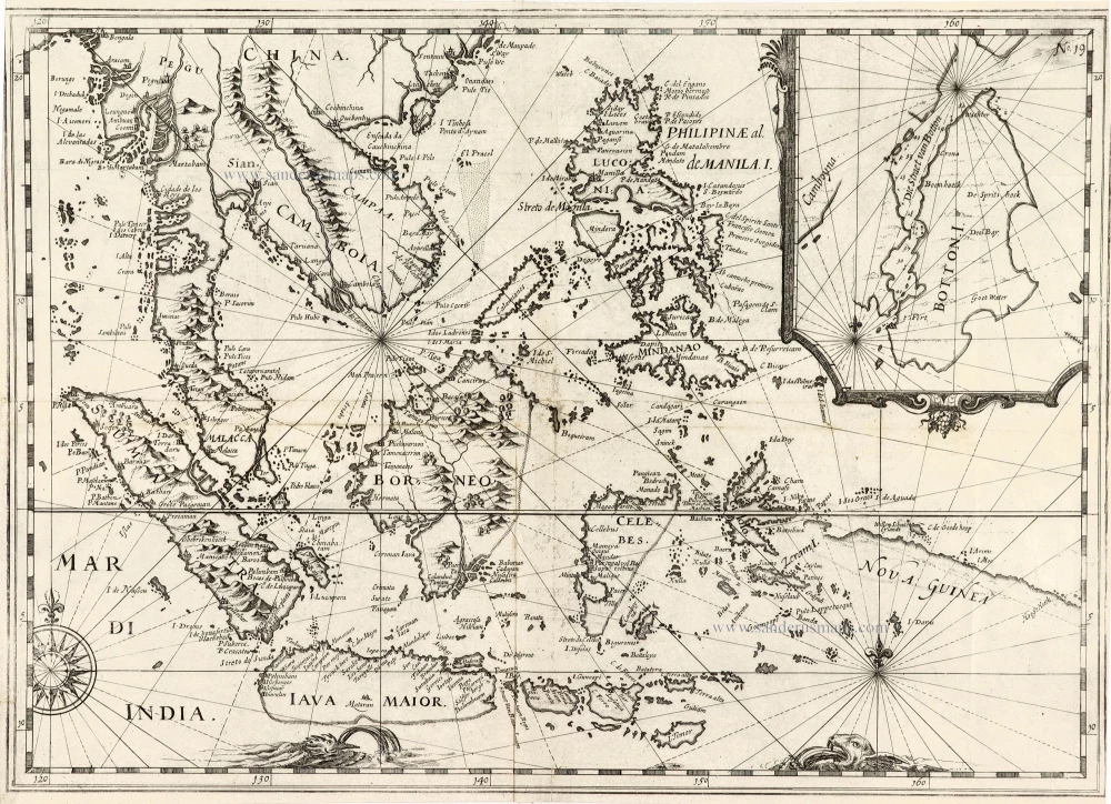
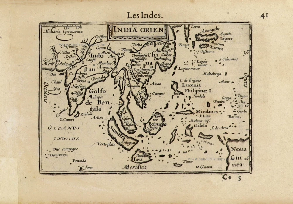
Tabu. Moder. Indiae [together with] India Orien talis.
Item Number: 30141 Authenticity Guarantee
Category: Antique maps > Asia > Southeast Asia
Two Ptolemy maps of Southeast Asia by Lorens Fries.
Title: Tabu. Moder. Indiae [together with] India Orien talis.
Date of the first edition: 1522.
Date of this map: 1535.
Woodcut, printed on paper.
Image size: 300 x 440mm (11.81 x 17.32 inches).
Sheet size: 390 x 535mm (15.35 x 21.06 inches).
Verso: Blank.
Condition: Excellent.
Condition Rating: A+.
From: Claudii Ptolemaei Alexandrini geographicae enarrationis libri octo. Lyon, M. Servetus, 1535. (Karrow, 28/G.2; Nordenskiold, #209)
Claudius Ptolemy (c.100 – c.170 AD)
Lorenz Fries* (c. 1485 – 1532)
Lorenz Fries, a physician, astrologer, and cartographic editor, was a native Alsatian. Nothing is known about his youth and early schooling. His university education in philosophy and medicine has been acquired at several schools. He probably attended Vienna, Montpellier, Piacenza, and Pavia. He obtained a Doctor of Arts degree at one of these institutions.
His first professional position was in Sélestat, near Strasbourg. He practised medicine in Colmar from 1514 to 1518. He wrote several medical works, including a practice entitled Spiegel der Artzny (Mirror of Medicine), a trendy book with seven editions up to 1546. After 1519, he moved to Strasbourg, where he stayed until about 1527.
In 1520, Fries became involved in publishing new editions of maps by Martin Waldseemüller. He collaborated with Peter Apian to publish a much-reduced version of Waldseemüller's map of 1507.
In the meantime, Fries was preparing a new edition of Ptolemy's Geographia. The book was printed in 1522 by Johannes Grüninger, an esteemed printer from Strasbourg who had previously published the Waldseemüller. It was based on Waldseemüller's editions of 1513 and 1520. Fries says in a note to the reader: "…, we declare that Martin Waldseemüller, piously deceased, originally constructed these maps and that they have been drawn in a format smaller than they ever had". The book sold well, and new editions would follow, printed with the same woodblocks.
In 1525, Willibald Pirkheimer, the Nuremberg humanist, published a new edition with Grüninger. The volume was published jointly with the Nuremberg printer Johannes Koberger. It included the same fifty Waldseemüller/Fries maps as the 1522 edition.
Michael Servetus (= Michael Villanovus) printed two more editions in Lyon in 1535 and 1541. Servetus was tried for heresy in 1553. One of the allegations was that he had written a statement on the verso of the map of the Holy Land describing it as primarily infertile. The idea originated in Fries's edition in 1522. Servetus was burned at the stake, and at Calvin's orders, many copies of Servetus's books followed him into the flames.
Fries also published other books on astrology and medicine. In addition, he undertook a reduction of Waldseemüller's large map of 1516, the Carta Marina Navigatoria, which he translated into German simultaneously. The map was published in 1525, but no copy of this edition survived. The earliest copy known is dated 1530.
In 1525, Strasbourg had become a thoroughly reformed city, and the Roman church's adherents found themselves increasingly unwelcome. For this reason, Fries probably renounced his citizenship and moved to Metz. During this period, he published his last two medical works.
*He should be distinct from the historian Lorenz Fries of Mergentheim (1491-1550).
Related items

Archipel des Indes Orientales qui Comprend les Isles de la Sonde, Moluques et Philippines. c. 1757
Southeast Asia, par Robert de Vaugondy.
[Item number: 4751]

The most accurate and one of the most elegant 17th c. maps of the East Indies
Indiae Orientalis Nova Descriptio. 1644-58
Southeast Asia by Janssonius, Johannes
[Item number: 10013]

India Orientalis. 1607
Southeast Asia, by G. Mercator - J. Hondius (small)
[Item number: 25186]

From the Cloppenburg edition
Insulae Indiae Orientalis. 1630
Southeast Asia, by G. Mercator - J. Hondius.
[Item number: 25234]

Le Royaume de Siam avec les Royaumes qui luy sont Tributaires, et les Isles de Sumatra, Andemaon, etc. et les Isles Voisine. c. 1700
Southeast Asia, by J. Ottens.
[Item number: 25716]

Indiae Orientalis nec non Insularum Adiacentium Nova Descriptio. c. 1740
Southeast Asia by Nicolaes Visscher, published by Petrus Schenk.
[Item number: 25718]
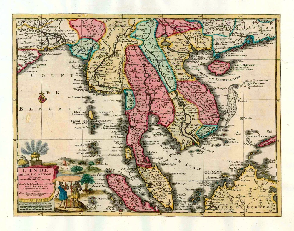
L'Inde de la le Gange, 1713
Southeast Asia, by Pieter van der Aa.
[Item number: 26097]

India Orientalis. 1597
Southeast Asia, by Giovanni Magini.
[Item number: 26521]
This map has the first accurate depiction of the Philippines
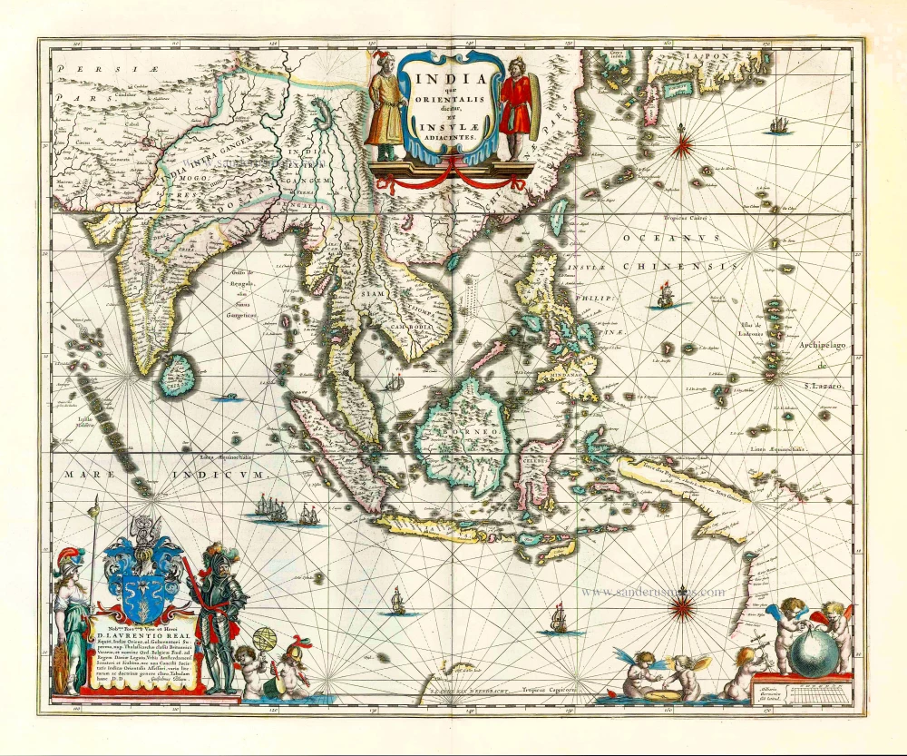
India quae Orientalis dicitur et Insulae Adiacentes. 1640-43
Southeast Asia by Willem & Joan Blaeu
[Item number: 26566]

Archipel des Indes Orientales qui comprend les Isles de la Sonde, Moluques et Philippines. 1776-79
Southeast Asia, by Francesco Santini.
[Item number: 26977]

Seconde Partie de la Carte d'Asie Contenant la Chine et Partie de la Tartarie, l'Inde au Deca du Gange, les Isles Sumatra, Java, Borneo, Moluques, Philippines, et du Japo 1746-53
Southeast Asia, by J.B. d'Anville.
[Item number: 27401]

A New and Accurate Map of the East India Islands. 1747
Southeast Asia, by Emanuel Bowen.
[Item number: 28012]

Suite de L'Ocean Oriental Contenant Les Isles de la Sonde Les Costes de Tunquin et de la Chine Les Isles du Japon les Philippines Moluques. 1747
Southeast Asia by Jacques Nicolas Bellin.
[Item number: 28189]

Carte des Indes en deçà et au dela du Gange; avec les Isles de la Sonde, Borneo, les Moluques et les Philippines. Partie Orientale. 1690
Southeast Asia by Rigobert Bonne.
[Item number: 28304]

Scarce
Tabula Asiae XI. 1548
Southeast Asia by Giacomo Gastaldi / Ptolemy.
[Item number: 28362]

Indiae Orientalis nec non Insularum Adiacentium Nova Descriptio. 1678
Southeast Asia by Nicolaes Visscher I.
[Item number: 28555]

Isole dell'Indie, Divise in Filippine, Molucche, e della Sonda. 1696
Southeast Asia and Northwest Australia by Vincenzo Coronelli.
[Item number: 28670]

Indiae Orientalis nec non Insularum Adiacentium. c. 1691-97
Southeast Asia - Australia by Frederick de Wit.
[Item number: 29091]
In rare original colour.
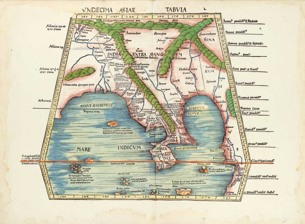
Undecima Asiae Tabula. 1513
South Asia by Waldseemüller Martin
[Item number: 29249]

Le Royaume de Siam avec les Royaumes qui luy sont Tributaires et les Isles de Sumatra Andemaon etc. et les isles voisines. 1719
Antique map of Southeast Asia by Châtelain
[Item number: 29372]
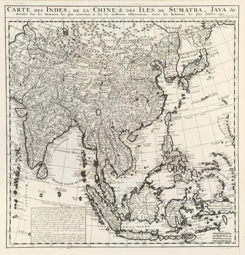
Carte des Indes, de la Chine & des Iles de Sumatra, Java &c. 1719
Southeast Asia, by Z. Châtelain.
[Item number: 29376]

Isole Molucche.- [Above map :] Descrittione del l'Isole Molucche. 1590
Southeast Asia by Tommaso Porcacchi.
[Item number: 29788]
Rare
[No title] - 'Mar di India'. 1645
East Indies by van Spilbergen Joris.
[Item number: 30057]

Very rare first 1570 A edition.
Indiae Orientalis Insularumque Adiacientium Typus. 1570
Southeast Asia, by Abraham Ortelius.
[Item number: 30592]

Scarce
D'Indize kusten van Bengale, Pegu, Malacca en Siam tot in China, met d'Eylanden Sumatra, Iava, Borneo, Moluccos en andere. [with:] De vaste kusten en eylanden van Indien, van Pegu en Malacca af, tot aan de Moluccos, etc. 1714
Southeast Asia by Pieter Vander Aa, two maps.
[Item number: 31123]
India Orien. c. 1600
Southeast Asia by Barent Langenes.
[Item number: 32298]

Scarce
Zee-togt van Alfonso d'Albuquerque na de Roode Zee, d'Arabize en Persize kusten, met die van Ormus, Guzaratte, Goa, Malacca en Verder Indien tot aan't Eiland Iava. 1707
Indian Ocean & Southeast Asia by Pieter Van der Aa.
[Item number: 32321]

Scarce
De Kusten van Guzaratte, Malabar, Bengale en Malacca met die van't Magtig Koninkryk Siam, tot aan China bestevend. 1707
Indian Ocean, India, Thailand, and Siam by Pieter Van der Aa.
[Item number: 32323]

Beautiful example of this important map
Indiae Orientalis Insularumque Adiacientium Typus. 1587
Southeast Asia, by Abraham Ortelius.
[Item number: 32831]

An extremely decorative sea chart (Norwhich)
Nieuwe Pascaert van Oost Indien Verthoonende hen van C. De Bona Esperanca tot aen het Landt van Eso. 1683
Indian Ocean - Southeast Asia - Australia by Johannes Van Keulen
[Item number: 33150]
new