
World map by Jacques-Nicolas Bellin, published by A.F. Prévost. 1750

Antoine François Prévost (l'abbé)
Antoine François Prévost (1697–1763), also known as Abbé Prévost, was a French writer, historian, and traveller, best remembered for his literary works, particularly Manon Lescaut. However, beyond his contributions to literature, Prévost also played a notable role in disseminating geographical and cartographical knowledge during the 18th century.
Prévost demonstrated a keen interest in geography and exploration, which was reflected in his ambitious historical and travel writings. One of his most significant contributions to the field of cartography came through his monumental work "Histoire générale des voyages", published between 1746 and 1759. This multi-volume series compiled detailed narratives of travels and discoveries from various parts of the world, accompanied by maps and illustrations.
Though Prévost was not a cartographer by profession, his work was instrumental in popularising geographical knowledge in Enlightenment Europe. The maps included in Histoire générale des voyages were often created by prominent contemporary cartographers and engravers, providing readers with visual representations of remote and little-known regions. Through these collaborations, Prévost helped disseminate some of the era’s most critical cartographical works to a broader, non-specialist audience.
His writings, along with the associated maps, made a significant contribution to the European understanding of global geography, colonial territories, and navigation routes during a period of rapid maritime exploration and expansion. Prévost's work stands as a testament to the interconnection between literature, travel writing, and cartography in the Enlightenment period.
Jacques-Nicolas Bellin (1703-1772)
Jacques-Nicolas Bellin, a French geographer, was among the most important mapmakers of the eighteenth century. In 1721, at the age of 18, he was appointed hydrographer of the Ministry of the Navy following the French hydrographic office's creation and the Dépot of charts and plans of the Navy. Appointed hydrographic engineer in August 1741. Member of the Academy of the Navy and the Royal Society of London.
Over the course of a 50-year career, he drew the maps of several major works of his time such as Histoire et description générale de la Nouvelle-France de Charlevoix (1744); Histoire générale des voyages de l'Abbé Prévost (published between 1746 and 1759) ); Neptune François (1753), Hydrographie Françoise (1756-1765), and Petit Atlas Français (1763) - reissued as Petit Atlas Maritime (1765). He is the most copied cartographer of the 18th century.
His maps of Canada and the French territories of North America are of considerable value. This is all the more remarkable since, an archetype of the cabinet cartographer, Bellin never came to America. For his cartography of the St. Lawrence River, he entrusted handwritten maps to navigators to correct and enrich. With each return of these maps, he was updating his knowledge. Two basic needs drive its cartography of North America: to secure navigation on the St. Lawrence River and to claim for France the lands explored by the French in the Great Lakes region and along the Mississippi River.
Jacques-Nicolas Bellin died on March 21, 1772, in Versailles. In the burial certificate, he is described as "the first engineer of the navy and the deposit of plans, royal censor of the academy of navy and the royal society of London".
Jakob van der Schley (1715–1779)
Jakob van der Schley was a Dutch engraver and draftsman. He became renowned in the 18th century for his precise and delicate engraving work, particularly in the fields of cartography, portraiture, and book illustration.
Much of Van der Schley's work was created for illustrated books, atlases, and travel accounts. He is primarily known for his engravings featured in Prévost’s Histoire Générale des Voyages, a widely read French travel collection published in the mid-18th century. For this monumental work, Van der Schley produced numerous maps, views, and depictions of peoples and customs from around the world, often based on earlier drawings by other artists, which he skillfully adapted for print.
An Essay of a New and Compact Map, containing the known parts of the Terrestrial Globe.
Item Number: 31883 Authenticity Guarantee
Category: Antique maps > World
World map by Jacques-Nicolas Bellin, published by A.F. Prévost.
Title: An Essay of a New and Compact Map, containing the known parts of the Terrestrial Globe.
by N. Bellin | Engineer of the Marine.
At The Hague by P. De Hondt | MDCCL.
J.V. Schley direx.
French and Dutch titles beneath the bottom neatline.
Cartographer: J.N. Bellin.
Engraver: Jacob van der Schley.
Date of the first edition: 1750.
Date of this map: 1750.
Copper engraving, printed on paper.
Image size: 510 x 680mm (20 x 26¾ inches).
Sheet size: 560 x 725mm (22 x 28½ inches).
Verso: Blank.
Condition: Excellent, folds as issued.
Condition Rating: A+.
From: Prévost d'Exiles A. Fr. Historische Beschryving der Reizen. Den Haag, P. De Hondt, 1747-80. Enlarged Dutch translation of the French edition of 1746-89.
Antoine François Prévost (l'abbé)
Antoine François Prévost (1697–1763), also known as Abbé Prévost, was a French writer, historian, and traveller, best remembered for his literary works, particularly Manon Lescaut. However, beyond his contributions to literature, Prévost also played a notable role in disseminating geographical and cartographical knowledge during the 18th century.
Prévost demonstrated a keen interest in geography and exploration, which was reflected in his ambitious historical and travel writings. One of his most significant contributions to the field of cartography came through his monumental work "Histoire générale des voyages", published between 1746 and 1759. This multi-volume series compiled detailed narratives of travels and discoveries from various parts of the world, accompanied by maps and illustrations.
Though Prévost was not a cartographer by profession, his work was instrumental in popularising geographical knowledge in Enlightenment Europe. The maps included in Histoire générale des voyages were often created by prominent contemporary cartographers and engravers, providing readers with visual representations of remote and little-known regions. Through these collaborations, Prévost helped disseminate some of the era’s most critical cartographical works to a broader, non-specialist audience.
His writings, along with the associated maps, made a significant contribution to the European understanding of global geography, colonial territories, and navigation routes during a period of rapid maritime exploration and expansion. Prévost's work stands as a testament to the interconnection between literature, travel writing, and cartography in the Enlightenment period.
Jacques-Nicolas Bellin (1703-1772)
Jacques-Nicolas Bellin, a French geographer, was among the most important mapmakers of the eighteenth century. In 1721, at the age of 18, he was appointed hydrographer of the Ministry of the Navy following the French hydrographic office's creation and the Dépot of charts and plans of the Navy. Appointed hydrographic engineer in August 1741. Member of the Academy of the Navy and the Royal Society of London.
Over the course of a 50-year career, he drew the maps of several major works of his time such as Histoire et description générale de la Nouvelle-France de Charlevoix (1744); Histoire générale des voyages de l'Abbé Prévost (published between 1746 and 1759) ); Neptune François (1753), Hydrographie Françoise (1756-1765), and Petit Atlas Français (1763) - reissued as Petit Atlas Maritime (1765). He is the most copied cartographer of the 18th century.
His maps of Canada and the French territories of North America are of considerable value. This is all the more remarkable since, an archetype of the cabinet cartographer, Bellin never came to America. For his cartography of the St. Lawrence River, he entrusted handwritten maps to navigators to correct and enrich. With each return of these maps, he was updating his knowledge. Two basic needs drive its cartography of North America: to secure navigation on the St. Lawrence River and to claim for France the lands explored by the French in the Great Lakes region and along the Mississippi River.
Jacques-Nicolas Bellin died on March 21, 1772, in Versailles. In the burial certificate, he is described as "the first engineer of the navy and the deposit of plans, royal censor of the academy of navy and the royal society of London".
Jakob van der Schley (1715–1779)
Jakob van der Schley was a Dutch engraver and draftsman. He became renowned in the 18th century for his precise and delicate engraving work, particularly in the fields of cartography, portraiture, and book illustration.
Much of Van der Schley's work was created for illustrated books, atlases, and travel accounts. He is primarily known for his engravings featured in Prévost’s Histoire Générale des Voyages, a widely read French travel collection published in the mid-18th century. For this monumental work, Van der Schley produced numerous maps, views, and depictions of peoples and customs from around the world, often based on earlier drawings by other artists, which he skillfully adapted for print.
Related items
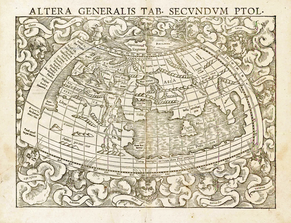
Altera Generalis Tab. Secundum Ptol. 1559
Ptolemaic world by Sebastian Münster
[Item number: 11981]

Aevi Veteris, Typus Geographicus. 1601
Ancient World by Abraham Ortelius.
[Item number: 22609]

Rare variant.
Cosmographia Universalis. 1592
World map by H. Bünting - D.A. Veleslavina.
[Item number: 26356]

Nouvelle Mappe Monde Dediee au Progres de nos Connoissances. 1776-79
World by Francesco Santini.
[Item number: 26946]

Universi Orbis Descriptio. 1597
World by Giovanni Magini
[Item number: 27837]
The most mystical world map of all time.
[No title] 1560-1600
Daniel's Dream Map. The Wittenberg world map.
[Item number: 28159]

Mappemonde en deux Hémisphères. c. 1797
World map, double hemisphere by Pierre Grégoire Chanlaire.
[Item number: 28209]

Mappe-Monde Physique. c. 1797
World map, double hemisphere by Pierre Grégoire Chanlaire.
[Item number: 28210]
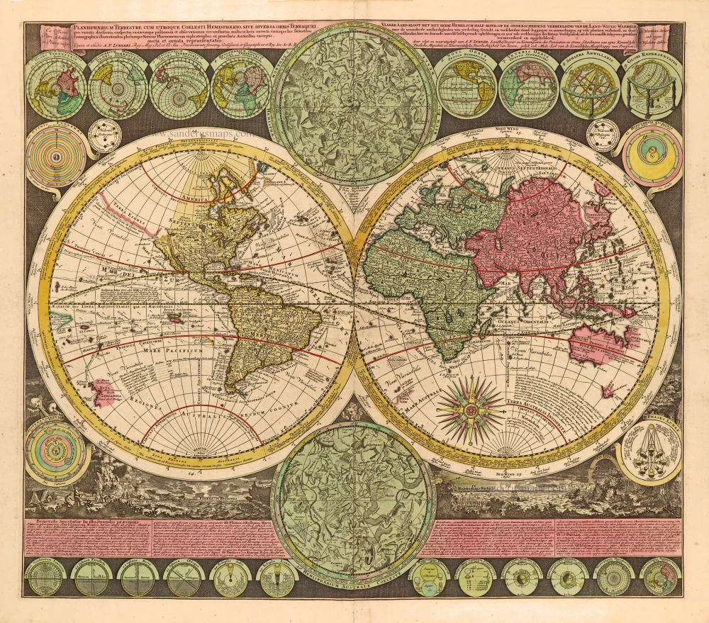
Planisphaerium Terrestre cum utroque Coelesti Hemisphaerio, sive Diversa Orbis Terraquei, c. 1700
World by Zürner A.F., double hemisphere.
[Item number: 28229]
First edition, scarce
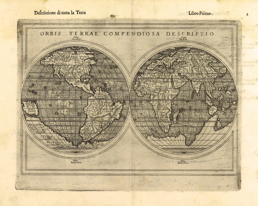
Orbis Terrae Compendiosa Descriptio. 1598
World by Giuseppe Rosaccio, double hemisphere.
[Item number: 28289]

Ptolemaei Cognita. 1598
Ptolemaic world map by Giuseppe Rosaccio.
[Item number: 28290]
The engraving and layout and elegance of decoration are all of the highest standards.
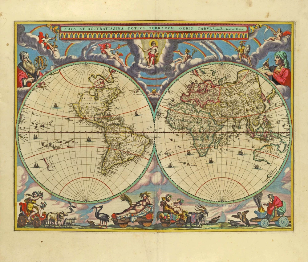
Nova Et Accuratissima Totius Terrarum Orbis Tabula. 1659
World by Joan Blaeu, double hemisphere.
[Item number: 28336]
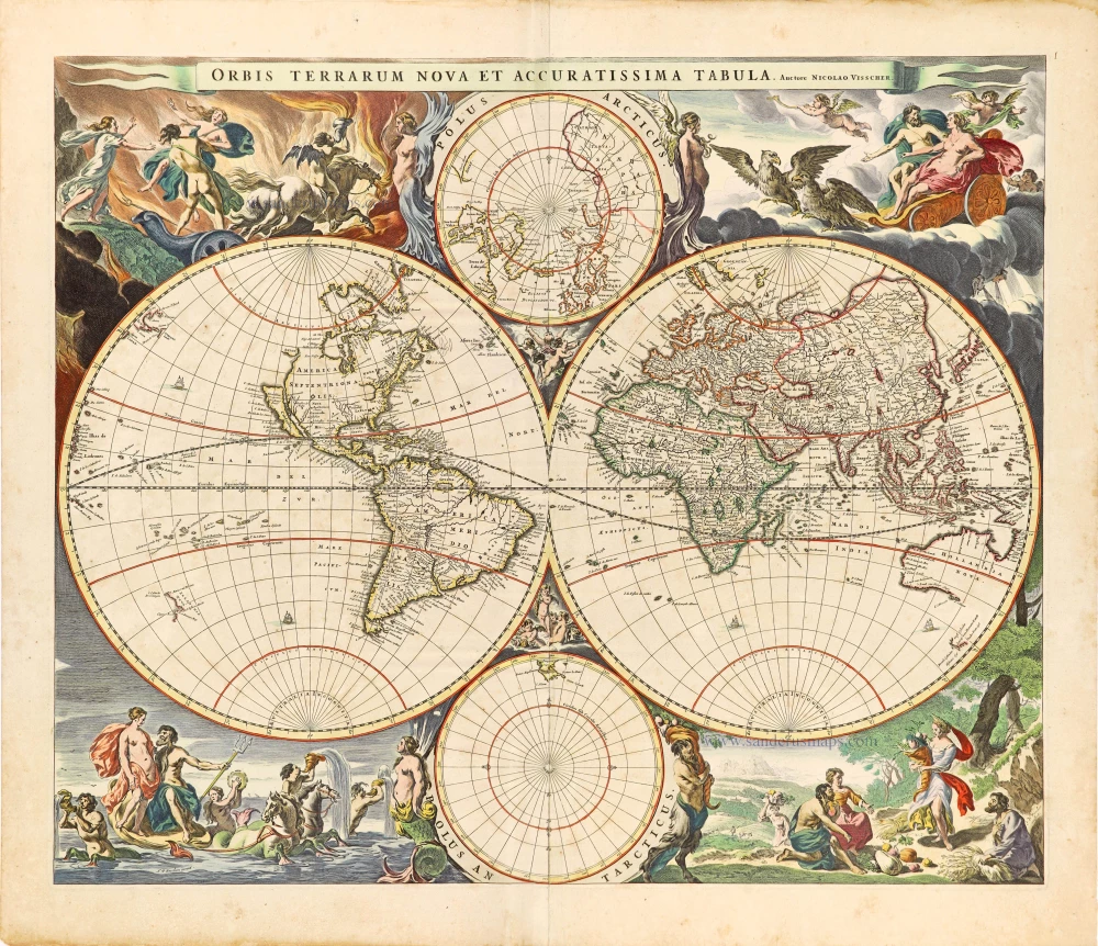
Orbis Terrarum Nova et Accuratissima Tabula. c. 1678
World by Nicolaas Visscher, double hemisphere.
[Item number: 28628]

A fine ornate example of the decorative cartography of the time.
Nova Totius Terrarum Orbis Geographica ac Hydrographica Tabula. Auct: Henr: Hondio. 1641
Double-hemisphere world map by Henricus Hondius.
[Item number: 28768]

Descrittione Del Mappamondo. 1572
World by Porcacchi Tommaso.
[Item number: 28910]
Luxury colouring.
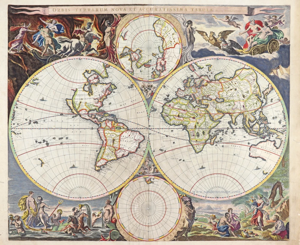
Orbis Terrarum Nova et Accuratissima Tabula. c. 1678
Double-hemisphere world map, by Nicolaas Visscher I.
[Item number: 28934]
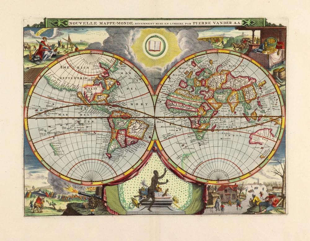
Nouvelle Mappe-Monde, 1710
World by Pieter Van der Aa, double hemisphere.
[Item number: 29136]

Nova Orbis Tabula in Lucem Edita, A. F. De Wit. c. 1690
World by Frederik De Wit, double hemisphere.
[Item number: 29231]

Mapmonde ou description generale du Globe Terrestre. 1713
World map by Zacharias Châtelain.
[Item number: 29555]
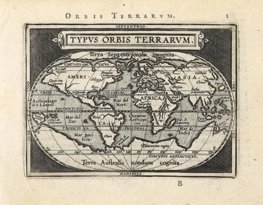
Typus Orbis Terrarum. 1589
The world by Abraham Ortelius / Philippe Galle.
[Item number: 29605]
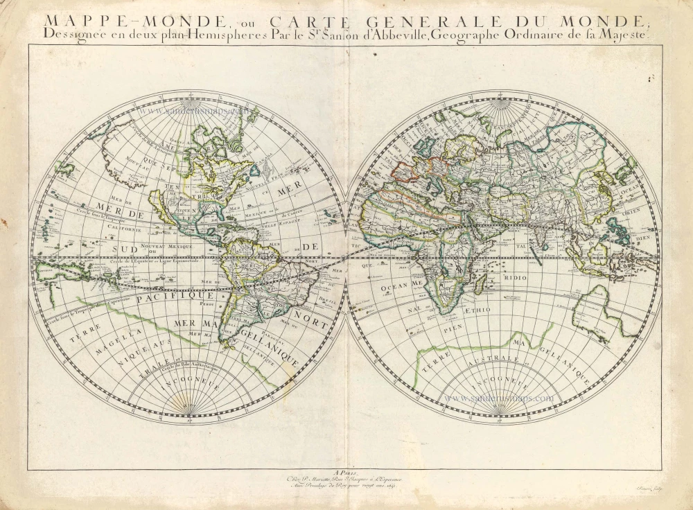
Mappe-Monde, ou Carte Generale du Monde, 1652
Double hemisphere world map by Nicolas Sanson.
[Item number: 29612]

Mercator projection
Discorso Intorno alla Carta da Navigare. 1590
World by Thomaso Porcacchi.
[Item number: 29786]

Rare original colour.
Typus Orbis Terrarum - Globus Terrestris. 1609
Two world maps by A. Ortelius, published by J.B. Vrients.
[Item number: 29861]

Mappe-Monde 1766-1780
World map by Louis Brion de la Tour, published by L.C Desnos.
[Item number: 30100]
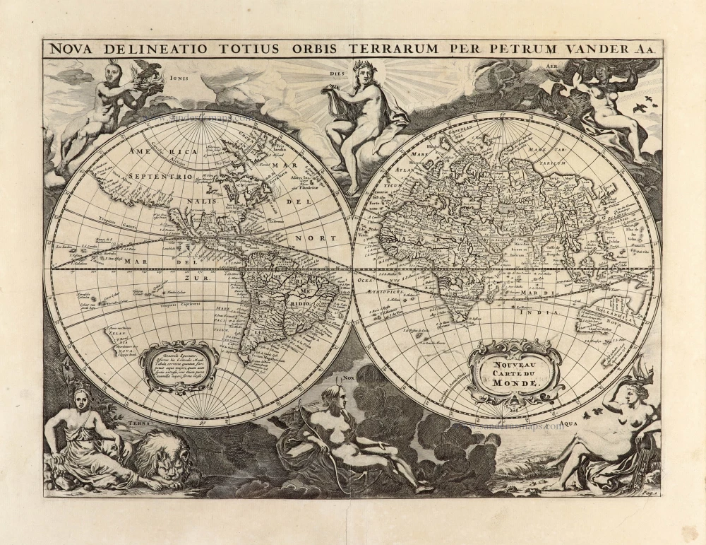
Nova Delineatio Totius Orbis Terrarum per Petrum Van der Aa. - Nouveau Carte du Monde. 1702
World by Pieter Van der Aa - double hemisphere.
[Item number: 30150]

Nouvelle Carte d'Angleterre, d'Ecosse et d'Irlande, avec des Instructions pour connoitre les differents etats de la Couronne d'Angleterre en Europe, Asie, Afrique, et Amérique. 1708
British Isles with a world map in two hemispheres, by Zacharias Châtelain.
[Item number: 30167]

'One of the supreme examples of map maker's art' (Shirley)
Nova Totius Terrarum Orbis Geographica ac Hydrographica. 1643
World by Willem Blaeu, in Mercator projection.
[Item number: 30271]

Superb old colouring, heightened with gold.
Orbis Terrarum Tabula Recens Emendata Et In Lucem Edita 1714
World - Double Hemisphere, by Daniel Stoopendaal
[Item number: 30635]
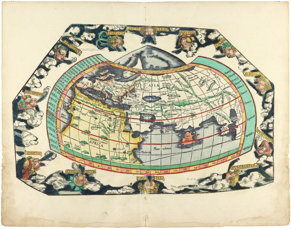
Rare 1525 edition in nice old colour.
[No title] 1525
Ptolemaic world by Lorenz Fries after Martin Waldseemüller.
[Item number: 30649]
Rare 1525 edition of the second modern world map by Fries, in nice old colour.
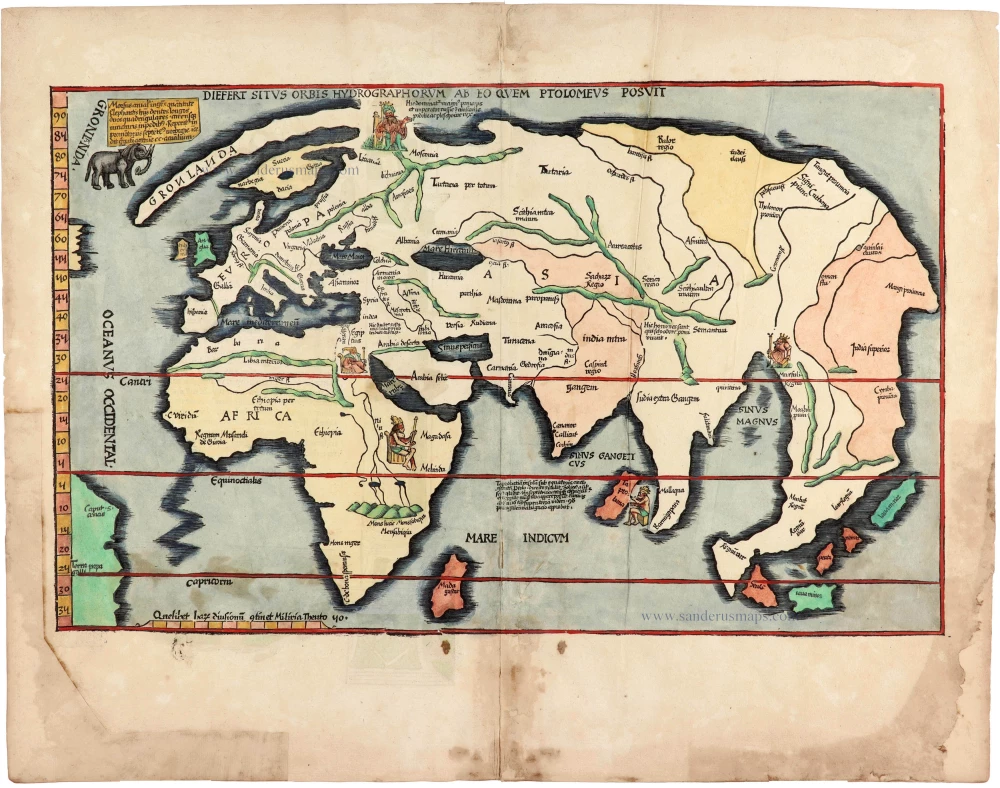
Diefert Situs Orbis Hydrographorum Ab Eo Quem Ptolomeus Posuit. 1525
Modern world map, by Lorenz Fries, after Martin Waldseemüller.
[Item number: 30661]

Heightened in gold and silver
[No title] 1599
World by Theodore De Bry, Great Voyages,
[Item number: 30719]

Drake map heightened in gold and silver
[No title] 1599
World by Theodore De Bry, Great Voyages,
[Item number: 30725]
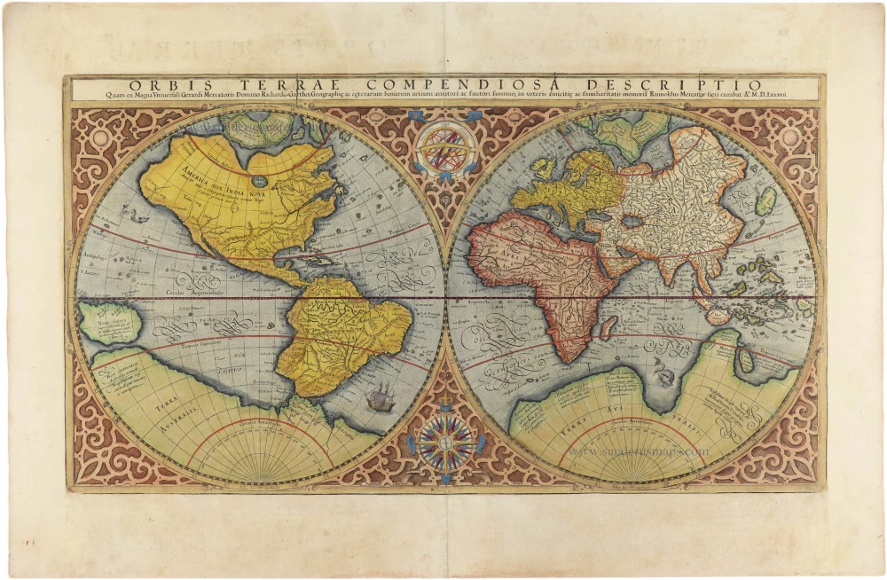
Orbis Terrae Compendiosa Descriptio. 1613
World by Mercator Rumold, double hemisphere.
[Item number: 30942]

Mappe-Monde Geo-Hydrographique, ou Description Generale du Globe Terrestre et Aquatique en Deux Plans-Hemispheres ... 1692
World map by Nicolas Sanson, so-called published by Hubert Jaillot. (Pirated edition by Pierre Mortier).
[Item number: 31136]

Typus Orbis Terrarum. 1618
World by Petrus Bertius, published by Jodocus Hondius II.
[Item number: 31520]

Gottfried's first edition 1631
[no title] 1631
Willem C. Schouten, world map published by Gottfried.
[Item number: 31560]

Rare first edition
[no title] 1618
World map in two hemispheres by Willem W. Schouten.
[Item number: 31601]

Beautiful example of this important world map
Typus Orbis Terrarum. 1584
World by Abraham Ortelius.
[Item number: 32090]

Planiglobii Terrestris cum Utroq Hemisphaerio Caelesti Generalis Repraesentatio. c. 1720
World by Homann J.B., double hemisphere.
[Item number: 32099]

Early Mercator projection
Universi Orbis Descriptio Ad Usum Navigantium. 1597
World by Giovanni Magini.
[Item number: 32281]

Carta Marina Nuova Tavola. 1574
World chart by Girolamo Ruscelli.
[Item number: 32432]

Orbis Descriptio. 1574
World in two hemisperes, by Girolamo Ruscelli.
[Item number: 32433]

Rare first state of Danckerts beautiful world map
Nova Totius Terrarum Orbis Tabula.. c. 1680
Double hemisphere world map by Justus Danckerts
[Item number: 32456]

The most mystical world map of all time.
[No title] 1560-1600
Daniel's Dream Map. The Wittenberg world map by Hanss Luft.
[Item number: 32507]
'One of the supreme examples of map maker's art' (Shirley)
Nova Totius Terrarum Orbis Geographica ac Hydrographica. 1635
World by Willem Blaeu, in Mercator projection.
[Item number: 32683]

Mappa Mondo O Vero Carta Generale Del Globo Terestre 1677
World in two hemisphers by Giovanni De Rossi, after Nicolas Sanson.
[Item number: 32885]

Typus Orbis Terrarum. 1618
World by Petrus Bertius.
[Item number: 33183]
new