
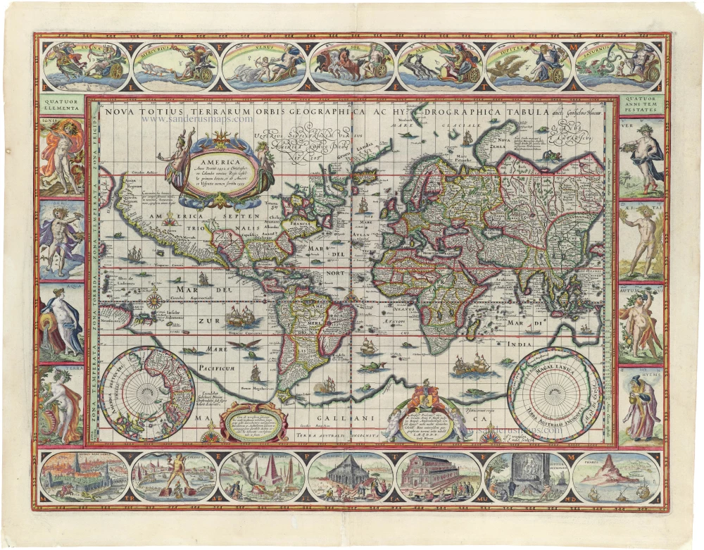
World by Homann J.B., double hemisphere. c. 1720

The Homann Family: Masters of German Cartography and Publishing
The Homann family stands as one of the most significant names in the history of German cartography and publishing. Their maps, atlases, and geographic works not only shaped contemporary understanding of the world during the 18th century but also left an enduring legacy in the fields of geography, engraving, and scholarly publishing.
The family's prominence began with Johann Baptist Homann (1664–1724), a native of Oberkammlach in Bavaria. Initially trained in law and theology, Johann Baptist later turned to engraving and cartography — a field that was flourishing amid the Age of Discovery and the growing demand for precise geographic knowledge.
In 1702, he founded his own publishing house in Nürnberg, a city then renowned for its vibrant intellectual, artistic, and scientific community. Nuremberg’s rich tradition of printmaking and map production provided fertile ground for Homann's enterprise.
Johann Baptist Homann quickly rose to prominence as one of Germany’s leading cartographers and publishers. His works combined technical accuracy, artistic merit, and rich ornamentation, often embellished with elaborate cartouches, mythological scenes, and heraldic symbols.
In 1715, Homann was appointed Imperial Geographer to the Holy Roman Emperor Charles VI. He obtained the "Imperial Privilege" (Privilegium Imperialis). This prestigious title solidified his status and bestowed upon his publishing house both credibility and influence. His most famous works include:
- Atlas Novus Terrarum Orbis (1707) — an early and ambitious atlas project.
- Grosser Atlas über die ganze Welt (1716) — one of the most crucial German world atlases of the early 18th century.
Homann’s maps covered both European and global territories, including the Americas, Asia, and Africa, reflecting contemporary geographical knowledge and political boundaries.
The Homann Heirs (Homannische Erben)
After Johann Baptist Homann died in 1724, his son Johann Christoph Homann (1703–1730) briefly took over the business. However, Johann Christoph died at a young age, and the enterprise was then continued under the name Homännische Erben ("Homann Heirs"), a partnership of family members and associates.
Despite the loss of its founder, the firm remained highly productive and influential for several decades. The Homann Heirs continued to publish atlases, wall maps, city views, and geographical treatises well into the late 18th century. Their catalogue included works by noted cartographers such as Johann Matthias Hase, Leonhard Euler, and Tobias Conrad Lotter.
The Homann publishing house played a crucial role in disseminating geographic and scientific knowledge during the Enlightenment. Their maps combined artistry with empirical detail and were sought after by scholars, navigators, governments, and collectors.
Several of their works are now prized as valuable historical artefacts, housed in museums, libraries, and private collections around the world. The Homann Heirs' firm gradually declined by the end of the 18th century, overtaken by newer publishing houses and changing technologies, but their contribution to the cartographic tradition remains significant.
The Homann family’s name is indelibly linked to the golden age of German cartography. Through meticulous craftsmanship and a keen sense of visual storytelling, they charted the known world of their time, leaving a remarkable record of early modern geography. Today, their maps not only inform historians of cartography but also captivate collectors and enthusiasts for their aesthetic beauty and historical value.
Planiglobii Terrestris cum Utroq Hemisphaerio Caelesti Generalis Repraesentatio.
Item Number: 32099 Authenticity Guarantee
Category: Antique maps > World
World by Homann J.B., double hemisphere.
Title: Planiglobii Terrestris cum Utroq Hemisphaerio Caelesti Generalis Repraesentatio.
Quam ex novissimis probatissimisque Gallorum & Batavorum Tabulis concinnatam, multisq. phaenomenis illustratam Luci publicae exponit Auctor Ioh. Baptista Homann Norimbergae.
Date of the first edition: c. 1702.
Date of this map: c. 1720.
Copper engraving, printed on paper.
Image size: 485 x 550mm (19 x 21¾ inches).
Sheet size: 520 x 600mm (20½ x 23½ inches).
Verso: Blank.
Condition: Original coloured, lower centrefold split reinforced.
Condition Rating: A.
From: Atlas Novus Terrarum Orbis Imperia, regna et status exactis tabulis geographice demonstrans. Nuremberg, J.B. Homann, [c. 1720].
The Homann Family: Masters of German Cartography and Publishing
The Homann family stands as one of the most significant names in the history of German cartography and publishing. Their maps, atlases, and geographic works not only shaped contemporary understanding of the world during the 18th century but also left an enduring legacy in the fields of geography, engraving, and scholarly publishing.
The family's prominence began with Johann Baptist Homann (1664–1724), a native of Oberkammlach in Bavaria. Initially trained in law and theology, Johann Baptist later turned to engraving and cartography — a field that was flourishing amid the Age of Discovery and the growing demand for precise geographic knowledge.
In 1702, he founded his own publishing house in Nürnberg, a city then renowned for its vibrant intellectual, artistic, and scientific community. Nuremberg’s rich tradition of printmaking and map production provided fertile ground for Homann's enterprise.
Johann Baptist Homann quickly rose to prominence as one of Germany’s leading cartographers and publishers. His works combined technical accuracy, artistic merit, and rich ornamentation, often embellished with elaborate cartouches, mythological scenes, and heraldic symbols.
In 1715, Homann was appointed Imperial Geographer to the Holy Roman Emperor Charles VI. He obtained the "Imperial Privilege" (Privilegium Imperialis). This prestigious title solidified his status and bestowed upon his publishing house both credibility and influence. His most famous works include:
- Atlas Novus Terrarum Orbis (1707) — an early and ambitious atlas project.
- Grosser Atlas über die ganze Welt (1716) — one of the most crucial German world atlases of the early 18th century.
Homann’s maps covered both European and global territories, including the Americas, Asia, and Africa, reflecting contemporary geographical knowledge and political boundaries.
The Homann Heirs (Homannische Erben)
After Johann Baptist Homann died in 1724, his son Johann Christoph Homann (1703–1730) briefly took over the business. However, Johann Christoph died at a young age, and the enterprise was then continued under the name Homännische Erben ("Homann Heirs"), a partnership of family members and associates.
Despite the loss of its founder, the firm remained highly productive and influential for several decades. The Homann Heirs continued to publish atlases, wall maps, city views, and geographical treatises well into the late 18th century. Their catalogue included works by noted cartographers such as Johann Matthias Hase, Leonhard Euler, and Tobias Conrad Lotter.
The Homann publishing house played a crucial role in disseminating geographic and scientific knowledge during the Enlightenment. Their maps combined artistry with empirical detail and were sought after by scholars, navigators, governments, and collectors.
Several of their works are now prized as valuable historical artefacts, housed in museums, libraries, and private collections around the world. The Homann Heirs' firm gradually declined by the end of the 18th century, overtaken by newer publishing houses and changing technologies, but their contribution to the cartographic tradition remains significant.
The Homann family’s name is indelibly linked to the golden age of German cartography. Through meticulous craftsmanship and a keen sense of visual storytelling, they charted the known world of their time, leaving a remarkable record of early modern geography. Today, their maps not only inform historians of cartography but also captivate collectors and enthusiasts for their aesthetic beauty and historical value.
Related items
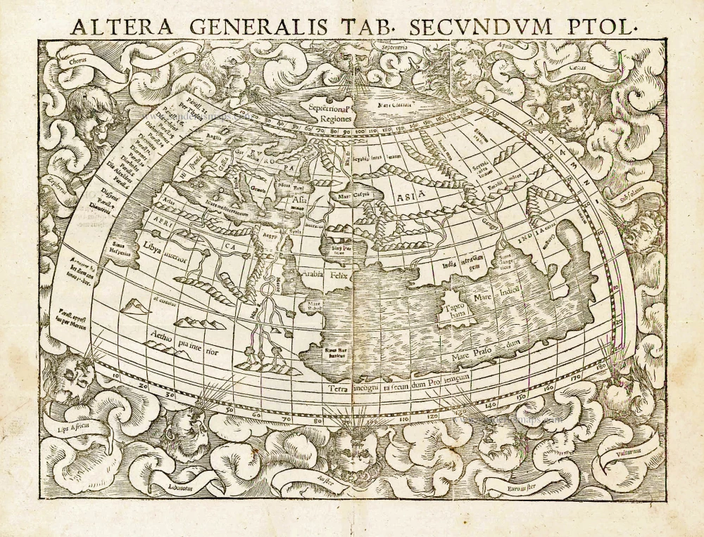
Altera Generalis Tab. Secundum Ptol. 1559
Ptolemaic world by Sebastian Münster
[Item number: 11981]

Aevi Veteris, Typus Geographicus. 1601
Ancient World by Abraham Ortelius.
[Item number: 22609]

Rare variant.
Cosmographia Universalis. 1592
World map by H. Bünting - D.A. Veleslavina.
[Item number: 26356]

Nouvelle Mappe Monde Dediee au Progres de nos Connoissances. 1776-79
World by Francesco Santini.
[Item number: 26946]

Universi Orbis Descriptio. 1597
World by Giovanni Magini
[Item number: 27837]
The most mystical world map of all time.
[No title] 1560-1600
Daniel's Dream Map. The Wittenberg world map.
[Item number: 28159]

Mappemonde en deux Hémisphères. c. 1797
World map, double hemisphere by Pierre Grégoire Chanlaire.
[Item number: 28209]

Mappe-Monde Physique. c. 1797
World map, double hemisphere by Pierre Grégoire Chanlaire.
[Item number: 28210]
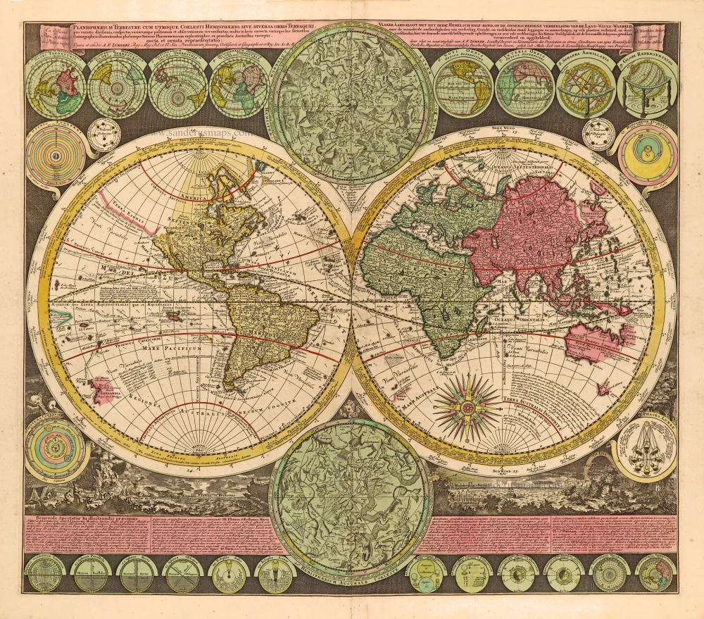
Planisphaerium Terrestre cum utroque Coelesti Hemisphaerio, sive Diversa Orbis Terraquei, c. 1700
World by Zürner A.F., double hemisphere.
[Item number: 28229]
First edition, scarce
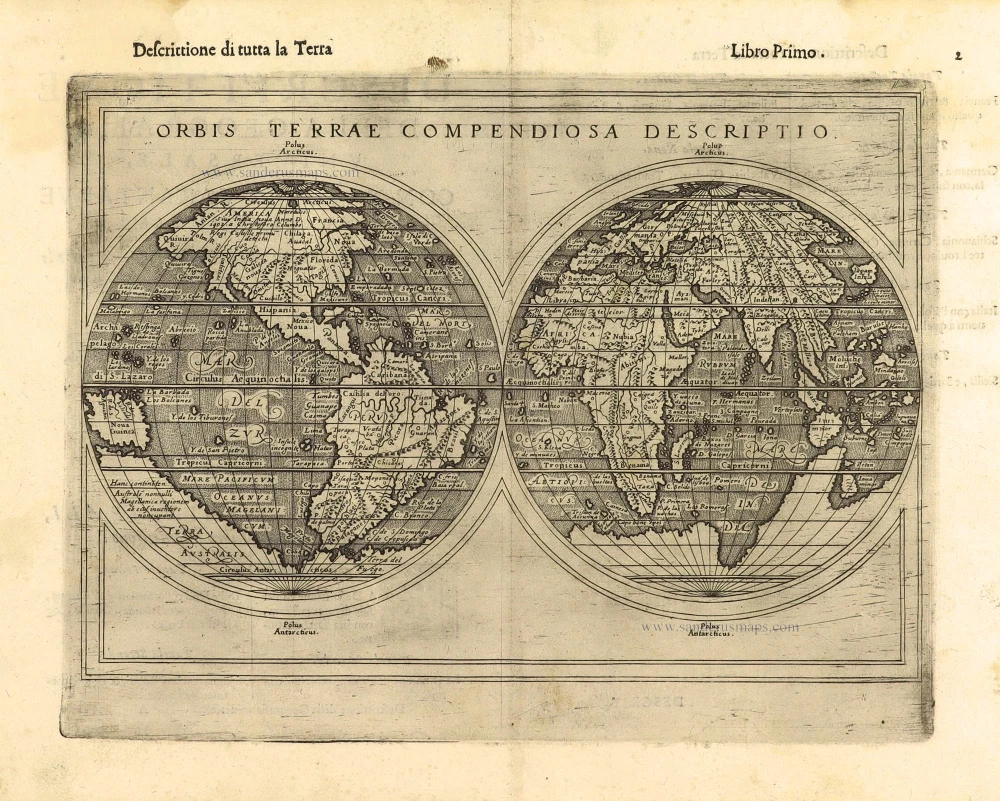
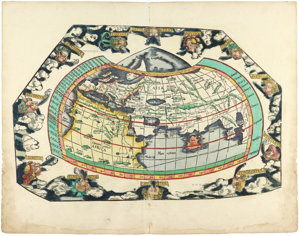
Orbis Terrae Compendiosa Descriptio. 1598
World by Giuseppe Rosaccio, double hemisphere.
[Item number: 28289]

Ptolemaei Cognita. 1598
Ptolemaic world map by Giuseppe Rosaccio.
[Item number: 28290]
The engraving and layout and elegance of decoration are all of the highest standards.
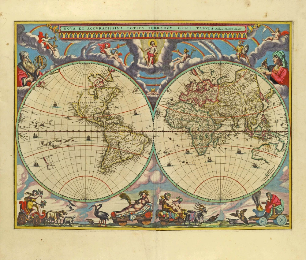
Nova Et Accuratissima Totius Terrarum Orbis Tabula. 1659
World by Joan Blaeu, double hemisphere.
[Item number: 28336]
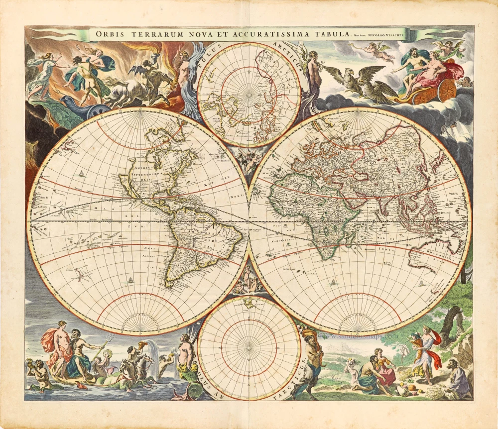
Orbis Terrarum Nova et Accuratissima Tabula. c. 1678
World by Nicolaas Visscher, double hemisphere.
[Item number: 28628]

A fine ornate example of the decorative cartography of the time.
Nova Totius Terrarum Orbis Geographica ac Hydrographica Tabula. Auct: Henr: Hondio. 1641
Double-hemisphere world map by Henricus Hondius.
[Item number: 28768]

Descrittione Del Mappamondo. 1572
World by Porcacchi Tommaso.
[Item number: 28910]
Luxury colouring.
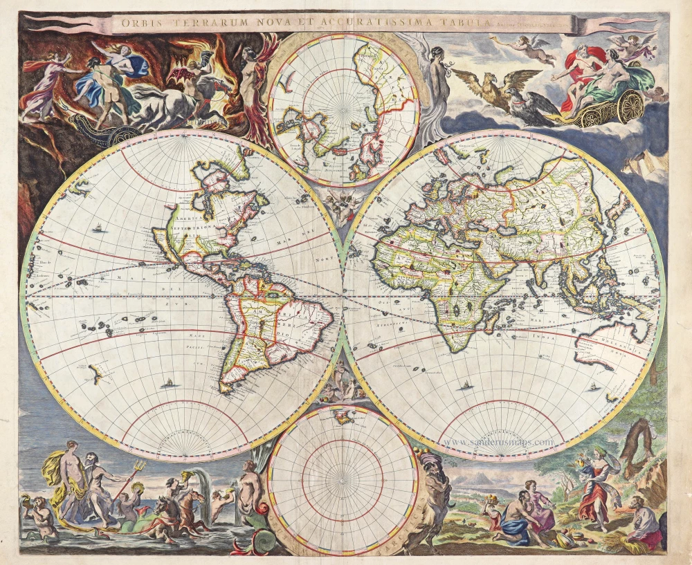
Orbis Terrarum Nova et Accuratissima Tabula. c. 1678
Double-hemisphere world map, by Nicolaas Visscher I.
[Item number: 28934]
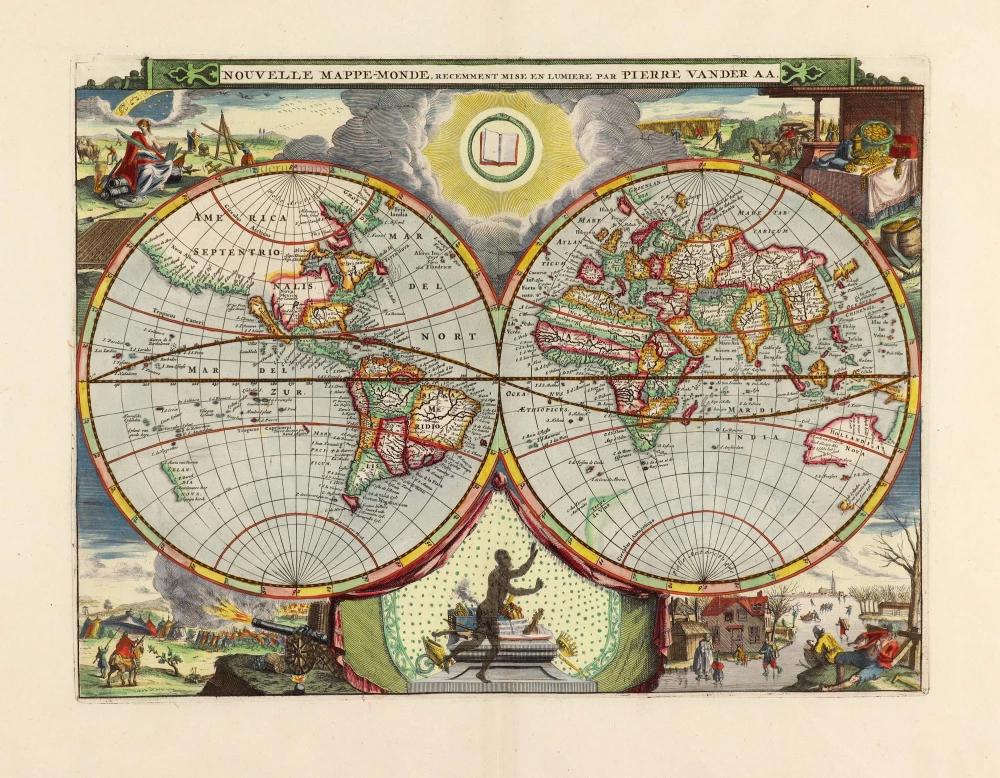
Nouvelle Mappe-Monde, 1710
World by Pieter Van der Aa, double hemisphere.
[Item number: 29136]

Nova Orbis Tabula in Lucem Edita, A. F. De Wit. c. 1690
World by Frederik De Wit, double hemisphere.
[Item number: 29231]

Mapmonde ou description generale du Globe Terrestre. 1713
World map by Zacharias Châtelain.
[Item number: 29555]
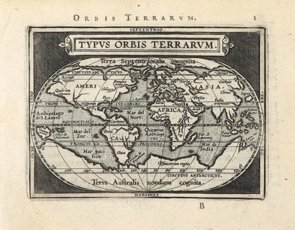
Typus Orbis Terrarum. 1589
The world by Abraham Ortelius / Philippe Galle.
[Item number: 29605]
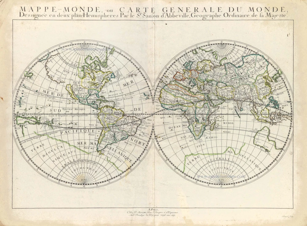
Mappe-Monde, ou Carte Generale du Monde, 1652
Double hemisphere world map by Nicolas Sanson.
[Item number: 29612]

Mercator projection
Discorso Intorno alla Carta da Navigare. 1590
World by Thomaso Porcacchi.
[Item number: 29786]

Rare original colour.
Typus Orbis Terrarum - Globus Terrestris. 1609
Two world maps by A. Ortelius, published by J.B. Vrients.
[Item number: 29861]

Mappe-Monde 1766-1780
World map by Louis Brion de la Tour, published by L.C Desnos.
[Item number: 30100]
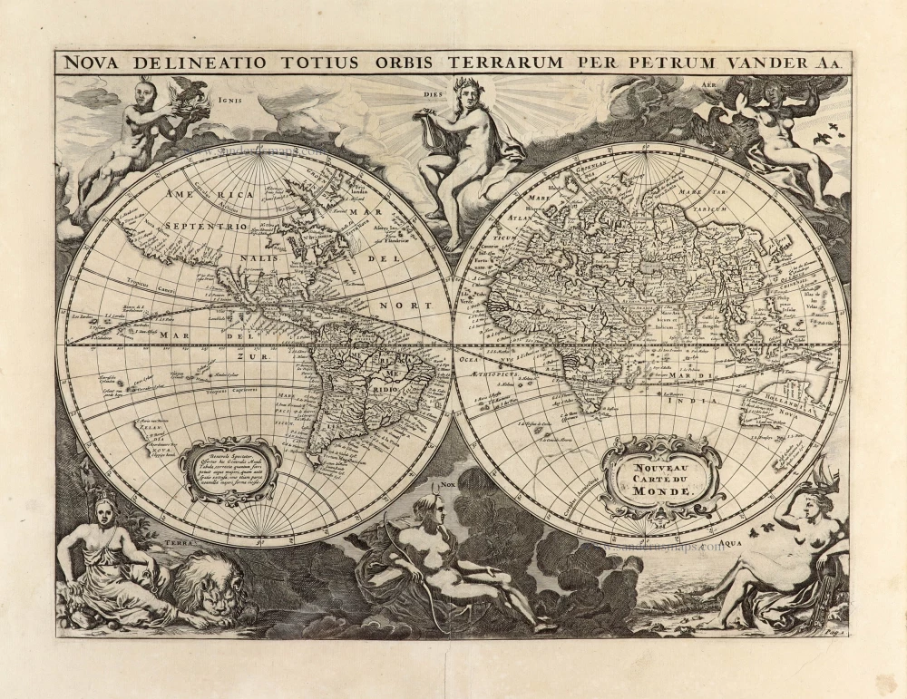
Nova Delineatio Totius Orbis Terrarum per Petrum Van der Aa. - Nouveau Carte du Monde. 1702
World by Pieter Van der Aa - double hemisphere.
[Item number: 30150]

Nouvelle Carte d'Angleterre, d'Ecosse et d'Irlande, avec des Instructions pour connoitre les differents etats de la Couronne d'Angleterre en Europe, Asie, Afrique, et Amérique. 1708
British Isles with a world map in two hemispheres, by Zacharias Châtelain.
[Item number: 30167]

'One of the supreme examples of map maker's art' (Shirley)
Nova Totius Terrarum Orbis Geographica ac Hydrographica. 1643
World by Willem Blaeu, in Mercator projection.
[Item number: 30271]

Superb old colouring, heightened with gold.
Orbis Terrarum Tabula Recens Emendata Et In Lucem Edita 1714
World - Double Hemisphere, by Daniel Stoopendaal
[Item number: 30635]
Rare 1525 edition in nice old colour.
[No title] 1525
Ptolemaic world by Lorenz Fries after Martin Waldseemüller.
[Item number: 30649]
Rare 1525 edition of the second modern world map by Fries, in nice old colour.
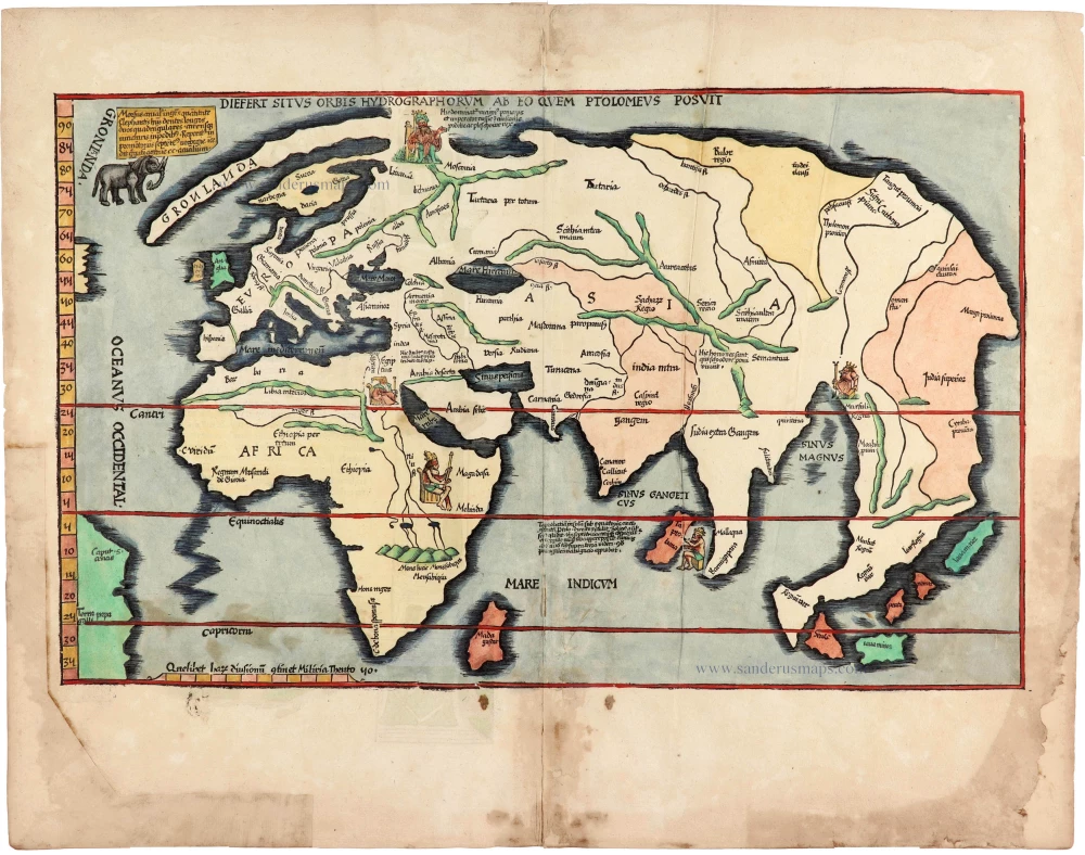
Diefert Situs Orbis Hydrographorum Ab Eo Quem Ptolomeus Posuit. 1525
Modern world map, by Lorenz Fries, after Martin Waldseemüller.
[Item number: 30661]

Heightened in gold and silver
[No title] 1599
World by Theodore De Bry, Great Voyages,
[Item number: 30719]

Drake map heightened in gold and silver
[No title] 1599
World by Theodore De Bry, Great Voyages,
[Item number: 30725]
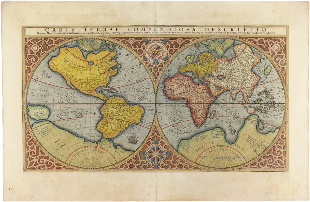
Orbis Terrae Compendiosa Descriptio. 1613
World by Mercator Rumold, double hemisphere.
[Item number: 30942]

Mappe-Monde Geo-Hydrographique, ou Description Generale du Globe Terrestre et Aquatique en Deux Plans-Hemispheres ... 1692
World map by Nicolas Sanson, so-called published by Hubert Jaillot. (Pirated edition by Pierre Mortier).
[Item number: 31136]

Typus Orbis Terrarum. 1618
World by Petrus Bertius, published by Jodocus Hondius II.
[Item number: 31520]

Gottfried's first edition 1631
[no title] 1631
Willem C. Schouten, world map published by Gottfried.
[Item number: 31560]

Rare first edition
[no title] 1618
World map in two hemispheres by Willem W. Schouten.
[Item number: 31601]

An Essay of a New and Compact Map, containing the known parts of the Terrestrial Globe. 1750
World map by Jacques-Nicolas Bellin, published by A.F. Prévost.
[Item number: 31883]

Beautiful example of this important world map
Typus Orbis Terrarum. 1584
World by Abraham Ortelius.
[Item number: 32090]

Early Mercator projection
Universi Orbis Descriptio Ad Usum Navigantium. 1597
World by Giovanni Magini.
[Item number: 32281]

Carta Marina Nuova Tavola. 1574
World chart by Girolamo Ruscelli.
[Item number: 32432]

Orbis Descriptio. 1574
World in two hemisperes, by Girolamo Ruscelli.
[Item number: 32433]

Rare first state of Danckerts beautiful world map
Nova Totius Terrarum Orbis Tabula.. c. 1680
Double hemisphere world map by Justus Danckerts
[Item number: 32456]

The most mystical world map of all time.
[No title] 1560-1600
Daniel's Dream Map. The Wittenberg world map by Hanss Luft.
[Item number: 32507]
'One of the supreme examples of map maker's art' (Shirley)
Nova Totius Terrarum Orbis Geographica ac Hydrographica. 1635
World by Willem Blaeu, in Mercator projection.
[Item number: 32683]

Mappa Mondo O Vero Carta Generale Del Globo Terestre 1677
World in two hemisphers by Giovanni De Rossi, after Nicolas Sanson.
[Item number: 32885]

Typus Orbis Terrarum. 1618
World by Petrus Bertius.
[Item number: 33183]
new