
Mercator projection
World by Thomaso Porcacchi. 1590

Chart of the World, on Mercator projection, covering most of the world, but not extending further eastwards than just beyond India.
The surface is crisscrossed with rhumb lines.
Thomaso (Tommaso) Porcacchi (1530-1585)
Thomaso Porcacchi was born in Castiglion Fiorentino (Arentino), Tuscany, into a poor family. Through the patronage of Duke Cosimo I de' Medici, he was able to pursue his studies; afterwards, he embarked on a career as a translator, editor and author, initially in Florence, often working with the humanist scholar Lodovico Domenichi. His speciality was classical texts, particularly of a geographical and historical nature. Through this work, he came into contact with the prominent Venetian publisher Gabriel Giolito de' Ferrari and, in 1559, he moved to Venice to form a fruitful association with Giolito, who had produced several books containing maps.
Later in his career, Porcacchi composed an isolario, L'isole piu famose del mondo ..., published by Simone Galignani de Karera and Girolamo Porro in 1572. In 1574 Porro engraved the plates for another Porcachi volume, Funerali antichi di diversi popoli, et nationi ..., and he later contributed the maps to a new edition of Claudius Prolemy's Geographiae universae tum veteris tum novae ..., edited by Giovanni Antonio Magini and published by the Heirs of Simone Galignani de Karera.
The first edition of Porcacchi's L'isole piu famose contained 30 engraved maps, set in text. The coverage was worldwide, albeit concentrated on the Mediterranean. For the second edition, the text was rewritten, and 17 additional maps were inserted, to make a total of 47.
Discorso Intorno alla Carta da Navigare.
Item Number: 29786 Authenticity Guarantee
Category: Antique maps > World
World, by Thomaso Porcacchi.
Title: Discorso Intorno alla Carta da Navigare.
Date of the first edition: 1572.
Date of this map: 1590.
Copper engraving, printed on paper.
Image size: 105 x 145mm (4.13 x 5.71 inches).
Sheet size: 295 x 195mm (11.61 x 7.68 inches).
Verso: Italian text.
Condition: Excellent.
Condition Rating: A+.
From: Porcacchi T. L'Isole Piu Famose Del Mondo. Venice, Giorgio Angelieri for the Heirs of Simone Galignani, 1590.
Chart of the World, on Mercator projection, covering most of the world, but not extending further eastwards than just beyond India.
The surface is crisscrossed with rhumb lines.
Thomaso (Tommaso) Porcacchi (1530-1585)
Thomaso Porcacchi was born in Castiglion Fiorentino (Arentino), Tuscany, into a poor family. Through the patronage of Duke Cosimo I de' Medici, he was able to pursue his studies; afterwards, he embarked on a career as a translator, editor and author, initially in Florence, often working with the humanist scholar Lodovico Domenichi. His speciality was classical texts, particularly of a geographical and historical nature. Through this work, he came into contact with the prominent Venetian publisher Gabriel Giolito de' Ferrari and, in 1559, he moved to Venice to form a fruitful association with Giolito, who had produced several books containing maps.
Later in his career, Porcacchi composed an isolario, L'isole piu famose del mondo ..., published by Simone Galignani de Karera and Girolamo Porro in 1572. In 1574 Porro engraved the plates for another Porcachi volume, Funerali antichi di diversi popoli, et nationi ..., and he later contributed the maps to a new edition of Claudius Prolemy's Geographiae universae tum veteris tum novae ..., edited by Giovanni Antonio Magini and published by the Heirs of Simone Galignani de Karera.
The first edition of Porcacchi's L'isole piu famose contained 30 engraved maps, set in text. The coverage was worldwide, albeit concentrated on the Mediterranean. For the second edition, the text was rewritten, and 17 additional maps were inserted, to make a total of 47.
Related items

Rare variant.
Cosmographia Universalis. 1592
World map by H. Bünting - D.A. Veleslavina.
[Item number: 26356]

Universi Orbis Descriptio. 1597
World by Giovanni Magini
[Item number: 27837]
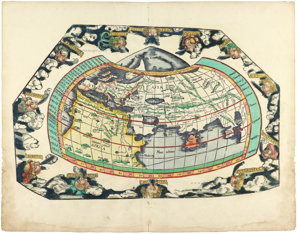
The most mystical world map of all time.
[No title] 1560-1600
Daniel's Dream Map. The Wittenberg world map.
[Item number: 28159]
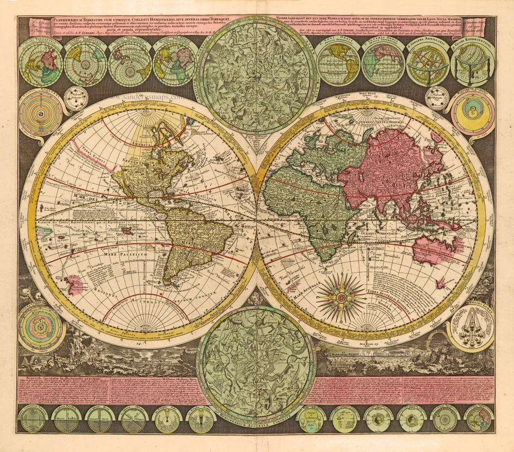
Planisphaerium Terrestre cum utroque Coelesti Hemisphaerio, sive Diversa Orbis Terraquei, c. 1700
World by Zürner A.F., double hemisphere.
[Item number: 28229]
First edition, scarce
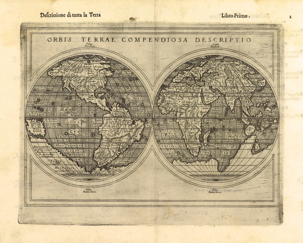
Orbis Terrae Compendiosa Descriptio. 1598
World by Giuseppe Rosaccio, double hemisphere.
[Item number: 28289]

Ptolemaei Cognita. 1598
Ptolemaic world map by Giuseppe Rosaccio.
[Item number: 28290]
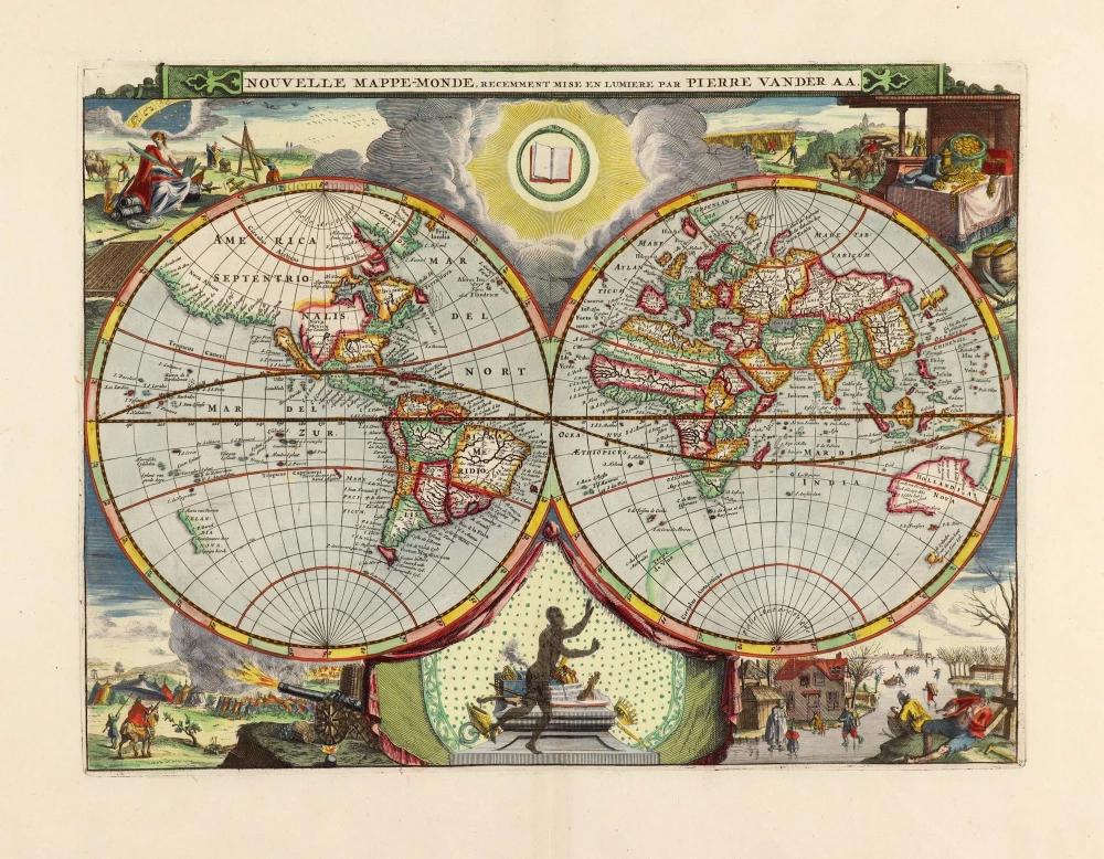
Nouvelle Mappe-Monde, 1710
World by Pieter Van der Aa, double hemisphere.
[Item number: 29136]

Mapmonde ou description generale du Globe Terrestre. 1713
World map by Zacharias Châtelain.
[Item number: 29555]
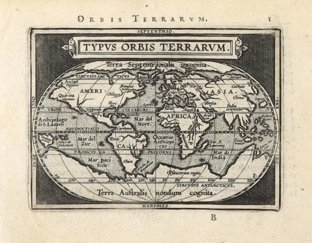
Typus Orbis Terrarum. 1589
The world by Abraham Ortelius / Philippe Galle.
[Item number: 29605]
Rare 1525 edition in nice old colour.
[No title] 1525
Ptolemaic world by Lorenz Fries after Martin Waldseemüller.
[Item number: 30649]

Mappe-Monde Geo-Hydrographique, ou Description Generale du Globe Terrestre et Aquatique en Deux Plans-Hemispheres ... 1692
World map by Nicolas Sanson, so-called published by Hubert Jaillot. (Pirated edition by Pierre Mortier).
[Item number: 31136]

Typus Orbis Terrarum. 1618
World by Petrus Bertius, published by Jodocus Hondius II.
[Item number: 31520]

Gottfried's first edition 1631
[no title] 1631
Willem C. Schouten, world map published by Gottfried.
[Item number: 31560]

Rare first edition
[no title] 1618
World map in two hemispheres by Willem W. Schouten.
[Item number: 31601]

An Essay of a New and Compact Map, containing the known parts of the Terrestrial Globe. 1750
World map by Jacques-Nicolas Bellin, published by A.F. Prévost.
[Item number: 31883]

Beautiful example of this important world map
Typus Orbis Terrarum. 1584
World by Abraham Ortelius.
[Item number: 32090]

Planiglobii Terrestris cum Utroq Hemisphaerio Caelesti Generalis Repraesentatio. c. 1720
World by Homann J.B., double hemisphere.
[Item number: 32099]

Early Mercator projection
Universi Orbis Descriptio Ad Usum Navigantium. 1597
World by Giovanni Magini.
[Item number: 32281]

Carta Marina Nuova Tavola. 1574
World chart by Girolamo Ruscelli.
[Item number: 32432]

Orbis Descriptio. 1574
World in two hemisperes, by Girolamo Ruscelli.
[Item number: 32433]

Rare first state of Danckerts beautiful world map
Nova Totius Terrarum Orbis Tabula.. c. 1680
Double hemisphere world map by Justus Danckerts
[Item number: 32456]

The most mystical world map of all time.
[No title] 1560-1600
Daniel's Dream Map. The Wittenberg world map by Hanss Luft.
[Item number: 32507]
'One of the supreme examples of map maker's art' (Shirley)
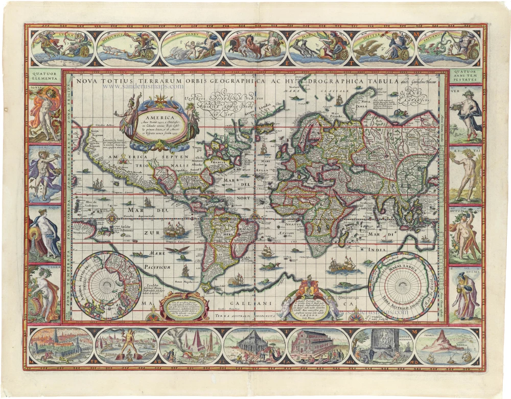
Nova Totius Terrarum Orbis Geographica ac Hydrographica. 1635
World by Willem Blaeu, in Mercator projection.
[Item number: 32683]

Mappa Mondo O Vero Carta Generale Del Globo Terestre 1677
World in two hemisphers by Giovanni De Rossi, after Nicolas Sanson.
[Item number: 32885]

Typus Orbis Terrarum. 1618
World by Petrus Bertius.
[Item number: 33183]
new