
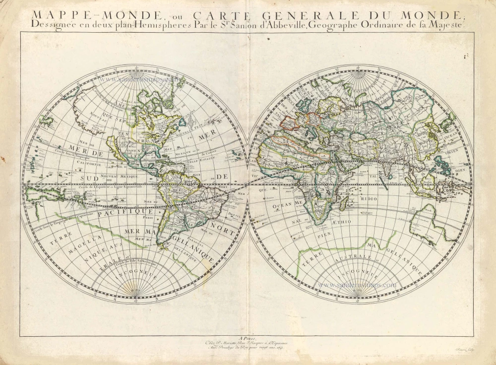
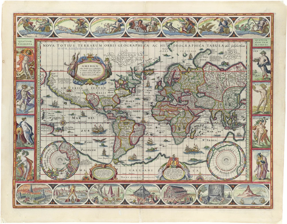
World map by Nicolas Sanson, so-called published by Hubert Jaillot. (Pirated edition by Pierre Mortier). 1692

This large double-hemisphere world map was first published in 1674 by the Frenchman Alexis Hubert Jaillot, who succeeded Sanson's publishing house in Paris. This map has several plates and states. This is the first state of the fourth plate, a pirated edition by Pierre Mortier.
Hubert Jaillot's Atlas Nouveau had a broader and longer distribution through the counterfeits made by Pierre Mortier in Amsterdam. It is also possible that these copies were published with the agreement of Jaillot or Sanson, but no document has yet been found to confirm this hypothesis. Mortier, of French origin, had lived in Paris between 1681 and 1685, and it is not impossible that he met Jaillot when the latter published the first two editions of the atlas. Mortier's first privilege for the publication of maps dates from September 15, 1690. He was granted the right to print all the maps published by Sanson, Jaillot, etc., the production and correction of which required a great deal of effort and expense.
This agreement was respected until Pierre Mortier died in 1711 and even after his widow died in 1719.
Alexis-Hubert JAILLOT (1632-1712)
A.-H. Jaillot first started as a sculptor. In 1664 he married Jeanne Berey, daughter of the publisher and dealer of prints Nicolas I Berey. Jaillot soon rushed into the print business due to his father-in-law's deaths in 1665 and his brother-in-law in 1667. In 1668, A.-H. Jaillot and his wife acquire the Berey fund's geographical part, which consists of globes, maps, city views and atlases. He becomes the tenant of his father-in-law's shop, Aux Deux Globes, which he buys two years later.
Jaillot enters into an agreement with Guillaume Sanson to publish his maps that will form his Atlas Nouveau's embryo. Sanson undertakes to obtain the privilege for his maps for twenty years and to cede it to Jaillot, as is the custom. Jaillot, for its part, takes care of the engraving, printing and sale of the maps. He engages engravers, François Caumartin and Louis Cordier, to engrave his maps.
A conflict arises between Jaillot and Sanson, and in 1674 it comes to a lawsuit. In 1677 they came back to an agreement.
The Atlas Nouveau first appeared in 1681 and brought great prosperity to his publisher. Jaillot owes him his title of the geographer to the king, awarded on July 20, 1686. He continues to issue maps and signs more and more himself. In 1695, he published the Atlas Français, two-thirds of which are his maps and only one third by Sanson.
A.H. Jaillot dies in 1712 and leaves a vast trading fund.
SANSON FAMILY
Nicolas Sanson (1600-1667) - Guillaume Sanson (1633-1703) - Pierre Moullart-Sanson (? -1730)
Originally from Abbeville, Nicolas I Sanson showed a keen interest in historical geography. He was still very young; he published a map of ancient Gaul and two treatises, Britannia and Portus Itius on Abbeville and Boulogne's origins. His meeting with Melchior Tavernier was decisive: it prompted him to give up his duties as a military engineer in Picardy and devote himself to engraved cartography.
At the same time, Sanson had drawn up the outline of modern France. He got the help of Tavernier, who encouraged him to compete with the Dutch map publishers. Tavernier contacted other French cartographers whose works he published.
From 1643, N. Sanson obtained a privilege to publish a work personally, the Princes souverains de l'Italie. Then, in 1644 and 1645, he had his famous geographical tables printed, which significantly contributed to his fame. He also published a series of atlases in quarto of the four continents.
In 1648, N. Sanson associated himself with Mariette to publish atlases. From then on, specific maps bore his name and others Mariette's. N. Sanson and Mariette worked together for more than 20 years. After the death of N. Sanson, Mariette acquired the entire fund. Since Mariette only wanted to publish complete atlases, individual maps were no longer sold, and some army generals complained to the king.
The disagreement between the Sanson family and Pierre II Mariette culminated in 1671 when Guillaume Sanson took the case to court. There was no longer any question of collaboration: Guillaume Sanson started working for another publisher, Alexis-Hubert Jaillot.
The Sanson family faced financial difficulties, and in 1692, their cousin, Pierre Moullart-Sanson, bought the entire geographic fund from his uncles and aunt. Pierre Moullart-Sanson was the son of Françoise Sanson (third child of Nicolas) and Pierre Moullart. He restarted the publishing of Sanson's world atlas, and in 1704 he acquired a privilege for publishing all the works of Nicolas and Guillaume Sanson, which continued to be published until 1730.
Mappe-Monde Geo-Hydrographique, ou Description Generale du Globe Terrestre et Aquatique en Deux Plans-Hemispheres ...
Item Number: 31136 Authenticity Guarantee
Category: Antique maps > World
World map by Nicolas Sanson, so-called published by Hubert Jaillot. (Pirated edition by Pierre Mortier).
Title: Mappe-Monde Geo-Hydrographique, ou Description Generale du Globe Terrestre et Aquatique en Deux Plans-Hemispheres ...
Par le Sr. Sanson Geographe Ordinaire du Roy 1691.
Presenté A Monseigneur le Dauphin, Par son tres-humble, tres-Obeissant, et tres fidele serviteur, Hubert Jaillot.
A Paris joigna[n]t les gra[n]ds Augustins, aux Globes
Avec Privilege du Roy pour Vingt Ans 1691.
Date of the first edition: 1674 (Plate I state 1).
Date of this map: 1692 (Plate IV state 1)
Copper engraving, printed on paper from two plates, joined.
Image size: 540 x 895mm (21.26 x 35.24 inches).
Sheet size: 625 x 945mm (24.61 x 37.2 inches).
Verso: Blank.
Condition: Original coloured in outline, lower centrefold split reinforced.
Condition Rating: A.
From: Atlas nouveau contenant toutes les parties du monde ... Paris, H. Jaillot, [1692] (Pastoureau, Jaillot I-D) = Dutch pirated edition.
This large double-hemisphere world map was first published in 1674 by the Frenchman Alexis Hubert Jaillot, who succeeded Sanson's publishing house in Paris. This map has several plates and states. This is the first state of the fourth plate, a pirated edition by Pierre Mortier.
Hubert Jaillot's Atlas Nouveau had a broader and longer distribution through the counterfeits made by Pierre Mortier in Amsterdam. It is also possible that these copies were published with the agreement of Jaillot or Sanson, but no document has yet been found to confirm this hypothesis. Mortier, of French origin, had lived in Paris between 1681 and 1685, and it is not impossible that he met Jaillot when the latter published the first two editions of the atlas. Mortier's first privilege for the publication of maps dates from September 15, 1690. He was granted the right to print all the maps published by Sanson, Jaillot, etc., the production and correction of which required a great deal of effort and expense.
This agreement was respected until Pierre Mortier died in 1711 and even after his widow died in 1719.
Alexis-Hubert JAILLOT (1632-1712)
A.-H. Jaillot first started as a sculptor. In 1664 he married Jeanne Berey, daughter of the publisher and dealer of prints Nicolas I Berey. Jaillot soon rushed into the print business due to his father-in-law's deaths in 1665 and his brother-in-law in 1667. In 1668, A.-H. Jaillot and his wife acquire the Berey fund's geographical part, which consists of globes, maps, city views and atlases. He becomes the tenant of his father-in-law's shop, Aux Deux Globes, which he buys two years later.
Jaillot enters into an agreement with Guillaume Sanson to publish his maps that will form his Atlas Nouveau's embryo. Sanson undertakes to obtain the privilege for his maps for twenty years and to cede it to Jaillot, as is the custom. Jaillot, for its part, takes care of the engraving, printing and sale of the maps. He engages engravers, François Caumartin and Louis Cordier, to engrave his maps.
A conflict arises between Jaillot and Sanson, and in 1674 it comes to a lawsuit. In 1677 they came back to an agreement.
The Atlas Nouveau first appeared in 1681 and brought great prosperity to his publisher. Jaillot owes him his title of the geographer to the king, awarded on July 20, 1686. He continues to issue maps and signs more and more himself. In 1695, he published the Atlas Français, two-thirds of which are his maps and only one third by Sanson.
A.H. Jaillot dies in 1712 and leaves a vast trading fund.
SANSON FAMILY
Nicolas Sanson (1600-1667) - Guillaume Sanson (1633-1703) - Pierre Moullart-Sanson (? -1730)
Originally from Abbeville, Nicolas I Sanson showed a keen interest in historical geography. He was still very young; he published a map of ancient Gaul and two treatises, Britannia and Portus Itius on Abbeville and Boulogne's origins. His meeting with Melchior Tavernier was decisive: it prompted him to give up his duties as a military engineer in Picardy and devote himself to engraved cartography.
At the same time, Sanson had drawn up the outline of modern France. He got the help of Tavernier, who encouraged him to compete with the Dutch map publishers. Tavernier contacted other French cartographers whose works he published.
From 1643, N. Sanson obtained a privilege to publish a work personally, the Princes souverains de l'Italie. Then, in 1644 and 1645, he had his famous geographical tables printed, which significantly contributed to his fame. He also published a series of atlases in quarto of the four continents.
In 1648, N. Sanson associated himself with Mariette to publish atlases. From then on, specific maps bore his name and others Mariette's. N. Sanson and Mariette worked together for more than 20 years. After the death of N. Sanson, Mariette acquired the entire fund. Since Mariette only wanted to publish complete atlases, individual maps were no longer sold, and some army generals complained to the king.
The disagreement between the Sanson family and Pierre II Mariette culminated in 1671 when Guillaume Sanson took the case to court. There was no longer any question of collaboration: Guillaume Sanson started working for another publisher, Alexis-Hubert Jaillot.
The Sanson family faced financial difficulties, and in 1692, their cousin, Pierre Moullart-Sanson, bought the entire geographic fund from his uncles and aunt. Pierre Moullart-Sanson was the son of Françoise Sanson (third child of Nicolas) and Pierre Moullart. He restarted the publishing of Sanson's world atlas, and in 1704 he acquired a privilege for publishing all the works of Nicolas and Guillaume Sanson, which continued to be published until 1730.
Related items
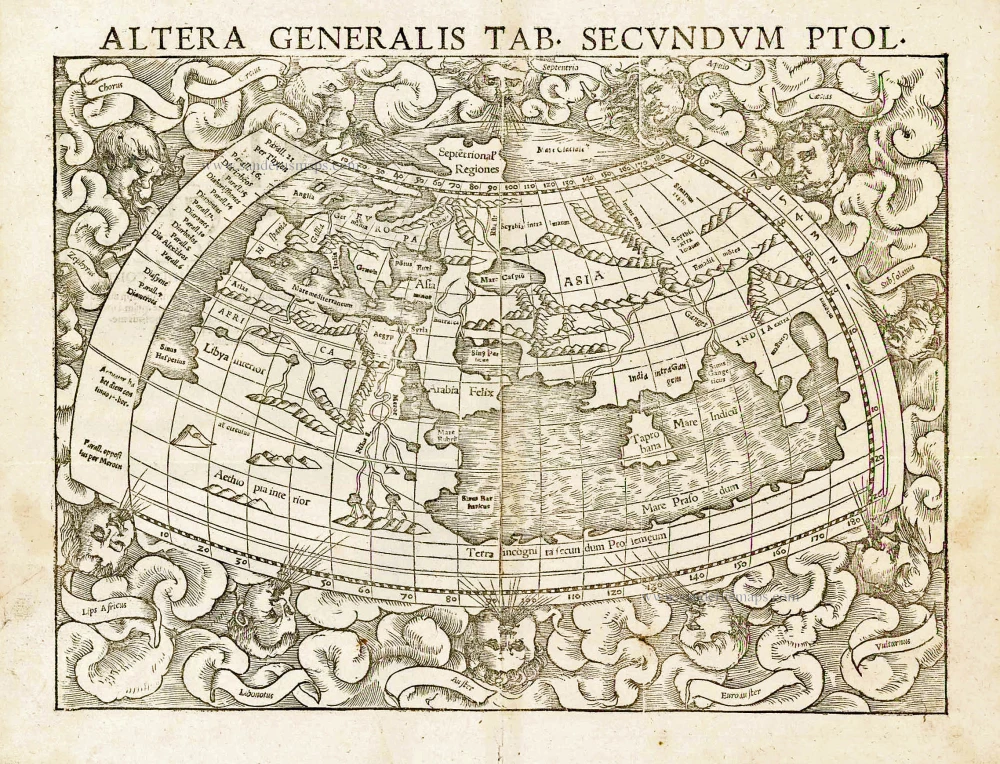
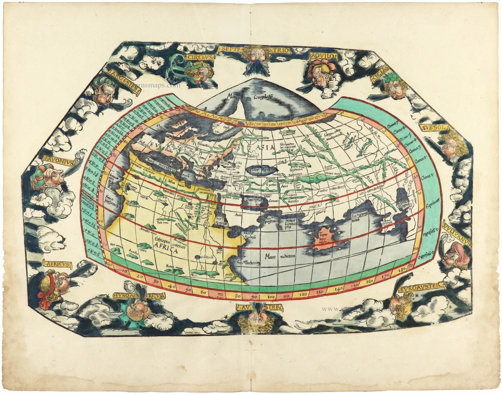
Altera Generalis Tab. Secundum Ptol. 1559
Ptolemaic world by Sebastian Münster
[Item number: 11981]

Aevi Veteris, Typus Geographicus. 1601
Ancient World by Abraham Ortelius.
[Item number: 22609]

Rare variant.
Cosmographia Universalis. 1592
World map by H. Bünting - D.A. Veleslavina.
[Item number: 26356]

Nouvelle Mappe Monde Dediee au Progres de nos Connoissances. 1776-79
World by Francesco Santini.
[Item number: 26946]

Universi Orbis Descriptio. 1597
World by Giovanni Magini
[Item number: 27837]
The most mystical world map of all time.
[No title] 1560-1600
Daniel's Dream Map. The Wittenberg world map.
[Item number: 28159]

Mappemonde en deux Hémisphères. c. 1797
World map, double hemisphere by Pierre Grégoire Chanlaire.
[Item number: 28209]

Mappe-Monde Physique. c. 1797
World map, double hemisphere by Pierre Grégoire Chanlaire.
[Item number: 28210]
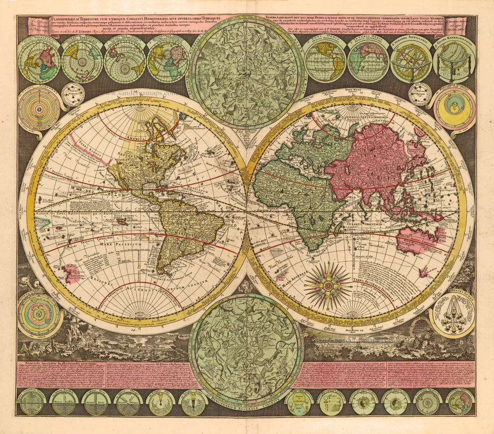
Planisphaerium Terrestre cum utroque Coelesti Hemisphaerio, sive Diversa Orbis Terraquei, c. 1700
World by Zürner A.F., double hemisphere.
[Item number: 28229]
First edition, scarce
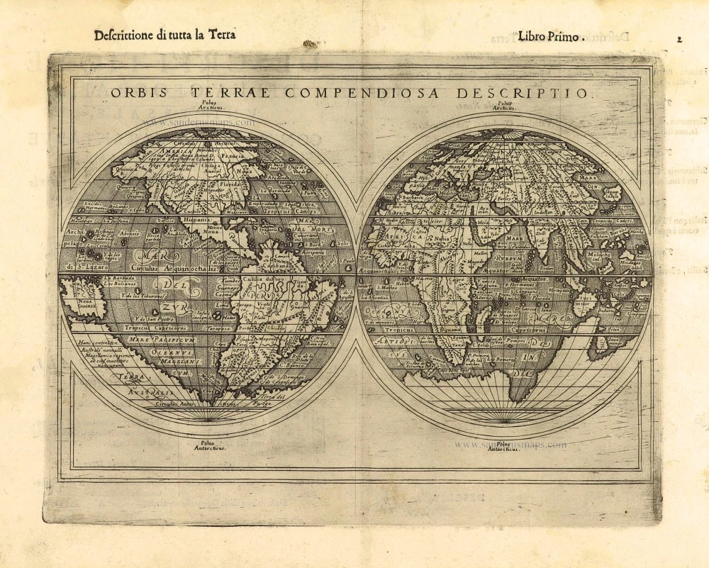
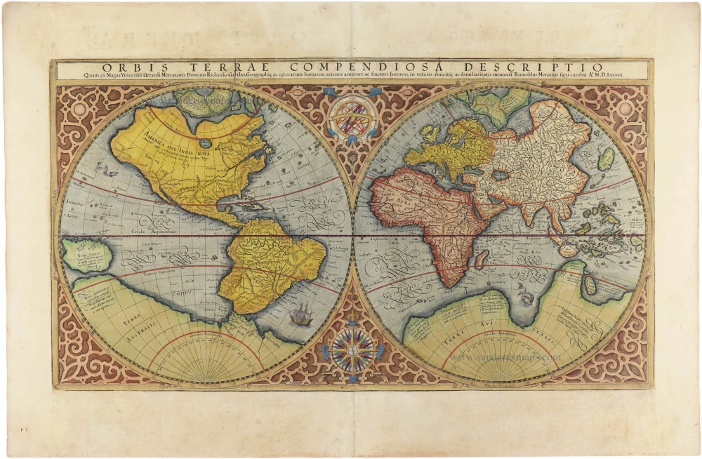
Orbis Terrae Compendiosa Descriptio. 1598
World by Giuseppe Rosaccio, double hemisphere.
[Item number: 28289]

Ptolemaei Cognita. 1598
Ptolemaic world map by Giuseppe Rosaccio.
[Item number: 28290]
The engraving and layout and elegance of decoration are all of the highest standards.
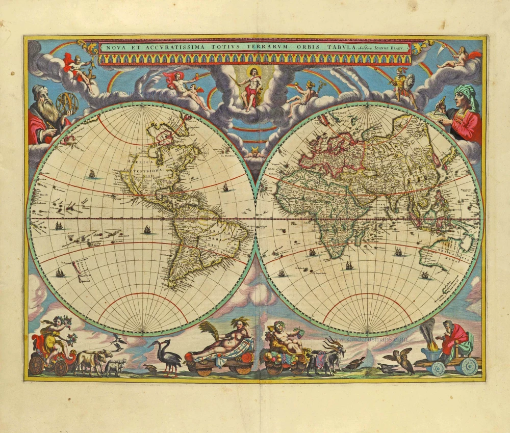
Nova Et Accuratissima Totius Terrarum Orbis Tabula. 1659
World by Joan Blaeu, double hemisphere.
[Item number: 28336]
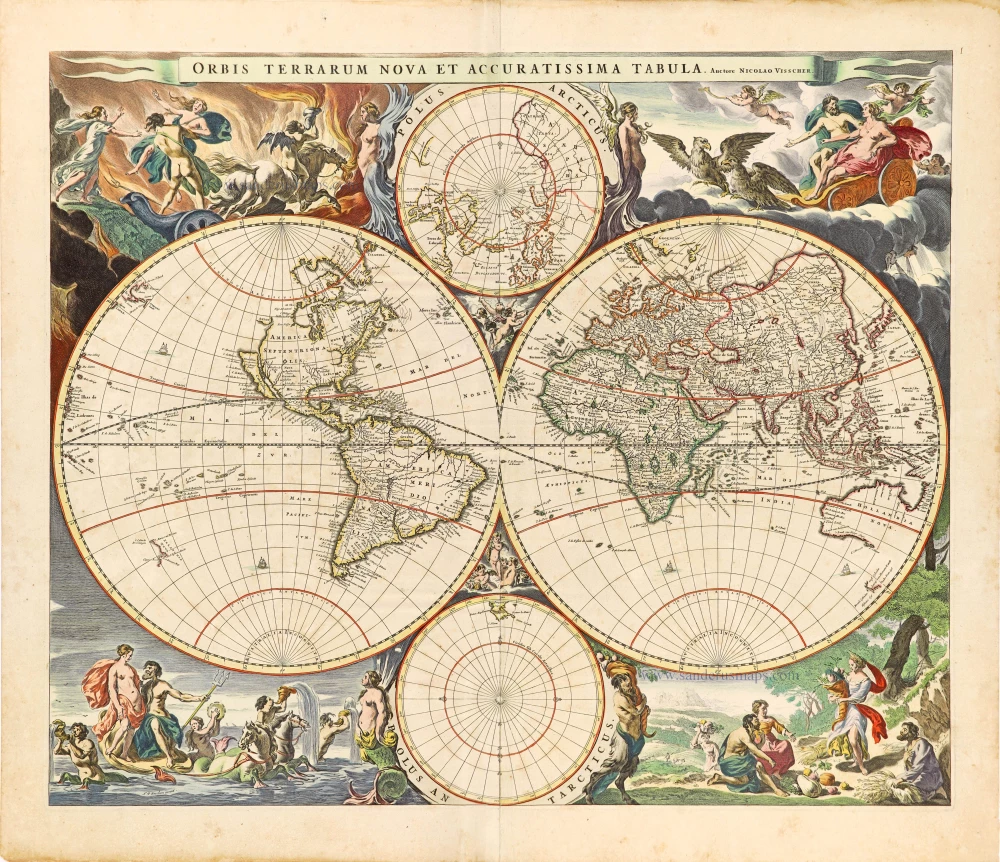
Orbis Terrarum Nova et Accuratissima Tabula. c. 1678
World by Nicolaas Visscher, double hemisphere.
[Item number: 28628]
Luxury colouring.
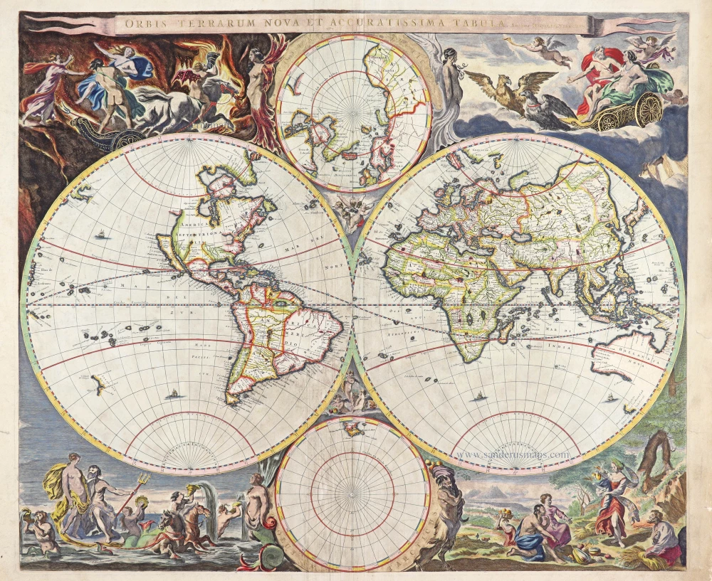
Orbis Terrarum Nova et Accuratissima Tabula. c. 1678
Double-hemisphere world map, by Nicolaas Visscher I.
[Item number: 28934]
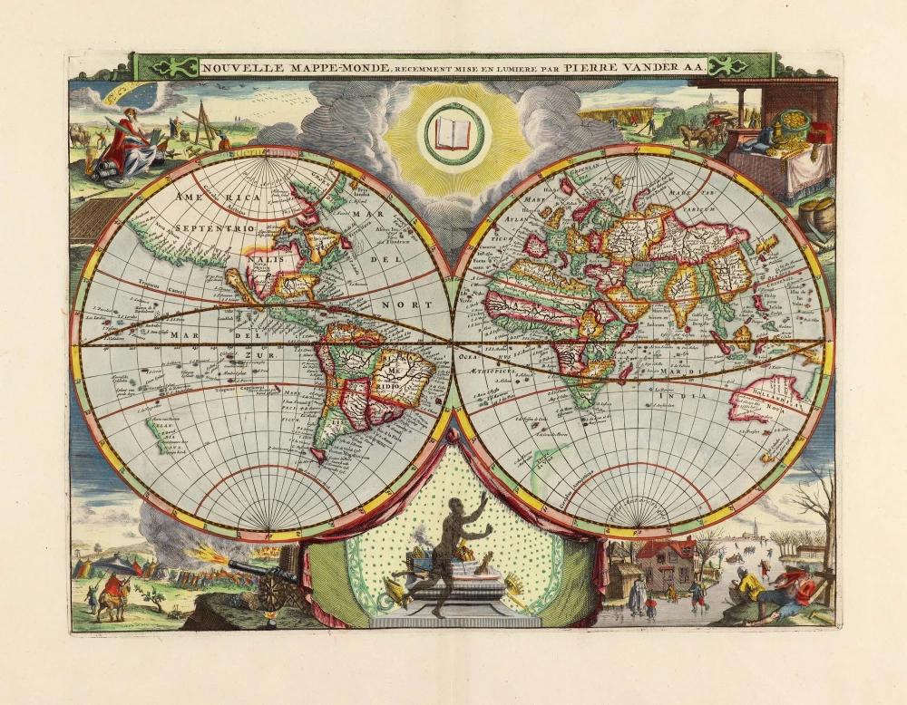
Nouvelle Mappe-Monde, 1710
World by Pieter Van der Aa, double hemisphere.
[Item number: 29136]

Nova Orbis Tabula in Lucem Edita, A. F. De Wit. c. 1690
World by Frederik De Wit, double hemisphere.
[Item number: 29231]

Mapmonde ou description generale du Globe Terrestre. 1713
World map by Zacharias Châtelain.
[Item number: 29555]
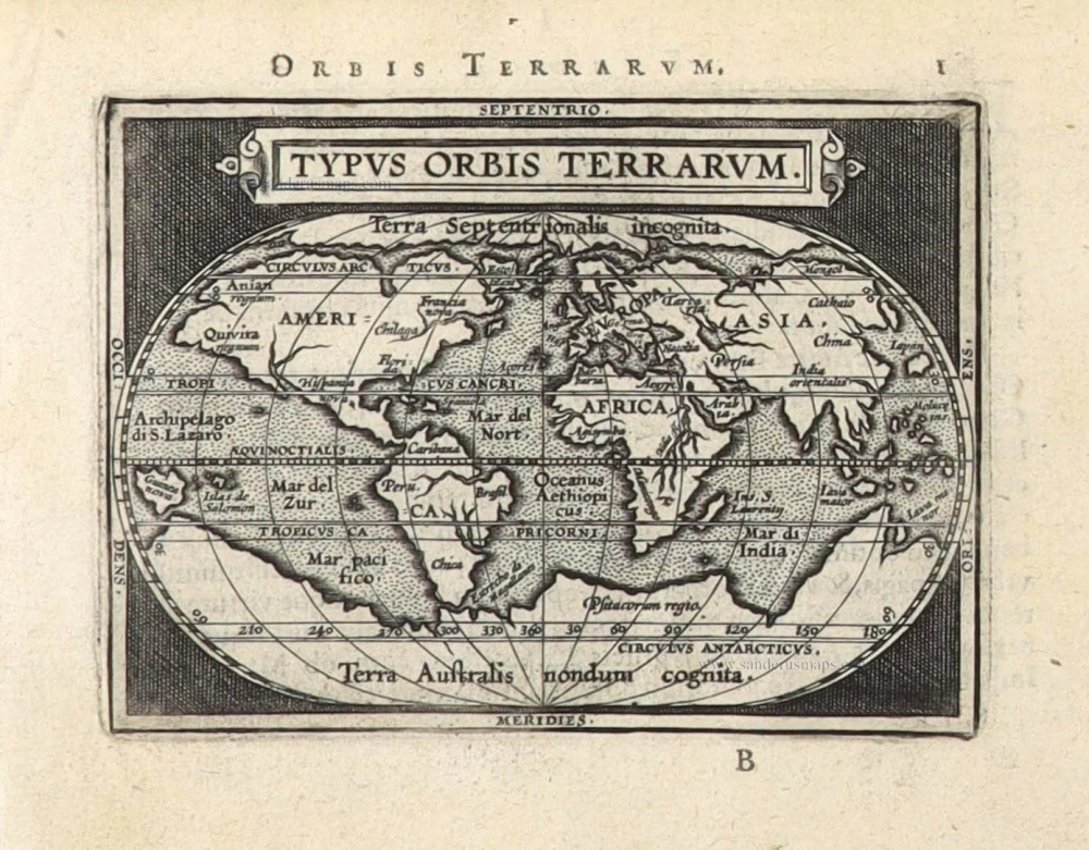
Typus Orbis Terrarum. 1589
The world by Abraham Ortelius / Philippe Galle.
[Item number: 29605]
Mappe-Monde, ou Carte Generale du Monde, 1652
Double hemisphere world map by Nicolas Sanson.
[Item number: 29612]

Mercator projection
Discorso Intorno alla Carta da Navigare. 1590
World by Thomaso Porcacchi.
[Item number: 29786]

Rare original colour.
Typus Orbis Terrarum - Globus Terrestris. 1609
Two world maps by A. Ortelius, published by J.B. Vrients.
[Item number: 29861]

Mappe-Monde 1766-1780
World map by Louis Brion de la Tour, published by L.C Desnos.
[Item number: 30100]
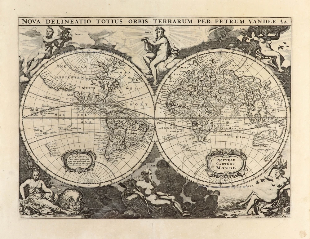
Nova Delineatio Totius Orbis Terrarum per Petrum Van der Aa. - Nouveau Carte du Monde. 1702
World by Pieter Van der Aa - double hemisphere.
[Item number: 30150]

'One of the supreme examples of map maker's art' (Shirley)
Nova Totius Terrarum Orbis Geographica ac Hydrographica. 1643
World by Willem Blaeu, in Mercator projection.
[Item number: 30271]

Superb old colouring, heightened with gold.
Orbis Terrarum Tabula Recens Emendata Et In Lucem Edita 1714
World - Double Hemisphere, by Daniel Stoopendaal
[Item number: 30635]
Rare 1525 edition in nice old colour.
[No title] 1525
Ptolemaic world by Lorenz Fries after Martin Waldseemüller.
[Item number: 30649]
Rare 1525 edition of the second modern world map by Fries, in nice old colour.
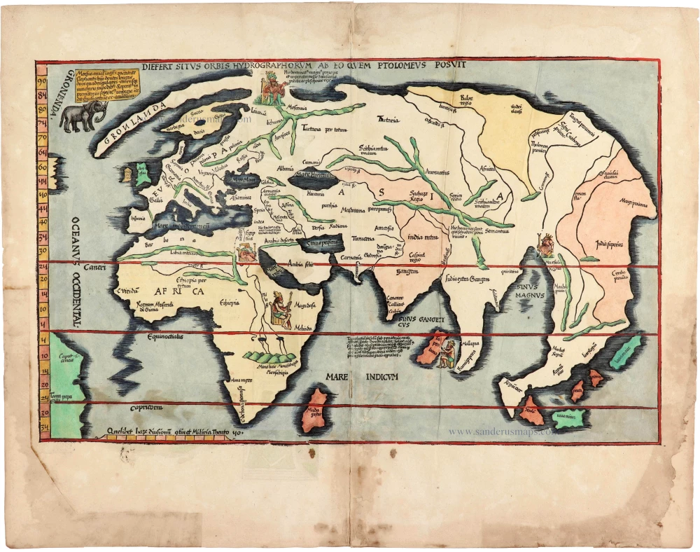
Diefert Situs Orbis Hydrographorum Ab Eo Quem Ptolomeus Posuit. 1525
Modern world map, by Lorenz Fries, after Martin Waldseemüller.
[Item number: 30661]

Heightened in gold and silver
[No title] 1599
World by Theodore De Bry, Great Voyages,
[Item number: 30719]

Drake map heightened in gold and silver
[No title] 1599
World by Theodore De Bry, Great Voyages,
[Item number: 30725]
Orbis Terrae Compendiosa Descriptio. 1613
World by Mercator Rumold, double hemisphere.
[Item number: 30942]

An Essay of a New and Compact Map, containing the known parts of the Terrestrial Globe. 1750
World map by Jacques-Nicolas Bellin, published by A.F. Prévost.
[Item number: 31883]

Beautiful example of this important world map
Typus Orbis Terrarum. 1584
World by Abraham Ortelius.
[Item number: 32090]

Planiglobii Terrestris cum Utroq Hemisphaerio Caelesti Generalis Repraesentatio. c. 1720
World by Homann J.B., double hemisphere.
[Item number: 32099]

Early Mercator projection
Universi Orbis Descriptio Ad Usum Navigantium. 1597
World by Giovanni Magini.
[Item number: 32281]

Carta Marina Nuova Tavola. 1574
World chart by Girolamo Ruscelli.
[Item number: 32432]

Orbis Descriptio. 1574
World in two hemisperes, by Girolamo Ruscelli.
[Item number: 32433]

Rare first state of Danckerts beautiful world map
Nova Totius Terrarum Orbis Tabula.. c. 1680
Double hemisphere world map by Justus Danckerts
[Item number: 32456]

The most mystical world map of all time.
[No title] 1560-1600
Daniel's Dream Map. The Wittenberg world map by Hanss Luft.
[Item number: 32507]
'One of the supreme examples of map maker's art' (Shirley)
Nova Totius Terrarum Orbis Geographica ac Hydrographica. 1635
World by Willem Blaeu, in Mercator projection.
[Item number: 32683]

Mappa Mondo O Vero Carta Generale Del Globo Terestre 1677
World in two hemisphers by Giovanni De Rossi, after Nicolas Sanson.
[Item number: 32885]

Typus Orbis Terrarum. 1618
World by Petrus Bertius.
[Item number: 33183]
new