
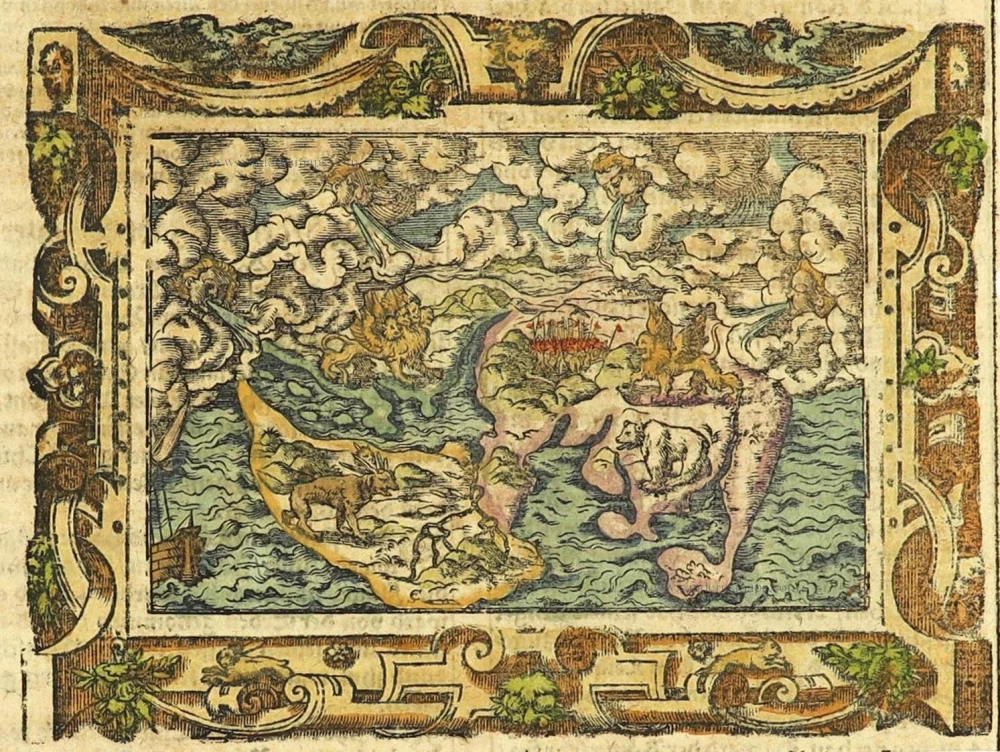
The earliest obtainable and visually the most stunning world map
Ptolemaic World by Hartmann Schedel. 1493
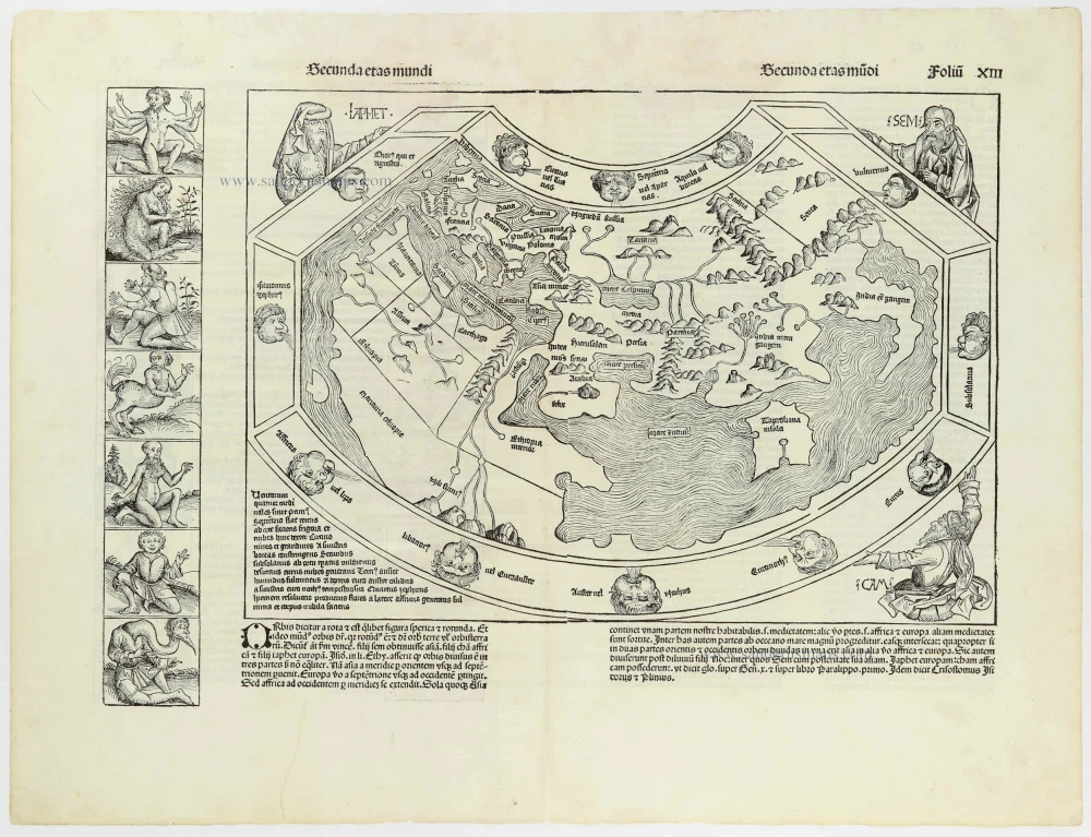

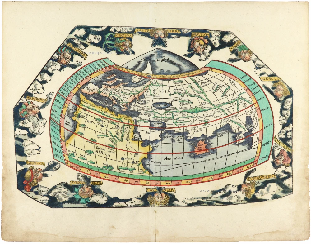
This world map is a robust woodcut taken from Ptolemy. The border contains twelve dour wind heads, while the map is supported in three corners by the solemn figures of Ham, Shem, and Japhet taken from the Old Testament. The panels representing the outlandish creatures and beings thought to inhabit the farthest parts of the earth give the map its present-day interest and attraction. Seven such scenes are to the left of the map and fourteen on its reverse.
The map is a copy of a Venetian woodcut added to Pomponius Mela's Cosmographia eleven years previously. Like the Mela map, it references contemporary discoveries in its hint of the Gulf of Guinea, e reflecting Portuguese knowledge of about 1470. The unsigned Mela map was the first to show these developments in print. This Schedel derivative and the separately published world map of Francesco Rosselli were the only fifteenth-century printed maps to repeat these details. The current map adds one minor refinement: a curiously shaped, unidentified island off the West African coast.
Hartmann Schedel (Nuremberg, 1440-1514) and the Nuremberg Chronicle.
Hartmann Schedel grew up in Nuremberg and first studied liberal arts in Leipzig. He earned a doctorate in medicine in Padua in 1466, then settled in Nuremberg to practice medicine and collect books. According to an inventory done in 1498, Schedel's library contained 370 manuscripts and 670 printed books.
Schedel is best known for writing the text for the Nuremberg Chronicle, an illustrated biblical paraphrase and world history that follows the story of human history related in the Bible; it includes the histories of many important Western cities. The Nuremberg Chronicle was one of the most remarkable books of its time. It was commissioned by Sebald Schreyer (1446–1520) and Sebastian Kammermeister (1446–1503) and published in 1493 in Nuremberg. Maps in the Chronicle were the first-ever illustrations of many cities and countries. Wolgemut and Pleydenwurff, the painters, were commissioned to provide the illustrations and to take care of the layout. The large workshop of Michael Wolgemut, then Nuremberg's leading artist in various media, provided the 1,809 woodcut illustrations (including duplications).
Albrecht Dürer was an apprentice with Wolgemut from 1486 to 1489, so he may well have participated in designing some of the illustrations.
The Liber Chronicarum was first published in Latin on 12 July 1493 in the city of Nuremberg, printed by Anton Koberger, the most successful publisher in Germany. A German translation followed on 23 December 1493. An estimated 1,400 to 1,500 Latin and 700 to 1,000 German copies were published.
Due to the great success and prestige of the Chronicle, pirate editions soon appeared on the market. Johann Schönsperger (c. 1455-1521), a printer working out of Augsburg, published smaller editions of the Chronicle in 1496, 1497, and 1500 in German and Latin.
Claudius Ptolemy (c.100 – c.170 AD)
Claudius Ptolemaeus was a Greek astronomer, mathematician, and geographer who lived in Alexandria in the 2nd century. His ideas influenced much of medieval astronomy and geography. He was the first to use longitudinal and latitudinal coordinates. His idea of a global coordinate system was highly influential, and we use a similar system today.
Ptolemy wrote several scientific treatises. The first is the astronomical treatise, now known as the Almagest. The second is the Geography, which is a thorough discussion of the geographic knowledge of the Greco-Roman world. The third is the Apotelesmatika, an astrological treatise in which he attempted to adapt horoscopic astrology to the Aristotelian natural philosophy of his day.
The Geographia is a compilation of geographical coordinates of the part of the world known to the Roman Empire during his time. However, the maps in surviving manuscripts of Ptolemy's Geography only date from about 1300, after Maximus Planudes rediscovered the text. It seems likely that the topographical tables are cumulative texts that were altered and added to as new knowledge became available in the centuries after Ptolemy.
The earliest printed edition with engraved maps was produced in Bologna in 1477, followed quickly by a Roman edition in 1478. An edition printed at Ulm in 1482, including woodcut maps, was the first one published north of the Alps.
Secunda Etas Mundi.
Item Number: 30669 Authenticity Guarantee
Category: Antique maps > World and Polar
Ptolemaic World by Hartmann Schedel.
Title: Secunda Etas Mundi.
Date of the first edition: 1493.
Date of this map: 1493.
Woodcut, printed on paper.
Image size: 31 x 44mm (1.22 x 1.73 inches).
Sheet size: 475 x 630mm (18.7 x 24.8 inches).
Verso: Latin text.
Condition: A few small restorations in margins (outside the image), two wormholes filled. Nice copy with wide margins.
Condition Rating: A.
From: Liber Chronicarum. (= Nuremberg Chronicle). Nuremberg, Koberger, 1493.
This world map is a robust woodcut taken from Ptolemy. The border contains twelve dour wind heads, while the map is supported in three corners by the solemn figures of Ham, Shem, and Japhet taken from the Old Testament. The panels representing the outlandish creatures and beings thought to inhabit the farthest parts of the earth give the map its present-day interest and attraction. Seven such scenes are to the left of the map and fourteen on its reverse.
The map is a copy of a Venetian woodcut added to Pomponius Mela's Cosmographia eleven years previously. Like the Mela map, it references contemporary discoveries in its hint of the Gulf of Guinea, e reflecting Portuguese knowledge of about 1470. The unsigned Mela map was the first to show these developments in print. This Schedel derivative and the separately published world map of Francesco Rosselli were the only fifteenth-century printed maps to repeat these details. The current map adds one minor refinement: a curiously shaped, unidentified island off the West African coast.
Hartmann Schedel (Nuremberg, 1440-1514) and the Nuremberg Chronicle.
Hartmann Schedel grew up in Nuremberg and first studied liberal arts in Leipzig. He earned a doctorate in medicine in Padua in 1466, then settled in Nuremberg to practice medicine and collect books. According to an inventory done in 1498, Schedel's library contained 370 manuscripts and 670 printed books.
Schedel is best known for writing the text for the Nuremberg Chronicle, an illustrated biblical paraphrase and world history that follows the story of human history related in the Bible; it includes the histories of many important Western cities. The Nuremberg Chronicle was one of the most remarkable books of its time. It was commissioned by Sebald Schreyer (1446–1520) and Sebastian Kammermeister (1446–1503) and published in 1493 in Nuremberg. Maps in the Chronicle were the first-ever illustrations of many cities and countries. Wolgemut and Pleydenwurff, the painters, were commissioned to provide the illustrations and to take care of the layout. The large workshop of Michael Wolgemut, then Nuremberg's leading artist in various media, provided the 1,809 woodcut illustrations (including duplications).
Albrecht Dürer was an apprentice with Wolgemut from 1486 to 1489, so he may well have participated in designing some of the illustrations.
The Liber Chronicarum was first published in Latin on 12 July 1493 in the city of Nuremberg, printed by Anton Koberger, the most successful publisher in Germany. A German translation followed on 23 December 1493. An estimated 1,400 to 1,500 Latin and 700 to 1,000 German copies were published.
Due to the great success and prestige of the Chronicle, pirate editions soon appeared on the market. Johann Schönsperger (c. 1455-1521), a printer working out of Augsburg, published smaller editions of the Chronicle in 1496, 1497, and 1500 in German and Latin.
Claudius Ptolemy (c.100 – c.170 AD)
Claudius Ptolemaeus was a Greek astronomer, mathematician, and geographer who lived in Alexandria in the 2nd century. His ideas influenced much of medieval astronomy and geography. He was the first to use longitudinal and latitudinal coordinates. His idea of a global coordinate system was highly influential, and we use a similar system today.
Ptolemy wrote several scientific treatises. The first is the astronomical treatise, now known as the Almagest. The second is the Geography, which is a thorough discussion of the geographic knowledge of the Greco-Roman world. The third is the Apotelesmatika, an astrological treatise in which he attempted to adapt horoscopic astrology to the Aristotelian natural philosophy of his day.
The Geographia is a compilation of geographical coordinates of the part of the world known to the Roman Empire during his time. However, the maps in surviving manuscripts of Ptolemy's Geography only date from about 1300, after Maximus Planudes rediscovered the text. It seems likely that the topographical tables are cumulative texts that were altered and added to as new knowledge became available in the centuries after Ptolemy.
The earliest printed edition with engraved maps was produced in Bologna in 1477, followed quickly by a Roman edition in 1478. An edition printed at Ulm in 1482, including woodcut maps, was the first one published north of the Alps.
Related items
Aevi Veteris, Typus Geographicus. 1601
Ancient World by Abraham Ortelius.
[Item number: 22609]

Rare variant.
Cosmographia Universalis. 1592
World map by H. Bünting - D.A. Veleslavina.
[Item number: 26356]
The most mystical world map of all time.
[No title] 1560-1600
Daniel's Dream Map. The Wittenberg world map.
[Item number: 28159]
The engraving and layout and elegance of decoration are all of the highest standards.
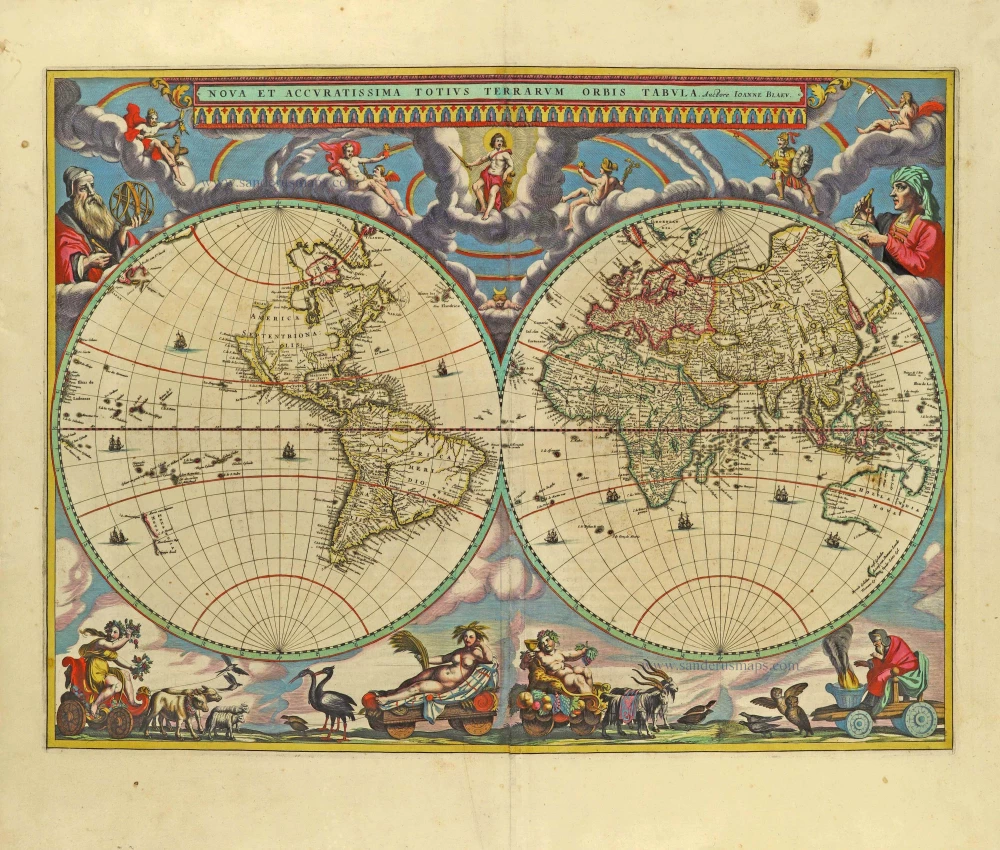
Nova Et Accuratissima Totius Terrarum Orbis Tabula. 1659
World by Joan Blaeu, double hemisphere.
[Item number: 28336]

A fine ornate example of the decorative cartography of the time.
Nova Totius Terrarum Orbis Geographica ac Hydrographica Tabula. Auct: Henr: Hondio. 1641
Double-hemisphere world map by Henricus Hondius.
[Item number: 28768]

Luxury colouring.
Orbis Terrarum Nova et Accuratissima Tabula. c. 1678
Double-hemisphere world map, by Nicolaas Visscher I.
[Item number: 28934]
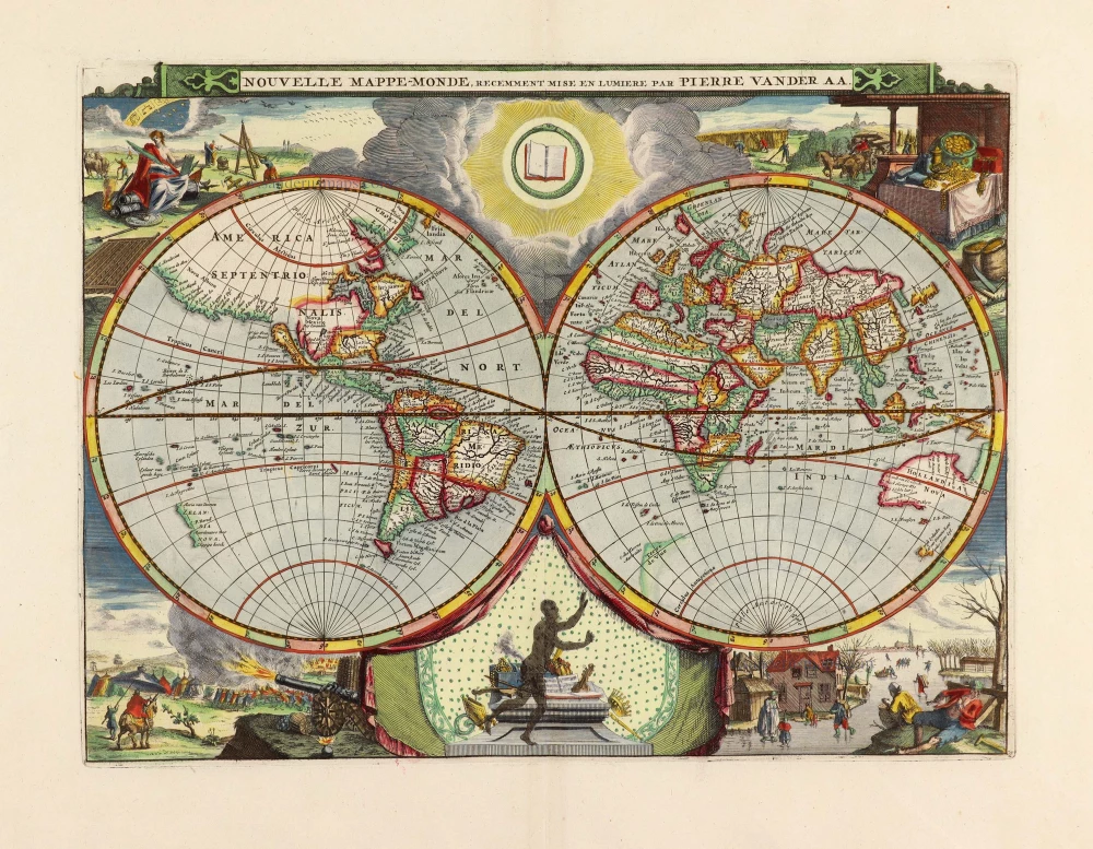
Nouvelle Mappe-Monde, 1710
World by Pieter Van der Aa, double hemisphere.
[Item number: 29136]
Superb old colouring, heightened with gold.
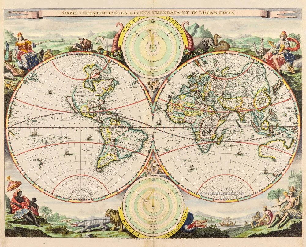
Orbis Terrarum Tabula Recens Emendata Et In Lucem Edita 1714
World - Double Hemisphere, by Daniel Stoopendaal
[Item number: 30635]
Rare 1525 edition in nice old colour.
[No title] 1525
Ptolemaic world by Lorenz Fries after Martin Waldseemüller.
[Item number: 30649]
Orbis Terrae Compendiosa Descriptio. 1613
World by Mercator Rumold, double hemisphere.
[Item number: 30942]
Jacobus iustus minor apostolus - Crucifixio Petri apostoli - Decapitatio Pauli - Sanctus Marcus evangelista - Jacobus maior apostolus CIIII 1493
Saints and martyrs, by Hartmann Schedel.
[Item number: 30951]
Tercia etas mundi XLI 1493
Incunabula sheet, by Hartmann Schedel.
[Item number: 30952]

Mappe-Monde Geo-Hydrographique, ou Description Generale du Globe Terrestre et Aquatique en Deux Plans-Hemispheres ... 1692
World map by Nicolas Sanson, so-called published by Hubert Jaillot. (Pirated edition by Pierre Mortier).
[Item number: 31136]
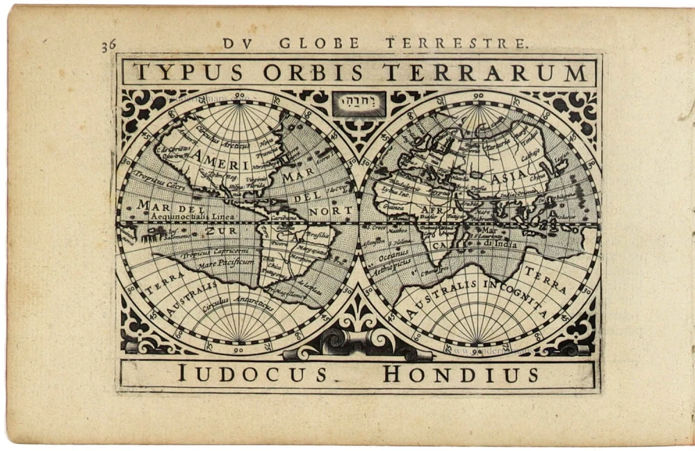
Typus Orbis Terrarum. 1618
World by Petrus Bertius, published by Jodocus Hondius II.
[Item number: 31520]

Gottfried's first edition 1631
[no title] 1631
Willem C. Schouten, world map published by Gottfried.
[Item number: 31560]

Rare first edition
[no title] 1618
World map in two hemispheres by Willem W. Schouten.
[Item number: 31601]

An Essay of a New and Compact Map, containing the known parts of the Terrestrial Globe. 1750
World map by Jacques-Nicolas Bellin, published by A.F. Prévost.
[Item number: 31883]

Beautiful example of this important world map
Typus Orbis Terrarum. 1584
World by Abraham Ortelius.
[Item number: 32090]
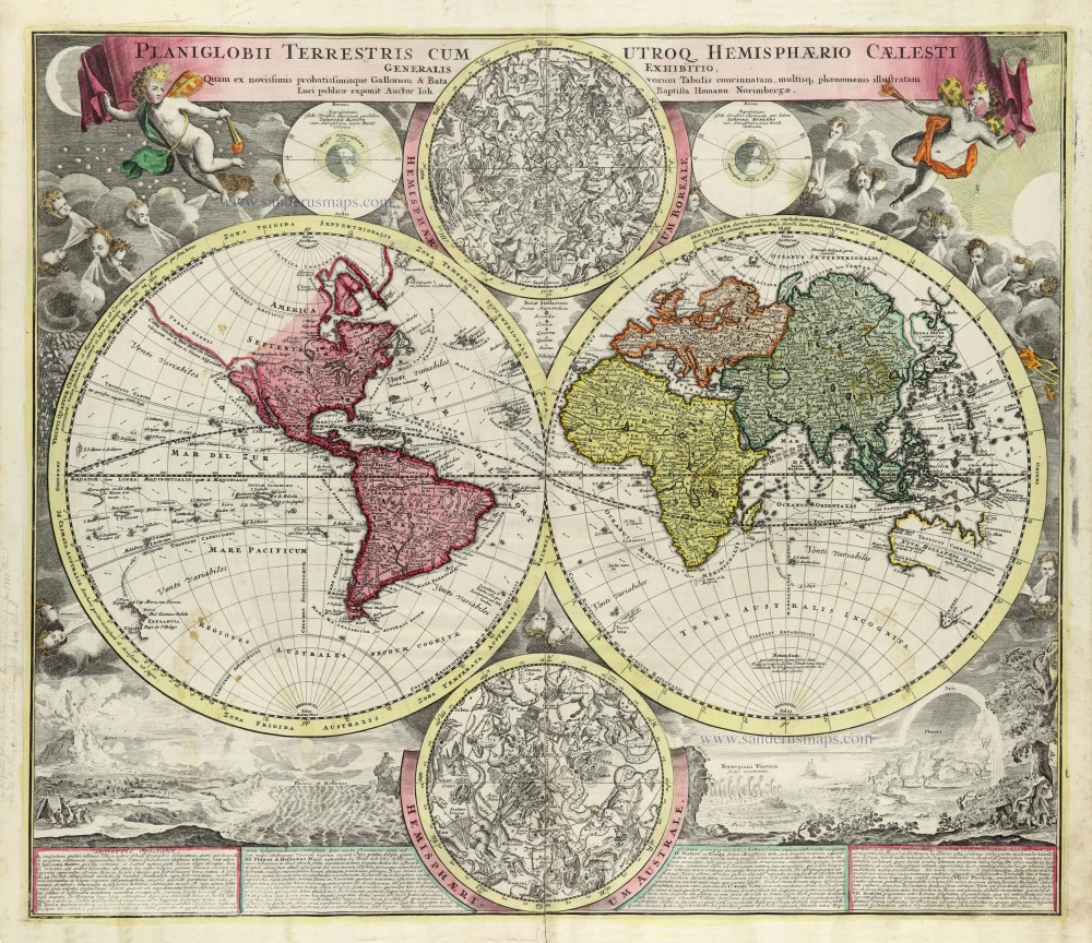
Planiglobii Terrestris cum Utroq Hemisphaerio Caelesti Generalis Repraesentatio. c. 1720
World by Homann J.B., double hemisphere.
[Item number: 32099]

Early Mercator projection
Universi Orbis Descriptio Ad Usum Navigantium. 1597
World by Giovanni Magini.
[Item number: 32281]

Carta Marina Nuova Tavola. 1574
World chart by Girolamo Ruscelli.
[Item number: 32432]
new

Orbis Descriptio. 1574
World in two hemisperes, by Girolamo Ruscelli.
[Item number: 32433]
new

Rare first state of Danckerts beautiful world map
Nova Totius Terrarum Orbis Tabula.. c. 1680
Double hemisphere world map by Justus Danckerts
[Item number: 32456]
new