
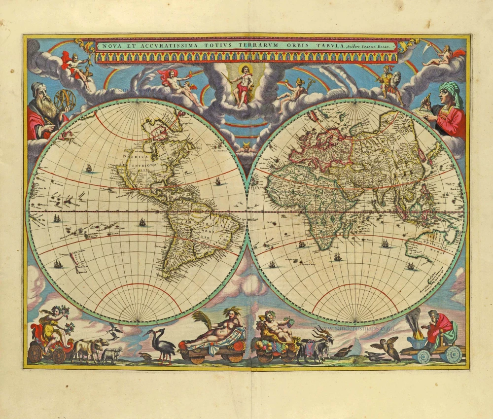
'One of the supreme examples of map maker's art' (Shirley)
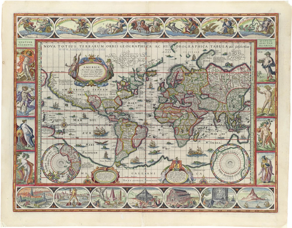
World by Willem Blaeu, in Mercator projection. 1643


While Blaeu was in the process of publishing his four-sheet wall map of the world on Mercator's projection, a world map in folio size using the same projection was issued by his publishing house. This map remained in atlases published by the Blaeu family for many years despite the increasing geographical knowledge (only the discovery of the Strait of Le Maire was added to later states). Apparently, purchasers preferred a decorative world map to one that provided up-to-date geographical knowledge. Eventually, Joan Blaeu, in his Atlas Maior (1662-64), replaced the world map made by his father with a new map.
The title in capitals runs along the upper edge of the map image. Because of the projection chosen, the areas north and south of the 50th degree of latitude are drawn in two hemispheres in the lower corners.
The map's dedication to the wealthy Amsterdam merchant and administrator Cornelis Pietersz Hooft (1547-1626) is now signed by Guilj. Blaeuw (in the first state, it was signed Gul. Iansonius 1606 = the old name of Willem Blaeu). The original 1606 state does not mention an engraver, but the name of Josua van den Ende appears on the map from the second state onward. Van den Ende probably engraved only the geographic content, while someone else was responsible for the decoration.
The geographic content is identical to the 1606/07 wall map. Because of the smaller size of the folio map, fewer toponyms are given, and the number of legends has also been reduced. The centre of North America is taken up by a large oval cartouche containing a Latin text, here in translation: 'America. First discovered in A.D. 1492 by Christopher Colombus in the name of the king of Castille and given the name by Amerigo Vespucci in 1499'. The following legend, here in translation, is inserted in the area to the east of Novaya Zemlya: 'Novaya Zemlya. It was discovered in 1596 by Willem Barentszoon from Amsterdam in the name of the States General of the Netherlands'.
Blaeu's world map is framed on all sides by decorative borders. Along the top are allegorical representations of the sun, moon and the five known planets: Mercury, Venus, Mars, Jupiter and Saturn. On the left are the four elements, and on the right are the four seasons. Along the bottom are seven vignettes showing the seven wonders of the world. The decorative borders of the world map were not derived from artists' designs specially ordered by the publisher. On the contrary, Blaeu had a compilation made from various series of prints which famous Dutch artists had already published at the end of the sixteenth century. A balanced composition and elegant ornamentation make this world map one of the small masterpieces of the seventeenth century.
The first state (1606) bears the name Gulielmus Ianssonius. The second state has the signature of the engraver Josua Van den Ende. The third state is with the Strait of Le Maire added (1618), and the fourth is with the publisher's name changed to 'Blaeuw'. The fourth state was included in Blaeu's 1630 Appendix and in all of the Blaeu family's atlases, except the Atlas Maior.
The Blaeus: Willem Janszoon, Cornelis & Joan
Willem Jansz. Blaeu and his son Joan Blaeu are the seventeenth century's most widely known cartographic publishers.
Willem Jansz. (also written Guilielmus Janssonius) = Willem Janszoon Blaeu was born in Uitgeest (Netherlands), near Alkmaar, in 1571. He studied mathematics under Tycho Brahe and learned the theory and practice of astronomical observations and the art of instrument- and globe-making.
In 1596, he came to Amsterdam, where he settled down as a globe-, instrument- and mapmaker. He published his first cartographic work (a globe) in 1599 and probably published his first printed map (a map of the Netherlands) in 1604. He specialised in maritime cartography, published the first edition of the pilot guide Het Licht der Zeevaert in 1608, and was appointed Hydrographer of the V.O.C. (United East India Company) in 1633. After publishing books, wall maps, globes, charts and pilot guides for thirty years, he brought out his first atlas, Atlas Appendix (1630). This was the beginning of the great tradition of atlas-making by the Blaeus.
In 1618, another mapmaker, bookseller and publisher, Johannes Janssonius, established himself in Amsterdam next door to Blaeu's shop. No wonder these two neighbours began accusing each other of copying and stealing their information and became fierce competitors who did not have a good word to say about each other. In about 1621 Willem Jansz. decided to end the confusion between his name and his competitor's and assumed his grandfather's nickname, 'blauwe Willem' ('blue Willem'), as the family name; after that, he called himself Willem Jansz. Blaeu.
Willem Janszoon Blaeu died in 1638, leaving his prospering business to his sons, Cornelis and Joan. We only know that Cornelis's name occurs in the prefaces of books and atlases until c. 1645.
Joan Blaeu, born in Amsterdam in 1596, became a partner in his father's book trade and printing business. 1638, he was appointed his father's successor in the Hydrographic Office of the V.O.C. His efforts culminated in the magnificent Atlas Major and the town books of the Netherlands and Italy – works unsurpassed in history and modern times, giving eternal fame to the name of the Blaeu's.
A fire ruined the business on February 23, 1672, and one year later, Dr. Joan Blaeu died. The fire and the director's passing caused the complete sale of the Blaeu House's stock. Five public auctions dispersed the remaining books, atlases, copperplates, globes, etc., among many other map dealers and publishers in Amsterdam. The majority was acquired by several booksellers acting in partnership.
In the succeeding years, the remaining printing department remained in the hands of the Blaeu family until 1695, when the printing house's inventory was sold at a public auction. That meant the end of the Blaeu family as a printing house of world renown.
Nova Totius Terrarum Orbis Geographica ac Hydrographica.
Item Number: 30271 Authenticity Guarantee
Category: Antique maps > World
World in Mercator projection, by Willem Blaeu.
Title: Nova Totius Terrarum Orbis Geographica ac Hydrographica.
Excudebat Guilelmo Blaeu / Ja. Vanden Ende sculpsit.
Dedicated to Cornelis Petri F. Hooft by Guilj. Blaeuw.
Date of the first edition: 1606.
Date of this map: 1643.
Copper engraving, printed on paper.
Image size: 410 x 540mm (16.14 x 21.26 inches).
Sheet size: 505 x 615mm (19.88 x 24.21 inches).
Verso: French text.
Condition: Original coloured, excellent.
Condition Rating: A+.
From: Le Theatre du Monde ou Nouvel Atlas Contenant les Chartes et descriptions De tous les Païs de la terre. Mis en lumiere Par Guillaume et Iean Blaeu. Amsterdam, Joan Blaeu, 1643. (Van der Krogt 2, 212.1F)
While Blaeu was in the process of publishing his four-sheet wall map of the world on Mercator's projection, a world map in folio size using the same projection was issued by his publishing house. This map remained in atlases published by the Blaeu family for many years despite the increasing geographical knowledge (only the discovery of the Strait of Le Maire was added to later states). Apparently, purchasers preferred a decorative world map to one that provided up-to-date geographical knowledge. Eventually, Joan Blaeu, in his Atlas Maior (1662-64), replaced the world map made by his father with a new map.
The title in capitals runs along the upper edge of the map image. Because of the projection chosen, the areas north and south of the 50th degree of latitude are drawn in two hemispheres in the lower corners.
The map's dedication to the wealthy Amsterdam merchant and administrator Cornelis Pietersz Hooft (1547-1626) is now signed by Guilj. Blaeuw (in the first state, it was signed Gul. Iansonius 1606 = the old name of Willem Blaeu). The original 1606 state does not mention an engraver, but the name of Josua van den Ende appears on the map from the second state onward. Van den Ende probably engraved only the geographic content, while someone else was responsible for the decoration.
The geographic content is identical to the 1606/07 wall map. Because of the smaller size of the folio map, fewer toponyms are given, and the number of legends has also been reduced. The centre of North America is taken up by a large oval cartouche containing a Latin text, here in translation: 'America. First discovered in A.D. 1492 by Christopher Colombus in the name of the king of Castille and given the name by Amerigo Vespucci in 1499'. The following legend, here in translation, is inserted in the area to the east of Novaya Zemlya: 'Novaya Zemlya. It was discovered in 1596 by Willem Barentszoon from Amsterdam in the name of the States General of the Netherlands'.
Blaeu's world map is framed on all sides by decorative borders. Along the top are allegorical representations of the sun, moon and the five known planets: Mercury, Venus, Mars, Jupiter and Saturn. On the left are the four elements, and on the right are the four seasons. Along the bottom are seven vignettes showing the seven wonders of the world. The decorative borders of the world map were not derived from artists' designs specially ordered by the publisher. On the contrary, Blaeu had a compilation made from various series of prints which famous Dutch artists had already published at the end of the sixteenth century. A balanced composition and elegant ornamentation make this world map one of the small masterpieces of the seventeenth century.
The first state (1606) bears the name Gulielmus Ianssonius. The second state has the signature of the engraver Josua Van den Ende. The third state is with the Strait of Le Maire added (1618), and the fourth is with the publisher's name changed to 'Blaeuw'. The fourth state was included in Blaeu's 1630 Appendix and in all of the Blaeu family's atlases, except the Atlas Maior.
The Blaeus: Willem Janszoon, Cornelis & Joan
Willem Jansz. Blaeu and his son Joan Blaeu are the seventeenth century's most widely known cartographic publishers.
Willem Jansz. (also written Guilielmus Janssonius) = Willem Janszoon Blaeu was born in Uitgeest (Netherlands), near Alkmaar, in 1571. He studied mathematics under Tycho Brahe and learned the theory and practice of astronomical observations and the art of instrument- and globe-making.
In 1596, he came to Amsterdam, where he settled down as a globe-, instrument- and mapmaker. He published his first cartographic work (a globe) in 1599 and probably published his first printed map (a map of the Netherlands) in 1604. He specialised in maritime cartography, published the first edition of the pilot guide Het Licht der Zeevaert in 1608, and was appointed Hydrographer of the V.O.C. (United East India Company) in 1633. After publishing books, wall maps, globes, charts and pilot guides for thirty years, he brought out his first atlas, Atlas Appendix (1630). This was the beginning of the great tradition of atlas-making by the Blaeus.
In 1618, another mapmaker, bookseller and publisher, Johannes Janssonius, established himself in Amsterdam next door to Blaeu's shop. No wonder these two neighbours began accusing each other of copying and stealing their information and became fierce competitors who did not have a good word to say about each other. In about 1621 Willem Jansz. decided to end the confusion between his name and his competitor's and assumed his grandfather's nickname, 'blauwe Willem' ('blue Willem'), as the family name; after that, he called himself Willem Jansz. Blaeu.
Willem Janszoon Blaeu died in 1638, leaving his prospering business to his sons, Cornelis and Joan. We only know that Cornelis's name occurs in the prefaces of books and atlases until c. 1645.
Joan Blaeu, born in Amsterdam in 1596, became a partner in his father's book trade and printing business. 1638, he was appointed his father's successor in the Hydrographic Office of the V.O.C. His efforts culminated in the magnificent Atlas Major and the town books of the Netherlands and Italy – works unsurpassed in history and modern times, giving eternal fame to the name of the Blaeu's.
A fire ruined the business on February 23, 1672, and one year later, Dr. Joan Blaeu died. The fire and the director's passing caused the complete sale of the Blaeu House's stock. Five public auctions dispersed the remaining books, atlases, copperplates, globes, etc., among many other map dealers and publishers in Amsterdam. The majority was acquired by several booksellers acting in partnership.
In the succeeding years, the remaining printing department remained in the hands of the Blaeu family until 1695, when the printing house's inventory was sold at a public auction. That meant the end of the Blaeu family as a printing house of world renown.
Related items
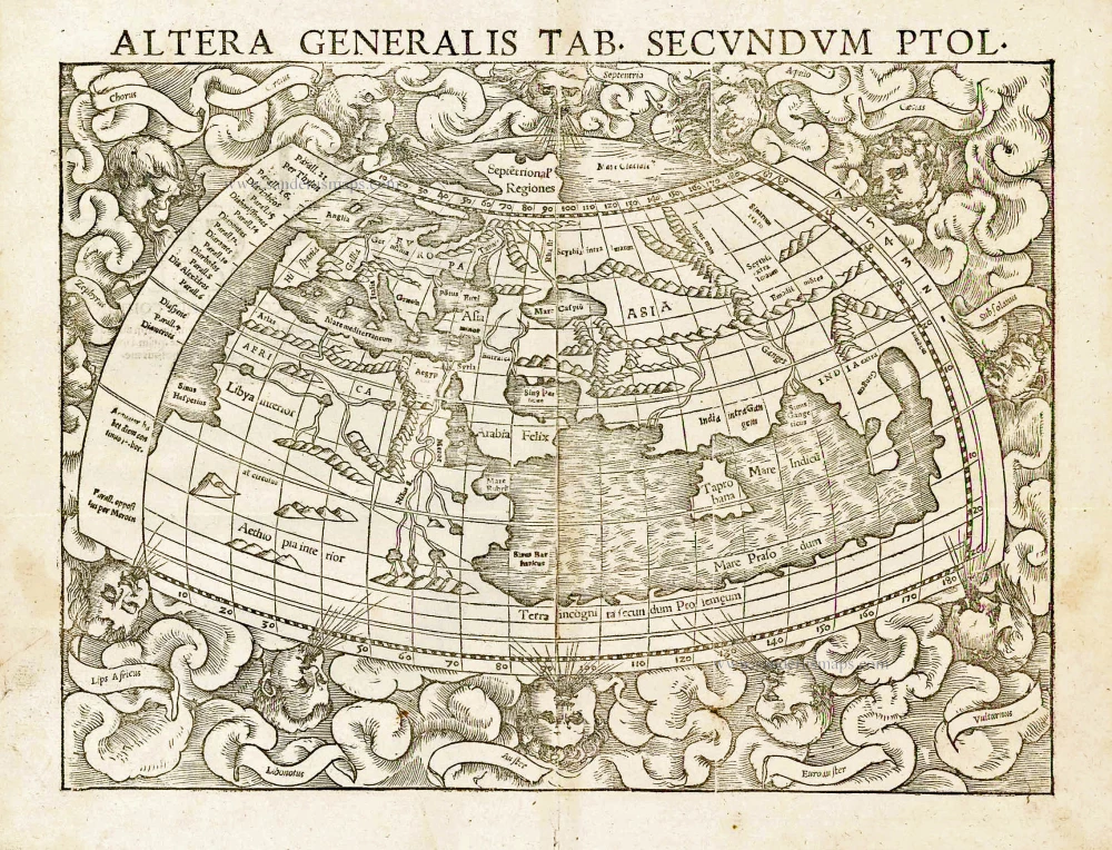
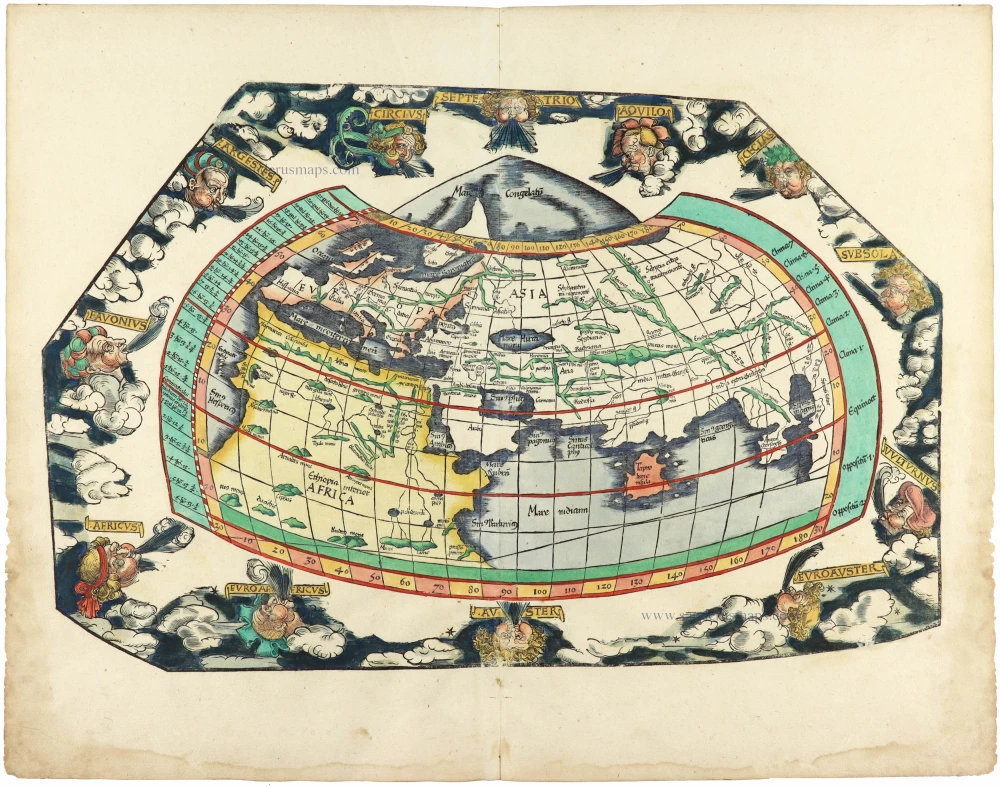
Altera Generalis Tab. Secundum Ptol. 1559
Ptolemaic world by Sebastian Münster
[Item number: 11981]
Rare first edition
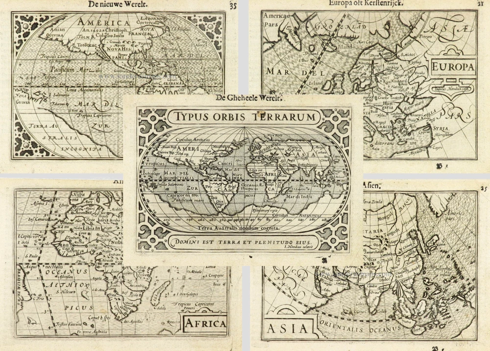
Typus Orbis Terrarum. [in set with:] America, [and] Europa, [and] Africa, [and] Asia. 1598
World and Continents by Barent Langenes & Cornelis Claesz. Five maps.
[Item number: 16457]

Rare variant.
Cosmographia Universalis. 1592
World map by H. Bünting - D.A. Veleslavina.
[Item number: 26356]

Nouvelle Mappe Monde Dediee au Progres de nos Connoissances. 1776-79
World by Francesco Santini.
[Item number: 26946]

Universi Orbis Descriptio. 1597
World by Giovanni Magini
[Item number: 27837]
The most mystical world map of all time.
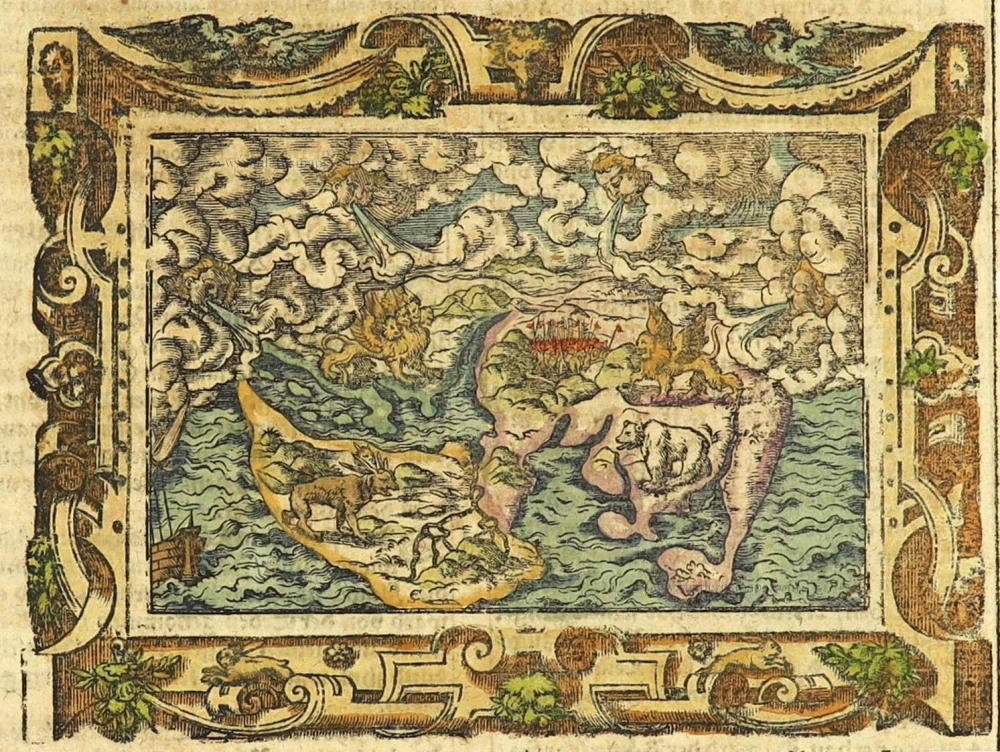
[No title] 1560-1600
Daniel's Dream Map. The Wittenberg world map.
[Item number: 28159]

Mappemonde en deux Hémisphères. c. 1797
World map, double hemisphere by Pierre Grégoire Chanlaire.
[Item number: 28209]

Mappe-Monde Physique. c. 1797
World map, double hemisphere by Pierre Grégoire Chanlaire.
[Item number: 28210]
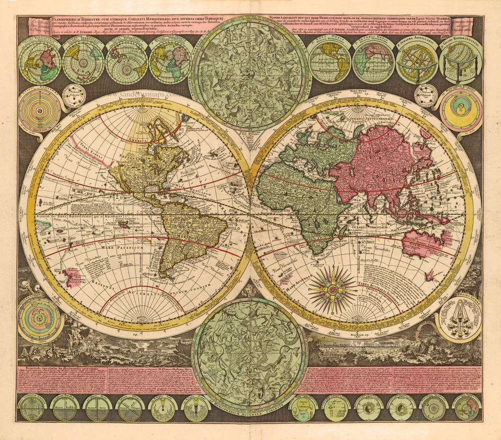
Planisphaerium Terrestre cum utroque Coelesti Hemisphaerio, sive Diversa Orbis Terraquei, c. 1700
World by Zürner A.F., double hemisphere.
[Item number: 28229]
First edition, scarce
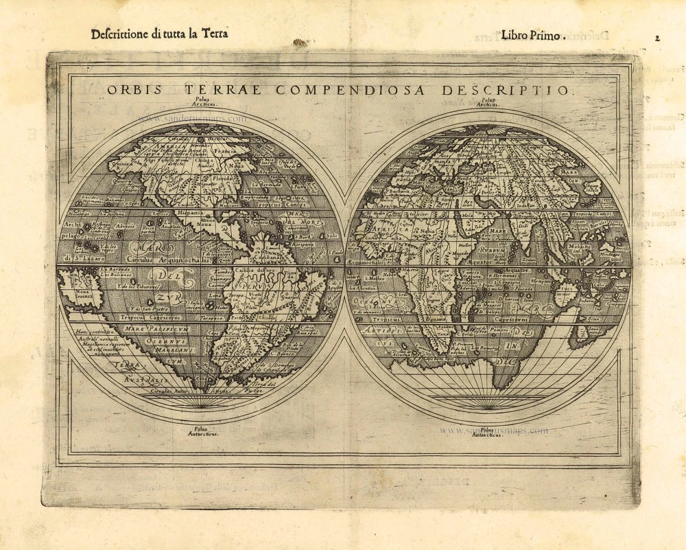
Orbis Terrae Compendiosa Descriptio. 1598
World by Giuseppe Rosaccio, double hemisphere.
[Item number: 28289]

Ptolemaei Cognita. 1598
Ptolemaic world map by Giuseppe Rosaccio.
[Item number: 28290]
The engraving and layout and elegance of decoration are all of the highest standards.
Nova Et Accuratissima Totius Terrarum Orbis Tabula. 1659
World by Joan Blaeu, double hemisphere.
[Item number: 28336]
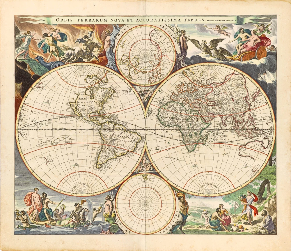
Orbis Terrarum Nova et Accuratissima Tabula. c. 1678
World by Nicolaas Visscher, double hemisphere.
[Item number: 28628]

A fine ornate example of the decorative cartography of the time.
Nova Totius Terrarum Orbis Geographica ac Hydrographica Tabula. Auct: Henr: Hondio. 1641
Double-hemisphere world map by Henricus Hondius.
[Item number: 28768]

Descrittione Del Mappamondo. 1572
World by Porcacchi Tommaso.
[Item number: 28910]
Luxury colouring.
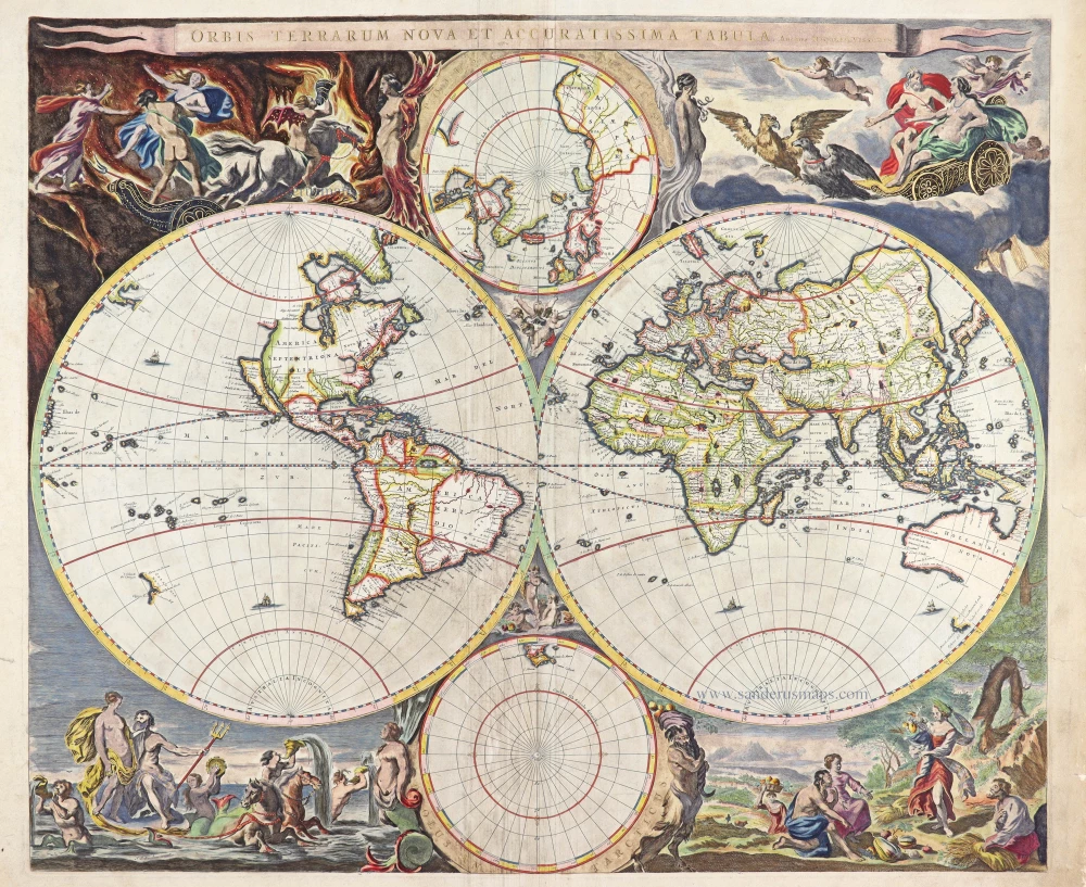
Orbis Terrarum Nova et Accuratissima Tabula. c. 1678
Double-hemisphere world map, by Nicolaas Visscher I.
[Item number: 28934]
Nouvelle Mappe-Monde, 1710
World by Pieter Van der Aa, double hemisphere.
[Item number: 29136]

Nova Orbis Tabula in Lucem Edita, A. F. De Wit. c. 1690
World by Frederik De Wit, double hemisphere.
[Item number: 29231]
Superb world set.
Typus Orbis Terrarum [in set with] Africae Tabula Nova [and] Americae sive Novi Orbis, Nova Descriptio [and] Asiae Nova Descriptio [and] Europae. 1584
Abraham Ortelius, 1584 World and Continents
[Item number: 29259]

Mapmonde ou description generale du Globe Terrestre. 1713
World map by Zacharias Châtelain.
[Item number: 29555]
Typus Orbis Terrarum. 1589
The world by Abraham Ortelius / Philippe Galle.
[Item number: 29605]

Rare original colour.
Typus Orbis Terrarum - Globus Terrestris. 1609
Two world maps by A. Ortelius, published by J.B. Vrients.
[Item number: 29861]

Mappe-Monde 1766-1780
World map by Louis Brion de la Tour, published by L.C Desnos.
[Item number: 30100]
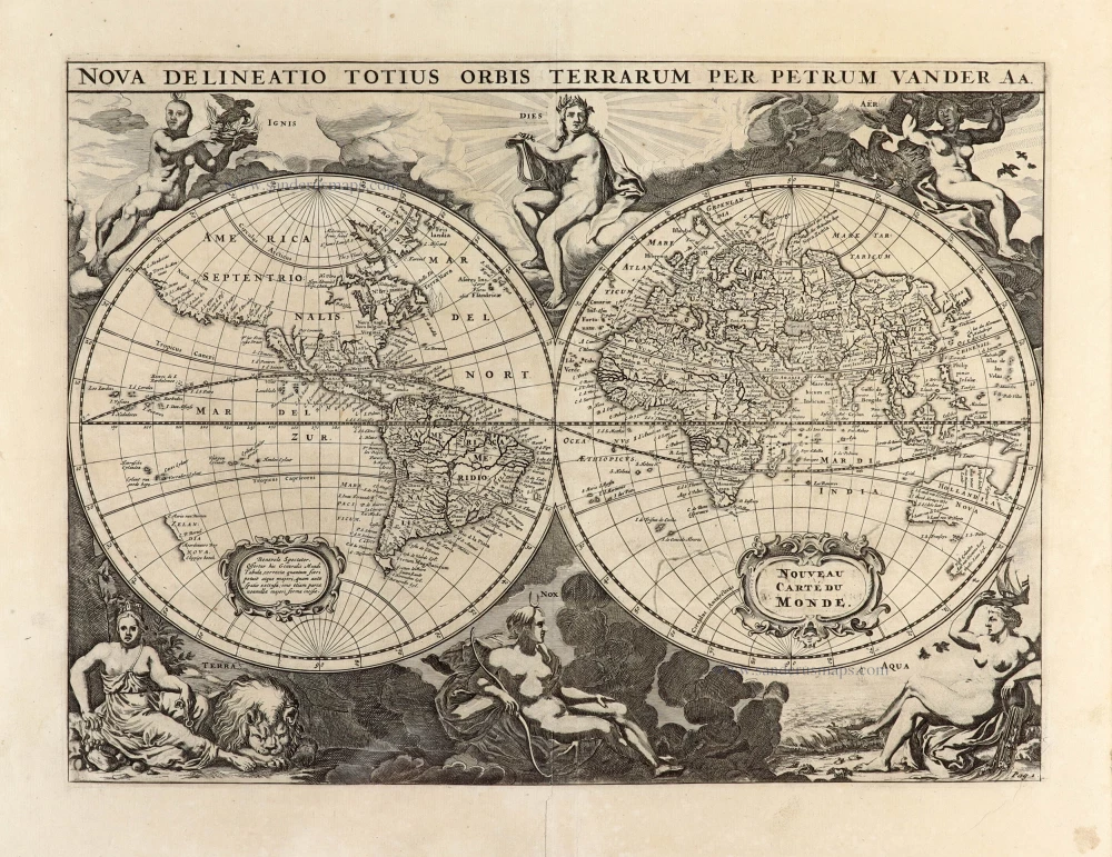
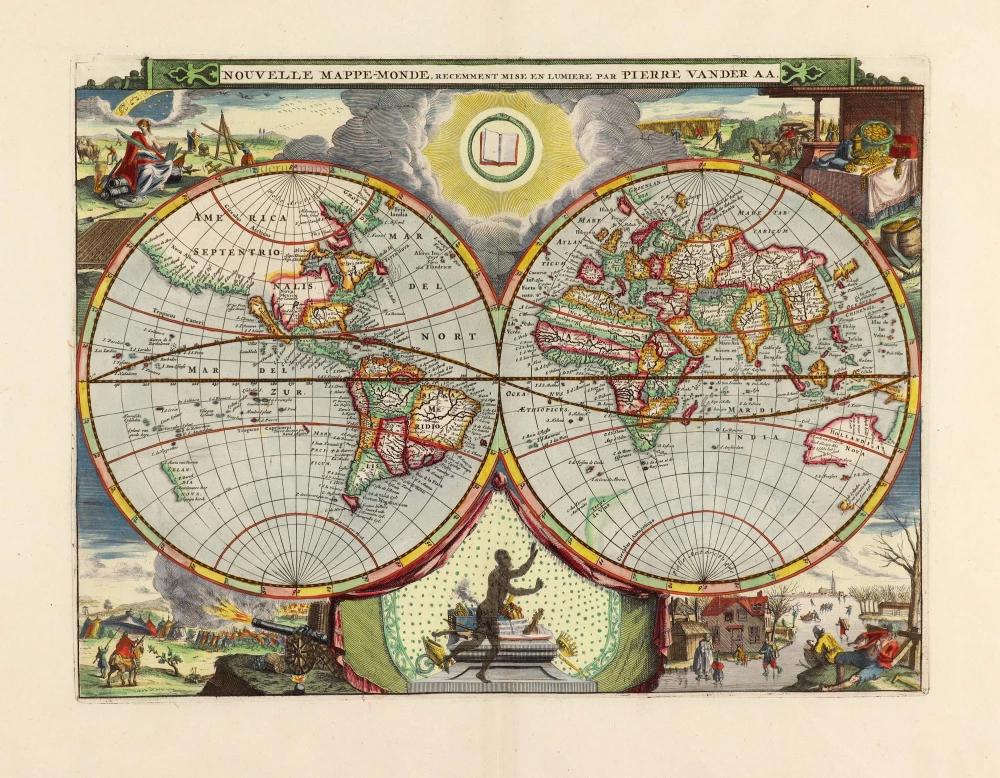
Nova Delineatio Totius Orbis Terrarum per Petrum Van der Aa. - Nouveau Carte du Monde. 1702
World by Pieter Van der Aa - double hemisphere.
[Item number: 30150]
Rare 1525 edition in nice old colour.
[No title] 1525
Ptolemaic world by Lorenz Fries after Martin Waldseemüller.
[Item number: 30649]

Mappe-Monde Geo-Hydrographique, ou Description Generale du Globe Terrestre et Aquatique en Deux Plans-Hemispheres ... 1692
World map by Nicolas Sanson, so-called published by Hubert Jaillot. (Pirated edition by Pierre Mortier).
[Item number: 31136]

Typus Orbis Terrarum. 1618
World by Petrus Bertius, published by Jodocus Hondius II.
[Item number: 31520]

Gottfried's first edition 1631
[no title] 1631
Willem C. Schouten, world map published by Gottfried.
[Item number: 31560]

Rare first edition
[no title] 1618
World map in two hemispheres by Willem W. Schouten.
[Item number: 31601]

An Essay of a New and Compact Map, containing the known parts of the Terrestrial Globe. 1750
World map by Jacques-Nicolas Bellin, published by A.F. Prévost.
[Item number: 31883]

Beautiful example of this important world map
Typus Orbis Terrarum. 1584
World by Abraham Ortelius.
[Item number: 32090]

Planiglobii Terrestris cum Utroq Hemisphaerio Caelesti Generalis Repraesentatio. c. 1720
World by Homann J.B., double hemisphere.
[Item number: 32099]

Early Mercator projection
Universi Orbis Descriptio Ad Usum Navigantium. 1597
World by Giovanni Magini.
[Item number: 32281]

Carta Marina Nuova Tavola. 1574
World chart by Girolamo Ruscelli.
[Item number: 32432]

Orbis Descriptio. 1574
World in two hemisperes, by Girolamo Ruscelli.
[Item number: 32433]

Rare first state of Danckerts beautiful world map
Nova Totius Terrarum Orbis Tabula.. c. 1680
Double hemisphere world map by Justus Danckerts
[Item number: 32456]

The most mystical world map of all time.
[No title] 1560-1600
Daniel's Dream Map. The Wittenberg world map by Hanss Luft.
[Item number: 32507]
'One of the supreme examples of map maker's art' (Shirley)
Nova Totius Terrarum Orbis Geographica ac Hydrographica. 1635
World by Willem Blaeu, in Mercator projection.
[Item number: 32683]

Mappa Mondo O Vero Carta Generale Del Globo Terestre 1677
World in two hemisphers by Giovanni De Rossi, after Nicolas Sanson.
[Item number: 32885]