
North Atlantic Ocean showing the east coast of North America, Greenland, Iceland, Azores, and part of Europe/Africa, by Pieter Van der Aa. 1707

The map shows the sea routes of Bartholomew Gosnold (voyage ~1602 to what is now New England) and Martin Pring (voyage ~1603) from the British Isles via the Azores to North America.
Pieter van der Aa (Leiden, 1659-1733)
Pieter van der Aa was already in 1682 owner of a bookshop and auction house. During his life, he has published an enormous amount of printed material.
After 1700, van der Aa increasingly specialised in books on geography and travel.
He published composite atlases, a series of geographical descriptions of European countries, and some very spectacular works. Between 1706 and 1708 he published the Naauweurige versameling der gedenkwaardigste zee- en land-reysen, in 28 volumes.
Many of Van der Aa’s publications are richly illustrated with maps and plates. He took over many copperplates and prints from other publishers such as Carel Allard and Frederik De Wit. The composite atlases that appeared from his workshop contain a curious mixture of his own material, copies of maps from other publishers, and reprints made from old copper plates, now with his own imprint.
The Galérie agréable du monde, was completed in 1729, and comprised 66 parts, bound in 27 volumes. Van der Aa presented it as a good investment; after publication, the antiquarian value of the work would double, the more so since it was printed in a limited edition of only one hundred copies.
't Noorder Gedeelte van Virginie door Batholomeus Gosnol en Martin Pringe uyt Engeland bevaaren.
Item Number: 32402 Authenticity Guarantee
Category: Antique maps > America > North America
North Atlantic Ocean showing the east coast of North America, Greenland, Iceland, Azores, and part of Europe/Africa., by Pieter Van der Aa.
Title: 't Noorder Gedeelte van Virginie door Batholomeus Gosnol en Martin Pringe uyt Engeland bevaaren.
Uytgevoerd te Leyden door Pieter Vander Aa met Privilegie. - Bartholomeus Gosnol.
Date of the first edition: 1707.
Date of this map: 1707.
Copper engraving, printed on paper.
Image size: 155 x 230mm (6 x 9 inches).
Sheet size: 175 x 280mm (7 x 11 inches).
Verso: Blank.
Condition: Excellent.
Condition Rating: A+.
From: Naaukeurige Versameling der gedenk-waardigste Zee- en landreysen na Oost en West-Indien. Leiden, Pieter Van der Aa, 1707.
Rare - not in Kershaw.
The map shows the sea routes of Bartholomew Gosnold (voyage ~1602 to what is now New England) and Martin Pring (voyage ~1603) from the British Isles via the Azores to North America.
Pieter van der Aa (Leiden, 1659-1733)
Pieter van der Aa was already in 1682 owner of a bookshop and auction house. During his life, he has published an enormous amount of printed material.
After 1700, van der Aa increasingly specialised in books on geography and travel.
He published composite atlases, a series of geographical descriptions of European countries, and some very spectacular works. Between 1706 and 1708 he published the Naauweurige versameling der gedenkwaardigste zee- en land-reysen, in 28 volumes.
Many of Van der Aa’s publications are richly illustrated with maps and plates. He took over many copperplates and prints from other publishers such as Carel Allard and Frederik De Wit. The composite atlases that appeared from his workshop contain a curious mixture of his own material, copies of maps from other publishers, and reprints made from old copper plates, now with his own imprint.
The Galérie agréable du monde, was completed in 1729, and comprised 66 parts, bound in 27 volumes. Van der Aa presented it as a good investment; after publication, the antiquarian value of the work would double, the more so since it was printed in a limited edition of only one hundred copies.
Related items

Estotilandia et Laboratoris Terra. 1607
Greenland and Northeast Canada, by C. van Wytfliet.
[Item number: 26499]
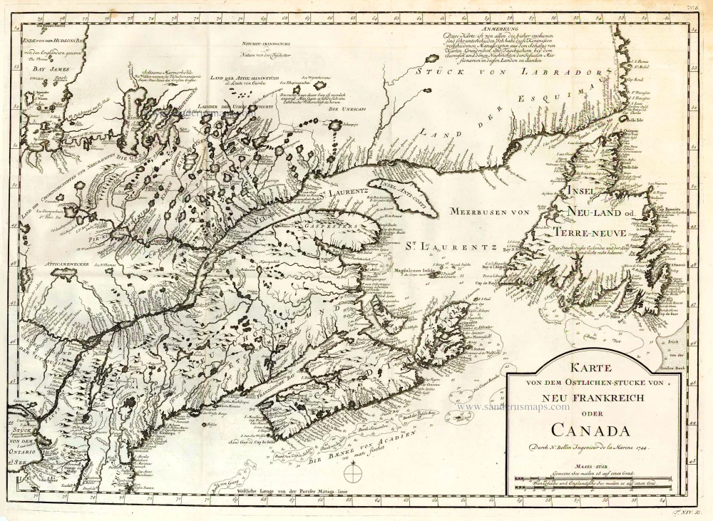
Karte von dem Ostlichen-Stucke von Neu Frankreich oder Canada. 1747-74
Eastern Canada, by Jacques Nicolas Bellin.
[Item number: 26796]
Rare.
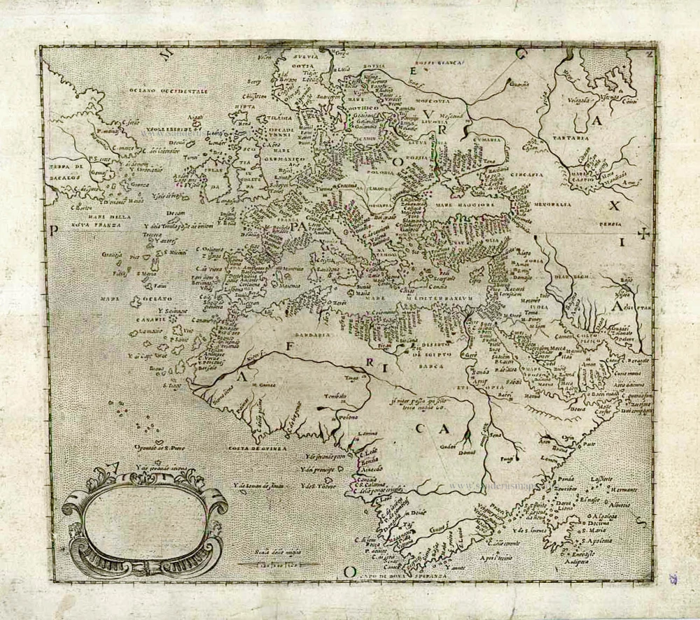
[No title] c. 1575
Europe, Africa, Arabia & Canada
[Item number: 27086]

Septemtrionaliora Americae à Groenlandia, per Freta Davidis et Hudson, ad Terram Novam = De Noordelyckste Zee kusten van America van Goenland door de Straet Davis ende Straet Hudson tot Terra Neuf. c. 1690
North-Eastern Coasts of North America (Canada), by Frederick de Wit.
[Item number: 29242]

The famous Sea Monster Map
Islandia. 1598
Iceland, by Abraham Ortelius.
[Item number: 33075]
new