
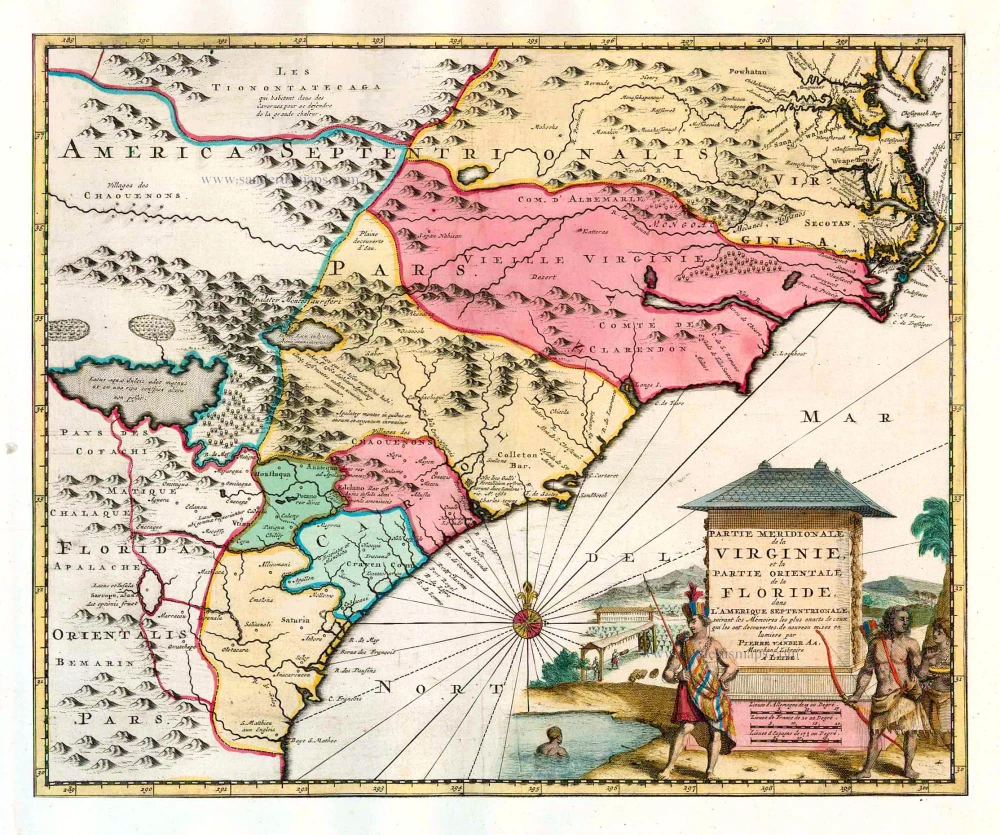
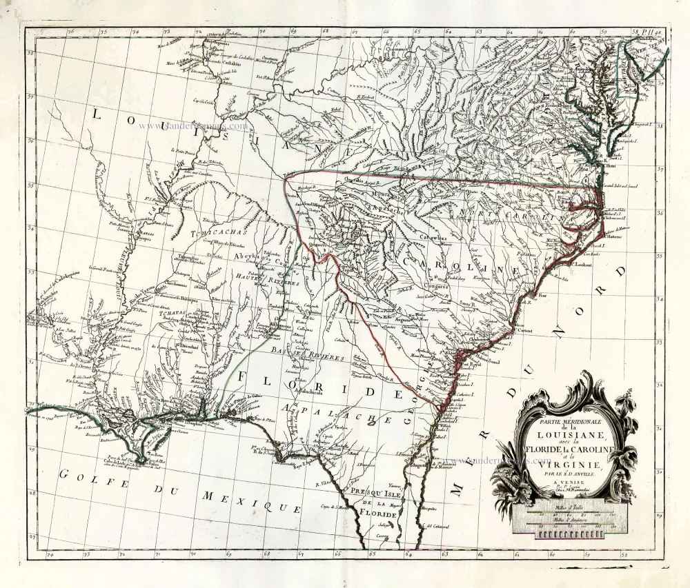
Carolina by Pieter van der Aa. 1713
Pieter van der Aa (Leiden, 1659-1733)
Pieter van der Aa was already in 1682 owner of a bookshop and auction house. During his life, he has published an enormous amount of printed material.
After 1700, van der Aa increasingly specialised in books on geography and travel.
He published composite atlases, a series of geographical descriptions of European countries, and some very spectacular works. Between 1706 and 1708 he published the Naauweurige versameling der gedenkwaardigste zee- en land-reysen, in 28 volumes.
Many of Van der Aa’s publications are richly illustrated with maps and plates. He took over many copperplates and prints from other publishers such as Carel Allard and Frederik De Wit. The composite atlases that appeared from his workshop contain a curious mixture of his own material, copies of maps from other publishers, and reprints made from old copper plates, now with his own imprint.
The Galérie agréable du monde, was completed in 1729, and comprised 66 parts, bound in 27 volumes. Van der Aa presented it as a good investment; after publication, the antiquarian value of the work would double, the more so since it was printed in a limited edition of only one hundred copies.
Partie Meridionale de la Virginie, et la Partie Orientale de la Floride dans l'Amerique Septentrionale.
Item Number: 26137 Authenticity Guarantee
Category: Antique maps > America > North America
Carolina by Pieter van der Aa.
Title: Partie Meridionale de la Virginie, et la Partie Orientale de la Floride dans l'Amerique Septentrionale.
Date of the first edition: 1713.
Date of this map: 1713.
Cumming dates this map as 1729 (Date of the Galérie Agréable), but the map appeared already in Van der Aa's rare Nouvel Atlas.
Copper engraving, printed on paper.
Image size: 290 x 357mm (11.42 x 14.06 inches).
Sheet size: 350 x 460mm (13.78 x 18.11 inches).
Verso: Blank.
Condition: Original coloured, trimmed to neatline and mounted on heavy paper at an early time.
Condition Rating: A.
From: Nouvel Atlas, très exact et fort commode pour toutes sortes de personnes, Contenant Les Principales cartes géographiques. Leiden, P. Van der Aa, n.d. (1713) (Koeman, Aa7).
Pieter van der Aa (Leiden, 1659-1733)
Pieter van der Aa was already in 1682 owner of a bookshop and auction house. During his life, he has published an enormous amount of printed material.
After 1700, van der Aa increasingly specialised in books on geography and travel.
He published composite atlases, a series of geographical descriptions of European countries, and some very spectacular works. Between 1706 and 1708 he published the Naauweurige versameling der gedenkwaardigste zee- en land-reysen, in 28 volumes.
Many of Van der Aa’s publications are richly illustrated with maps and plates. He took over many copperplates and prints from other publishers such as Carel Allard and Frederik De Wit. The composite atlases that appeared from his workshop contain a curious mixture of his own material, copies of maps from other publishers, and reprints made from old copper plates, now with his own imprint.
The Galérie agréable du monde, was completed in 1729, and comprised 66 parts, bound in 27 volumes. Van der Aa presented it as a good investment; after publication, the antiquarian value of the work would double, the more so since it was printed in a limited edition of only one hundred copies.
Related items
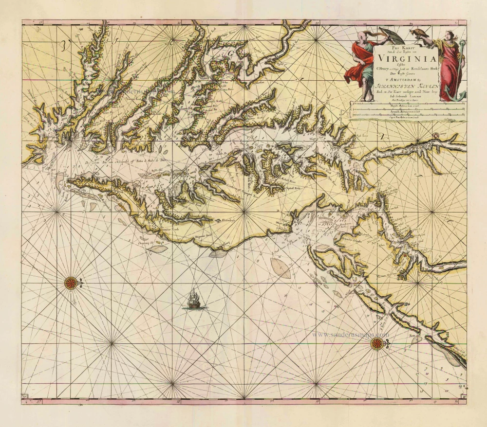
Pas Kaart van de Zee Kusten van Virginia tusschen C. Henry en t Hooge Land van Renselaars Hoek. 1702
Virginia by Johannes van Keulen
[Item number: 1332]
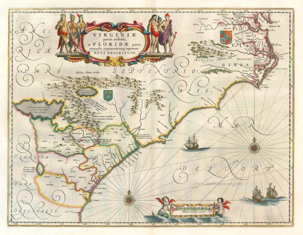
Virginiae Partis Australis, Et Floridae Partis Orientalis ... 1649-55
Virginia by Willem Blaeu.
[Item number: 15427]
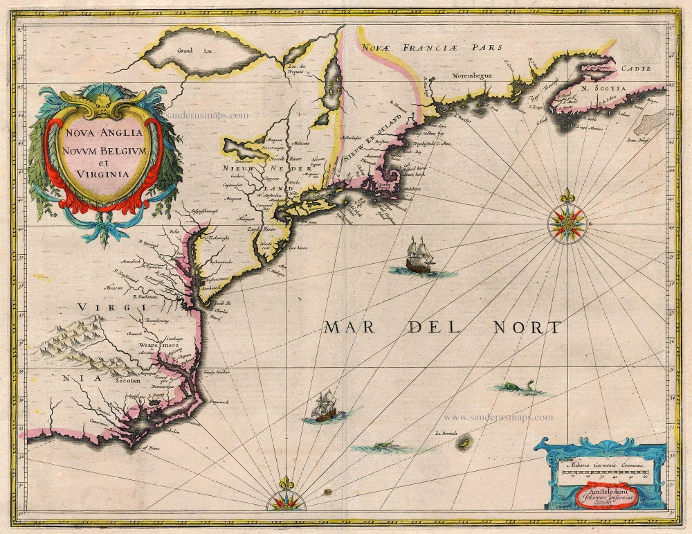
Nova Anglia Novum Belgium et Virginia 1638
United States (Northeast) by Janssonius J.
[Item number: 19011]
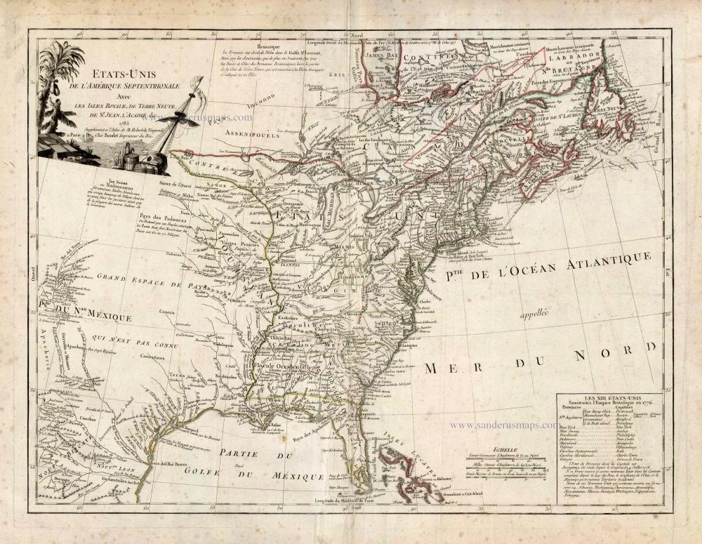
Etats-Unis de l'Amerique Septentrionale avec les Isles Royale, de Terre Neuve de St. Jean, l'Acadie &c. 1786
United States (East) by Boudet A. - de Vaugondy R.
[Item number: 25265]
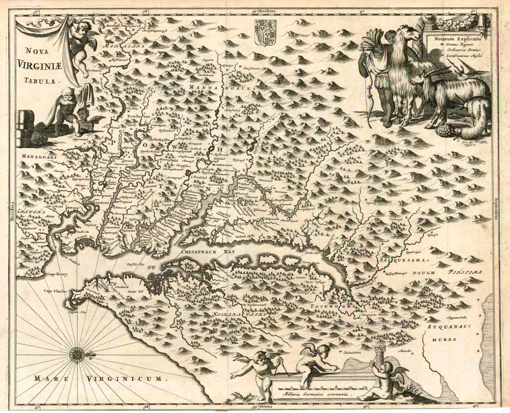
Nova Virginiae Tabula. 1671
Virginia, by A. Montanus.
[Item number: 25613]
Partie Méridionale de la Louisiane, avec la Floride, la Caroline et la Virginie. 1776-79
The United States (Southeast), by Francesco Santini.
[Item number: 26983]
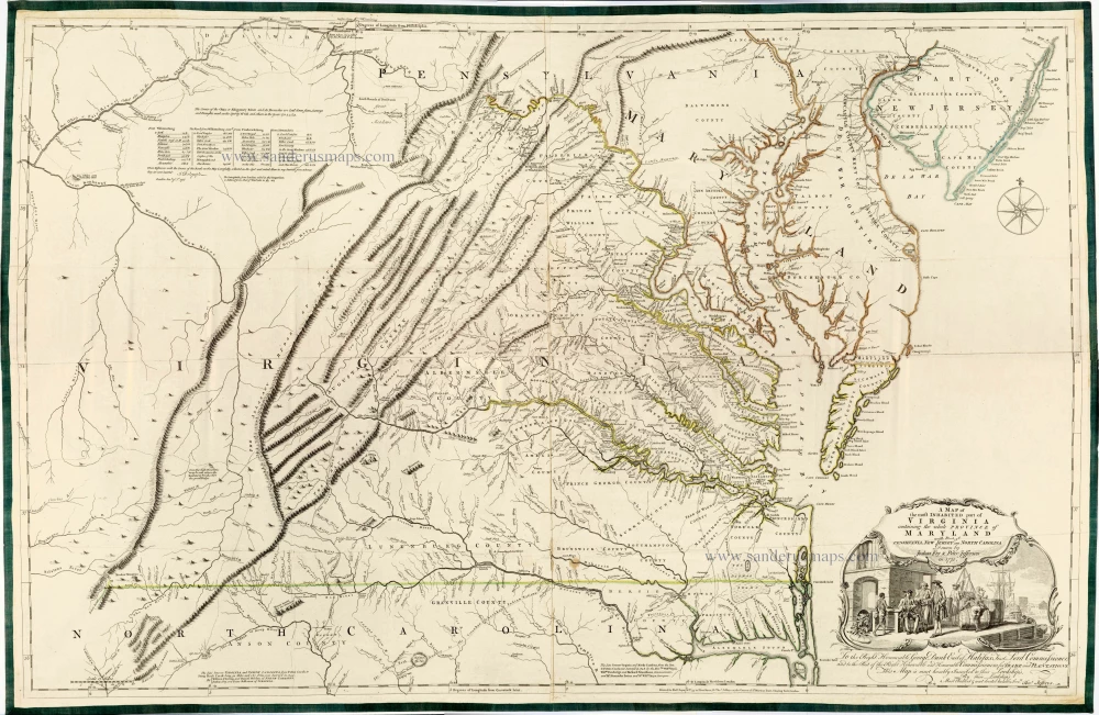
Very important Virginia map.
A Map of the Most Inhabited Part of Virginia Containing the Whole Province of Maryland with Part of Pensilvania, New Jersey and North Carolina. 1775
Joshua Fry & Peter Jefferson
[Item number: 28119]