
Arctic and Antarctic - North and South Polar calottes from Coronelli's 110-centimetre Terrestrial Globe 1691
North and South Polar Calottes from Coronelli's 110-centimetre Terrestrial Globe
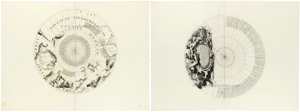
A magnificent and highly decorative pair of polar calottes by Vincenzo Maria Coronelli, depicting the Arctic and Antarctic regions, originally designed for his celebrated 110-centimetre terrestrial globe.
These two remarkable circular engravings represent the northern and southern polar caps of Coronelli's terrestrial globe and were published as separate plates in his Atlante Veneto (Venice, 1691). Together, they provide a fascinating illustration of late seventeenth-century geographical knowledge, combining scientific cartography, accounts of exploration and elaborate Baroque decoration.
The North Polar Calotte presents the Arctic regions in a polar projection, with the meridians radiating from the North Pole. The northern extremities of Europe, Asia and America are depicted around the circumference, including Greenland, Iceland and the Arctic islands. The coastlines reflect the period's geographical discoveries and uncertainties, as much of the far north remained unexplored.
Numerous geographical annotations refer to voyages of discovery, navigational observations and contemporary theories concerning the Arctic. The engraving is enriched with decorative scenes of ships, figures, animals and mountainous landscapes, illustrating European perceptions of the northern world.
The South Polar Calotte, by contrast, is dominated by the vast, largely unexplored Antarctic Ocean. Its striking composition features radiating meridians, extensive geographical annotations, and an exceptionally elaborate ornamental cartouche that describes Magellan's first circumnavigation of 1519-1522. It shows Magellan lifting the veil from a globe while placing his hand on the shoulder of Mercurius (Hermes), the Roman/Greek God of commerce. On the right we see trading goods, emphasising the notion that international trade will bring prosperity to all.
The numerous inscriptions surrounding the southern polar projection record geographical information and observations associated with voyages into the southern oceans. Unlike the northern calotte, the southern hemisphere contains little recognisable land, emphasising the uncertainty surrounding the existence and extent of an Antarctic continent.
The two engravings are particularly interesting when viewed together. The northern calotte presents a comparatively well-documented geographical region, while the southern calotte illustrates the considerable limits of contemporary exploration. Their contrasting compositions also demonstrate Coronelli's ability to combine geographical scholarship with the decorative traditions of Venetian Baroque engraving.
These two polar calottes are fine examples of Coronelli's exceptional achievements in engraving and globe-making. Originally conceived as integral components of a large terrestrial globe, they are equally impressive as independent cartographic compositions.
A rare and exceptionally attractive pair of seventeenth-century polar engravings, combining the geographical discoveries of the age with the artistic splendour of Venetian Baroque cartography.
Vincenzo Coronelli (1650-1718)
Vincenzo Coronelli was born in Venice on 16 August 1650 and primarily brought up in Ravenna. He returned to Venice in 1665 and joined the convent of the Minor Conventuals. Five years later, he was sent to Rome to study, and by 1673, he was already a doctor of theology.
Having achieved fame by constructing two globes for the Duke of Parma, he was invited to Paris for three years in 1681 and made two enormous examples for Louis XIV. On his return to Venice, he assiduously collected cartographic material and founded the Academy of the Argonauts. In 1685, he was appointed Cosmographer to the Republic of Venice and authorised to publish a large atlas. He became a geography lecturer at the University of Venice and brought out an Atlante Veneto the following year.
In 1696, he visited Germany, Holland and southern England. During intervals in compiling his vast encyclopaedia, he continued with cartographic projects up to 1709. He died in his native Venice on 9 December 1718.
Coronelli became famous for his globes. In addition, he was a renowned encyclopaedist, mapmaker and geographer. Most of his maps and other material are gathered in his Atlante Veneto (13 vols, 1690-1705). The first volume, subtitled Descrizione generale istorica geografica, was his masterpiece, planned as an extension of Blaeu’s atlas.
Other volumes of the atlas which contain maps are Isolario, two parts (1696-8), with detailed maps and plans, mostly of islands; Corso geografico, two parts based on the edition 1694-7; Libro de’ globi (1697); and Lo Specchio del Mare, a reprint of Levanto's Lo Specchio del Mare Mediterraneo of 1664.
The other vital aspects of his mapping are those arising from the Venetian conquest and his travels. His most extensive military compilation was the Teatro della Guerra, in more than 30 volumes.
[No title]
Item Number: 33311 new Authenticity Guarantee
Category: Antique maps > America > South America
North and South Pole calottes from a 110-centimetre globe, by Coronelli V.M.
Two separate, unjoined sheets.
[No title]
Date: 1691.
Copper engraving, printed on paper.
Image size: 370 x 370mm (14½ x 14½ inches) each.
Sheet size: 475 x 645mm (18¾ x 25½ inches) each.
Verso: Blank.
Condition: Excellent.
Condition Rating: A+.
From: Atlante Veneto, nel quale si contiene la descrittione... degl' Imperii, Regni, Provincie, e Stati dell' Universo. Venice: Girolamo Albrizzi, 1691. Shirley (Brit.Lib.), T.CORO-7a
North and South Polar Calottes from Coronelli's 110-centimetre Terrestrial Globe
A magnificent and highly decorative pair of polar calottes by Vincenzo Maria Coronelli, depicting the Arctic and Antarctic regions, originally designed for his celebrated 110-centimetre terrestrial globe.
These two remarkable circular engravings represent the northern and southern polar caps of Coronelli's terrestrial globe and were published as separate plates in his Atlante Veneto (Venice, 1691). Together, they provide a fascinating illustration of late seventeenth-century geographical knowledge, combining scientific cartography, accounts of exploration and elaborate Baroque decoration.
The North Polar Calotte presents the Arctic regions in a polar projection, with the meridians radiating from the North Pole. The northern extremities of Europe, Asia and America are depicted around the circumference, including Greenland, Iceland and the Arctic islands. The coastlines reflect the period's geographical discoveries and uncertainties, as much of the far north remained unexplored.
Numerous geographical annotations refer to voyages of discovery, navigational observations and contemporary theories concerning the Arctic. The engraving is enriched with decorative scenes of ships, figures, animals and mountainous landscapes, illustrating European perceptions of the northern world.
The South Polar Calotte, by contrast, is dominated by the vast, largely unexplored Antarctic Ocean. Its striking composition features radiating meridians, extensive geographical annotations, and an exceptionally elaborate ornamental cartouche that describes Magellan's first circumnavigation of 1519-1522. It shows Magellan lifting the veil from a globe while placing his hand on the shoulder of Mercurius (Hermes), the Roman/Greek God of commerce. On the right we see trading goods, emphasising the notion that international trade will bring prosperity to all.
The numerous inscriptions surrounding the southern polar projection record geographical information and observations associated with voyages into the southern oceans. Unlike the northern calotte, the southern hemisphere contains little recognisable land, emphasising the uncertainty surrounding the existence and extent of an Antarctic continent.
The two engravings are particularly interesting when viewed together. The northern calotte presents a comparatively well-documented geographical region, while the southern calotte illustrates the considerable limits of contemporary exploration. Their contrasting compositions also demonstrate Coronelli's ability to combine geographical scholarship with the decorative traditions of Venetian Baroque engraving.
These two polar calottes are fine examples of Coronelli's exceptional achievements in engraving and globe-making. Originally conceived as integral components of a large terrestrial globe, they are equally impressive as independent cartographic compositions.
A rare and exceptionally attractive pair of seventeenth-century polar engravings, combining the geographical discoveries of the age with the artistic splendour of Venetian Baroque cartography.
Vincenzo Coronelli (1650-1718)
Vincenzo Coronelli was born in Venice on 16 August 1650 and primarily brought up in Ravenna. He returned to Venice in 1665 and joined the convent of the Minor Conventuals. Five years later, he was sent to Rome to study, and by 1673, he was already a doctor of theology.
Having achieved fame by constructing two globes for the Duke of Parma, he was invited to Paris for three years in 1681 and made two enormous examples for Louis XIV. On his return to Venice, he assiduously collected cartographic material and founded the Academy of the Argonauts. In 1685, he was appointed Cosmographer to the Republic of Venice and authorised to publish a large atlas. He became a geography lecturer at the University of Venice and brought out an Atlante Veneto the following year.
In 1696, he visited Germany, Holland and southern England. During intervals in compiling his vast encyclopaedia, he continued with cartographic projects up to 1709. He died in his native Venice on 9 December 1718.
Coronelli became famous for his globes. In addition, he was a renowned encyclopaedist, mapmaker and geographer. Most of his maps and other material are gathered in his Atlante Veneto (13 vols, 1690-1705). The first volume, subtitled Descrizione generale istorica geografica, was his masterpiece, planned as an extension of Blaeu’s atlas.
Other volumes of the atlas which contain maps are Isolario, two parts (1696-8), with detailed maps and plans, mostly of islands; Corso geografico, two parts based on the edition 1694-7; Libro de’ globi (1697); and Lo Specchio del Mare, a reprint of Levanto's Lo Specchio del Mare Mediterraneo of 1664.
The other vital aspects of his mapping are those arising from the Venetian conquest and his travels. His most extensive military compilation was the Teatro della Guerra, in more than 30 volumes.
Related items
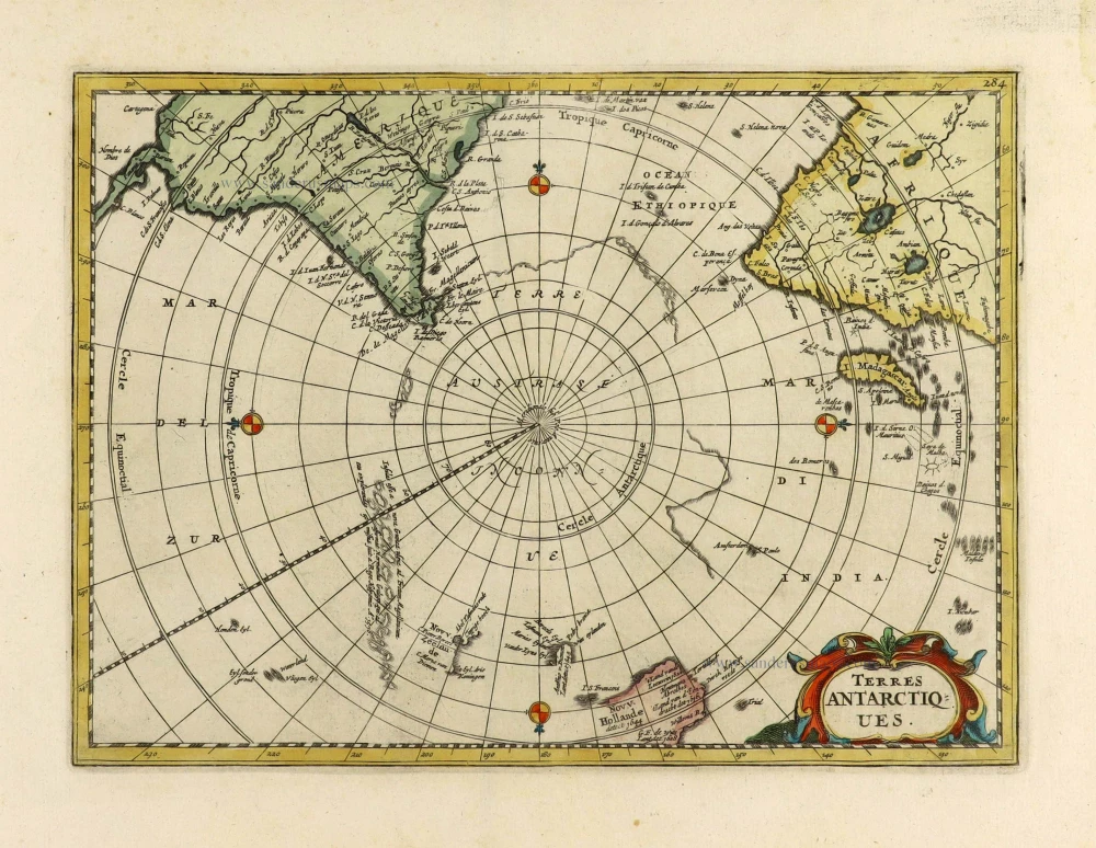
With Tasman discoveries.
Terres Antarctiques. 1734
South Pole by Henri Du Sauzet.
[Item number: 28364]
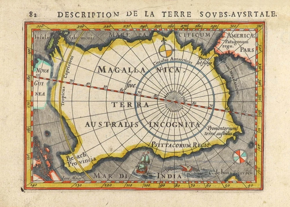
Magallanica sive Terra Australis Incognita. [Title in map] 1616
Antartic Region by Petrus Bertius.
[Item number: 29797]

Very rare first state of Mercator's North Pole map.
Septentrionalium Terrarum descriptio. 1595
Arctic Region - North Pole by Gerard Mercator, first state published by Rumold Mercator.
[Item number: 29799]
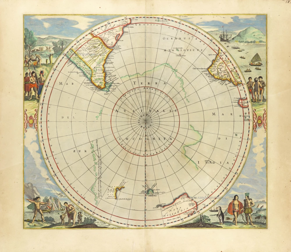
Scarce edition with New Zeeland & Tasmania by J. Janssonius.
Polus Antarcticus. 1666
South Pole, by Henricus Hondius, published by J. Janssonius.
[Item number: 30316]
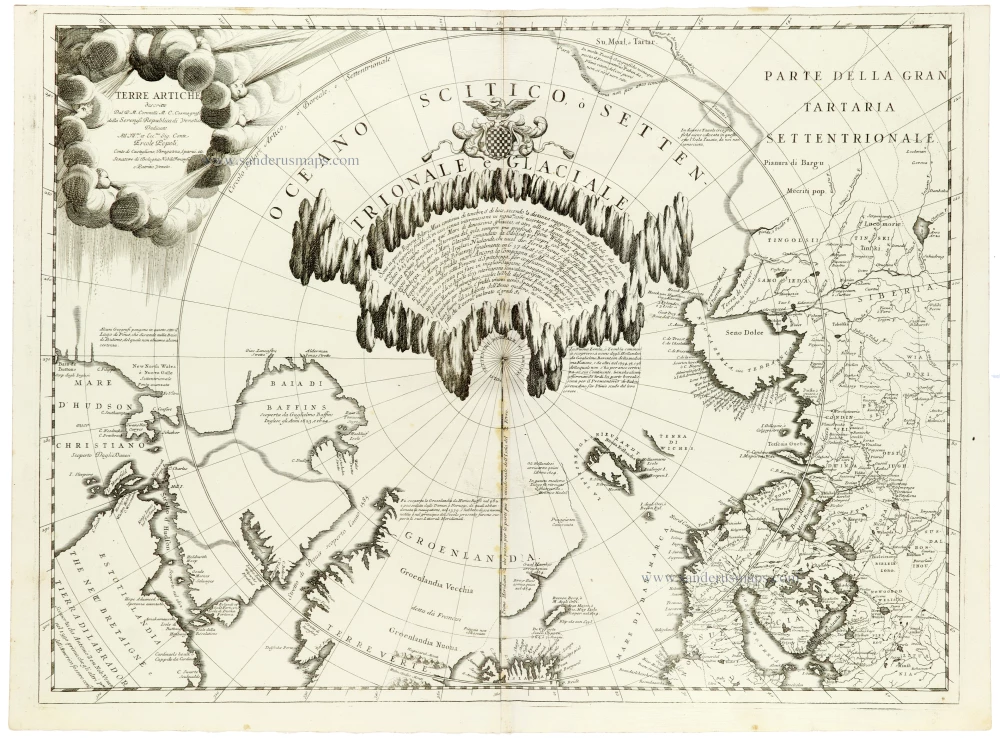
Terre Artiche. 1691
North Pole by Coronelli V.M.
[Item number: 33310]
new