
For the China atlas by Martino Martini
Title page by Joan Blaeu. 1655
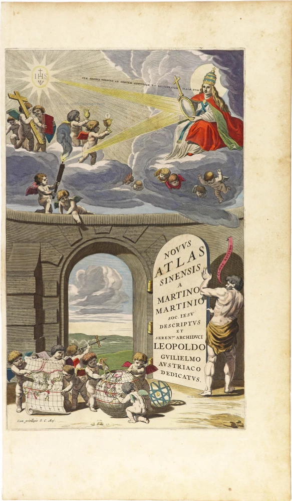
A large door in the lower part of this frontispiece reveals an open portal. In the foreground, several putti unroll part of a map of China and cluster around a globe where measurements are being made. The upper part of the title page is a complex symbolic piece upholding the activities of the Jesuit missionaries in the Far East. Light from a radiant starry emblem of Jesus Christ (IHS) on the left is reflected by a mirror held by an allegorical figure of the Catholic Church wearing the triple tiara that commonly symbolizes the pope (the figure is a female with long hair). The reflected light lights up a torch in a putto's hand. The more extended quotation from Isaiah 18.2 uttering from the mouth of the blond figure translates as 'Go, swift messengers, to a nation powerful but divided'. The blond figure that embodies the Church underlines its European identity. While six putti support the cloud on which "the Church" sits serenely, in front of her, five putti carry Christian religious symbols: a large cross, a Bible, an ampoule with wine for consecration, and a chalice with the Host.
Martino Martini (1614-1661)
Martino Martini went to China in 1642 as a Jesuit missionary and was ordered back to Rome in 1651, taking with him some maps of the provinces of China which he translated into Latin. On his voyage back to Europe, he was captured by the Dutch and sent to Amsterdam, where he arrived in 1654. In addition to his contribution to the cartography of the Far East, he wrote a history of the war of the Tartars against China. (J.C. Hubbard)
The Blaeus: Willem Janszoon, Cornelis & Joan
Willem Jansz. Blaeu and his son Joan Blaeu are the most widely known cartographic publishers of the seventeenth century.
Willem Jansz. (also written Guilielmus Janssonius) = Willem Janszoon Blaeu, was born in Uitgeest (Netherlands), near Alkmaar in 1571. He studied mathematics under Tycho Brahe and learned the theory and practice of astronomical observations and the art of instrument- and globe making.
In 1596 he came to Amsterdam where he settled down as a globe-, instrument- and map-maker. He published his first cartographic work (a globe) in 1599 and probably published his first printed map (a map of the Netherlands) in 1604. He specialized in maritime cartography and published the first edition of the pilot guide Het Licht der Zeevaert in 1608, and was appointed Hydrographer of the V.O.C. (United East India Company) in 1633. After thirty years of publishing books, wall maps, globes, charts and pilot guides, he brought out his first atlas, Atlas Appendix (1630). This was the beginning of the great tradition of atlas-making by the Blaeus.
In 1618 another mapmaker, bookseller and publisher, Johannes Janssonius established himself in Amsterdam next door to Blaeu's shop. It is no wonder that these two neighbours, who began accusing each other of copying and stealing their information, became fierce competitors who did not have a good word to say about each other. In about 1621 Willem Jansz. decided to put an end to the confusion between his name and his competitor's, and assumed his grandfather's sobriquet, 'blauwe Willem' ('blue Willem'), as the family name; thereafter he called himself Willem Jansz. Blaeu.
Willem Janszoon Blaeu died in 1638, leaving his prospering business to his sons, Cornelis and Joan. Of Cornelis we only know that his name occurs in the prefaces of books and atlases until c. 1645.
Joan Blaeu, born in Amsterdam, 1596, became partner in his father’s book trade and printing business. In 1638 he was appointed his father’s successor in the Hydrographic office of the V.O.C. His efforts culminated in the magnificent Atlas Major and the town-books of the Netherlands and of Italy – works unsurpassed in history and in modern times, which gave eternal fame to the name of the Blaeus.
On February 23, 1672, a fire ruined the business. One year later, Dr. Joan Blaeu died. The fire of 1672 and the passing away of the director gave rise to a complete sale of the stock of the Blaeu House. Five public auctions dispersed the remaining books, atlases, copperplates, globes, etc., among many other map dealers and publishers in Amsterdam. The majority was acquired by a number of booksellers acting in partnership.
In the succeeding years, the remaining printing department was left in the hands of the Blaeu family until 1695 when also the inventory of the printing house was sold at a public auction. That meant the end of the Blaeus as a printing house of world renown.
Novus Atlas Sinensis a Martino Martinio Soc. Iesu Descriptus et Seren.mo Archiduci Leopoldo Guilielmo Austriaco Dedicatus.
Item Number: 29974 Authenticity Guarantee
Category: Antique maps > Asia > China
Title page for the Atlas of China by Martino Martini, published by Joan Blaeu. (separate edition).
Title: Novus Atlas Sinensis a Martino Martinio Soc. Iesu Descriptus et Seren.mo Archiduci Leopoldo Guilielmo Austriaco Dedicatus.
Cum privilegio S.C. Maj.
Date: 1655.
Copper engraving, printed on paper.
Image size: 415 x 260mm (16.34 x 10.24 inches).
Sheet size: 545 x 320mm (21.46 x 12.6 inches).
Verso: Blank.
Condition: Original coloured, short left margin, heightened with gold..
Condition Rating: A.
From: Novus Atlas Sinensis a Martino Martinio Soc. Iesu Descriptus. Amsterdam, J. Blaeu, 1655. (Van der Krogt 2, 2:501B)
A large door in the lower part of this frontispiece reveals an open portal. In the foreground, several putti unroll part of a map of China and cluster around a globe where measurements are being made. The upper part of the title page is a complex symbolic piece upholding the activities of the Jesuit missionaries in the Far East. Light from a radiant starry emblem of Jesus Christ (IHS) on the left is reflected by a mirror held by an allegorical figure of the Catholic Church wearing the triple tiara that commonly symbolizes the pope (the figure is a female with long hair). The reflected light lights up a torch in a putto's hand. The more extended quotation from Isaiah 18.2 uttering from the mouth of the blond figure translates as 'Go, swift messengers, to a nation powerful but divided'. The blond figure that embodies the Church underlines its European identity. While six putti support the cloud on which "the Church" sits serenely, in front of her, five putti carry Christian religious symbols: a large cross, a Bible, an ampoule with wine for consecration, and a chalice with the Host.
Martino Martini (1614-1661)
Martino Martini went to China in 1642 as a Jesuit missionary and was ordered back to Rome in 1651, taking with him some maps of the provinces of China which he translated into Latin. On his voyage back to Europe, he was captured by the Dutch and sent to Amsterdam, where he arrived in 1654. In addition to his contribution to the cartography of the Far East, he wrote a history of the war of the Tartars against China. (J.C. Hubbard)
The Blaeus: Willem Janszoon, Cornelis & Joan
Willem Jansz. Blaeu and his son Joan Blaeu are the most widely known cartographic publishers of the seventeenth century.
Willem Jansz. (also written Guilielmus Janssonius) = Willem Janszoon Blaeu, was born in Uitgeest (Netherlands), near Alkmaar in 1571. He studied mathematics under Tycho Brahe and learned the theory and practice of astronomical observations and the art of instrument- and globe making.
In 1596 he came to Amsterdam where he settled down as a globe-, instrument- and map-maker. He published his first cartographic work (a globe) in 1599 and probably published his first printed map (a map of the Netherlands) in 1604. He specialized in maritime cartography and published the first edition of the pilot guide Het Licht der Zeevaert in 1608, and was appointed Hydrographer of the V.O.C. (United East India Company) in 1633. After thirty years of publishing books, wall maps, globes, charts and pilot guides, he brought out his first atlas, Atlas Appendix (1630). This was the beginning of the great tradition of atlas-making by the Blaeus.
In 1618 another mapmaker, bookseller and publisher, Johannes Janssonius established himself in Amsterdam next door to Blaeu's shop. It is no wonder that these two neighbours, who began accusing each other of copying and stealing their information, became fierce competitors who did not have a good word to say about each other. In about 1621 Willem Jansz. decided to put an end to the confusion between his name and his competitor's, and assumed his grandfather's sobriquet, 'blauwe Willem' ('blue Willem'), as the family name; thereafter he called himself Willem Jansz. Blaeu.
Willem Janszoon Blaeu died in 1638, leaving his prospering business to his sons, Cornelis and Joan. Of Cornelis we only know that his name occurs in the prefaces of books and atlases until c. 1645.
Joan Blaeu, born in Amsterdam, 1596, became partner in his father’s book trade and printing business. In 1638 he was appointed his father’s successor in the Hydrographic office of the V.O.C. His efforts culminated in the magnificent Atlas Major and the town-books of the Netherlands and of Italy – works unsurpassed in history and in modern times, which gave eternal fame to the name of the Blaeus.
On February 23, 1672, a fire ruined the business. One year later, Dr. Joan Blaeu died. The fire of 1672 and the passing away of the director gave rise to a complete sale of the stock of the Blaeu House. Five public auctions dispersed the remaining books, atlases, copperplates, globes, etc., among many other map dealers and publishers in Amsterdam. The majority was acquired by a number of booksellers acting in partnership.
In the succeeding years, the remaining printing department was left in the hands of the Blaeu family until 1695 when also the inventory of the printing house was sold at a public auction. That meant the end of the Blaeus as a printing house of world renown.
Related items
Exceptional nice old colour. Heightened in gold.
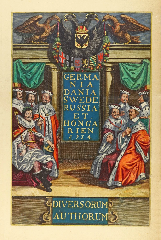
Germania Dania Swede Russia et Hongarien 1714. - Diversorum Authorum. 1714
Joannes Janssonius, title page
[Item number: 30095]

De Praecipuis, Totius Universi Urbibus Liber Secundus. 1575-1612
Georg Braun & Frans Hogenberg, allegorical atlas title page of the second part.
[Item number: 30096]
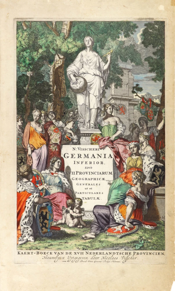
N: Visscheri Germania Inferior Sive XVII Provinciarum Geographicae Generales ut et Particulares Tabulae. - Kaert-Boeck van de XVII Nederlandtsche Provincien, Nieuwlycx uytgegeven door Nicolaes Visscher. After 1677 (privilege)
Atlas title page by Nicolas Visscher II.
[Item number: 30417]