
Holy Land by Nicolas Sanson. 1665
Nicolas Sanson (1600-1667) - Guillaume Sanson (1633-1703)
Originally from Abbeville, Nicolas I Sanson showed a keen interest in historical geography. Still very young, he published a map of ancient Gaul and two treatises, Britannia and Portus Itius on Abbeville and Boulogne's origins. His meeting with Melchior Tavernier was decisive: it prompted him to give up his duties as a military engineer in Picardy and devote himself to engraved cartography.
At the same time, Sanson had drawn up the outline of modern France. He got the help of Tavernier who encouraged him to compete with the Dutch map publishers. Tavernier contacted other French cartographers whose works he published.
From 1643, N. Sanson obtained a privilege to publish a work personally, the Princes souverains de l'Italie. Then, in 1644 and 1645, he had his famous geographical tables printed, which significantly contributed to his fame. He also published a series of atlases in quarto of the four continents.
In 1648, N. Sanson associated himself with Mariette for the publishing of atlases. From then on, certain maps bore his name, and others Mariette's. N. Sanson and Mariette worked together for more than 20 years. After the death of N. Sanson, Mariette acquired the entire fund. Since Mariette only wanted to publish complete atlases, individual maps were no longer sold, and some army generals complained to the king.
The disagreement between the Sanson family and Pierre II Mariette culminated in 1671 when Guillaume Sanson took the case to court. From then on, there was no longer any question of collaboration: Guillaume Sanson started working for another publisher, Alexis-Hubert Jaillot.
The Sanson family faced financial difficulties, and in 1692, their cousin, Pierre Moullart-Sanson, bought the entire geographic fund from his uncles and aunt. Moullart-Sanson restarted the publishing of Sanson's world atlas, and in 1704 he acquired a privilege for publishing all the works of Nicolas and Guillaume Sanson, which continued to be published until 1730.
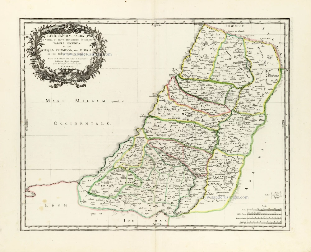
Geographiae Sacrae ex Veteri et Novo Testamento desumptae Tabula Secunda: in qua Terra Promissa, sive Iudaea in suas Tribus Partesq, distincta.
Item Number: 30105 Authenticity Guarantee
Category: Antique maps > Asia > Holy Land
Old, antique map of Holy Land by Nicolas Sanson.
Title: Geographiae Sacrae ex Veteri et Novo Testamento desumptae Tabula Secunda: in qua Terra Promissa, sive Iudaea in suas Tribus Partesq, distincta.
Autore N. Sanson Abbanillaeo et Christianis. Galliarum Regis Geographo.
Cum Privilegio Annorum Viginti. MDCLXII. [1662]
Date: 1665.
Date on map: 1662.
Copper engraving, printed on paper.
Image size: 390 x 495mm (15.35 x 19.49 inches).
Sheet size: 490 x 635mm (19.29 x 25 inches).
Verso: Blank.
Condition: Original coloured in outline, excellent.
Condition Rating: A+.
From: Sanson N. & G. Cartes generales de toutes les parties du monde, ou les empires, monarchies, republiques, estats, peuples, &c. ... Paris, P. Mariette, 1665. (Pastoureau, Sanson V B 1665)
Nicolas Sanson (1600-1667) - Guillaume Sanson (1633-1703)
Originally from Abbeville, Nicolas I Sanson showed a keen interest in historical geography. Still very young, he published a map of ancient Gaul and two treatises, Britannia and Portus Itius on Abbeville and Boulogne's origins. His meeting with Melchior Tavernier was decisive: it prompted him to give up his duties as a military engineer in Picardy and devote himself to engraved cartography.
At the same time, Sanson had drawn up the outline of modern France. He got the help of Tavernier who encouraged him to compete with the Dutch map publishers. Tavernier contacted other French cartographers whose works he published.
From 1643, N. Sanson obtained a privilege to publish a work personally, the Princes souverains de l'Italie. Then, in 1644 and 1645, he had his famous geographical tables printed, which significantly contributed to his fame. He also published a series of atlases in quarto of the four continents.
In 1648, N. Sanson associated himself with Mariette for the publishing of atlases. From then on, certain maps bore his name, and others Mariette's. N. Sanson and Mariette worked together for more than 20 years. After the death of N. Sanson, Mariette acquired the entire fund. Since Mariette only wanted to publish complete atlases, individual maps were no longer sold, and some army generals complained to the king.
The disagreement between the Sanson family and Pierre II Mariette culminated in 1671 when Guillaume Sanson took the case to court. From then on, there was no longer any question of collaboration: Guillaume Sanson started working for another publisher, Alexis-Hubert Jaillot.
The Sanson family faced financial difficulties, and in 1692, their cousin, Pierre Moullart-Sanson, bought the entire geographic fund from his uncles and aunt. Moullart-Sanson restarted the publishing of Sanson's world atlas, and in 1704 he acquired a privilege for publishing all the works of Nicolas and Guillaume Sanson, which continued to be published until 1730.
Related items

Palaestinae sive totius Terrae Promissionis nova descriptio Auctore Tilemanno Stella Sigenensi. 1624
Holy Land, by Abraham Ortelius.
[Item number: 1583]

Tribus Aser 1590
The Holy Land, by Adrichomius C.
[Item number: 1891]

Tribus Zabulon, Isachar, Et, Dimidia Manasse ... 1590
Holy Land, by Adrichomius C.
[Item number: 1902]

Vue et Description de Bethleem et de Nazareth et de Plusieurs Singularitez Curieuses .. 1719
Holy Land - Bethlehem - Nazareth, by Z. Châtelain.
[Item number: 16855]

Terra Sancta quae in Sacris Terra Promissionis ol: Palestina 1630
HOLY LAND by Mercator - Janssonius
[Item number: 17710]

Beschreibung des Heiligen Landes Canaan. 1581
The Holy Land, by Bünting H.
[Item number: 18420]
Iudaea, seu Terra Sancta quae Hebraeorum sive Israelitarum ... c. 1700
HOLY LAND by Schenk P.
[Item number: 19146]

Situs Terrae Promissionis. S.S. Bibliorum intelligentiam exacte aperiens per Chr. Adrichom. c. 1658
The Holy Land, by Janssonius J.
[Item number: 19521]
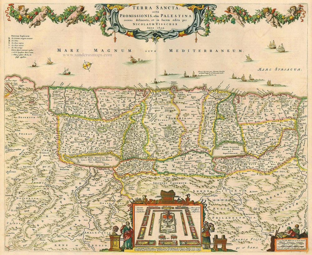
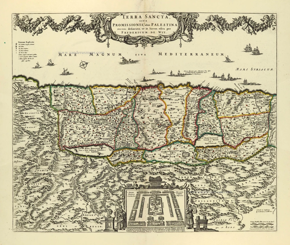
Terra Sancta, sive Promissionis, olim Palestina recens delineata. 1683-1696
The Holy Land, by Visscher N.
[Item number: 19522]

Reisen der Kinder von Israel aus Egypten. 1582
Holy Land - Egypt by Heinrich Bünting.
[Item number: 22612]

Taffel des Heiligen Landes zu dem Newen Testament dienlich. 1582
Holy Land, by Bünting H.
[Item number: 22640]

Terra Sancta, A Petro Laicstain perlustrata, et ab eius ore et schedisà Chistino Schrot in tabulam redacta. 1612
Holy Land by Abraham Ortelius.
[Item number: 23099]

Situs Terrae Canaan sive Terrae Promissionis, hodie Palestinae, ... 1710
The Holy Land, by Jaillot - Covens & Mortier.
[Item number: 23600]

Terra Sancta, sive Promissionis, olim Palestina recens delineata. 1683-1696
The Holy Land by Nicolaas Visscher
[Item number: 24441]

Terre Sainte Suivant les Nouvelles Observations. 1713
The Holy Land, by Pieter van der Aa.
[Item number: 26110]

La Judée ou Terre Sainte divisée en ses Douze Tribus. 1776-79
Holy Land, by Paolo Santini.
[Item number: 27015]
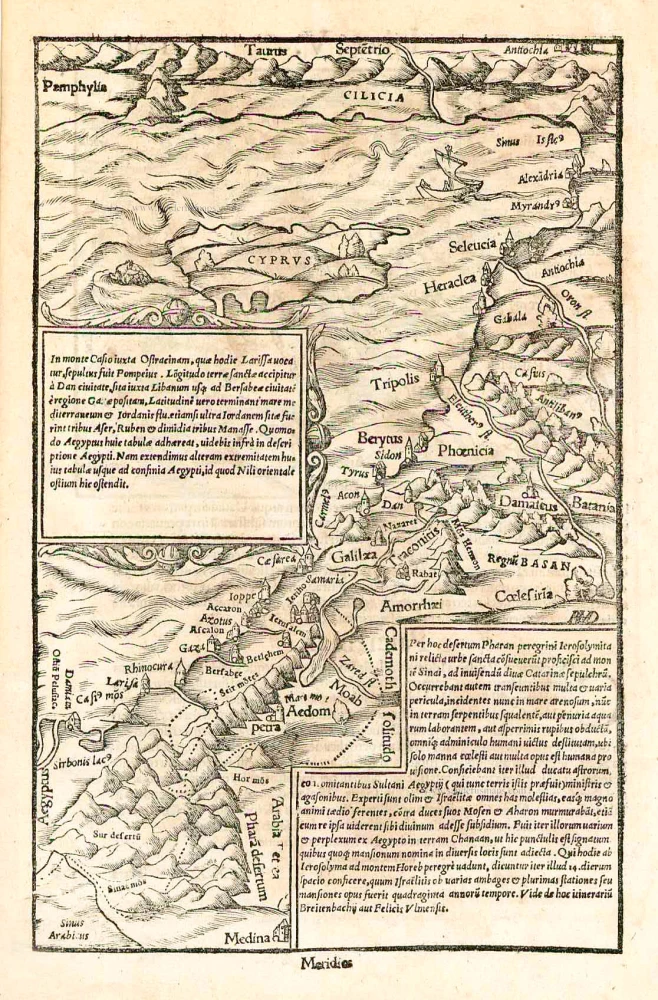
In monte Casio iuxta Ostracinam, ... 1550
Cyprus and the Holy Land, by Sebastian Münster.
[Item number: 27073]
Terra Sancta, sive Promissionis, olim Palestina. after 1721
Holy Land by Frederik de Wit, published by Covens & Mortier.
[Item number: 28329]

Terra Sancta, sive Promissionis, olim Palestina recens delineata. 1664-80
The Holy Land by Nicolaas Visscher.
[Item number: 28582]

Terra Sancta, A Petro Laicstain perlustrata, et ab eius ore et schedisà Chistino Schrot in tabulam redacta. 1601
Holy Land by Abraham Ortelius.
[Item number: 28669]
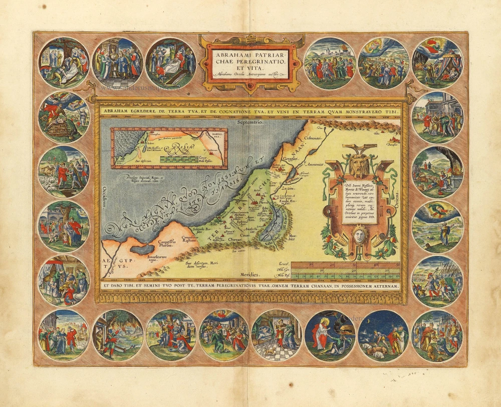
Parergon map
Abrahami Patriarchae Peregrinatio, et Vita. 1612
The Holy Land by Abraham Ortelius.
[Item number: 28921]

Carte de la Terre Sainte Divisée dans Toutes ses Parties selon le nombre des Tribus d'Israel. 1719
Holy Land, by Zacharias Châtelain.
[Item number: 29383]

The most decorative map of the Holy Land to be included in a seventeenth century atlas
Palestina, sive Terrae Sanctae Descriptio. 1666
The Holy Land by Joannes Janssonius.
[Item number: 29972]

Palestinae Delineatio Ad Geographiae Canones Revocata. 1641
Holy Land - Jerusalem by Philippe Briet, published by Pierre Mariette.
[Item number: 30056]

Pinax Geogpaphicus [sic] Patriarchatus Hierosolymitani [...] 1651
The Patriarchate of Jerusalem, by Philippe de la Rue, published by Pierre Mariette.
[Item number: 30120]
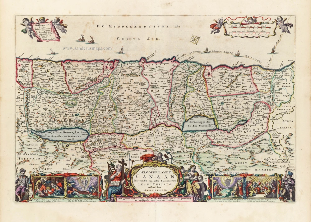
Superb old colouring, heightened with gold.
Het Beloofde Landt Canaan door wandelt van onsen Salichmaeker Iesu Christo, neffens syne Apostelen. 1663
Holy Land by Nicolaas Visscher.
[Item number: 30535]
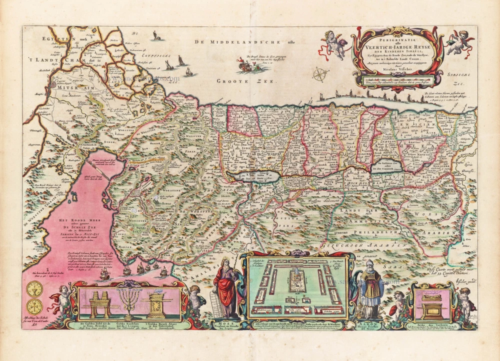
Superb old colouring, heightened with gold.
Perigrinatie ofte Veertigh-Iarige Reyse der Kinderen Israëls. 1663
Holy Land, by Nicolaes Visscher I.
[Item number: 30538]

Holy Land map from the very rare van Liesveldt Bible
Die ghelegentheit ende die palen des lants van Beloften. 1532-1560
Holy Land by van Jacob van Liesveldt.
[Item number: 30549]

Terra Sancta quae in Sacris Terra Promissionis olim Palestina. 1645
Holy Land, by Willem Blaeu.
[Item number: 30914]

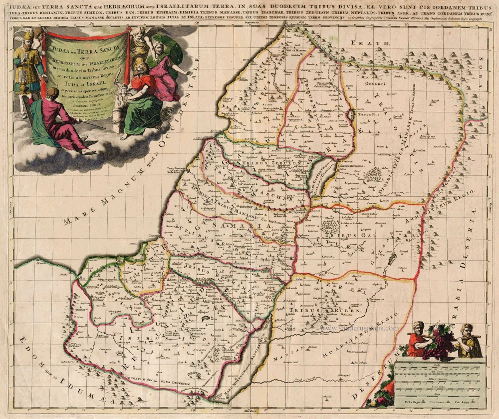
Iudaea seu Terra Sancta quae Hebraeorum sive Israelitarum in suas duodecim Tribus divisa; secretis ab invicem Regnis Iuda et Israel. 1692
Holy Land by N. Sanson, so-called published by Hubert Jaillot. (Pirated edition by Pierre Mortier).
[Item number: 31200]

Tabula Cananaeae prout tempore Christi et Apostolorum divisa fuit 1618
Holy Land by Petrus Bertius, published by Jodocus Hondius II.
[Item number: 32140]

Iudaea seu Palaestina ob Sacratißima Redemtoris vestigia hodie dicta Terra Sancta prout olim in Duodecim Tribus Divisa separatis ab Invicem Regnis Iuda et Israel expreßis insuper VI ultimi temporis ejusdem Terrae Procinciis. c. 1720
Holy Land, by J.B. Homann.
[Item number: 32192]