
Ceylon and Maldives by Petrus Bertius. 1618
Petrus Bertius (1565-1629)
Petrus Bertius, born at Beveren, Flanders, in 1565, was related to Pieter van den Keere (Kaerius) and Jodocus Hondius. Both famous cartographers were brothers-in-law of Petrus Bertius. As a refugee, he settled in Amsterdam, and after finishing his studies, he became a professor of mathematics and librarian at the University of Leiden. In 1618, he became a cosmographer and historiographer for Louis XIII of France. He lived in Paris, where he died in 1629.
Petrus Bertius's remarkable work ethic is evident in the numerous geographical and theological works he produced. His contributions to the works of Clüver and Herrera further solidified his reputation in geography.
His fame among geographers was established by his text in the pocket atlas Tabularum Geographicarum and by his edition of Ptolemy’s Geographia.
The origin of the Tabularum Geographicum lies in the well-known miniature atlas Caert thresoor, published by Barent Langenes in 1598 in Middelburg. Bertius engraved 169 maps for this small but attractive atlas, sold for the first time in 1599 by Cornelis Claesz in Amsterdam. In 1600, Claesz published the pocket atlas with a Latin text composed by Petrus Bertius. From then on, new editions, often enlarged with new maps, regularly appeared, subsequently published by Cornelis Claesz, Jodocus Hondius, Johannes Janssonius and ultimately, in 1649, by Claes Jansz. Visscher.
Koeman divides this series of pocketbooks into two atlases: The Caert-thresoor, published by Langenes and Claesz., with five editions between 1598 and 1609, and the Tabularum Geographicarum Contractarum by Petrus Bertius with ten editions between 1600 and 1650.
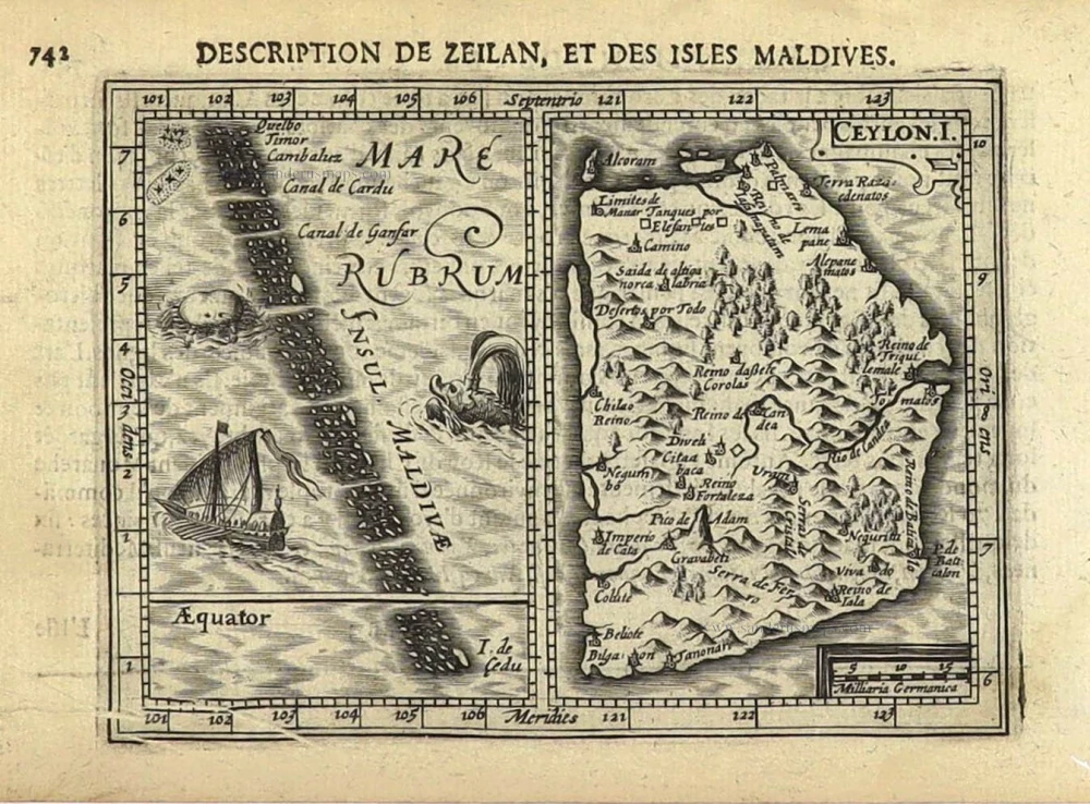
Ceylon. I. [Title above map:] Description de Zeilan, et des Isles Maldives.
Item Number: 28392 Authenticity Guarantee
Category: Antique maps > Asia > India - Ceylon
Old, antique map of Ceylon and Maldives, by Bertius Petrus.
Title: Ceylon. I. [Title above map:] Description de Zeilan, et des Isles Maldives.
Date of the first edition: 1616.
Date of this map: 1618.
Copper engraving, printed on paper.
Map size: 95 x 135mm (3.74 x 5.31 inches).
Sheet size: 120 x 180mm (4.72 x 7.09 inches).
Verso: French text.
Condition: Excellent.
Condition Rating: A+.
References: Van der Krogt 3, 8380:342
From: La Geographie Racourcie de Pierre Bertius. Amsterdam, Jodocus Hondius jr. 1618. (Van der Krogt 3, 342:11)
Petrus Bertius (1565-1629)
Petrus Bertius, born at Beveren, Flanders, in 1565, was related to Pieter van den Keere (Kaerius) and Jodocus Hondius. Both famous cartographers were brothers-in-law of Petrus Bertius. As a refugee, he settled in Amsterdam, and after finishing his studies, he became a professor of mathematics and librarian at the University of Leiden. In 1618, he became a cosmographer and historiographer for Louis XIII of France. He lived in Paris, where he died in 1629.
Petrus Bertius's remarkable work ethic is evident in the numerous geographical and theological works he produced. His contributions to the works of Clüver and Herrera further solidified his reputation in geography.
His fame among geographers was established by his text in the pocket atlas Tabularum Geographicarum and by his edition of Ptolemy’s Geographia.
The origin of the Tabularum Geographicum lies in the well-known miniature atlas Caert thresoor, published by Barent Langenes in 1598 in Middelburg. Bertius engraved 169 maps for this small but attractive atlas, sold for the first time in 1599 by Cornelis Claesz in Amsterdam. In 1600, Claesz published the pocket atlas with a Latin text composed by Petrus Bertius. From then on, new editions, often enlarged with new maps, regularly appeared, subsequently published by Cornelis Claesz, Jodocus Hondius, Johannes Janssonius and ultimately, in 1649, by Claes Jansz. Visscher.
Koeman divides this series of pocketbooks into two atlases: The Caert-thresoor, published by Langenes and Claesz., with five editions between 1598 and 1609, and the Tabularum Geographicarum Contractarum by Petrus Bertius with ten editions between 1600 and 1650.
Related items
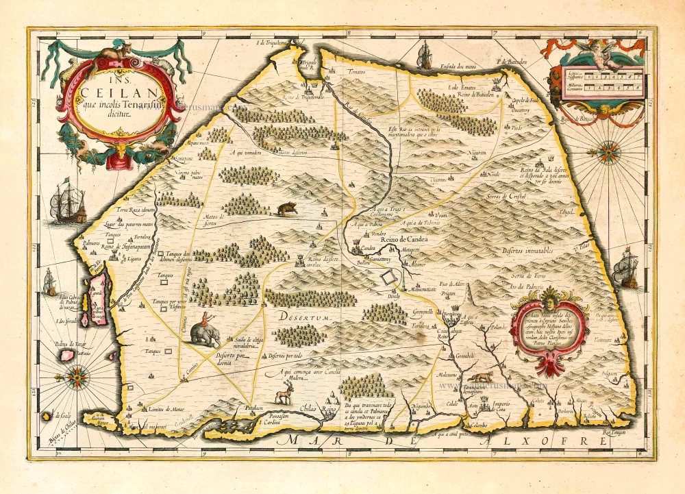
Ins. Ceilan quae incolis Tenarisin dicitur. 1638
Sri Lanka (Ceylon), by Jodocus Hondius.
[Item number: 26006]
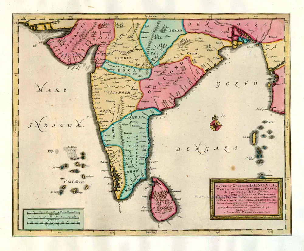
Carte du Golfe de Bengale, Mer des Indes, et Riviere du Gange, Avec les Païs et Iles d'alentour, Savoir les Côtes de Malabar, Cormandel, Ile de Ceylon, les Maldives, les Rolaumes de Visiapour, Golconda, Guzaratte, etc. 1713
India and Ceylon (Sri Lanka), by Pieter van der Aa.
[Item number: 26095]

Peninsula Indiae citra Gangem, hoc est Orae Celeberrimae Malabar & Coromandel. Cum Adjacente Insula non Minus Celebratissima Ceylon. c. 1737
India & Ceylon, by Homann Heirs.
[Item number: 26752]
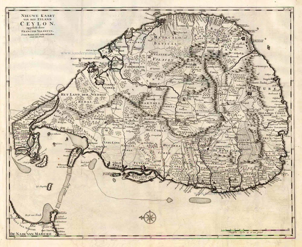
Nieuwe kaart van het eyland Ceylon. 1724-26
Ceylon (Sri Lanka) by François Valentyn (Valentijn)
[Item number: 26901]
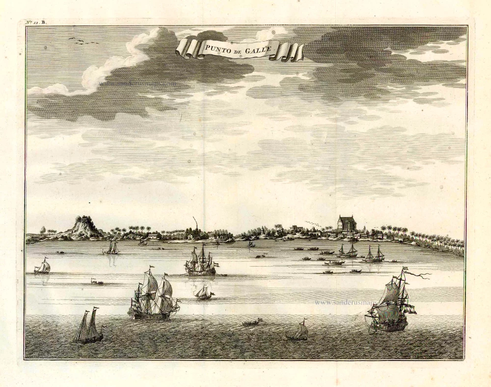
Punto de Galle. 1724-26
Galle (Ceylon - Sri Lanka) ,by François Valentyn (Valentijn).
[Item number: 26902]
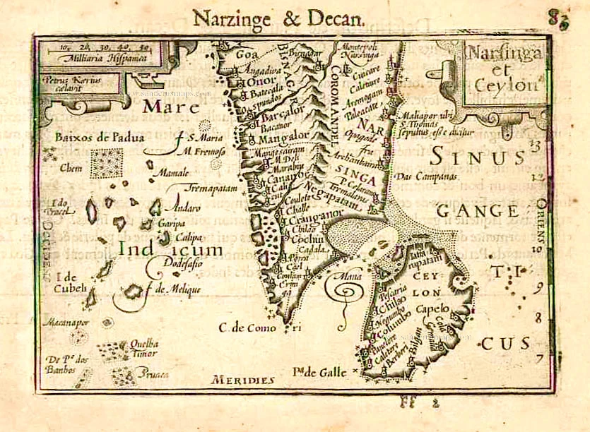
Narsinga et Ceylon. c. 1600
South India and Ceylon by Barent Langenes & Cornelis Claesz
[Item number: 26999]
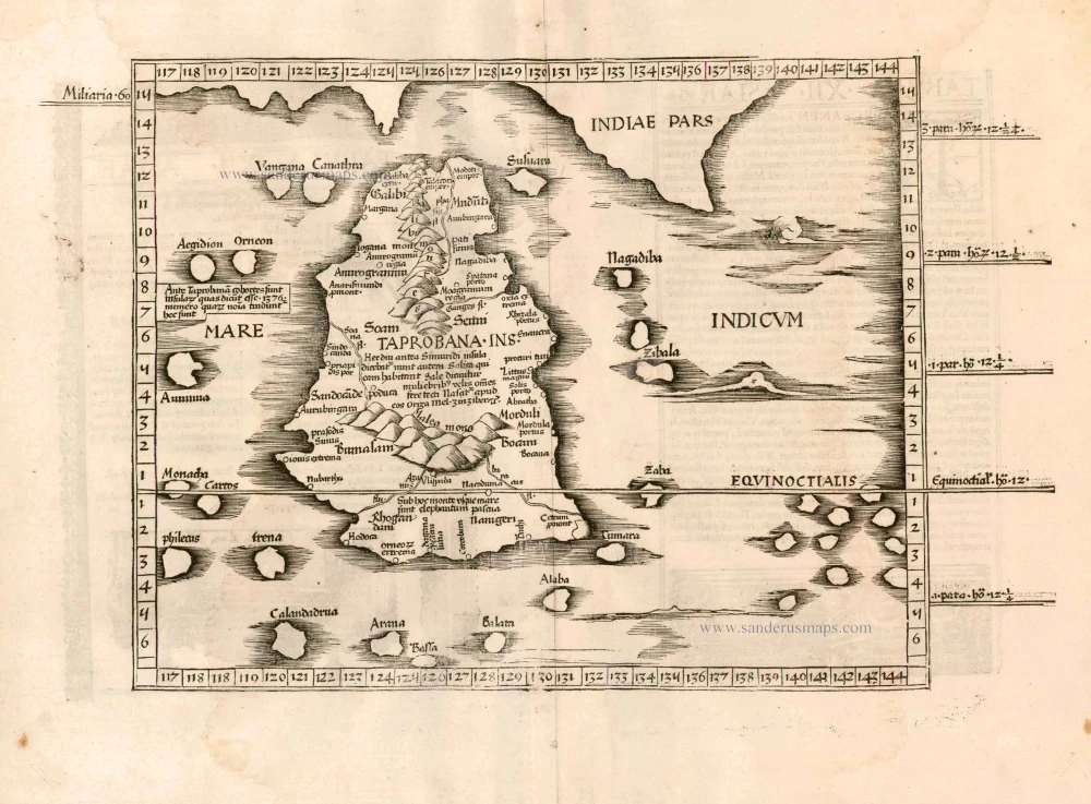
[No title] 1525
Ceylon (Sri Lanka), by Lorenz Fries.
[Item number: 27932]
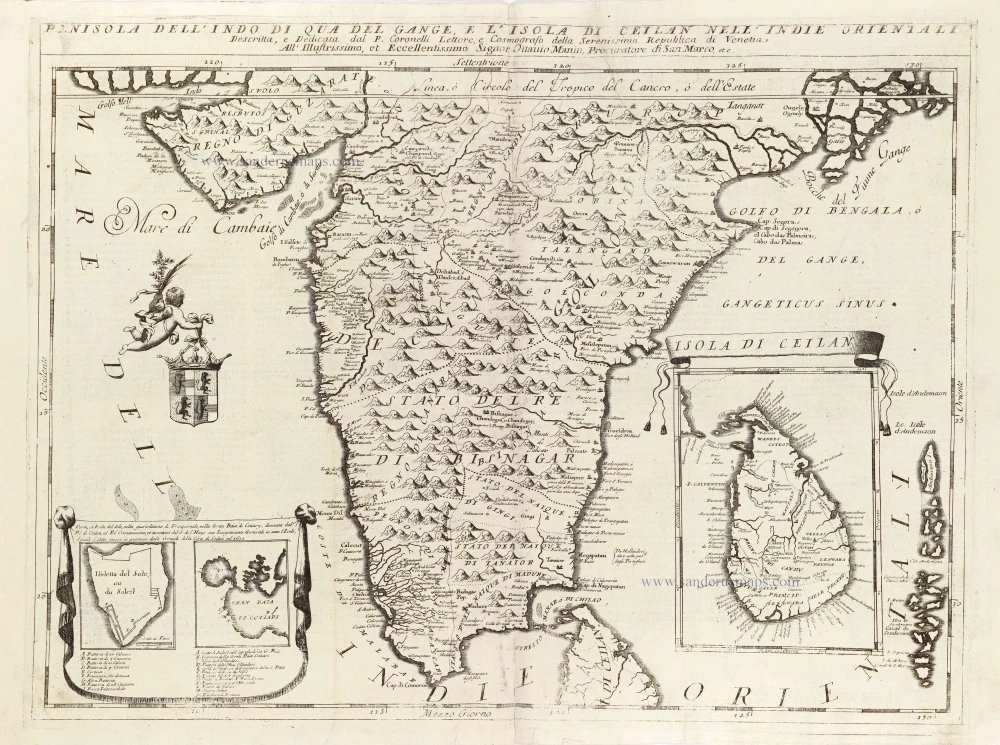
Penisola dell'Indo di qua del Gange, e l'Isola di Ceilan nell'Indie Orientali. 1696
India - Ceylon (Sri Lanka) by Vincenzo Coronelli.
[Item number: 28674]
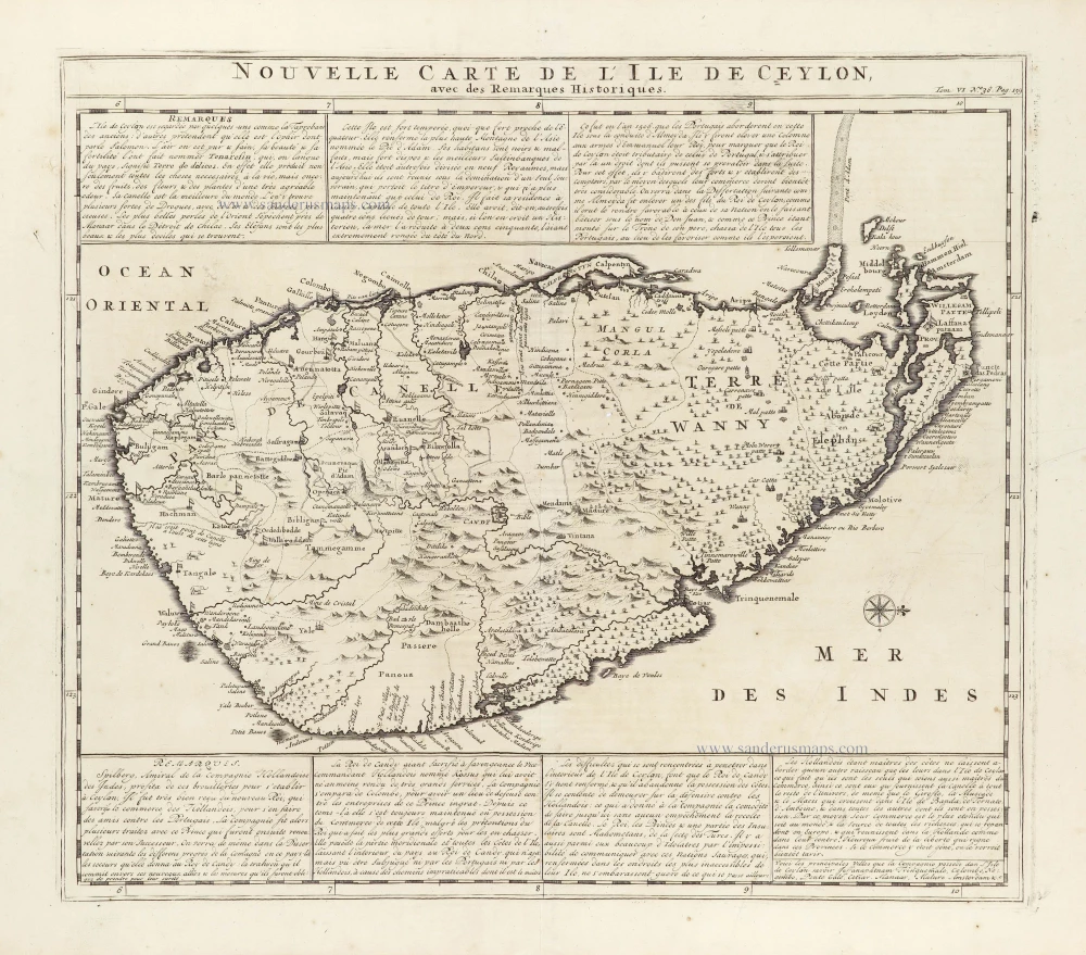
Nouvelle Carte de L'Ile de Ceylon, avec des Remarques Historiques. 1719
Ceylon (Sri Lanka), by Zacharias Châtelain.
[Item number: 29360]
SCARCE !
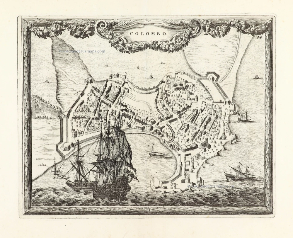
Colombo. 1685/90
Ceylon (Sri Lanka) - Colombo, by Carel Allard.
[Item number: 30576]