
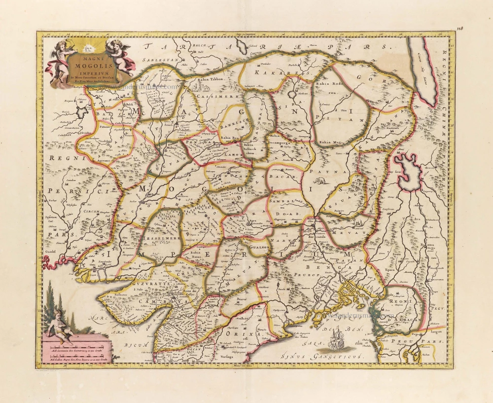
Mongol Empire, by Frederick de Wit - Covens & Mortier. After 1721

Frederick de Wit (1630-1706)
The engraver and map-seller, Frederick de Wit, was born in Gouda (Netherlands) in 1630 as a son of Hendrick Fredericksz de Wit. Through his marriage with Maria van der Waag of Amsterdam in 1661, he obtained citizenship of the city where he had been working since 1648 and where he became one of the most famous engravers of maps of the second half of the 17th century. Although De Wit was a Catholic, which meant that he was not favoured at the time by the city council, he was awarded the honour of being listed as one of the "excellent citizens" on the roll of the city council in the years 1694-1704. However, his name was not written in the Guild of St. Luke book before 1664. At that time, he lived on the Kalverstraat "in de Witte Pascaert", where he stayed until his death in 1706. His earliest dates on maps engraved are 1659 (Regni Daniae) and 1660 (World map).
Frederick de Wit published several world atlases, a sea atlas, and an atlas of the Netherlands.
The dating of the maps is difficult. However, as a privilege was granted in 1689, the annotation 'cum privilegio' marks an edition after 1688.
Around 1700, Frederick de Wit entered the market with a town atlas. He produced two volumes with a total of 260 plans and views. Most were printed from plates used for Janssonius and Blaeu town atlases.
After he died in 1706, his widow continued the shop until 1709. The plates and stock of De Wit's atlas were sold to Covens & Mortier in 1710, who sold the atlas for an extended period.
Covens & Mortier. A Map Publishing House in Amsterdam. 1721-1866.
For almost two centuries, the Amsterdam firm of Covens & Mortier was the most significant and crucial Dutch publishing house in commercial cartography. In terms of quantity, it was the biggest contemporary map-trading house worldwide, distributing innumerable maps, atlases, globes, and books.
Pieter (Pierre) Mortier (Leiden, 1661 – Amsterdam, 1711)
Nothing is known about the youth of Pieter Mortier. He studied in Paris from 1681 to approximately 1685. He must have come into contact with French 'libraires' and learned the bookselling trade there. In 1685, he returned to Amsterdam and opened a small bookshop. He joined the Book, Art Sellers' and Printers' Guild the same year.
Pieter sold books in Dutch and foreign languages but also published books himself, usually in French. His business flourished so much that in 1688, he was forced to rent another house on the Vijgendam.
Pieter Mortier's first privilege for maps was granted by the States of Holland and West Friesland on September 15, 1690. It refers to Sanson's maps, which he 'is printing and correcting with great pains and care'.
Pieter began publishing maps and atlases on a large scale. By the beginning of the 18th century, he had become so wealthy that he could purchase three houses in Amsterdam: the Beurssluis, on the Vijgendam, and the Heremietensteeg. He rebuilt the Vijgendam house into a large, prestigious structure that would serve for over a century as a shop, business, and residential structure for Covens & Mortier's publishing house.
He died on February 13, 1711, after a brief illness. The company continued under the management of Pieter's widow, Amelia' s-Gravesande.
After she died in 1719, her son, Cornelis, took over the management for a few years.
On November 20, 1721, a company was founded by Cornelis Mortier and Johannes Covens I. The latter was married the same year to Cornelis's sister. From that year on, the name of :
Covens & Mortier.
Their firm would see a massive expansion in the next 140 years. In 1732, the heirs sold the property to their brother Cornelis and his partner Covens. Their main competitors were Reinier & Josua Ottens and Gerard Valck & Petrus Schenck. After the death of Johannes Covens I (1774), his son Johannes Covens II (1722-1794) entered the business. In 1778, Johannes added a new company name :
J. Covens & Son.
Johannes Covens II was succeeded by his son Cornelis Covens (1764-1825), who, in turn, brought Peter Mortier IV, the great-grandson of Petrus Mortier I, into the business. The name was from 1794 to 1866:
Mortier, Covens & Son.
The last Covens in the series was Cornelis Johannes Covens (1806-1880).
Covens & Mortier had a large stock of atlases and maps, including Delisle, Jaillot, Johannes Janssonius, Sanson, and Claes Jansz. Visscher, Nicolaas Visscher, and Frederik de Wit. For decades, the press produced an impressive number of atlases.
Magni Mogolis Imperium.
Item Number: 25838 Authenticity Guarantee
Category: Antique maps > Asia > India - Ceylon
Old, antique map of India (North) by F. de Wit - Covens & Mortier.
Title: Magni Mogolis Imperium.
de Novo Correctum et Dicisum
Per F. de Witt Amstelodami
ex Officina I. Covens & C. Mortier.
Cartographer: F. de Wit.
Date of the first edition: ca. 1705-06.
Date of this map: After 1721.
Copper engraving, printed on paper.
Size (not including margins): 410 x 510mm (16.14 x 20.08 inches).
Verso: Blank.
Condition: Original coloured in outline, excellent.
Condition Rating: A+.
From: Composite Atlas. Amsterdam, J. Covens & C. Mortier, After 1721.
Frederick de Wit (1630-1706)
The engraver and map-seller, Frederick de Wit, was born in Gouda (Netherlands) in 1630 as a son of Hendrick Fredericksz de Wit. Through his marriage with Maria van der Waag of Amsterdam in 1661, he obtained citizenship of the city where he had been working since 1648 and where he became one of the most famous engravers of maps of the second half of the 17th century. Although De Wit was a Catholic, which meant that he was not favoured at the time by the city council, he was awarded the honour of being listed as one of the "excellent citizens" on the roll of the city council in the years 1694-1704. However, his name was not written in the Guild of St. Luke book before 1664. At that time, he lived on the Kalverstraat "in de Witte Pascaert", where he stayed until his death in 1706. His earliest dates on maps engraved are 1659 (Regni Daniae) and 1660 (World map).
Frederick de Wit published several world atlases, a sea atlas, and an atlas of the Netherlands.
The dating of the maps is difficult. However, as a privilege was granted in 1689, the annotation 'cum privilegio' marks an edition after 1688.
Around 1700, Frederick de Wit entered the market with a town atlas. He produced two volumes with a total of 260 plans and views. Most were printed from plates used for Janssonius and Blaeu town atlases.
After he died in 1706, his widow continued the shop until 1709. The plates and stock of De Wit's atlas were sold to Covens & Mortier in 1710, who sold the atlas for an extended period.
Covens & Mortier. A Map Publishing House in Amsterdam. 1721-1866.
For almost two centuries, the Amsterdam firm of Covens & Mortier was the most significant and crucial Dutch publishing house in commercial cartography. In terms of quantity, it was the biggest contemporary map-trading house worldwide, distributing innumerable maps, atlases, globes, and books.
Pieter (Pierre) Mortier (Leiden, 1661 – Amsterdam, 1711)
Nothing is known about the youth of Pieter Mortier. He studied in Paris from 1681 to approximately 1685. He must have come into contact with French 'libraires' and learned the bookselling trade there. In 1685, he returned to Amsterdam and opened a small bookshop. He joined the Book, Art Sellers' and Printers' Guild the same year.
Pieter sold books in Dutch and foreign languages but also published books himself, usually in French. His business flourished so much that in 1688, he was forced to rent another house on the Vijgendam.
Pieter Mortier's first privilege for maps was granted by the States of Holland and West Friesland on September 15, 1690. It refers to Sanson's maps, which he 'is printing and correcting with great pains and care'.
Pieter began publishing maps and atlases on a large scale. By the beginning of the 18th century, he had become so wealthy that he could purchase three houses in Amsterdam: the Beurssluis, on the Vijgendam, and the Heremietensteeg. He rebuilt the Vijgendam house into a large, prestigious structure that would serve for over a century as a shop, business, and residential structure for Covens & Mortier's publishing house.
He died on February 13, 1711, after a brief illness. The company continued under the management of Pieter's widow, Amelia' s-Gravesande.
After she died in 1719, her son, Cornelis, took over the management for a few years.
On November 20, 1721, a company was founded by Cornelis Mortier and Johannes Covens I. The latter was married the same year to Cornelis's sister. From that year on, the name of :
Covens & Mortier.
Their firm would see a massive expansion in the next 140 years. In 1732, the heirs sold the property to their brother Cornelis and his partner Covens. Their main competitors were Reinier & Josua Ottens and Gerard Valck & Petrus Schenck. After the death of Johannes Covens I (1774), his son Johannes Covens II (1722-1794) entered the business. In 1778, Johannes added a new company name :
J. Covens & Son.
Johannes Covens II was succeeded by his son Cornelis Covens (1764-1825), who, in turn, brought Peter Mortier IV, the great-grandson of Petrus Mortier I, into the business. The name was from 1794 to 1866:
Mortier, Covens & Son.
The last Covens in the series was Cornelis Johannes Covens (1806-1880).
Covens & Mortier had a large stock of atlases and maps, including Delisle, Jaillot, Johannes Janssonius, Sanson, and Claes Jansz. Visscher, Nicolaas Visscher, and Frederik de Wit. For decades, the press produced an impressive number of atlases.
Related items

Partie de la Nouvelle Grande Carte des Indes Orientales, Contenant les Isles Maldives, Ceylan, Malacca, Sumatra &c. 1792
Indian Ocean (North), by J.B. Elwe.
[Item number: 2363]
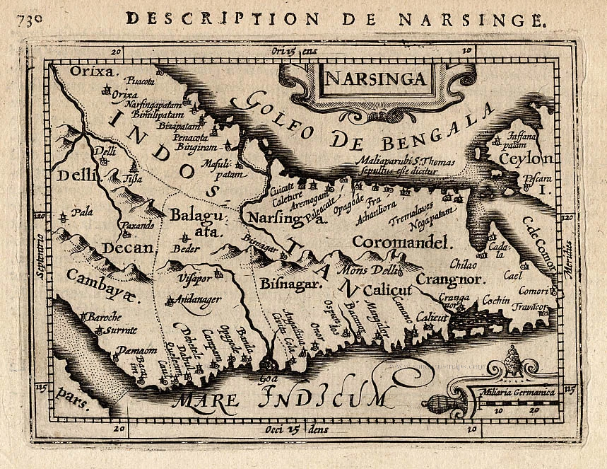
Narsinga. 1618
Narsinga, by P. Bertius.
[Item number: 18299]

Carte des Cotes de Malabar et de Coromandel. 1721-41
India by Guillaume Delisle, published by Covens & Mortier.
[Item number: 23609]

Goa. 1638
Goa, by M. Merian.
[Item number: 25903]

Carte du Golfe de Bengale, Mer des Indes, et Riviere du Gange, Avec les Païs et Iles d'alentour, Savoir les Côtes de Malabar, Cormandel, Ile de Ceylon, les Maldives, les Rolaumes de Visiapour, Golconda, Guzaratte, etc. 1713
India and Ceylon (Sri Lanka), by Pieter van der Aa.
[Item number: 26095]
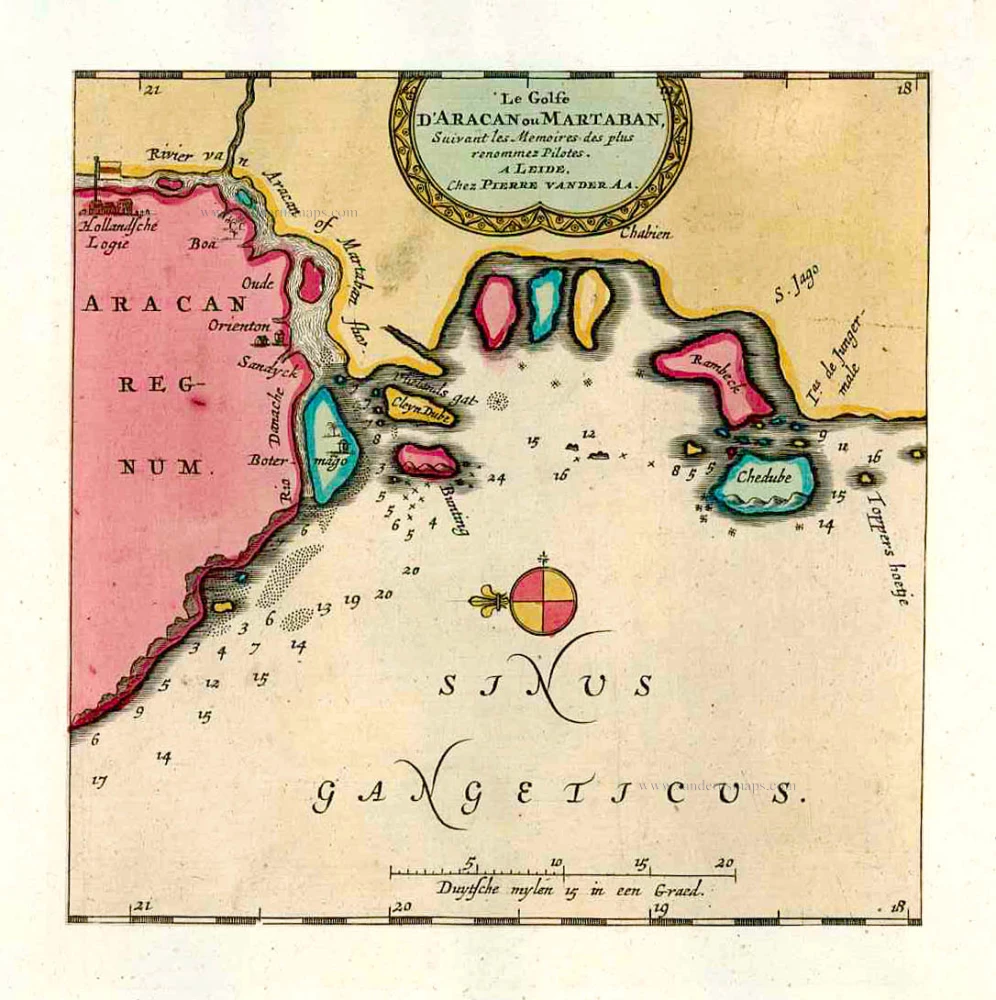
Le Golfe D'Aracan ou Martaban. 1713
The Gulf of Martaban, by Pieter van der Aa.
[Item number: 26106]

Royaume du Grand Mogol, avec tous les Pays qui en dépendent, suivant les Relations des fideles Voyageurs. 1713
India by Pieter van de Aa
[Item number: 26117]

Tabula Asiae XI. 1597
India, by Giovanni Magini
[Item number: 26522]

Peninsula Indiae citra Gangem, hoc est Orae Celeberrimae Malabar & Coromandel. Cum Adjacente Insula non Minus Celebratissima Ceylon. c. 1737
India & Ceylon, by Homann Heirs.
[Item number: 26752]

Nieuwe kaart van Choromandel ende Malabar. 1724-26
Southern India, by François Valentyn (Valentijn).
[Item number: 26896]

Tabula .X. Asiae. [On verso] 1525
Ptolemy map of India by Lorenz Fries, after Martin Waldseemüller.
[Item number: 28198]
Magni Mogolis Imperium. c. 1691-97
Mongol Empire, by Frederick de Wit.
[Item number: 29092]

Cambaia 1618
India - Cambay by Petrus Bertius, published by Jodocus Hondius II.
[Item number: 32145]

Malabar. 1618
India - Malabar by Petrus Bertius, published by Jodocus Hondius II.
[Item number: 32146]
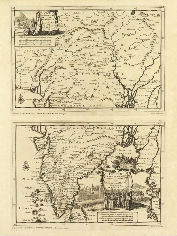
'T Ryk van den Grooten Mogol met de Grenzen van Cambaya en 't Koninkryk Deli etc. + Indien binnen de Ganges Vertoonende de Koninkryken van Golconda, Decan, Bisnaga en Grenzen van Mogol. 1707
India on two maps, by Pieter Van der Aa.
[Item number: 32362]

H[et] Koninkryk van Guzaratte met d'engte van Cambaya en der selver vloeden, 1707
India - Cambay, by Pieter Van der Aa.
[Item number: 32363]

De Koninkryken van Guzaratte Cambaya en Mogol tot aan Bengale en Pegu. 1707
India by Pieter Van der Aa.
[Item number: 32392]

Magni Mogolis Imperium. 1643
India, by Joan Blaeu.
[Item number: 32739]