
Scarce
Japan by Petrus Bertius, published by Jodocus Hondius jr. 1616
Petrus Bertius (1565-1629)
Petrus Bertius, born at Beveren, Flanders in 1565, was related with Pieter van den Keere (Kaerius) and Jodocus Hondius. Both famous cartographers were brothers-in-law of Petrus Bertius. As a refugee, he settled in Amsterdam and, after finishing his studies, he became professor of mathematics and librarian at the University of Leiden. In 1618 he also became cosmographer and historiographer to Louis XIII of France and lived in Paris, where he died in 1629.
His enormous working power resulted in many geographical and theological works. He also contributed geographic materials to the works of Clüver and Herrera.
His fame among geographers was established by his text in the pocket atlas Tabularum Geographicarum and by his edition of Ptolemy’s Geographia.
The origin of the Tabularum Geographicum lies in the well-know miniature atlas Caert thresoor, published by Barent Langenes in 1598 in Middelburg. Bertius engraved 169 maps for this small but attractive atlas which was also sold for the first time in 1599 by Cornelis Claesz in Amsterdam. In 1600, Claesz published the pocket atlas with a Latin text composed by Petrus Bertius. From then on, new editions, often enlarged with new maps, regularly appeared, subsequently published by Cornellis Claesz, Jodocus Hondius, Johannes Janssonius and ultimately, in 1649, by Claes Jansz. Visscher.
Koeman divides this series of pocketbooks into two atlases: The Caert-thresoor, published by Langenes and Claesz., with five editions between 1598 and 1609; and the Tabularum Geographicarum Contractarum by Petrus Bertius with ten editions between 1600 and 1650.
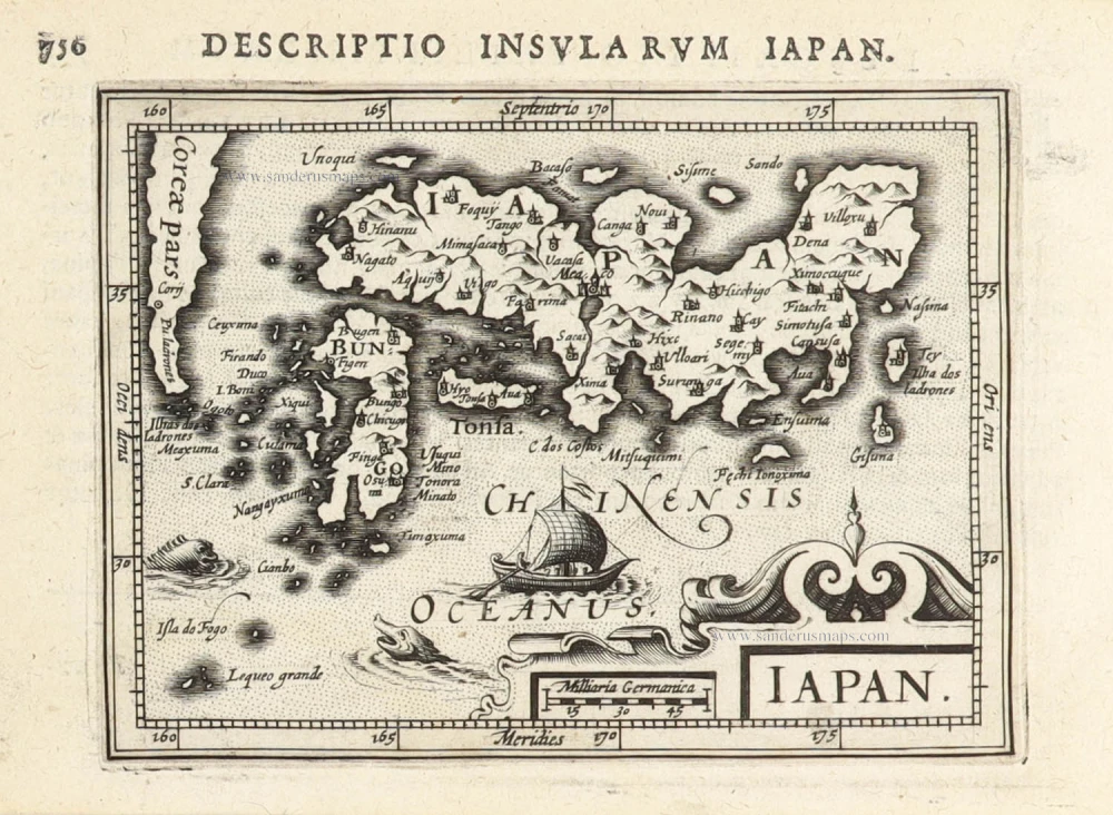
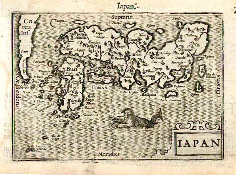
Iapan.
Item Number: 30244 Authenticity Guarantee
Category: Antique maps > Asia > Japan
Japan by Petrus Bertius, published by Jodocus Hondius jr.
Title: Iapan.
Date of the first edition: 1616.
Date of this map: 1616.
Copper engraving, printed on paper.
Image size: 95 x 130mm (3.74 x 5.12 inches).
Sheet size: 120 x 190mm (4.72 x 7.48 inches).
Verso: Latin text.
Condition: Excellent.
Condition Rating: A+.
From: P. Bertij; Tabularum Geographicarum Contractarum Libri septem ... Sumptibus et typus aeneis Iodoci Hondij. Amsterdam, Jodocus Hondius Jr., 1616. First edition. (Van der Krogt 3, 342:01)
Petrus Bertius (1565-1629)
Petrus Bertius, born at Beveren, Flanders in 1565, was related with Pieter van den Keere (Kaerius) and Jodocus Hondius. Both famous cartographers were brothers-in-law of Petrus Bertius. As a refugee, he settled in Amsterdam and, after finishing his studies, he became professor of mathematics and librarian at the University of Leiden. In 1618 he also became cosmographer and historiographer to Louis XIII of France and lived in Paris, where he died in 1629.
His enormous working power resulted in many geographical and theological works. He also contributed geographic materials to the works of Clüver and Herrera.
His fame among geographers was established by his text in the pocket atlas Tabularum Geographicarum and by his edition of Ptolemy’s Geographia.
The origin of the Tabularum Geographicum lies in the well-know miniature atlas Caert thresoor, published by Barent Langenes in 1598 in Middelburg. Bertius engraved 169 maps for this small but attractive atlas which was also sold for the first time in 1599 by Cornelis Claesz in Amsterdam. In 1600, Claesz published the pocket atlas with a Latin text composed by Petrus Bertius. From then on, new editions, often enlarged with new maps, regularly appeared, subsequently published by Cornellis Claesz, Jodocus Hondius, Johannes Janssonius and ultimately, in 1649, by Claes Jansz. Visscher.
Koeman divides this series of pocketbooks into two atlases: The Caert-thresoor, published by Langenes and Claesz., with five editions between 1598 and 1609; and the Tabularum Geographicarum Contractarum by Petrus Bertius with ten editions between 1600 and 1650.
Related items

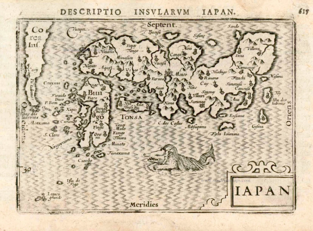
With Korea as an island.
China 1619
China, Korea and Japan by J. Hondius.
[Item number: 6494]
Iapan. 1602
Japan by Langenes, published by Bertius P.
[Item number: 12487]
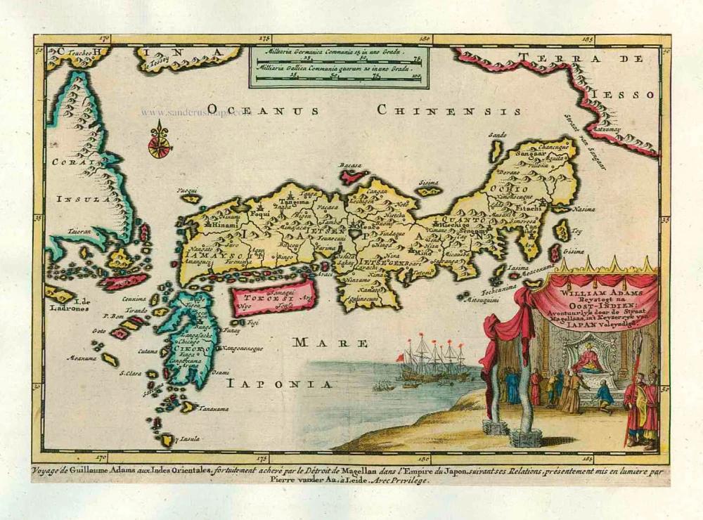
Scarce map in old colour
William Adams Reystogt na Oost-Indien; Avontuurlyk door de Straat Magellaan, in't Keyzerryk van Japan Voleyndigd. 1713
Japan by P. Van der Aa
[Item number: 26121]
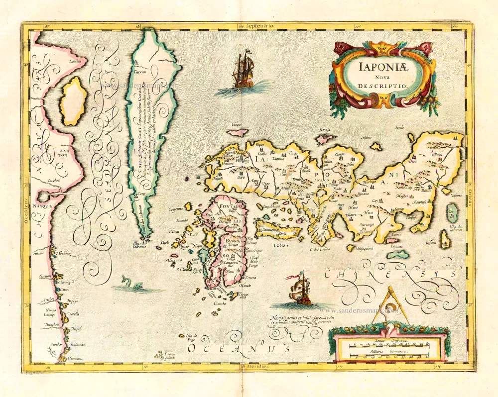
Iaponiae Nova Desciptio. 1641
Japan & Korea by Johannes Janssonius
[Item number: 26441]
Rare first edition!
Iapan. 1598
Japan by Barent Langenes & Cornelis Claesz
[Item number: 26543]
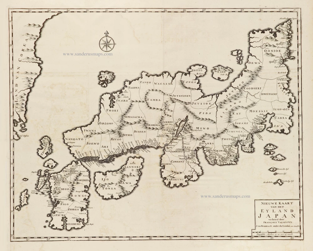
Nieuwe kaart van het Eyland Japan. 1724-26
Japan by François Valentyn (Valentijn).
[Item number: 26876]
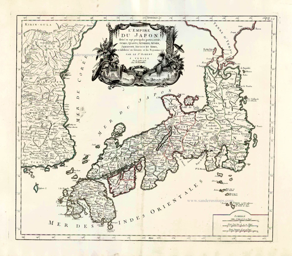
L'Empire du Japon Divisé en sept principales parties, savoir, Ochio, Quanto, Jetsegen, Jetsen, Jamaisoit, Xicoco et Ximo, et subdivisé en soixante et six Royaumes. 1776-79
Japan, by Francesco Santini.
[Item number: 26975]
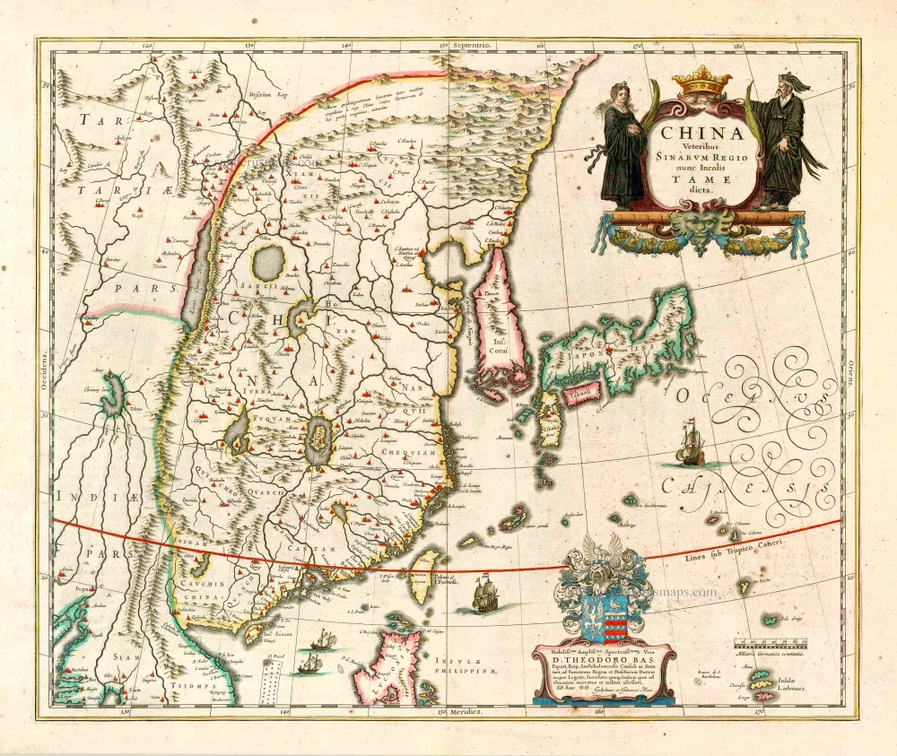
China Veteribus Sinarum Regio Nunc Incolis Tame Dicta. 1649-55
China - Japan - Korea, by Willem & Joan Blaeu.
[Item number: 27043]
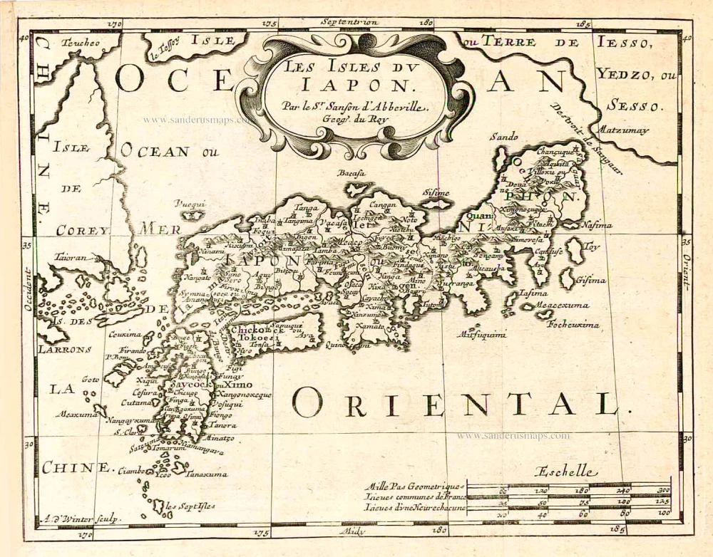
Les Isles du Iapon. 1683
Japan, by Nicolas Sanson.
[Item number: 27081]
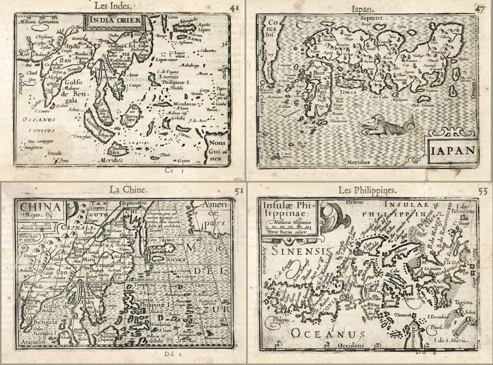
Including the first map of the Philippines.
India Orien. - Iapan. - China. - Insulae Philippinae. 1602
Barent Langenes & Cornelis Claesz.: Southeast Asia, Japan, China, and the Philippines.
[Item number: 27705]
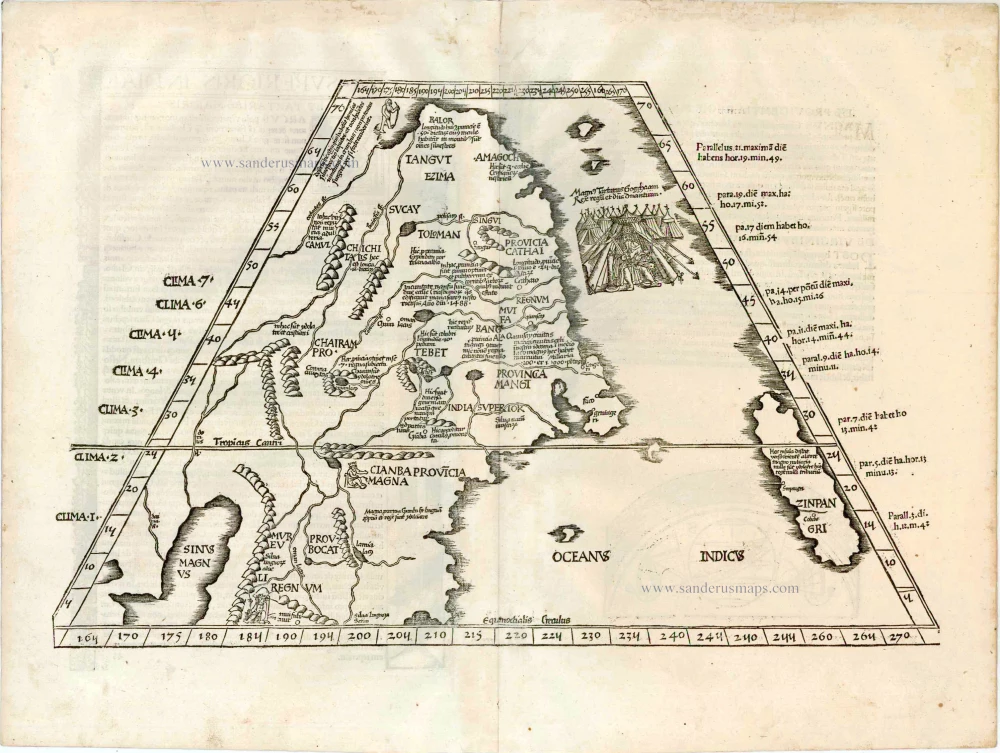
Ta. Superioris Indiae et Tartariae Maioris. 1525
China - Japan, by Lorenz Fries after Martin Waldseemüller.
[Item number: 27928]

The first accurate European map of Japan.
Iaponiae Insulae Descriptio. 1609
Japan by Abraham Ortelius.
[Item number: 28433]
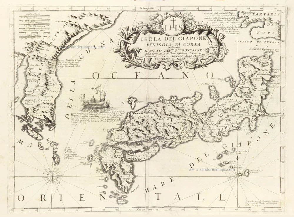
Isola del Giapone e Penisola di Corea. 1696
Japan - Korea by Vincenzo Coronelli.
[Item number: 28757]
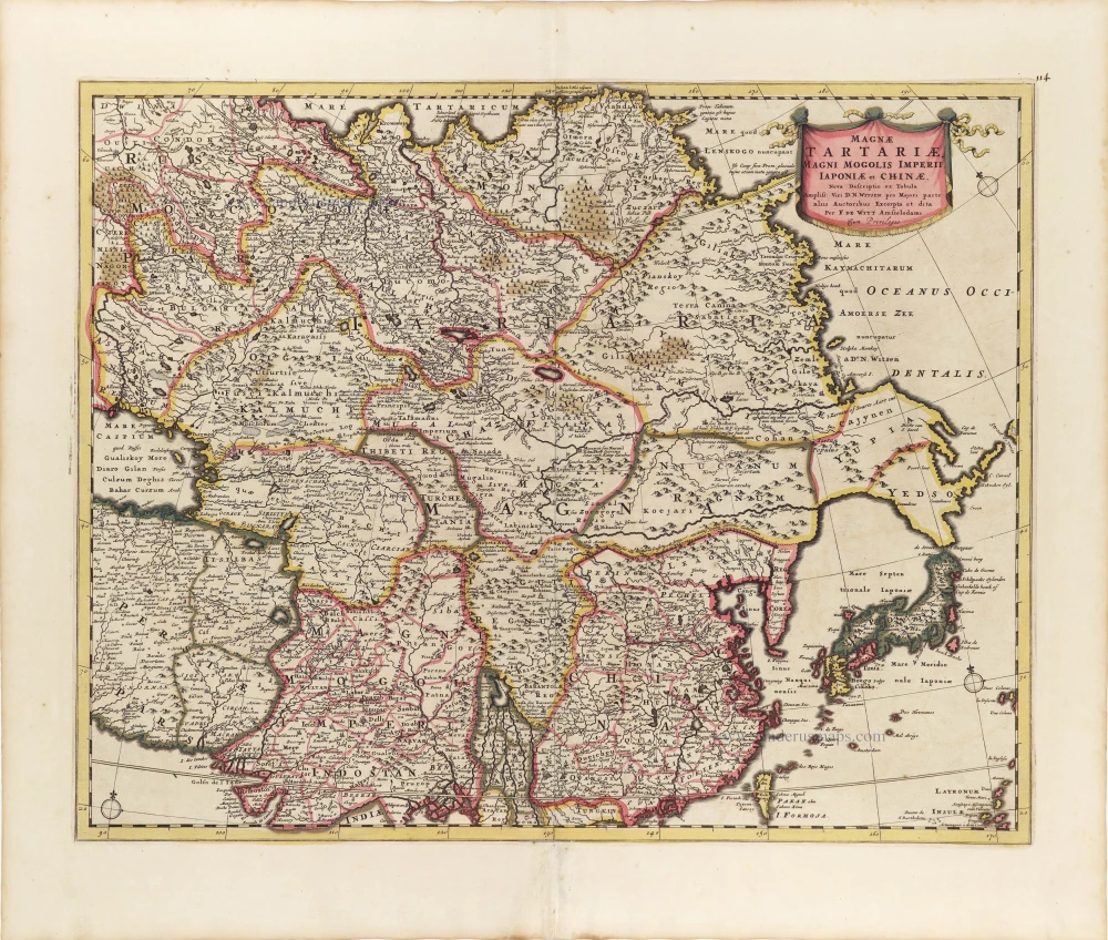
Magnae Tartariae, Magni Mogolis Imperii, Iaponiae et Chinae. ca. 1697-1707
Tartary, China, and Japan, by Frederick de Wit.
[Item number: 28996]
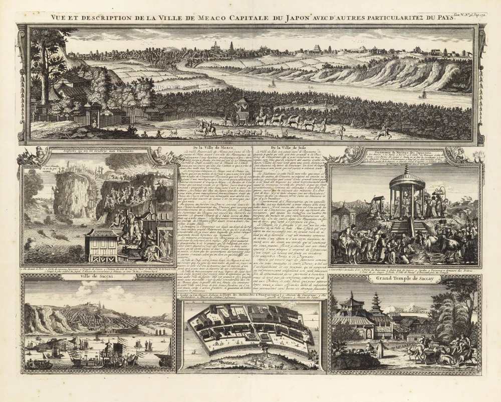
Vue et Description de la Ville de Meaco, Capitale du Japon avec d'autres Particularitez du Pays. 1719
Meaco (Kyoto - Japan), by Z. Châtelain.
[Item number: 29373]
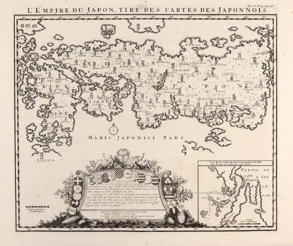
L'Empire du Japon, tiré des Cartes des Japonnois. 1719
Japan, by Z. Châtelain.
[Item number: 29379]

Succession des Empereurs du Japon avec une Description du Meurtre de l'Empereur Cubo et la Reception des Ambassadeurs Hollandais en ce Pays la. 1719
Japan - two historical scenes and a map, by Z. Châtelain.
[Item number: 29380]
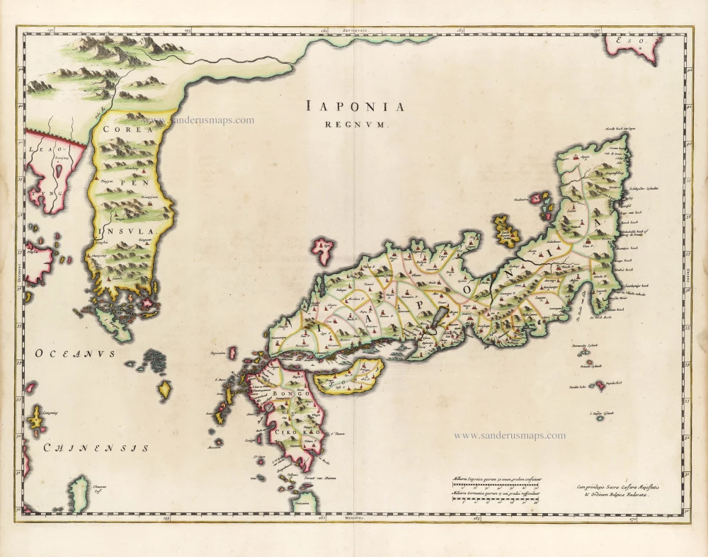
First map to show Korea as a peninsula. Excellent condition.
Iaponia Regnum. 1655-1659
Japan & Korea by Joan Blaeu.
[Item number: 29853]
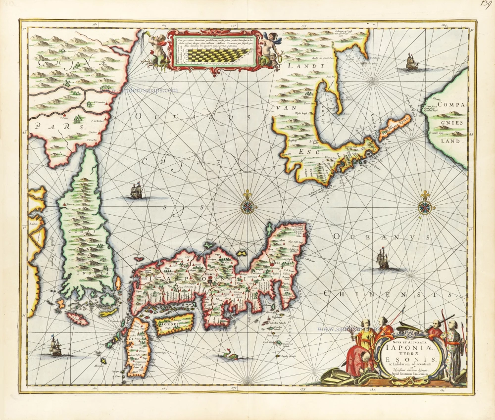
Nova et Accurata Iaponiae, Terrae Esonis, ac Insularum Adjacentium. 1666
Japan - Korea by Johannes Janssonius
[Item number: 30335]