
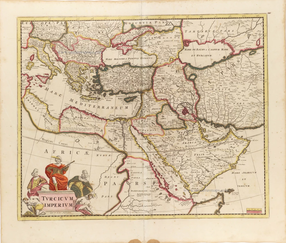
Ottoman Empire by Hugo Allard. c. 1680

The Allard Family
The founder of this family of map-makers, publishers and print-sellers was Huych (Hugo) Allard (1625-1691). He worked in Amsterdam in 1684 and is supposed to have begun his business as early as 1645. He died in 1691, leaving his shop to his son, Carel Allard (1648-c. 1706). Carel brought out many maps and some atlases. His atlases are mainly composed of maps from the stock of other publishers like Janssonius and De Wit. However, some maps were his original creations. The States of Holland granted him a privilege for these maps in 1683.
One of the sons of Carel, Abraham Allard (1676-c.1730), joined his father in the map trade and was accepted as a member of the ‘Constvercoopers gilde’ (Art dealer’s Guild) in 1708.
The original geographical maps by Allard, designed and cut between 1680 and 1700, are very decorative, well-composed and up-to-date.
Turcicum Imperium. [Above map:] Nova Tabula et Accurata Turcicum Imperium autto Hugo Allard.
Item Number: 28524 Authenticity Guarantee
Category: Antique maps > Asia > Middle East
Old, antique map of Ottoman Empire, by Hugo Allard.
Title: Turcicum Imperium. [Above map:] Nova Tabula et Accurata Turcicum Imperium autto Hugo Allard.
Hugo Allardt Excudit
inde Kalverstraat inde Wereldt Caert.
Extremely rare first state by Hugo Allard. The copy quoted by Koeman, All1 (71) is a second edition by Carel Allard.
Date: c. 1680.
Copper engraving, printed on paper.
Map size: 450 x 570mm (17.72 x 22.44 inches).
Sheet size: 495 x 595mm (19.49 x 23.43 inches).
Verso: Blank.
Condition: Original coloured, excellent.
Condition Rating: A.
References: Koeman, All1 (71)
From: Separate publication.
The Allard Family
The founder of this family of map-makers, publishers and print-sellers was Huych (Hugo) Allard (1625-1691). He worked in Amsterdam in 1684 and is supposed to have begun his business as early as 1645. He died in 1691, leaving his shop to his son, Carel Allard (1648-c. 1706). Carel brought out many maps and some atlases. His atlases are mainly composed of maps from the stock of other publishers like Janssonius and De Wit. However, some maps were his original creations. The States of Holland granted him a privilege for these maps in 1683.
One of the sons of Carel, Abraham Allard (1676-c.1730), joined his father in the map trade and was accepted as a member of the ‘Constvercoopers gilde’ (Art dealer’s Guild) in 1708.
The original geographical maps by Allard, designed and cut between 1680 and 1700, are very decorative, well-composed and up-to-date.
Related items
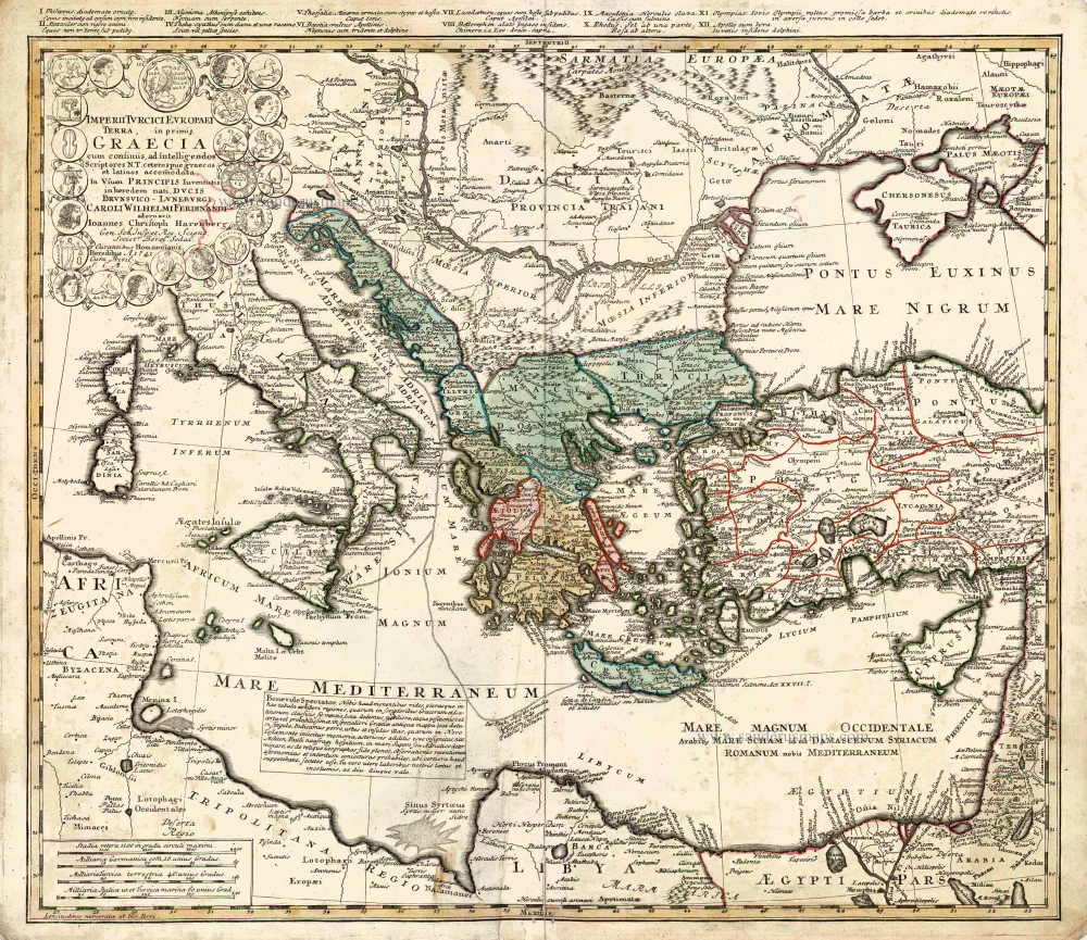
Imperii Turcici Europaei Terra in Primis Graecia. 1752-1775
Southeastern Europe - Turkey by Homann Heirs
[Item number: 26592]

Turquie d'Europe. 1776-79
The Ottoman Empire, by Francesco Santini.
[Item number: 26972]
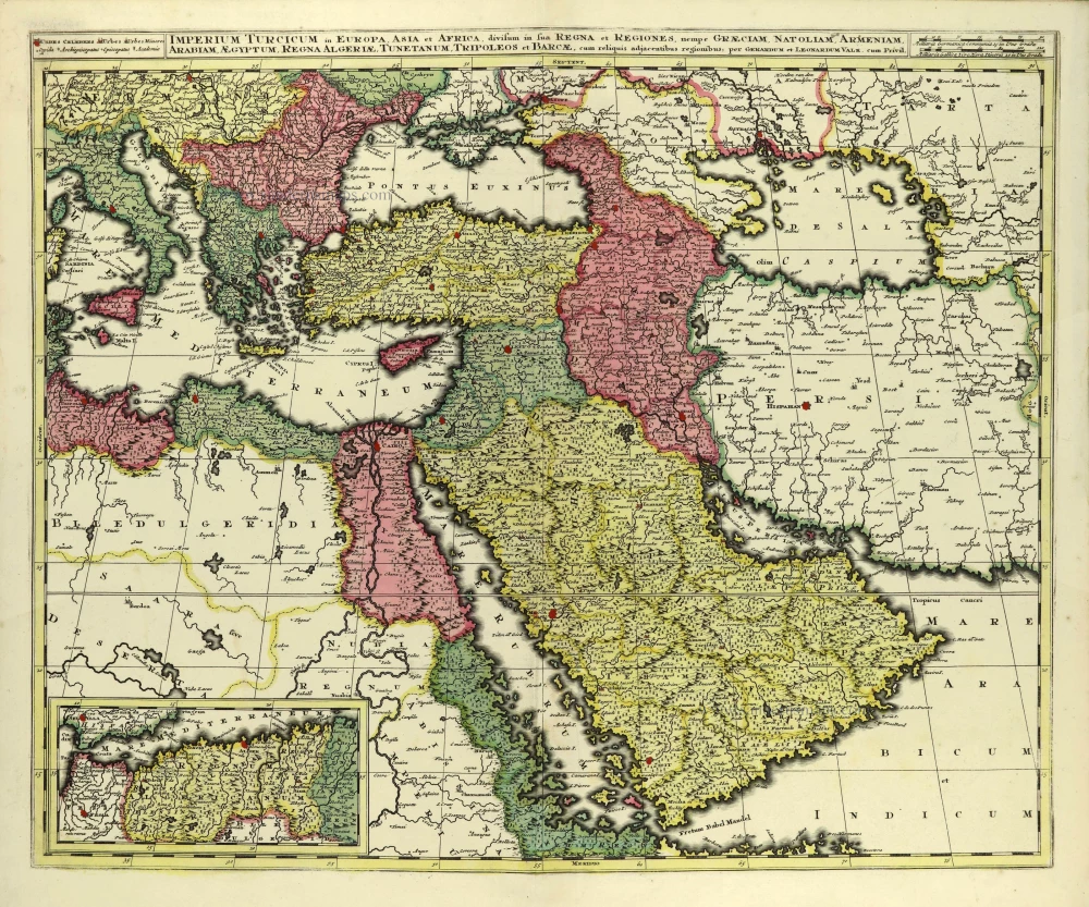
Imperium Turcicum in Europa, Asia et Africa, divisum in sua Regna et Regiones, nempe Graeciam, Natoliam, Armeniam, Arabiam, Aegyptum, Regna Algeriae, Tunetanum, Tripoleos et Barcae, cum reliquis adjacentibus regionibus. c. 1700
Ottoman Empire by Gerard and Leonard Valck.
[Item number: 28322]
Turcicum Imperium. ca. 1691-96
Ottoman Empire, by De Wit F.
[Item number: 28988]