
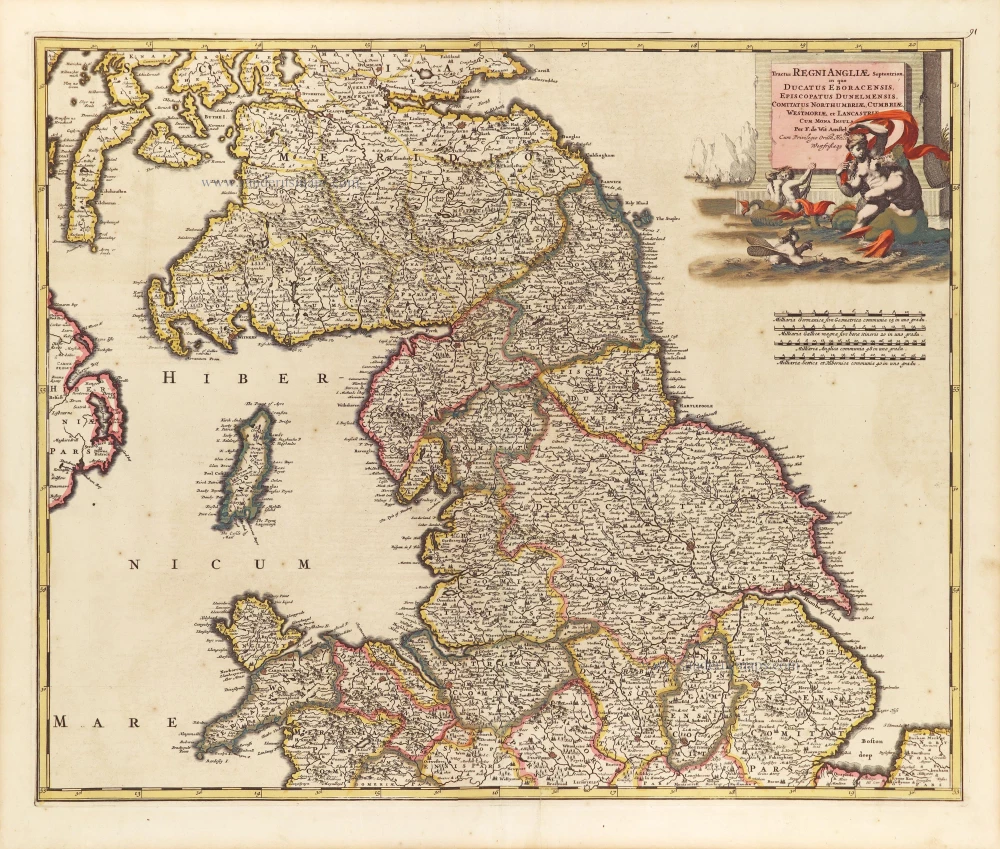
Northern England, by Frederick de Wit. ca. 1691-93
Frederick de Wit (1630-1706)
The engraver and map-seller, Frederick de Wit, was born in Gouda (Netherlands) in 1630 as a son of Hendrick Fredericksz de Wit. Through his marriage with Maria van der Waag of Amsterdam in 1661, he obtained citizenship of the city where he had been working since 1648 and where he became one of the most famous engravers of maps of the second half of the 17th century. Although De Wit was a Catholic, which meant that he was not favoured at the time by the city council, he was awarded the honour of being listed as one of the "excellent citizens" on the roll of the city council in the years 1694-1704. However, his name was not written in the Guild of St. Luke book before 1664. At that time, he lived on the Kalverstraat "in de Witte Pascaert", where he stayed until his death in 1706. His earliest dates on maps engraved are 1659 (Regni Daniae) and 1660 (World map).
Frederick de Wit published several world atlases, a sea atlas, and an atlas of the Netherlands.
The dating of the maps is difficult. However, as a privilege was granted in 1689, the annotation 'cum privilegio' marks an edition after 1688.
Around 1700, Frederick de Wit entered the market with a town atlas. He produced two volumes with a total of 260 plans and views. Most were printed from plates used for Janssonius and Blaeu town atlases.
After he died in 1706, his widow continued the shop until 1709. The plates and stock of De Wit's atlas were sold to Covens & Mortier in 1710, who sold the atlas for an extended period.
Tractus Regni Angliae Septentrion, in quo Ducatus Eboracensis, Episcopatus Dunelmensis, Comitatus Northumbriae, Cumbiae, Westmoriae, et Lancasstriae Cum Mona Insula.
Item Number: 29031 Authenticity Guarantee
Category: Antique maps > Europe > British Isles
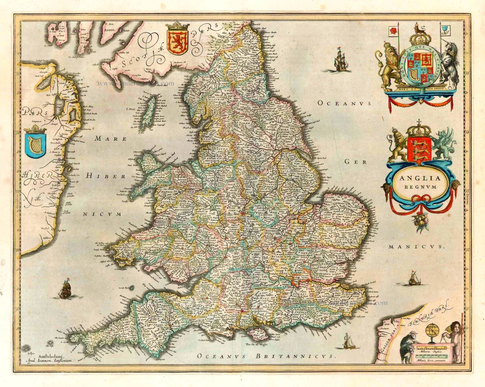
Antique map of Northern England, by Frederick de Wit.
Title: Tractus Regni Angliae Septentrion, in quo Ducatus Eboracensis, Episcopatus Dunelmensis, Comitatus Northumbriae, Cumbriae, Westmoriae, et Lancastriae Cum Mona Insula.
Per F. de Wit Amstel
Cum Privilegio Ordin. Holla. Westfrisiaeq.
Date of the first edition: ca. 1691-93.
Date of this map: ca. 1691-93.
Copper engraving, printed on paper.
Map size: 485 x 590mm (19.09 x 23.23 inches).
Sheet size: 535 x 630mm (21.06 x 24.8 inches).
Verso: Blank.
Condition: Original coloured, excellent.
Condition Rating: A.
From: Composite Atlas by F. De Wit, c. 1680.
Frederick de Wit (1630-1706)
The engraver and map-seller, Frederick de Wit, was born in Gouda (Netherlands) in 1630 as a son of Hendrick Fredericksz de Wit. Through his marriage with Maria van der Waag of Amsterdam in 1661, he obtained citizenship of the city where he had been working since 1648 and where he became one of the most famous engravers of maps of the second half of the 17th century. Although De Wit was a Catholic, which meant that he was not favoured at the time by the city council, he was awarded the honour of being listed as one of the "excellent citizens" on the roll of the city council in the years 1694-1704. However, his name was not written in the Guild of St. Luke book before 1664. At that time, he lived on the Kalverstraat "in de Witte Pascaert", where he stayed until his death in 1706. His earliest dates on maps engraved are 1659 (Regni Daniae) and 1660 (World map).
Frederick de Wit published several world atlases, a sea atlas, and an atlas of the Netherlands.
The dating of the maps is difficult. However, as a privilege was granted in 1689, the annotation 'cum privilegio' marks an edition after 1688.
Around 1700, Frederick de Wit entered the market with a town atlas. He produced two volumes with a total of 260 plans and views. Most were printed from plates used for Janssonius and Blaeu town atlases.
After he died in 1706, his widow continued the shop until 1709. The plates and stock of De Wit's atlas were sold to Covens & Mortier in 1710, who sold the atlas for an extended period.
Related items
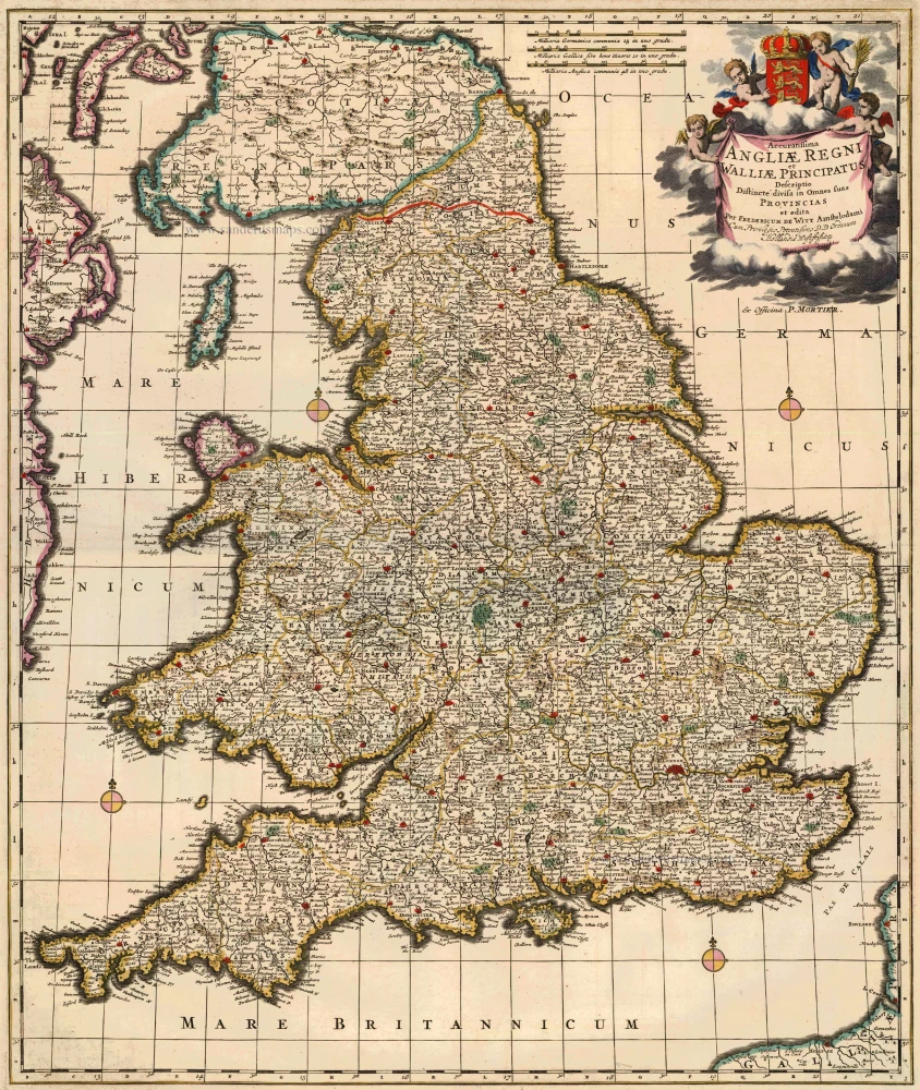
Accuratissima Angliae Regni et Walliae Principatus ... c. 1715
England & Wales, by F. De Wit, published by Pierre Mortier.
[Item number: 13684]

Carte Particulière des Costes Méridionales d'Angleterre Qui comprend l'Isle de Wight ... 1693
England, Isle of Wight & Hampshire, by P. Mortier.
[Item number: 15482]
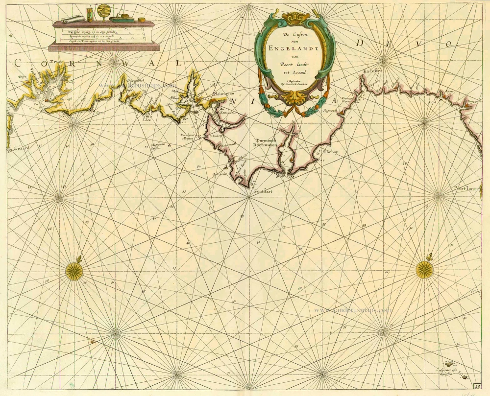
De Custen van Engelandt van Poort landt tot Lezard. 1686
England, by Doncker H.
[Item number: 16207]

Anglia 1493
London by Hartmann Schedel
[Item number: 24702]
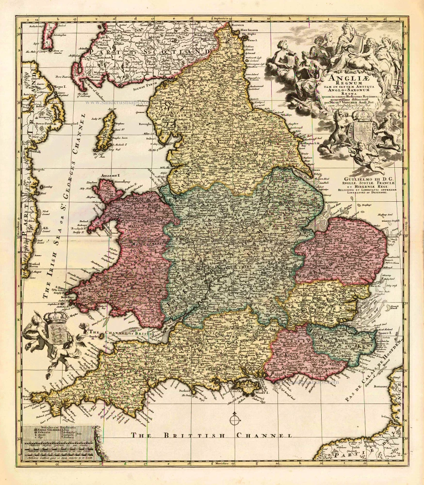
Angliae Regnum tam in septem Antiqua Anglo-Saxonum Regna ... c. 1740
England, by N. Visscher II, published by P. Schenk.
[Item number: 25720]
Anglia Regnum. 1641
England, by J. Janssonius, published by Henricus Hondius.
[Item number: 26242]

Le Royaume d'Angleterre, Divisé Selon les Sept Royaumes, ou Heptarchie des Saxons, avec la Principauté de Galles et Subdivisé en Shires ou Comtés. 1776-79
England, by Francesco Santini.
[Item number: 26960]

A New Mapp of the Kingdome of England, Representing the Princedome of Wales, and other Provinces, Cities, Market Towns, with the Roads from Town to Town ... to be sould at London by John Overton . . . c. 1688
England and Wales by Visscher N. - Overton J.
[Item number: 27517]
Anglia Regnum. 1623
England, by Gerard Mercator.
[Item number: 28132]

Parte Settentrionale del Regno D'Inghilterra. [in set with:] Parte Meridionale del Regno D'Inghilterra. 1696
England by Vincenzo Coronelli.
[Item number: 28662]

Ancien Royaume de Northumberland, aujourdhuy Provinces de Nort: ou sont les Comtés de Northumberland, Cimberland, Durham, Westmorland Lancaster, et Yorck. 1658
Northern England by Nicolas Sanson.
[Item number: 29666]

Angliae Regni Florentissimi nova descriptio. 1584
England by A. Ortelius.
[Item number: 30145]
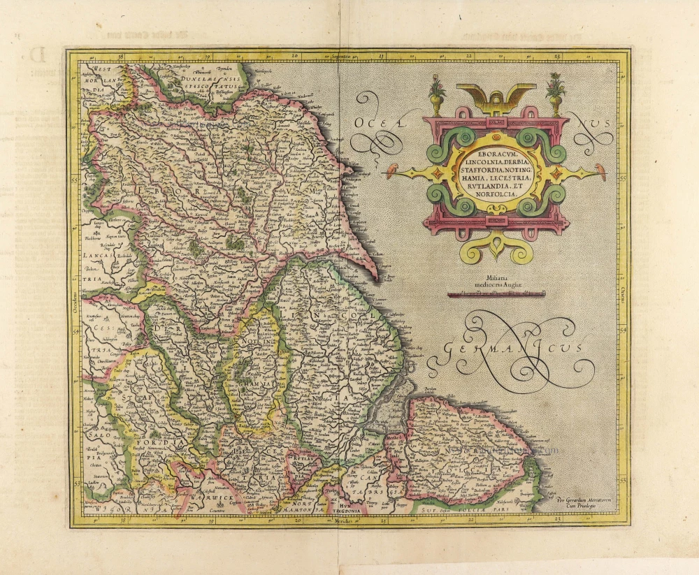
Eboracum, Lincolnia, Derbia, Statfordia, Notinghamia, Lecestria, Rutlandia et Norfolcia. 1638
Northeast England, by Gerard Mercator.
[Item number: 32453]