
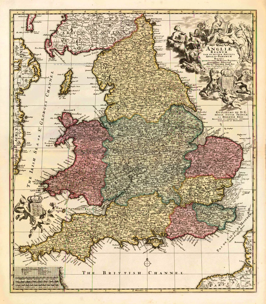
England, by Francesco Santini. 1776-79

Francesco and Paolo Santini (c.1729-1793)
Francesco Santini, a Venetian publisher, acquired the printing plates of Vaugondy’s Atlas Universel …, a commercial and cartographic success, with widespread influence on mapmakers throughout Europe. Together with his brother Paolo, he commissioned a new set of plates and reissued the atlas in 1776. The following year, Paolo Santini assigned all his publication rights to M. Remondini, who in 1777 reissued the same atlas but with his name.
Gilles and Didier Robert de Vaugondy
Gilles Robert de Vaugondy (1688-1766) and his son Didier Robert de Vaugondy (1723-1786) were leading cartographers in France during the 18th century. They served both as geographer to the king of France. The father, Gilles is also known as ‘Le Sieur’ or ‘Monsieur Robert’. He descended from the Nicolas Sanson family through Sanson's grandson Pierre Moulard-Sanson, from whom he inherited Sanson's cartographic material. After Hubert Jaillot died in 1712, the de Vaugondy's acquired numerous copies of his maps and plates, which formed the basis of their beautiful Atlas Universel (1757).
Their business flourished from 1731 to 1778. They made a substantial contribution to the world of cartography.
Le Royaume d'Angleterre, Divisé Selon les Sept Royaumes, ou Heptarchie des Saxons, avec la Principauté de Galles et Subdivisé en Shires ou Comtés.
Item Number: 26960 Authenticity Guarantee
Category: Antique maps > Europe > British Isles
Old, antique map of England, by Francesco Santini.
Cartographer: Sr Robert de Vaugondy
First state with the imprint of Remondini: with engraved page numbers in the top right corner: "P.I.41".
Date of the first edition: 1776
Date of this map: 1776
Copper engraving, printed on paper.
Size (not including margins): 47.5 x 51cm (18.5 x 19.9 inches)
Verso: Blank
Condition: Original coloured in outline, excellent.
Condition Rating: A+
References: Pedley, #48.
From: Atlas Universel dressé sur les meilleures cartes modernes. Venice, Remondini, 1776.
Francesco and Paolo Santini (c.1729-1793)
Francesco Santini, a Venetian publisher, acquired the printing plates of Vaugondy’s Atlas Universel …, a commercial and cartographic success, with widespread influence on mapmakers throughout Europe. Together with his brother Paolo, he commissioned a new set of plates and reissued the atlas in 1776. The following year, Paolo Santini assigned all his publication rights to M. Remondini, who in 1777 reissued the same atlas but with his name.
Gilles and Didier Robert de Vaugondy
Gilles Robert de Vaugondy (1688-1766) and his son Didier Robert de Vaugondy (1723-1786) were leading cartographers in France during the 18th century. They served both as geographer to the king of France. The father, Gilles is also known as ‘Le Sieur’ or ‘Monsieur Robert’. He descended from the Nicolas Sanson family through Sanson's grandson Pierre Moulard-Sanson, from whom he inherited Sanson's cartographic material. After Hubert Jaillot died in 1712, the de Vaugondy's acquired numerous copies of his maps and plates, which formed the basis of their beautiful Atlas Universel (1757).
Their business flourished from 1731 to 1778. They made a substantial contribution to the world of cartography.
Related items
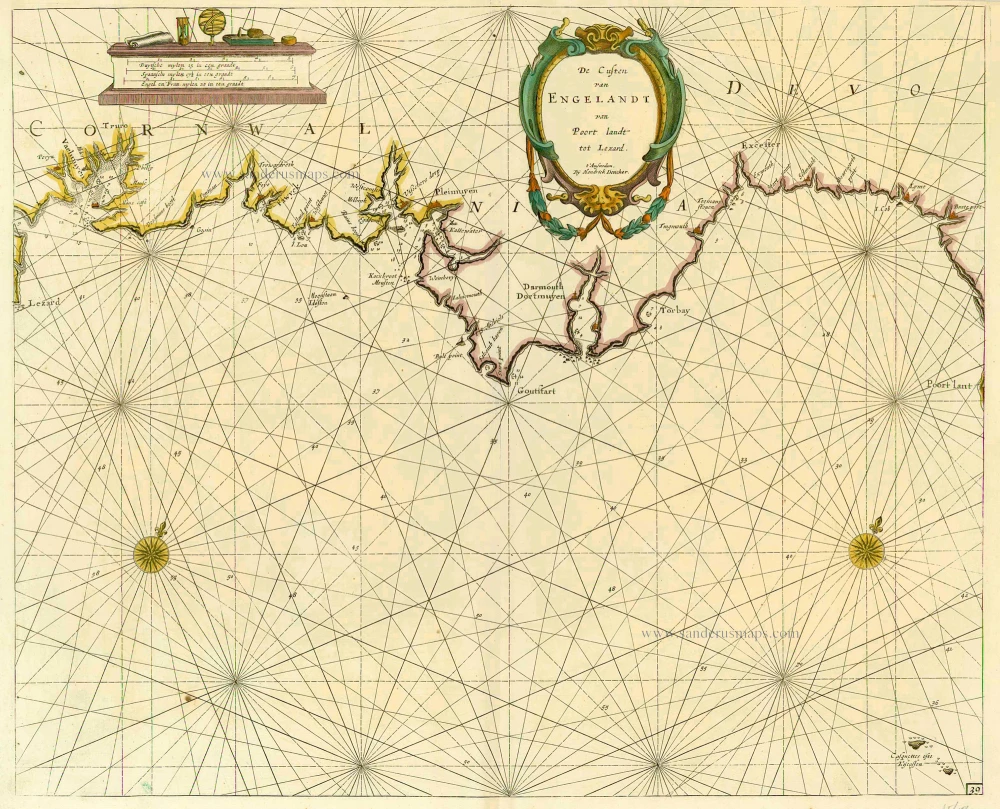
De Custen van Engelandt van Poort landt tot Lezard. 1686
England, by Doncker H.
[Item number: 16207]

Anglia 1493
London by Hartmann Schedel
[Item number: 24702]
Angliae Regnum tam in septem Antiqua Anglo-Saxonum Regna ... c. 1740
England, by N. Visscher II, published by P. Schenk.
[Item number: 25720]
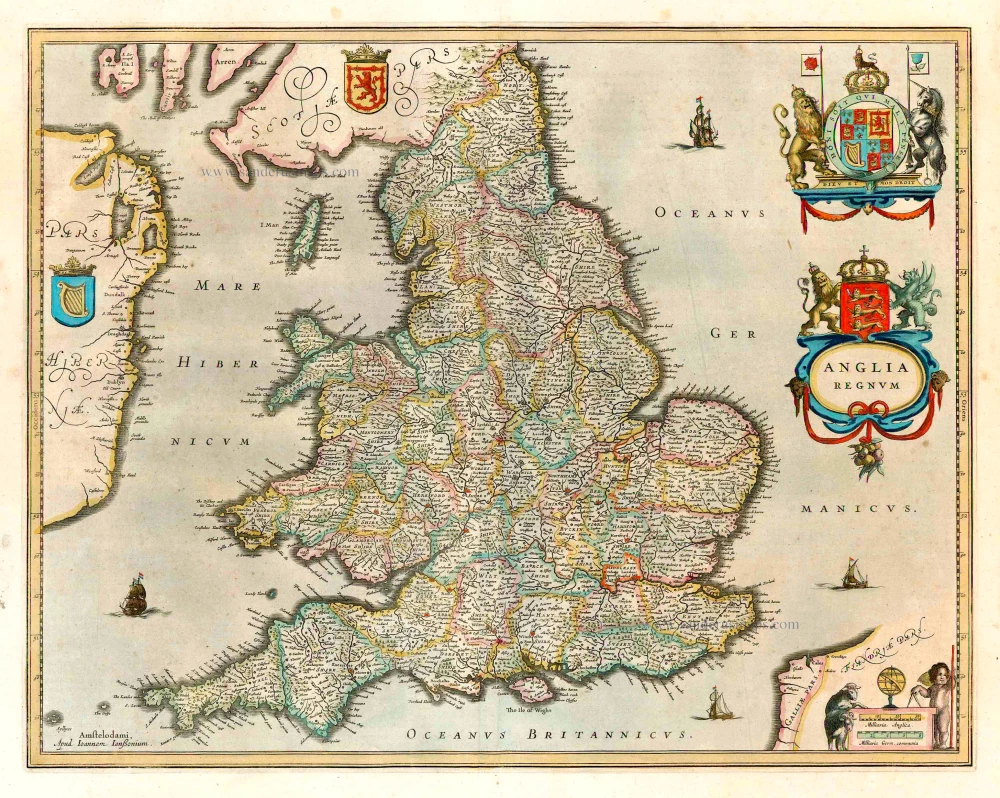
Anglia Regnum. 1641
England, by J. Janssonius, published by Henricus Hondius.
[Item number: 26242]
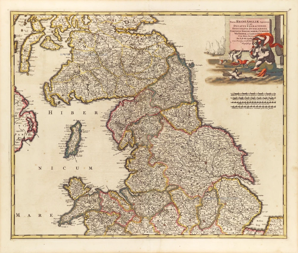
Tractus Regni Angliae Septentrion, in quo Ducatus Eboracensis, Episcopatus Dunelmensis, Comitatus Northumbriae, Cumbiae, Westmoriae, et Lancasstriae Cum Mona Insula. ca. 1691-93
Northern England, by Frederick de Wit.
[Item number: 29031]
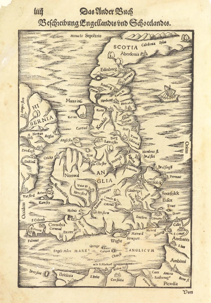
Beschreibung Engellandts und Schottlandts. 1578
Great Brittain by Sebastian Münster.
[Item number: 29468]

Ancien Royaume de Northumberland, aujourdhuy Provinces de Nort: ou sont les Comtés de Northumberland, Cimberland, Durham, Westmorland Lancaster, et Yorck. 1658
Northern England by Nicolas Sanson.
[Item number: 29666]

Angliae Regni Florentissimi nova descriptio. 1584
England by A. Ortelius.
[Item number: 30145]

Scarce
Accuratissima Angliae Regni et Walliae Principatus Descriptio Distincte divisa in Omnes suas Provincias 1696-1713
England and Wales, by Cornelis Danckerts.
[Item number: 32495]