
Scarce
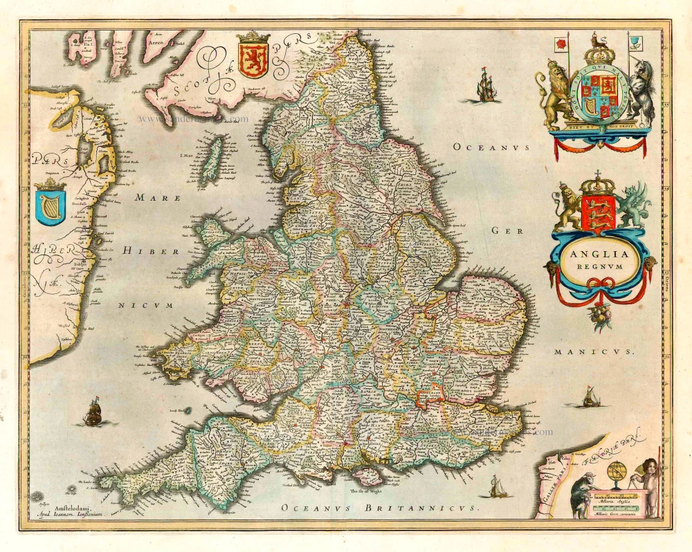
England and Wales, by Cornelis Danckerts. 1696-1713


The Danckerts Family.
The Danckerts family of Amsterdam was one of the best-known print and map sellers in 17th century Amsterdam. Their business activity covered a vast period, from ca. 1633. From 1669 until 1701, father Justus and his sons had their shop in the ‘Calverstraet in de Danckbaerheyt’.
Cornelis Danckerts (1561-1631) was a printseller born in Amsterdam and active in Antwerp.
Cornelis Danckerts, the elder (1603-1656) was an engraver and publisher in Amsterdam and Nieuwendijk. Son of Cornelis (above), whom he succeeded in 1631.
The house of Danckerts gained its greatest fame from Justus Danckerts (1635-1701 - son of Cornelis the elder) and his two sons, Theodorus and Cornelis. Dancker Danckerts (1634-1666), the elder brother of Justus, was known for his etchings of paintings, maps, and publications.
The grandfather, father, and sons were highly skilled and excellent artistic drafters and engravers. They are famous for the edition of their Atlas, which appeared from ca. 1686, and for several monumental and beautiful wall maps and views. However, compared with that published by the Blaeu's or Janssonius's, their cartographic work has attracted little attention and has never received proper recognition.
On 14 August 1684, Justus and his sons obtained the privilege from the States of Holland for their publications. In 1713, twelve years after Justus Danckerts, the heirs decided to sell part of the stock of maps and atlases and many copperplates. In 1727, after the death of the last surviving brother Theodorus, a final sale took place.
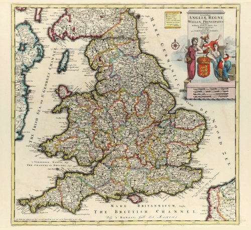
Accuratissima Angliae Regni et Walliae Principatus Descriptio Distincte divisa in Omnes suas Provincias
Item Number: 32495 Authenticity Guarantee
Category: Antique maps > Europe > British Isles
England and Wales, by Cornelis Danckerts.
Title: Accuratissima Angliae Regni et Walliae Principatus Descriptio Distincte divisa in Omnes suas Provincias
et editia per Cornelium Danckerts Amstelodami Cum Privilegio.
tot Amsterdam uytgegeven door Cornelis Danckerts voor aen op de Niewendyck in den Atlas.
Date of the first edition: c. 1680.
Date of this map: 1696-1713.
Copper engraving, printed on paper.
Image size: 515 x 530mm (20¼ x 20¾ inches).
Sheet size: 530 x 620mm (20¾ x 24½ inches).
Verso: Blank.
Condition: Original coloured, excellent.
Condition Rating: A+.
From: Atlas. Amsterdam, after 1696.
The Danckerts Family.
The Danckerts family of Amsterdam was one of the best-known print and map sellers in 17th century Amsterdam. Their business activity covered a vast period, from ca. 1633. From 1669 until 1701, father Justus and his sons had their shop in the ‘Calverstraet in de Danckbaerheyt’.
Cornelis Danckerts (1561-1631) was a printseller born in Amsterdam and active in Antwerp.
Cornelis Danckerts, the elder (1603-1656) was an engraver and publisher in Amsterdam and Nieuwendijk. Son of Cornelis (above), whom he succeeded in 1631.
The house of Danckerts gained its greatest fame from Justus Danckerts (1635-1701 - son of Cornelis the elder) and his two sons, Theodorus and Cornelis. Dancker Danckerts (1634-1666), the elder brother of Justus, was known for his etchings of paintings, maps, and publications.
The grandfather, father, and sons were highly skilled and excellent artistic drafters and engravers. They are famous for the edition of their Atlas, which appeared from ca. 1686, and for several monumental and beautiful wall maps and views. However, compared with that published by the Blaeu's or Janssonius's, their cartographic work has attracted little attention and has never received proper recognition.
On 14 August 1684, Justus and his sons obtained the privilege from the States of Holland for their publications. In 1713, twelve years after Justus Danckerts, the heirs decided to sell part of the stock of maps and atlases and many copperplates. In 1727, after the death of the last surviving brother Theodorus, a final sale took place.
Related items
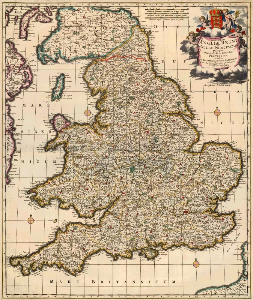
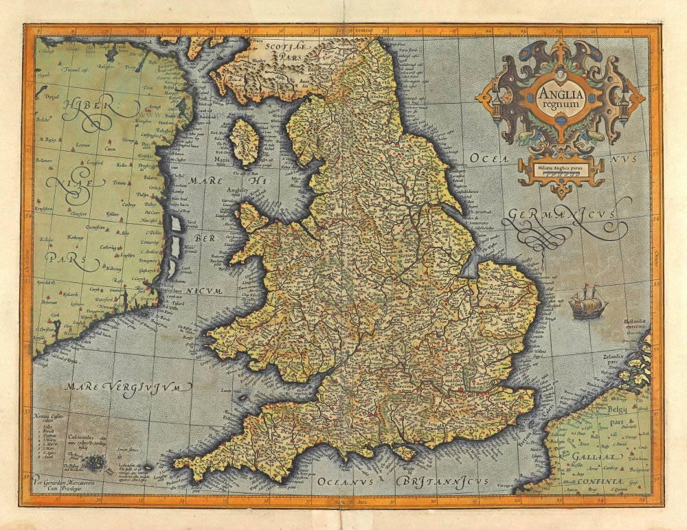
Accuratissima Angliae Regni et Walliae Principatus ... c. 1715
England & Wales, by F. De Wit, published by Pierre Mortier.
[Item number: 13684]
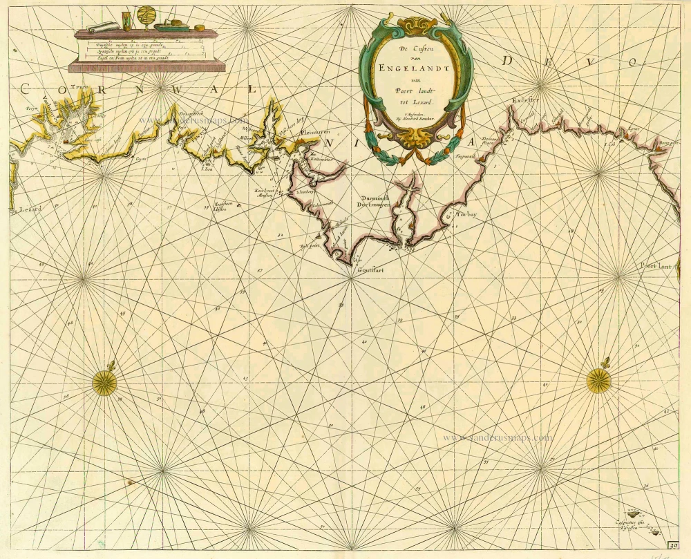
De Custen van Engelandt van Poort landt tot Lezard. 1686
England, by Doncker H.
[Item number: 16207]

Anglia 1493
London by Hartmann Schedel
[Item number: 24702]
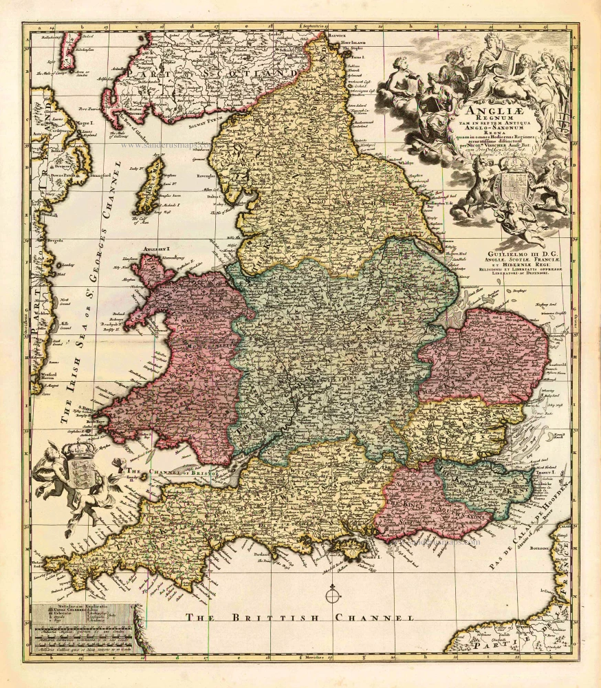
Angliae Regnum tam in septem Antiqua Anglo-Saxonum Regna ... c. 1740
England, by N. Visscher II, published by P. Schenk.
[Item number: 25720]
Anglia Regnum. 1641
England, by J. Janssonius, published by Henricus Hondius.
[Item number: 26242]

Le Royaume d'Angleterre, Divisé Selon les Sept Royaumes, ou Heptarchie des Saxons, avec la Principauté de Galles et Subdivisé en Shires ou Comtés. 1776-79
England, by Francesco Santini.
[Item number: 26960]

A New Mapp of the Kingdome of England, Representing the Princedome of Wales, and other Provinces, Cities, Market Towns, with the Roads from Town to Town ... to be sould at London by John Overton . . . c. 1688
England and Wales by Visscher N. - Overton J.
[Item number: 27517]
Anglia Regnum. 1623
England, by Gerard Mercator.
[Item number: 28132]

Parte Settentrionale del Regno D'Inghilterra. [in set with:] Parte Meridionale del Regno D'Inghilterra. 1696
England by Vincenzo Coronelli.
[Item number: 28662]

Accuratissima Angliae Regni et Walliae Principatus ... c. 1691-97
England & Wales by F. De Wit, published by Pierre Mortier.
[Item number: 29563]

Angliae Regni Florentissimi nova descriptio. 1584
England by A. Ortelius.
[Item number: 30145]

Le Royaume d'Angleterre distingué en ses Provinces. 1692
England and Wales by N. Sanson, so-called published by Hubert Jaillot. (Pirated edition by Pierre Mortier).
[Item number: 31409]

Wallia Principatus vulgo Wales. 1645
Wales, by Joan Blaeu.
[Item number: 33047]
new