
Scotland by Abraham Ortelius 1584


Abraham Ortelius (1527-1598)
The maker of the 'first atlas', the Theatrum Orbis Terrarum (1570), was born on 4 April 1527 into an old Antwerp family. He learned Latin and studied Greek and mathematics.
Abraham and his sisters Anne and Elizabeth took up map colouring. He was admitted to the Guild of St. Luke as an "illuminator of maps." Besides colouring maps, Ortelius was a dealer in antiques, coins, maps, and books, with the book and map trade gradually becoming his primary occupation.
Business went well because his means permitted him to start an extensive collection of medals, coins, antiques, and a library of many volumes. In addition, he travelled a lot and visited Italy and France, made contacts everywhere with scholars and editors, and maintained extensive correspondence with them.
In 1564 he published his first map, a large and ambitious world wall map. The inspiration for this map may well have been Gastaldi's large world map. In 1565 he published a map of Egypt and a map of the Holy Land, a large map of Asia followed.
In 1568 the production of individual maps for his atlas Theatrum Orbis Terrarum was already in full swing. He completed the atlas in 1569, and in May of 1570, the Theatrum was available for sale. It was one of the most expensive books ever published.
This first edition contained seventy maps on fifty-three sheets. Franciscus Hogenberg engraved the maps.
Later editions included Additamenta (additions), resulting in Ortelius' historical atlas, the Parergon, mostly bound together with the atlas. The Parergon can be called a truly original work of Ortelius, who drew the maps based on his research.
The importance of the Theatrum Orbis Terrarum for geographical knowledge in the last quarter of the sixteenth century is difficult to overemphasize. Nothing was like it until Mercator's atlas appeared twenty-five years later. Demand for the Theatrum was remarkable. Some 24 editions appeared during Ortelius's lifetime and another ten after his death in 1598. Editions were published in Dutch, German, French, Spanish, English, and Italian. The number of map sheets grew from 53 in 1570 to 167 in 1612 in the last edition.
In 1577, engraver Philip Galle and poet-translator Pieter Heyns published the first pocket-sized edition of the Theatrum, the Epitome. The work was trendy. Over thirty editions of this Epitome were published in different languages.
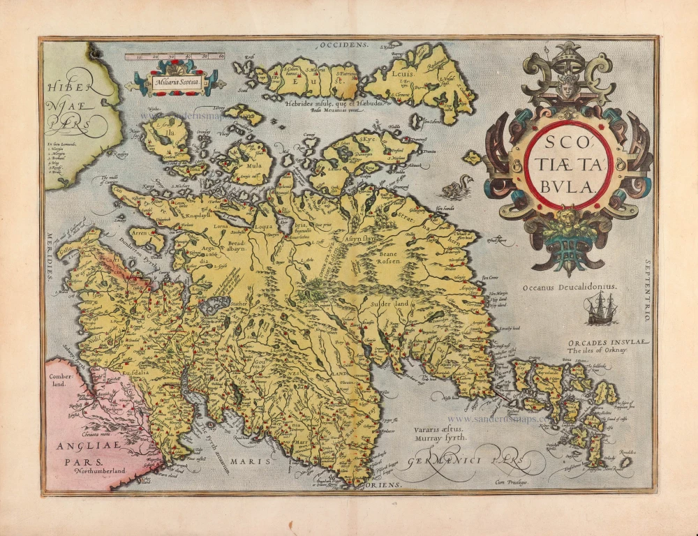
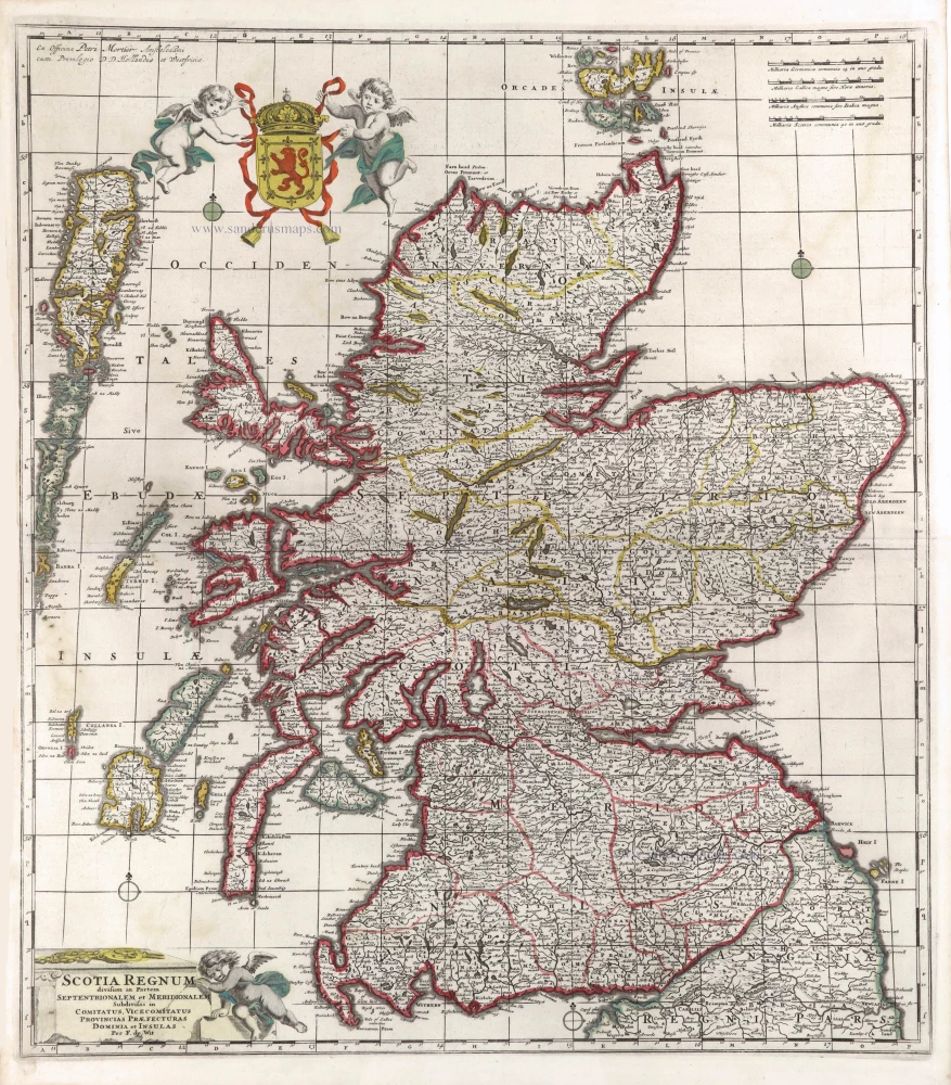
Scotiae Tabula.
Item Number: 30325 Authenticity Guarantee
Category: Antique maps > Europe > British Isles
Scotland by Abraham Ortelius.
Title: Scotiae Tabula.
Cum Privilegio.
Oriented to the west.
Cartographer: Gerard Mercator.
Date of the first edition: 1573.
Date of this map: 1584.
Copper engraving, printed on paper.
Image size: 356 x 480mm (14.02 x 18.9 inches).
Sheet size: 420 x 530mm (16.54 x 20.87 inches).
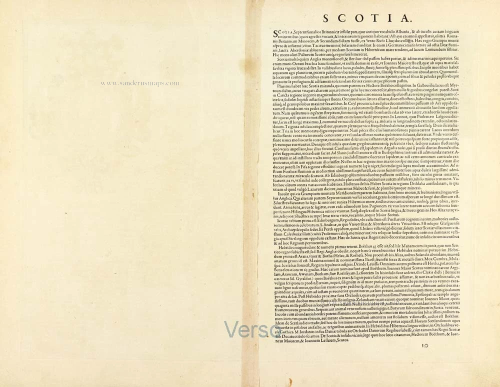
Verso: Latin text.
Condition: Original coloured, excellent.
Condition Rating: A+.
From: Theatrum Orbis Terrarum. Antwerp, Christoffel Plantin, 1584. (Van der Krogt, 31:031)
Abraham Ortelius (1527-1598)
The maker of the 'first atlas', the Theatrum Orbis Terrarum (1570), was born on 4 April 1527 into an old Antwerp family. He learned Latin and studied Greek and mathematics.
Abraham and his sisters Anne and Elizabeth took up map colouring. He was admitted to the Guild of St. Luke as an "illuminator of maps." Besides colouring maps, Ortelius was a dealer in antiques, coins, maps, and books, with the book and map trade gradually becoming his primary occupation.
Business went well because his means permitted him to start an extensive collection of medals, coins, antiques, and a library of many volumes. In addition, he travelled a lot and visited Italy and France, made contacts everywhere with scholars and editors, and maintained extensive correspondence with them.
In 1564 he published his first map, a large and ambitious world wall map. The inspiration for this map may well have been Gastaldi's large world map. In 1565 he published a map of Egypt and a map of the Holy Land, a large map of Asia followed.
In 1568 the production of individual maps for his atlas Theatrum Orbis Terrarum was already in full swing. He completed the atlas in 1569, and in May of 1570, the Theatrum was available for sale. It was one of the most expensive books ever published.
This first edition contained seventy maps on fifty-three sheets. Franciscus Hogenberg engraved the maps.
Later editions included Additamenta (additions), resulting in Ortelius' historical atlas, the Parergon, mostly bound together with the atlas. The Parergon can be called a truly original work of Ortelius, who drew the maps based on his research.
The importance of the Theatrum Orbis Terrarum for geographical knowledge in the last quarter of the sixteenth century is difficult to overemphasize. Nothing was like it until Mercator's atlas appeared twenty-five years later. Demand for the Theatrum was remarkable. Some 24 editions appeared during Ortelius's lifetime and another ten after his death in 1598. Editions were published in Dutch, German, French, Spanish, English, and Italian. The number of map sheets grew from 53 in 1570 to 167 in 1612 in the last edition.
In 1577, engraver Philip Galle and poet-translator Pieter Heyns published the first pocket-sized edition of the Theatrum, the Epitome. The work was trendy. Over thirty editions of this Epitome were published in different languages.
Related items

Pascaert, vande Westkust van Schotlant, als mede een Gedeelte vande Lewys Eylanden, van S. Patricius tot Nary, Nog t' I. Roda ofte Barre en t' I. S. Kilda ... 1697-1709
Scotland, with Lewis Island, by J. Van Keulen. Sea chart.
[Item number: 12461]
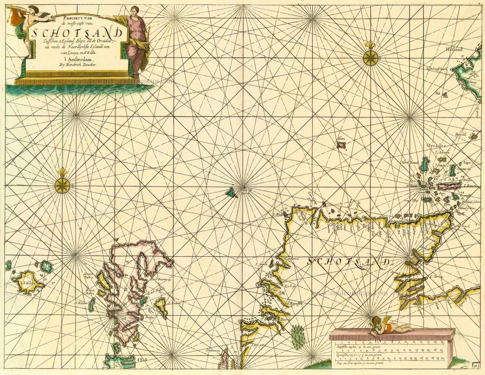
Pascaert van de Westcust van Schotland Tusschen t Eyland Kye en de Orcades, als mede de Noordlyckste Eylande van Lewys en S. Kilda. 1686
Scotland, by Doncker H.
[Item number: 13737]

Scotia. 1618
Scotland, by Petrus Bertius.
[Item number: 18211]
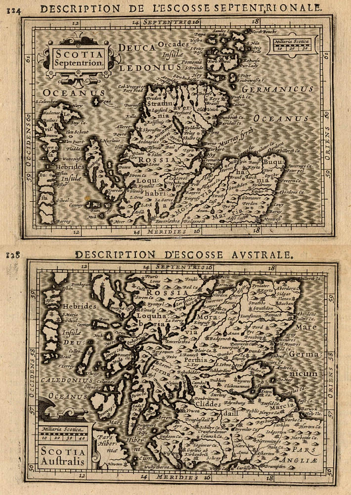
Scotia Septentrion [in set with] Scotia Australis. 1618
Scotland (North and South), by Petrus Bertius.
[Item number: 18212]
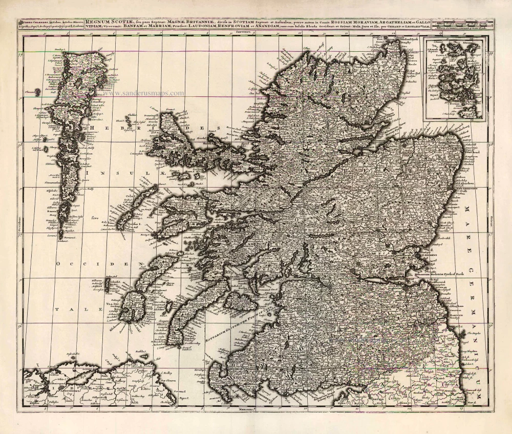
Regnum Scotiae, seu Pars Septent: Magnae Britanniae Divisa ... c. 1700
Scotland, by G. & L. Valck.
[Item number: 26013]
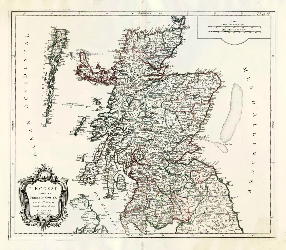
L'Ecosse Divisée en Shires ou Comtés. 1776-79
Scotland, by Francesco Santini.
[Item number: 26961]

Scotia Regnum divisum in Partem Septentrionalem et Meridionalem. After 1721
Scotland by Frederik de Wit, published by Covens & Mortier.
[Item number: 28242]
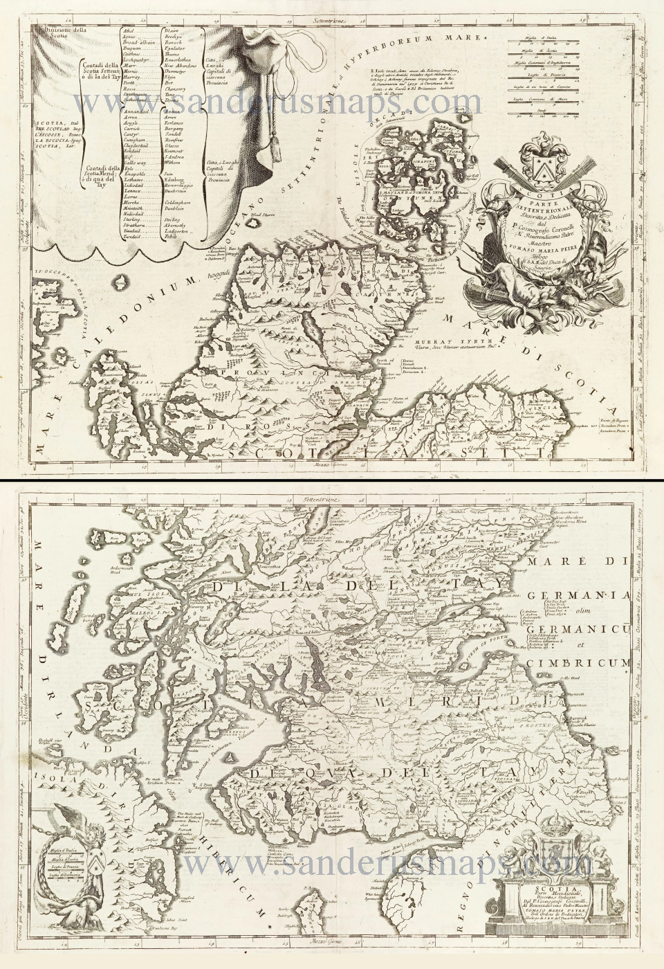
Scotia - Parte Settentrionale. [in set with:] Parte Meridionale. 1696
Scotland by Vincenzo Coronelli.
[Item number: 28661]
Scotia Regnum divisum in Partem Septentrionalem et Meridionalem. c. 1691-97
Scotland by Frederik de Wit, published by Covens & Mortier.
[Item number: 29564]