
Ukraine - Black Sea & Crimea by Nicolas & Guillaume Sanson. 1665


SANSON FAMILY
Nicolas Sanson (1600-1667) - Guillaume Sanson (1633-1703) - Pierre Moullart-Sanson (? -1730)
Originally from Abbeville, Nicolas I Sanson showed a keen interest in historical geography. He was still very young; he published a map of ancient Gaul and two treatises, Britannia and Portus Itius on Abbeville and Boulogne's origins. His meeting with Melchior Tavernier was decisive: it prompted him to give up his duties as a military engineer in Picardy and devote himself to engraved cartography.
At the same time, Sanson had drawn up the outline of modern France. He got the help of Tavernier, who encouraged him to compete with the Dutch map publishers. Tavernier contacted other French cartographers whose works he published.
From 1643, N. Sanson obtained a privilege to publish a work personally, the Princes souverains de l'Italie. Then, in 1644 and 1645, he had his famous geographical tables printed, which significantly contributed to his fame. He also published a series of atlases in quarto of the four continents.
In 1648, N. Sanson associated himself with Mariette to publish atlases. From then on, specific maps bore his name and others Mariette's. N. Sanson and Mariette worked together for more than 20 years. After the death of N. Sanson, Mariette acquired the entire fund. Since Mariette only wanted to publish complete atlases, individual maps were no longer sold, and some army generals complained to the king.
The disagreement between the Sanson family and Pierre II Mariette culminated in 1671 when Guillaume Sanson took the case to court. There was no longer any question of collaboration: Guillaume Sanson started working for another publisher, Alexis-Hubert Jaillot.
The Sanson family faced financial difficulties, and in 1692, their cousin, Pierre Moullart-Sanson, bought the entire geographic fund from his uncles and aunt. Pierre Moullart-Sanson was the son of Françoise Sanson (third child of Nicolas) and Pierre Moullart. He restarted the publishing of Sanson's world atlas, and in 1704 he acquired a privilege for publishing all the works of Nicolas and Guillaume Sanson, which continued to be published until 1730.
Pierre Mariette (1602-1658)
Bookseller, printseller, printer, and publisher, located in the Rue Saint-Jacques in Paris. On February 12, 1644, Pierre Mariette acquired most of Melchior Tavernier's fund. In 1646, he had a series of maps by Blaeu copied and asked Abraham Peyrounin to engrave them. In the meantime, he published the works of Nicolas Sanson. In 1650, he published the atlas Théâtre Géographique de France. A second edition followed in 1653. He later contributed to Sanson's atlas, the Cartes générales de toutes les parties du monde. Many maps of Mariette's Théatre appeared in later editions of Sanson's Cartes générales.
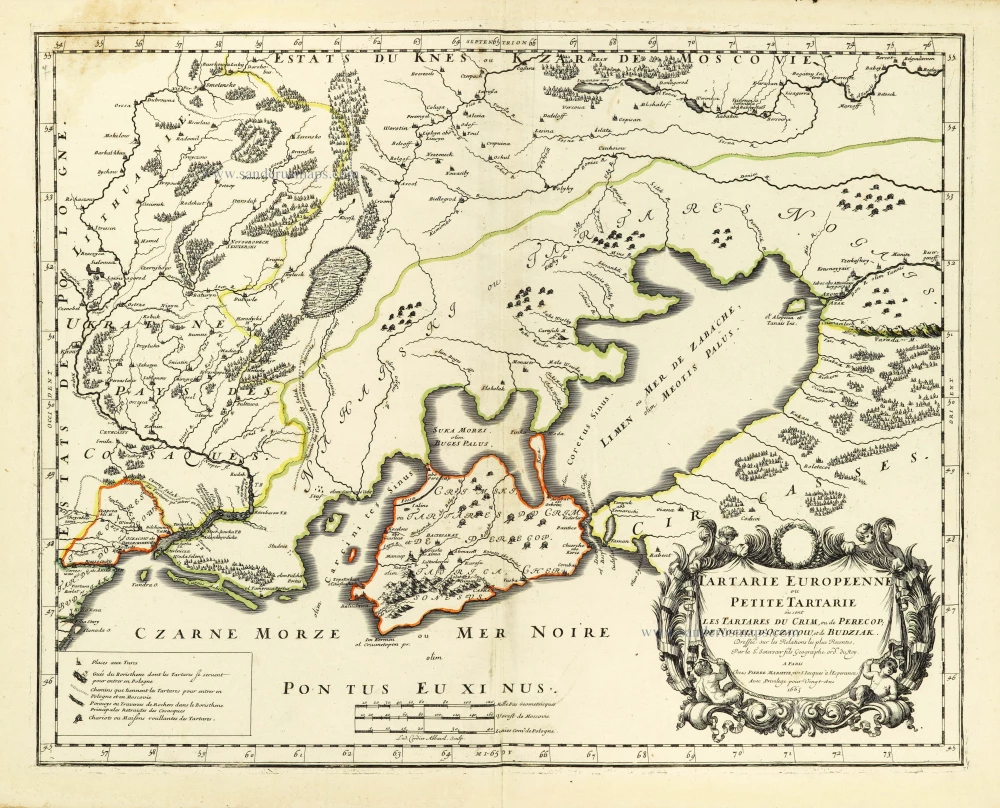
Tartarie Europeenne ou Petite Tartarie où sont Les Tartares du Crim, ou de Perecop; de Nogais, d'Oczacow, et de Budziak.
Item Number: 28451 Authenticity Guarantee
Category: Antique maps > Europe > Eastern Europe
Old, antique map of Ukraine - Black Sea & Crimea by Nicolas & Guillaume Sanson.
Title: Tartarie Europeenne ou Petite Tartarie où sont Les Tartares du Crim, ou de Perecop; de Nogais, d'Oczacow, et de Budziak.
Dressée sur les Relations les plus Recentes,
Par le Sr. Sanson fils Geographe ordre. du Roy.
A Paris Chez Pierre Mariette, rue S. Iacques à l Esperance
Avec Privilege pour Vingt Ans 1665.
Lud. Cordier Abbavil. Sculp.
Engraver: L. Cordier.
Date of the first edition: 1665.
Date of this map: 1665.
Date on map: 1665.
Copper engraving, printed on paper.
Image size: 400 x 505mm (15.75 x 19.88 inches).
Sheet size: 445 x 605mm (17.52 x 23.82 inches).
Verso: Blank.
Condition: Original coloured in outline, excellent.
Condition Rating: A+.
From: Sanson N. & G. Cartes generales de toutes les parties du monde, ou les empires, monarchies, republiques, estats, peuples, &c. ... Paris, P. Mariette, 1665. (Pastoureau, Sanson V B 1665)
SANSON FAMILY
Nicolas Sanson (1600-1667) - Guillaume Sanson (1633-1703) - Pierre Moullart-Sanson (? -1730)
Originally from Abbeville, Nicolas I Sanson showed a keen interest in historical geography. He was still very young; he published a map of ancient Gaul and two treatises, Britannia and Portus Itius on Abbeville and Boulogne's origins. His meeting with Melchior Tavernier was decisive: it prompted him to give up his duties as a military engineer in Picardy and devote himself to engraved cartography.
At the same time, Sanson had drawn up the outline of modern France. He got the help of Tavernier, who encouraged him to compete with the Dutch map publishers. Tavernier contacted other French cartographers whose works he published.
From 1643, N. Sanson obtained a privilege to publish a work personally, the Princes souverains de l'Italie. Then, in 1644 and 1645, he had his famous geographical tables printed, which significantly contributed to his fame. He also published a series of atlases in quarto of the four continents.
In 1648, N. Sanson associated himself with Mariette to publish atlases. From then on, specific maps bore his name and others Mariette's. N. Sanson and Mariette worked together for more than 20 years. After the death of N. Sanson, Mariette acquired the entire fund. Since Mariette only wanted to publish complete atlases, individual maps were no longer sold, and some army generals complained to the king.
The disagreement between the Sanson family and Pierre II Mariette culminated in 1671 when Guillaume Sanson took the case to court. There was no longer any question of collaboration: Guillaume Sanson started working for another publisher, Alexis-Hubert Jaillot.
The Sanson family faced financial difficulties, and in 1692, their cousin, Pierre Moullart-Sanson, bought the entire geographic fund from his uncles and aunt. Pierre Moullart-Sanson was the son of Françoise Sanson (third child of Nicolas) and Pierre Moullart. He restarted the publishing of Sanson's world atlas, and in 1704 he acquired a privilege for publishing all the works of Nicolas and Guillaume Sanson, which continued to be published until 1730.
Pierre Mariette (1602-1658)
Bookseller, printseller, printer, and publisher, located in the Rue Saint-Jacques in Paris. On February 12, 1644, Pierre Mariette acquired most of Melchior Tavernier's fund. In 1646, he had a series of maps by Blaeu copied and asked Abraham Peyrounin to engrave them. In the meantime, he published the works of Nicolas Sanson. In 1650, he published the atlas Théâtre Géographique de France. A second edition followed in 1653. He later contributed to Sanson's atlas, the Cartes générales de toutes les parties du monde. Many maps of Mariette's Théatre appeared in later editions of Sanson's Cartes générales.
Related items
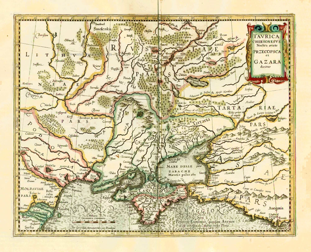
Taurica Chersonesus VS. nostra Aetate Przecopsca et Gazara Dicitur. 1641
Ukraine - Crimea by Henricus Hondius.
[Item number: 26264]

Carte de la Lithuanie Russienne qui Comprend les Palatinats de Livonie, de Witepsk, de Miscislaw, et une Partie de ceux de Polock et de Minsk Cédés par la Pologne a la Russie. 1776-79
Bellarus and parts of Lithuania and Ukraine, by Francesco Santini.
[Item number: 26969]
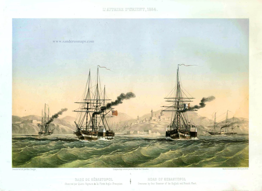
Rade de Sébastopol. Observée par quatre Vapeurs de la Flotte Anglo-Française. / Road of Sebastopol. Overseen by four Steamer of the English and French Fleet. 1854
Sebastopol (Ukraine), by Max Beeger.
[Item number: 27436]
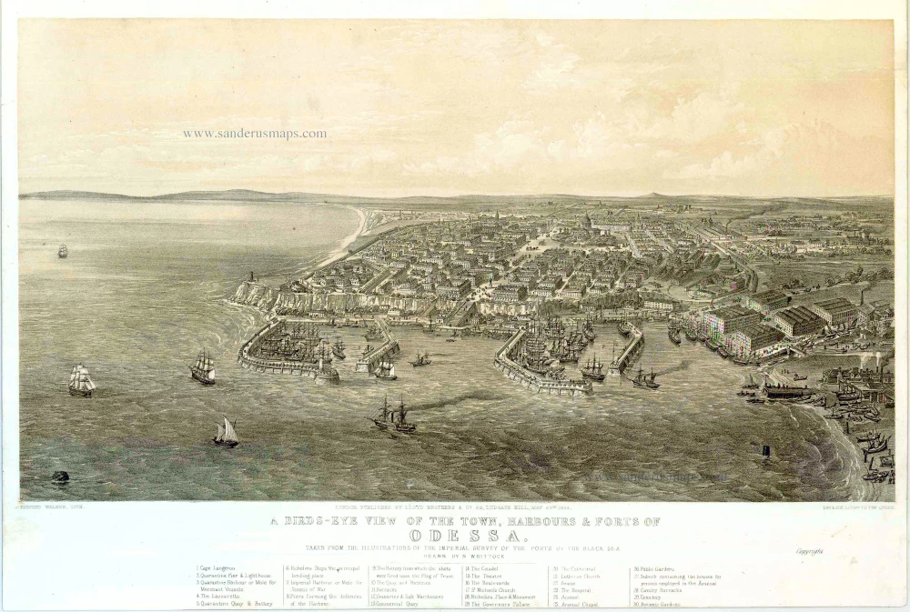
A bird's-eye view of the Town, Harbours & Forts of Odessa. 1854
Odessa (Ukraine), by H. Whittock.
[Item number: 27448]
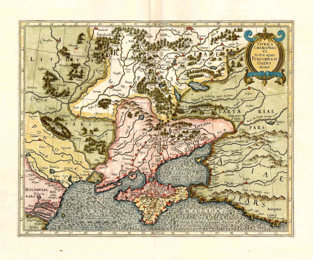
Taurica Chersonesus VS. nostra Aetate Przecopsca et Gazara Dicitur. 1633
Crimea by Gerard Mercator.
[Item number: 27745]
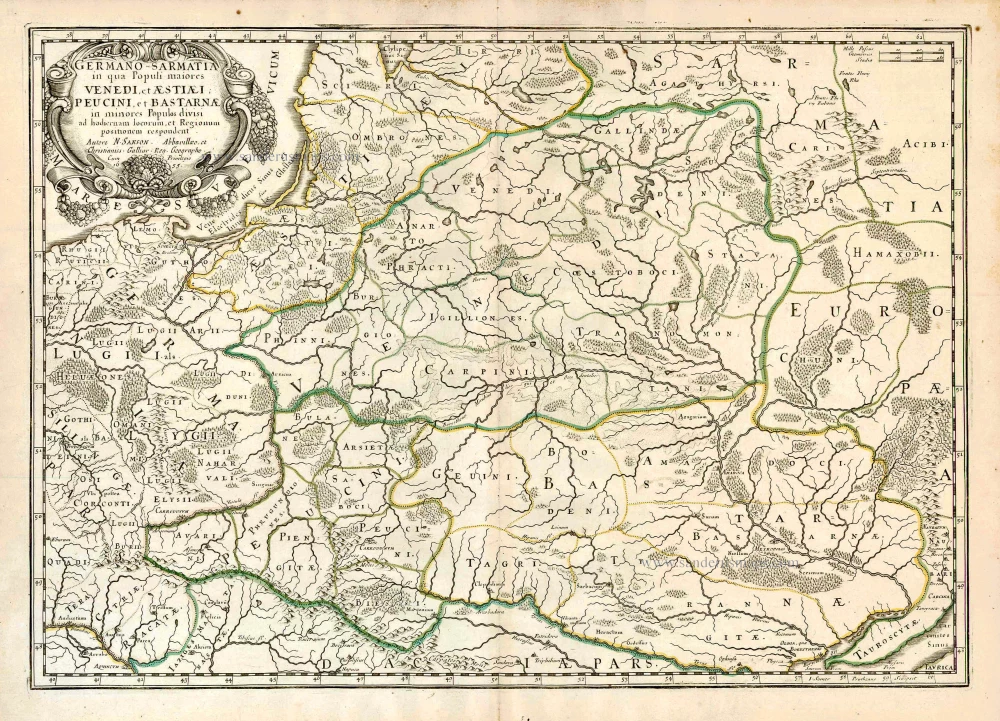
Germano-Sarmatia in qua populi maiores Venedi et Aestiaei Peucini et Bastarnae in minores populos divisi ad hodiernam locorum et regionum positionem respondent. 1658
Poland, Lithuania, Ukraine, Latvia, by Nicolas Sanson.
[Item number: 27918]

Cimmeria quae Postea Scythia Europaea Seu Parua Scythia. 1665
Ukraine, by Nicolas Sanson.
[Item number: 27919]
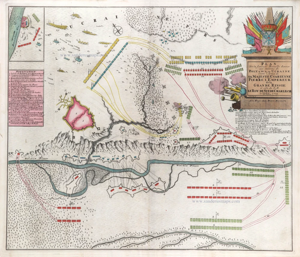
Plan de la fameuse Bataille donnee aux environs de Poltawa en Ucraine Entre l'Armee de sa Majesté Csarienne Pierre I. Empereur de la Grande Russie et celle de S.M. le Roy de Suede Charles XII. me 27 Juin -8 Jullet 1709. c. 1709
Map of the Battle of Poltawa (Ukraine) in 1709, by Pierre Husson.
[Item number: 29587]
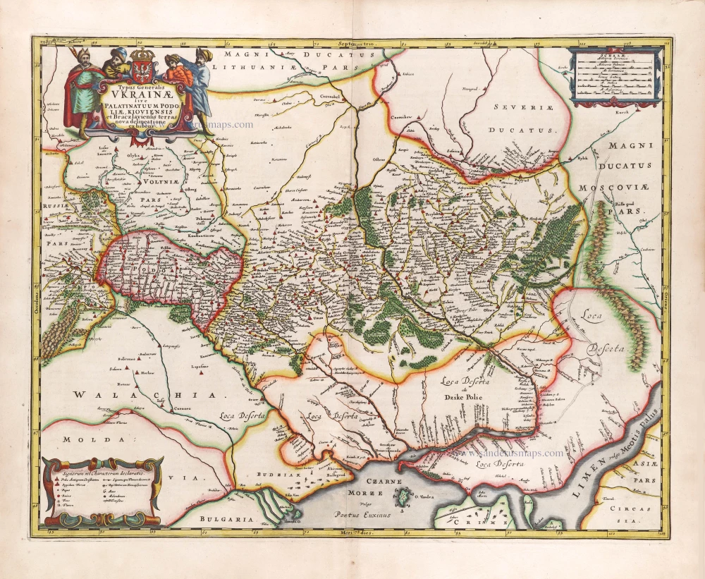
Typus Generalis Ukrainae sive Palatinatuum Podoliae, Kioviensis et Braczlaviensis Terras Nova Delineatione Exhibens. 1666
Ukraine, by Johannes Janssonius.
[Item number: 29957]