
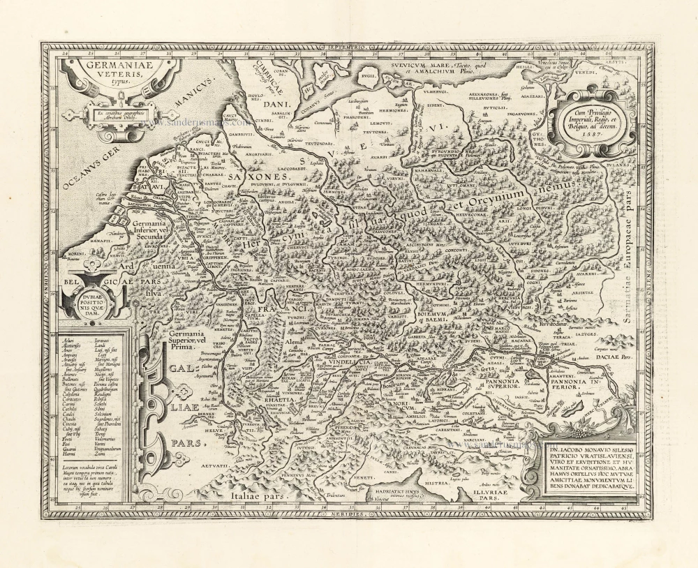
Very rare. First state.
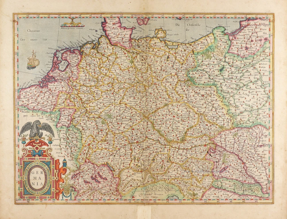
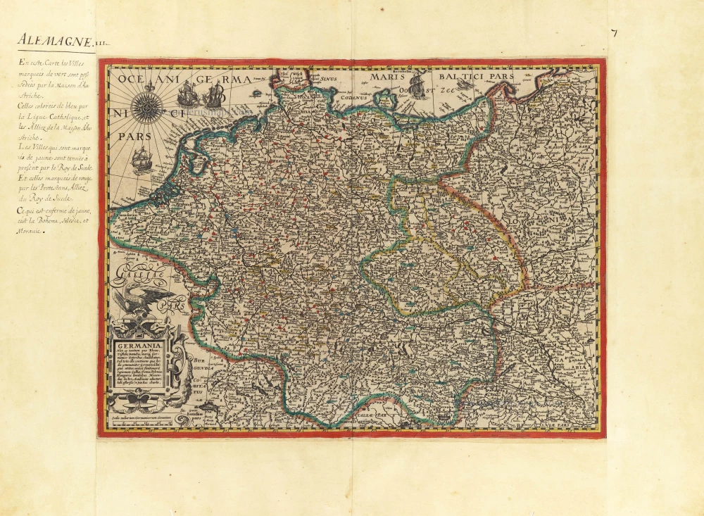
Germania, by Pieter Verbiest. 1628

Scarce Germania map by Pieter Verbiest - First state, only one complete copy recorded.
First state (of four). The publisher has expanded the original map by 8.5 cm in height to include Denmark and southern Sweden. He made a new plate for the top piece, and the two printed pieces were joined.
Only one recorded complete copy of this first state (Paris, BN) and a second copy without the supplement were in the former collection of Stopp.
Pieter Verbiest II (Petrus Verbist) and Isaak Verbiest (Isack Verbist)
Pieter Verbiest (Antwerpen, 1605-1693) was an Antwerp cartographer and engraver. Little is known about his life.
One of his most important works is the Novus Tabularum Geographicorum Belgicae (Antwerp, 1636), a pocket atlas of which two more editions were published later (1644 and 1652). Isaak Verbiest, probably a brother of Pieter, drew and engraved certain maps. Their collaboration also led to the production of two rare world maps.
Pieter Verbiest also published folio maps as separate publications. Koeman describes three editions of a Verbiest Atlas of the Netherlands, published between 1636 and 1652. Only one copy of each of these atlases is known.
Verbiest maps, some with beautiful decorative borders, city views, costumed figures, and coats of arms, were sometimes bound in composite atlases. Occasionally, copies of these scarce maps come onto the market.
Pieter Verbiest II was the son of Pieter Verbiest I (c. 1585-c. 1642), publisher and illuminator of maps in Antwerp.
Nova Germaniae & Accurata delineatio.
Item Number: 27933 Authenticity Guarantee
Category: Antique maps > Europe > Germany
Old, antique map of Germania, by Pieter Verbiest.
Title: Nova Germaniae & Accurata delineatio.
UbieunqueB. Lector talem (*) viderit asteriscum cogitabit inibi esse Academiam.
Antwerpia ex officina Petri Verbiest | Anno 1628.
Date of the first edition: 1628.
Date of this map: 1628.
Date on map: 1628.
Copper engraving, printed on paper from two plates: Top piece (8.5 cm high) added to the bottom one (37.5 cm high).
Size (not including margins): 460 x 500mm (18.11 x 19.69 inches).
Verso: Blank.
Condition: Original coloured, upper margin trimmed to neatline, two additional vertical folds, some discoloration, good copy.
Condition Rating: A
References: Meurer (Germania), 8.9.1.a
Separate publication.
Scarce Germania map by Pieter Verbiest - First state, only one complete copy recorded.
First state (of four). The publisher has expanded the original map by 8.5 cm in height to include Denmark and southern Sweden. He made a new plate for the top piece, and the two printed pieces were joined.
Only one recorded complete copy of this first state (Paris, BN) and a second copy without the supplement were in the former collection of Stopp.
Pieter Verbiest II (Petrus Verbist) and Isaak Verbiest (Isack Verbist)
Pieter Verbiest (Antwerpen, 1605-1693) was an Antwerp cartographer and engraver. Little is known about his life.
One of his most important works is the Novus Tabularum Geographicorum Belgicae (Antwerp, 1636), a pocket atlas of which two more editions were published later (1644 and 1652). Isaak Verbiest, probably a brother of Pieter, drew and engraved certain maps. Their collaboration also led to the production of two rare world maps.
Pieter Verbiest also published folio maps as separate publications. Koeman describes three editions of a Verbiest Atlas of the Netherlands, published between 1636 and 1652. Only one copy of each of these atlases is known.
Verbiest maps, some with beautiful decorative borders, city views, costumed figures, and coats of arms, were sometimes bound in composite atlases. Occasionally, copies of these scarce maps come onto the market.
Pieter Verbiest II was the son of Pieter Verbiest I (c. 1585-c. 1642), publisher and illuminator of maps in Antwerp.
Related items

S.R.I. in Germania ... c. 1715
Germania, by F. de Wit - Covens & Mortier.
[Item number: 1262]
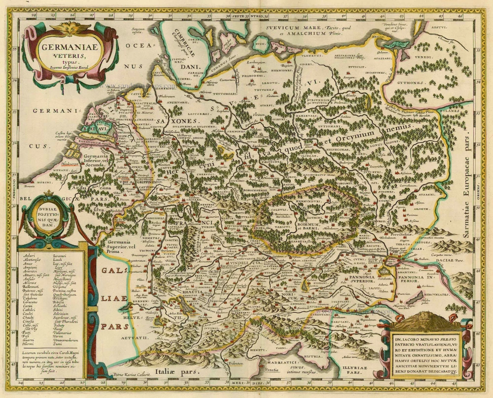
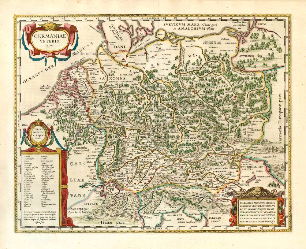
Germaniae Veteris, typus. 1630
GERMANY by Joannes Janssonius
[Item number: 21525]
Deutschlanndt - Germaniae Typus 1612
Germania, by Frans Hogenberg, published by J.B. Vrients.
[Item number: 21682]

Germania 1598
Germania, by A. Ortelius.
[Item number: 22916]
Germaniae Veteris Typus. 1612
Ancient Germania by Abraham Ortelius.
[Item number: 23115]

Nova et prae caeteris aliis Correcta Germaniae Tabula, comprehendens accuratam X. Circulorum, Bohemiae Regni, ac Universae Helvetiae descriptionem. 1689-90
GERMANIA by de Wit F.
[Item number: 24404]

L'Allemagne. 1713
Germania, by P. Van der Aa.
[Item number: 26178]
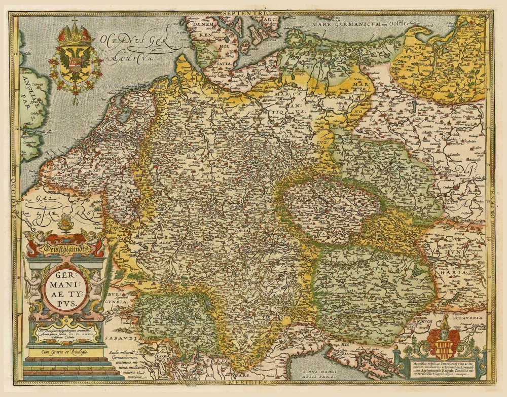
Nova Totius Germaniae Descriptio. 1643
Germania, by Willem Blaeu.
[Item number: 27104]
Germaniae Veteris Typus. 1643
Ancient Germania, by Willem Blaeu.
[Item number: 27122]

Germania. [Above the map :] Carte générale d'Alemaigne. 1575
Germania, by François de Belleforest.
[Item number: 27381]
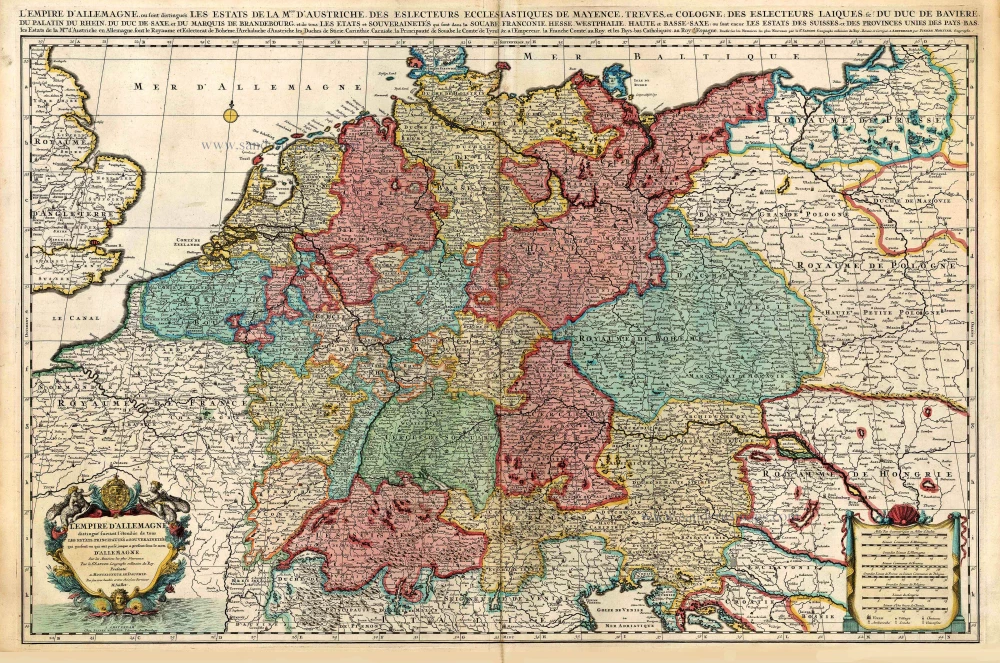
L'Empire d'Allemagne distingué suivant l'étendue de tous les Estats, Principautés et Souverainetés qui passent ou qui ont passé jusque a present sous le nom d'Allemagne. c. 1705
Germania, by Pieter Mortier.
[Item number: 27803]
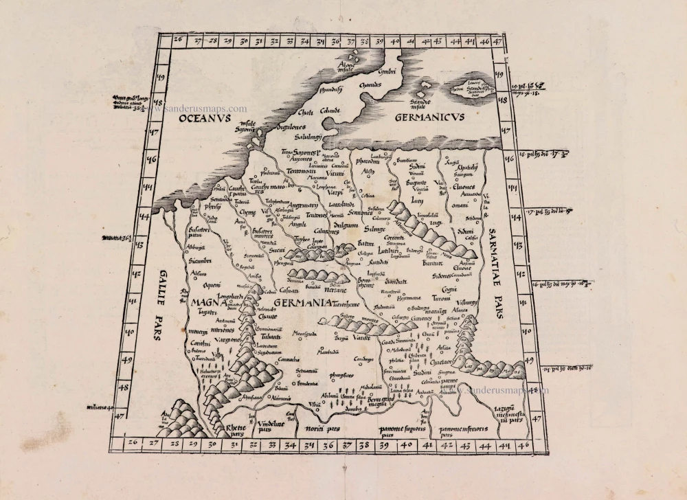
[No title] - [On verso:] Tabula .IIII. Europae. 1525
Ptolemaic Germania, by Lorenz Fries.
[Item number: 27958]
Germania. 1623
Germania by Gerard Mercator.
[Item number: 28939]

Germania. 1595
Germania, by Abraham Ortelius.
[Item number: 30248]

Description de la Germanie. 1568
Germania by Sebastian Münster.
[Item number: 30522]
Germania, Non ea tantum quae Rheno, Vistula, Danubio, mariqz Germanico Veteribus claudebatur; c. 1630-1650
Germania by an unknown mapmaker (Jean Leclerc?)
[Item number: 30842]

Scarce second state, unknown to Hollstein
Germania - Germaniae post omnes in hac forma editiones exactissima locupletißimaqz descriptio. 1631
Germania by Claes Jansz Visscher.
[Item number: 31336]

Accuratissima Germaniae Tabula 1682-88
Germania by Frederick de Wit.
[Item number: 32604]