
Southern Germany (Schwaben & Bayern), by Sebastian Münster. 1550

Sebastian Münster (1488-1552)
Sebastian Münster, a German geographer, cartographer, Hebraist, and theologian, was born in Ingelheim, near Mainz In 1505, he went to Heidelberg to enter the Franciscan order. In 1507 he went to Louvain, where he studied mathematics, geography, and astronomy. In 1509 Münster became a student of Konrad Pelikan, who taught Hebrew and Greek as well as mathematics and cosmography. In 1518 he completed his studies at the University of Tübingen. He was the favorite of the famous mathematician and astronomer Johann Stöffler.
In 1524 Münster was appointed professor of Hebrew at Heidelberg University. In 1525 he published his first map as part of a broadside: The Instrument of the Suns combined a map, calendar, astrological almanac, sundial, and nocturnal on one attractive sheet, suitable for wall mounting.
In 1540 he published a Latin edition of Ptolemy's Geographia with illustrations. He based this edition on the Latin translation by Willibald Pirkheimer and produced new maps to supplement the Ptolemaic maps. The twenty-seven maps of the Ptolemaic canon are supplemented by twenty-one new maps. Further editions appeared in 1541 and 1542.
In 1544 he published the Cosmographia, a bulky book with 659 pages and some 520 woodcuts. Maps in this edition included three maps from the Ptolemaic canon and fourteen modern maps (from previous editions of the Geographia), as well as nine new maps. Later editions (1545, 1546, 1548) enlarged the Cosmographia. The 1550 edition contains cities, portraits, and costumes. These editions in both Latin and German constitute the full fruition of Münster's dream of a comprehensive geography.
The Cosmographia was one of the most successful works of the 16th century. It passed through 24 editions in 100 years, in different languages, including Latin, French, Italian, English, and even Czech. The last German edition was published in 1628.
He died at Basel of the plague in 1552.
As a cartographer, Münster deserves special recognition for formulating a plan for a comprehensive and uniform map of a country. As a geographer, his greatest achievement was the Cosmographia. (Karrow).
Sueviae et Bavariae Descriptio.
Item Number: 29302 Authenticity Guarantee
Category: Antique maps > Europe > Germany
Old, antique map of Southern Germany (Schwaben & Bayern), by Sebastian Münster.
Title: Sueviae et Bavariae Descriptio.
Date of the first edition: 1544.
Date of this map: 1550.
Woodcut, printed on paper.
Map size, not including title: 260 x 345mm (10.24 x 13.58 inches).
Sheet size: 300 x 385mm (11.81 x 15.16 inches).
Verso: Latin text.
Condition: Excellent.
Condition Rating: A+.
From: Cosmographiae universalis Lib. VI. . . . Basle, H. Petri, 1550.
Sebastian Münster (1488-1552)
Sebastian Münster, a German geographer, cartographer, Hebraist, and theologian, was born in Ingelheim, near Mainz In 1505, he went to Heidelberg to enter the Franciscan order. In 1507 he went to Louvain, where he studied mathematics, geography, and astronomy. In 1509 Münster became a student of Konrad Pelikan, who taught Hebrew and Greek as well as mathematics and cosmography. In 1518 he completed his studies at the University of Tübingen. He was the favorite of the famous mathematician and astronomer Johann Stöffler.
In 1524 Münster was appointed professor of Hebrew at Heidelberg University. In 1525 he published his first map as part of a broadside: The Instrument of the Suns combined a map, calendar, astrological almanac, sundial, and nocturnal on one attractive sheet, suitable for wall mounting.
In 1540 he published a Latin edition of Ptolemy's Geographia with illustrations. He based this edition on the Latin translation by Willibald Pirkheimer and produced new maps to supplement the Ptolemaic maps. The twenty-seven maps of the Ptolemaic canon are supplemented by twenty-one new maps. Further editions appeared in 1541 and 1542.
In 1544 he published the Cosmographia, a bulky book with 659 pages and some 520 woodcuts. Maps in this edition included three maps from the Ptolemaic canon and fourteen modern maps (from previous editions of the Geographia), as well as nine new maps. Later editions (1545, 1546, 1548) enlarged the Cosmographia. The 1550 edition contains cities, portraits, and costumes. These editions in both Latin and German constitute the full fruition of Münster's dream of a comprehensive geography.
The Cosmographia was one of the most successful works of the 16th century. It passed through 24 editions in 100 years, in different languages, including Latin, French, Italian, English, and even Czech. The last German edition was published in 1628.
He died at Basel of the plague in 1552.
As a cartographer, Münster deserves special recognition for formulating a plan for a comprehensive and uniform map of a country. As a geographer, his greatest achievement was the Cosmographia. (Karrow).
Related items

Circulus Bavaricus in quo sunt ... c. 1715
Bayern by de Wit - Covens & Mortier.
[Item number: 1266]

Scarce
Bavariae Utriusque cum Inferioris tu Superioris Vera et ad Amus Sim Descriptio 1593
Bayern, by de Jode.
[Item number: 5101]

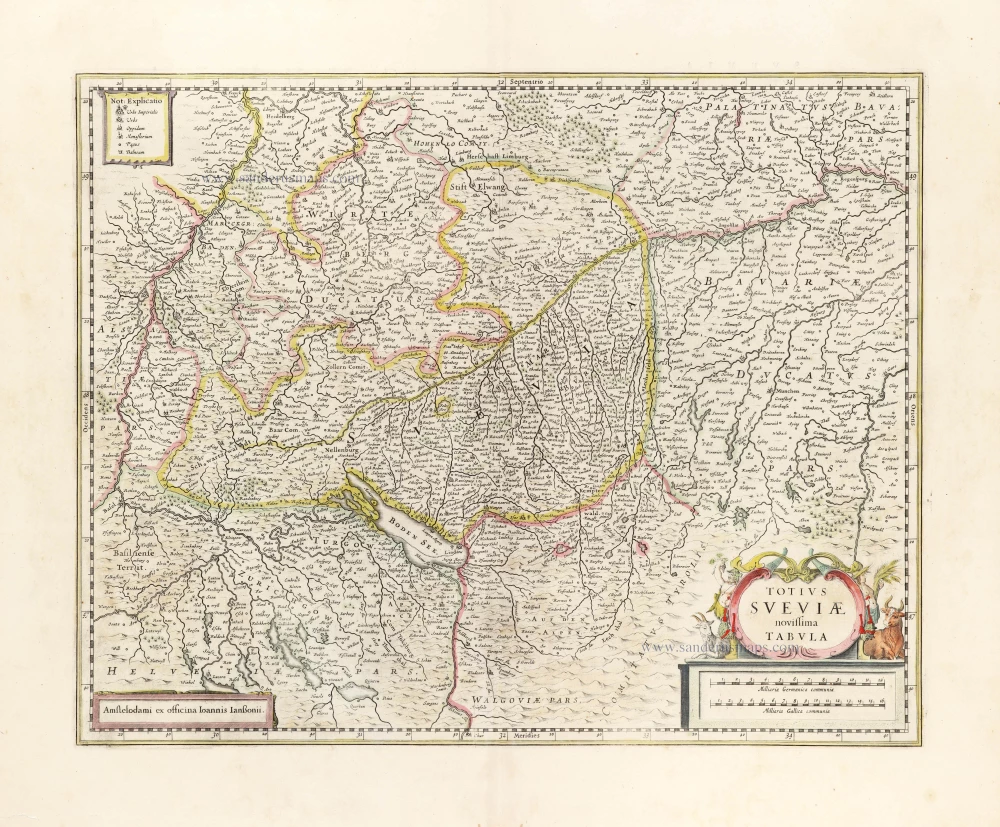
Totius Suevia Novissima Tabula 1633
Schwaben by Janssonius - Hondius.
[Item number: 8678]
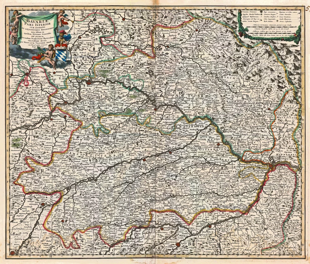
Bavariae Pars Inferior cum insertis et adjacentibus Regionibus ... 1683-1696
Bavaria (Bayern), by N. Visscher.
[Item number: 14590]

S.R.I. Sueviae Circulus atq Ducatus una cum Insertis et Adjacentibus Regionibus, . . . 1683-1696
Schwaben, by N. Visscher.
[Item number: 14613]
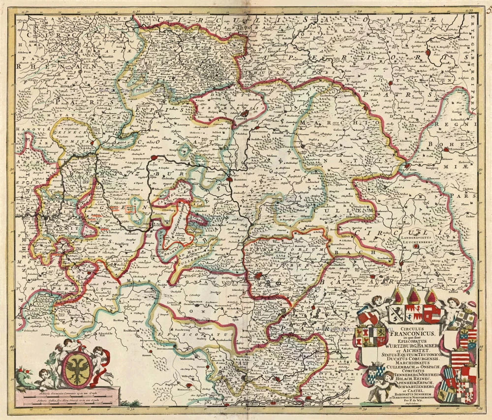
Circulus Franconicus in quo sunt Episcopatus Wurtzburg, Bamberg et Aichstet, Status Equitum Teutonicor Ducatus Coburgensis, Marchionatus Cullembach, et Onspach, Comitatus Henneberg, Wertheim Holach, Reinec, Papenheim, Erpach Schwartzenberg, et Castel, Baronatus Sensheim et Territorium Norinbergensis. c. 1682-96
Bavaria (Bayern) by F. de Wit
[Item number: 14815]

Alemannia sive Suevia Superior. 1647-50
Oberschwaben, by Blaeu W.
[Item number: 18630]

Sueviae Nova Tabula. 1635
Schwaben, by Blaeu W. & J.
[Item number: 20312]
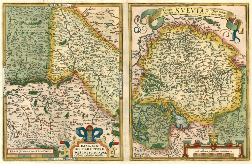
Basiliensis Territorii Descritorii Nova. - Circulus sive Liga Sveviae 1612
Basel and Schwaben by Abraham Ortelius.
[Item number: 22964]

Bavariae olim Vindeliciae, delineationis compendium 1612
Bayern, by A. Ortelius.
[Item number: 23005]

Le Cercle de Baviere subdivisé en tous les Estats qui le composent ... 1721-41
Bavaria (Bayern), by Covens & Mortier.
[Item number: 23814]
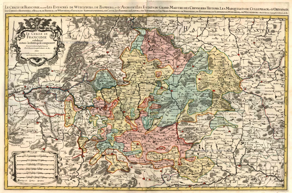
Le Cercle de Franconie subdivisé en tous les Estats qui le composent. c. 1695
Bavaria (Bayern) by Hubert Jaillot - Covens & Mortier.
[Item number: 23819]

Partie Orientale du Cercle de Franconie. 1721-41
Bavaria (Bayern), by Covens & Mortier.
[Item number: 23820]

Brixen - Brixia Tyrolis [on sheet with] Laugingen - Laubinga Sueviae Opp. Alberti Magni Patria. 1599
Bressanone (Brixen) in South Tyrol Italy and Lauingen in Schwaben Germany, by Georg Braun and Frans Hogenberg.
[Item number: 24119]

Circulus Bavaricus in quo sunt Ducatus Electoratus, & Palatinat Bavariae, Archiepisc. Salisburgi, Episcopatus Ratisbonae, Pataviae, & Fruxini, Palatinat Neoburgi & Landgravius Leuchtenbergi. c. 1680
Bayern, by F. De Wit.
[Item number: 24403]

Bavaria Ducatus 1623
Bayern, by G. Mercator.
[Item number: 24950]

La description de Souabe et Baviere. 1555
Bayern, by S. Munster.
[Item number: 25169]

Suevia et Bavaria XI Nova Tabula. 1550
Antique map of Southern Germany by Munster S.
[Item number: 29513]
Totius Sueviae novissima Tabula. 1653
Schwaben by Joannes Janssonius.
[Item number: 30387]

Bavariae superioris et Inferioris nova descriptio. 1653
Bayern by Johannes Janssonius.
[Item number: 30392]
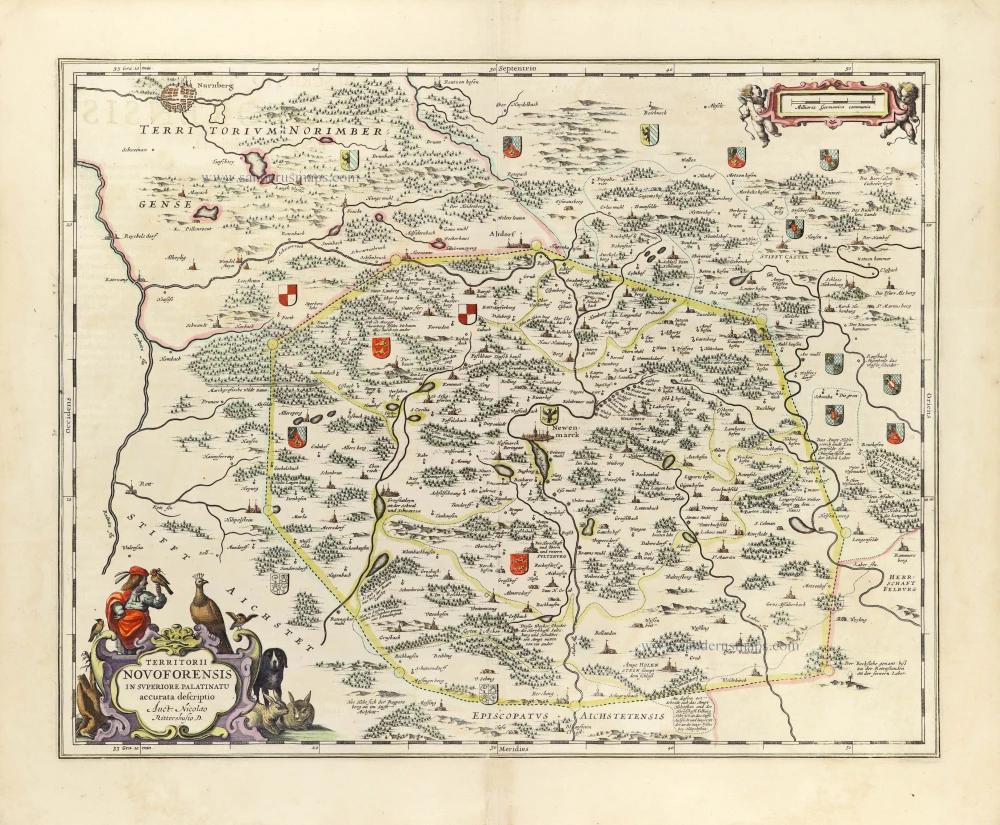
Territorii Novoforensis in Superiore Palatinatu accurata descriptio. 1653
Neuburg by Johannes Janssonius.
[Item number: 30393]
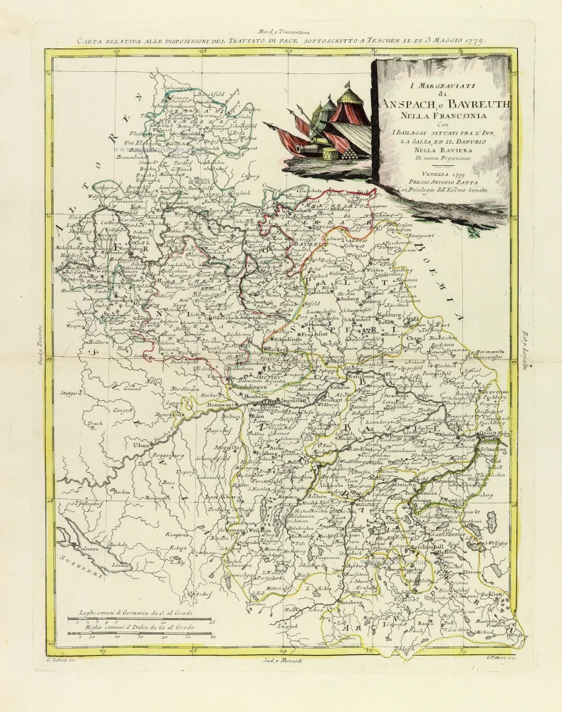
I Margraviati di Anspach, e Bayreuth nella Franconia Con I Bailaggi situati fra l'Inn, La Salza, ed il Danubio nella Baviera. 1779-1785
Southeastern Germany, by Antonio Zatta.
[Item number: 32317]