
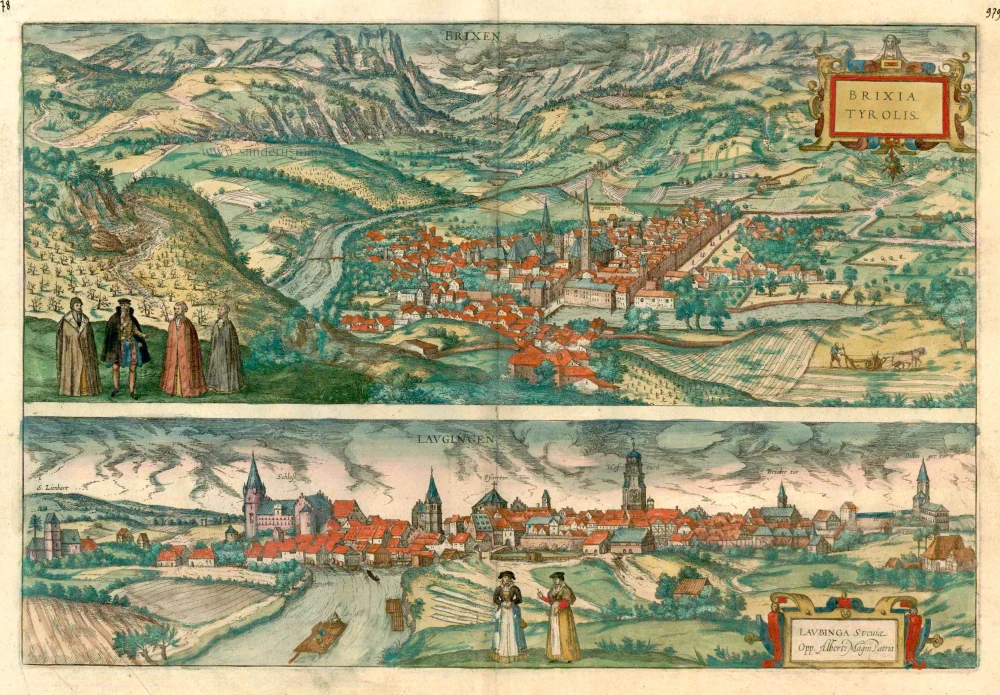
Bressanone (Brixen) in South Tyrol Italy and Lauingen in Schwaben Germany, by Georg Braun and Frans Hogenberg. 1599

BRESSANONE
COMMENTARY BY BRAUN (on verso): "High mountains surround the countryside around Bressanone, and there are many splendid fruit trees and other things here, notably white and red wine, so excellent that it is bought at a high price and exported to distant countries, where it is often drunk at princely tables and is reserved for banquets of state. The city boasts a very fine episcopal cathedral, a collegiate church, and an ancient episcopal palace."
Bressanone (in German Brixen), situated in a valley at the confluence of the Rienza and the Isarco, is seen from a mountain vantage point west-southwest of the city. The wide bridge spanning the Isarco leads to the parish church of St Michael with its pointed spire in the east abutting the chancel. To the left of it is the smaller 12th-century cathedral. The importance of the city's location at the head of the Brenner Pass is underscored by the inscription Roads from Potzen (Bolzano). Made an episcopal see in AD 990, Bressanone became the self-governing seat of prince-bishops in the 11th century. In 1150, Bressanone was fortified with walls, and the transit traffic flourishing on the Brenner route made its citizens prosper.
LAUINGEN
CARTOUCHE: Lauingen in Swabia, the birthplace of Albertus Magnus.
COMMENTARY BY BRAUN: "Lauingen is an old town on the Danube belonging to the Bavarian princes is Swaba, which can be seen not only in the design of its houses but can be read from its many Latin inscriptions. This city is the birthplace of Albertus Magnus, who descended from the illustrious Sollstetter family. On the site of his birthplace or house, a handsome church has been built, on the tower of which the inhabitants have placed his likeness to commemorate him."
This view from the east shows Lauingen, known for its artisans, as the figures in the foreground indicate. The bolts of cloth laid out to bleach on the meadows allude to the craft of weaving, which was an important source of income for the town. Erected as a watchtower in the 15th century, the Schimmel Tower (Hofturn) dwarfs the town. To the left is the late Gothic hall church of St Martin. The Spitalkirche (Hospice Church) by the Danube, whose late Gothic tower is visible to the right of the 15th-century castle, dates from the 13th century. The Dukes of Bavaria-Landshut built it. Lauingen, first mentioned in the 8th century, is now a small town in the rural district of Dillingen. (Taschen)
Braun G. & Hogenberg F. and the Civitates Orbis Terrarum.
The Civitates Orbis Terrarum, also known as the 'Braun & Hogenberg', is a six-volume town atlas and the most excellent book of town views and plans ever published: 363 engravings, sometimes beautifully coloured. It was one of the best-selling works in the last quarter of the 16th century. Georg Braun, a skilled writer, wrote the text accompanying the plans and views on the verso. Many plates were engraved after the original drawings of a professional artist, Joris Hoefnagel (1542-1600). The first volume was published in Latin in 1572 and the sixth in 1617. Frans Hogenberg, a talented engraver, created the tables for volumes I through IV, and Simon van den Neuwel made those for volumes V and VI. Other contributors were cartographers Daniel Freese and Heinrich Rantzau, who provided valuable geographical information. Works by Jacob van Deventer, Sebastian Münster, and Johannes Stumpf were also used as references. Translations appeared in German and French, making the atlas accessible to a broader audience.
Since its original publication of volume 1 in 1572, the Civitates Orbis Terrarum has left an indelible mark on the history of cartography. Seven more editions followed the first volume in 1575, 1577, 1582, 1588, 1593, 1599, and 1612. Vol.2, initially released in 1575, saw subsequent editions in 1597 and 1612. The subsequent volumes, each a treasure trove of historical insights, graced the world in 1581, 1588, 1593, 1599, and 1606. The German translation of the first volume, a testament to its widespread appeal, debuted in 1574, followed by the French edition in 1575.
Several printers were involved: Theodor Graminaeus, Heinrich von Aich, Gottfried von Kempen, Johannis Sinniger, Bertram Buchholtz, and Peter von Brachel, all of whom worked in Cologne.
Georg Braun (1541-1622)
Georg Braun, the author of the text accompanying the plans and views in the Civitates Orbis Terrarum, was born in Cologne in 1541. After his studies in Cologne, he entered the Jesuit Order as a novice, indicating his commitment to learning and intellectual pursuits. In 1561, he obtained his bachelor's degree; in 1562, he received his Magister Artium, further demonstrating his academic achievements. Although he left the Jesuit Order, he continued his studies in theology, gaining a licentiate in theology. His theological background likely influenced the content and tone of the text in the Civitates Orbis Terrarum, adding a unique perspective to the work.
Frans Hogenberg (1535-1590)
Frans Hogenberg was a Flemish and German painter, engraver, and mapmaker. He was born in Mechelen as the son of Nicolaas Hogenberg.
By the end of the 1560s, Frans Hogenberg was employed upon Abraham Ortelius's Theatrum Orbis Terrarum, published in 1570; he is named an engraver of numerous maps. In 1568, he was banned from Antwerp by the Duke of Alva and travelled to London, where he stayed a few years before emigrating to Cologne. He immediately embarked on his two most important works, the Civitates, published in 1572 and the Geschichtsblätter, which appeared in several series from 1569 until about 1587.
Thanks to large-scale projects like the Geschichtsblätter and the Civitates, Hogenberg's social circumstances improved with each passing year. He died as a wealthy man in Cologne in 1590.
Brixen - Brixia Tyrolis [on sheet with] Laugingen - Laubinga Sueviae Opp. Alberti Magni Patria.
Item Number: 24119 Authenticity Guarantee
Category: Antique maps > Europe > Germany - Cities
Antique map with two bird's-eye views by Braun and Hogenberg: Bressanone (Brixen) in South Tyrol, and Lauingen in Schwaben, Germany.
Title: Brixen - Brixia Tyrolis [on sheet with] Laugingen - Laubinga Sueviae Opp. Alberti Magni Patria.
Date of the first edition: 1588.
Date of this map: 1599.
Copper engraving, printed on paper.
Size (not including margins): 333 x 493mm (13.11 x 19.41 inches).
Verso: Latin text.
Condition: Uncoloured, excellent.
Condition Rating: A.
From: Liber quartus Urbium Praecipuarum totius Mundi. Cologne, Bertram Buchholtz, 1599. (Van der Krogt 4, 41:1.4(1599))
BRESSANONE
COMMENTARY BY BRAUN (on verso): "High mountains surround the countryside around Bressanone, and there are many splendid fruit trees and other things here, notably white and red wine, so excellent that it is bought at a high price and exported to distant countries, where it is often drunk at princely tables and is reserved for banquets of state. The city boasts a very fine episcopal cathedral, a collegiate church, and an ancient episcopal palace."
Bressanone (in German Brixen), situated in a valley at the confluence of the Rienza and the Isarco, is seen from a mountain vantage point west-southwest of the city. The wide bridge spanning the Isarco leads to the parish church of St Michael with its pointed spire in the east abutting the chancel. To the left of it is the smaller 12th-century cathedral. The importance of the city's location at the head of the Brenner Pass is underscored by the inscription Roads from Potzen (Bolzano). Made an episcopal see in AD 990, Bressanone became the self-governing seat of prince-bishops in the 11th century. In 1150, Bressanone was fortified with walls, and the transit traffic flourishing on the Brenner route made its citizens prosper.
LAUINGEN
CARTOUCHE: Lauingen in Swabia, the birthplace of Albertus Magnus.
COMMENTARY BY BRAUN: "Lauingen is an old town on the Danube belonging to the Bavarian princes is Swaba, which can be seen not only in the design of its houses but can be read from its many Latin inscriptions. This city is the birthplace of Albertus Magnus, who descended from the illustrious Sollstetter family. On the site of his birthplace or house, a handsome church has been built, on the tower of which the inhabitants have placed his likeness to commemorate him."
This view from the east shows Lauingen, known for its artisans, as the figures in the foreground indicate. The bolts of cloth laid out to bleach on the meadows allude to the craft of weaving, which was an important source of income for the town. Erected as a watchtower in the 15th century, the Schimmel Tower (Hofturn) dwarfs the town. To the left is the late Gothic hall church of St Martin. The Spitalkirche (Hospice Church) by the Danube, whose late Gothic tower is visible to the right of the 15th-century castle, dates from the 13th century. The Dukes of Bavaria-Landshut built it. Lauingen, first mentioned in the 8th century, is now a small town in the rural district of Dillingen. (Taschen)
Braun G. & Hogenberg F. and the Civitates Orbis Terrarum.
The Civitates Orbis Terrarum, also known as the 'Braun & Hogenberg', is a six-volume town atlas and the most excellent book of town views and plans ever published: 363 engravings, sometimes beautifully coloured. It was one of the best-selling works in the last quarter of the 16th century. Georg Braun, a skilled writer, wrote the text accompanying the plans and views on the verso. Many plates were engraved after the original drawings of a professional artist, Joris Hoefnagel (1542-1600). The first volume was published in Latin in 1572 and the sixth in 1617. Frans Hogenberg, a talented engraver, created the tables for volumes I through IV, and Simon van den Neuwel made those for volumes V and VI. Other contributors were cartographers Daniel Freese and Heinrich Rantzau, who provided valuable geographical information. Works by Jacob van Deventer, Sebastian Münster, and Johannes Stumpf were also used as references. Translations appeared in German and French, making the atlas accessible to a broader audience.
Since its original publication of volume 1 in 1572, the Civitates Orbis Terrarum has left an indelible mark on the history of cartography. Seven more editions followed the first volume in 1575, 1577, 1582, 1588, 1593, 1599, and 1612. Vol.2, initially released in 1575, saw subsequent editions in 1597 and 1612. The subsequent volumes, each a treasure trove of historical insights, graced the world in 1581, 1588, 1593, 1599, and 1606. The German translation of the first volume, a testament to its widespread appeal, debuted in 1574, followed by the French edition in 1575.
Several printers were involved: Theodor Graminaeus, Heinrich von Aich, Gottfried von Kempen, Johannis Sinniger, Bertram Buchholtz, and Peter von Brachel, all of whom worked in Cologne.
Georg Braun (1541-1622)
Georg Braun, the author of the text accompanying the plans and views in the Civitates Orbis Terrarum, was born in Cologne in 1541. After his studies in Cologne, he entered the Jesuit Order as a novice, indicating his commitment to learning and intellectual pursuits. In 1561, he obtained his bachelor's degree; in 1562, he received his Magister Artium, further demonstrating his academic achievements. Although he left the Jesuit Order, he continued his studies in theology, gaining a licentiate in theology. His theological background likely influenced the content and tone of the text in the Civitates Orbis Terrarum, adding a unique perspective to the work.
Frans Hogenberg (1535-1590)
Frans Hogenberg was a Flemish and German painter, engraver, and mapmaker. He was born in Mechelen as the son of Nicolaas Hogenberg.
By the end of the 1560s, Frans Hogenberg was employed upon Abraham Ortelius's Theatrum Orbis Terrarum, published in 1570; he is named an engraver of numerous maps. In 1568, he was banned from Antwerp by the Duke of Alva and travelled to London, where he stayed a few years before emigrating to Cologne. He immediately embarked on his two most important works, the Civitates, published in 1572 and the Geschichtsblätter, which appeared in several series from 1569 until about 1587.
Thanks to large-scale projects like the Geschichtsblätter and the Civitates, Hogenberg's social circumstances improved with each passing year. He died as a wealthy man in Cologne in 1590.
Related items
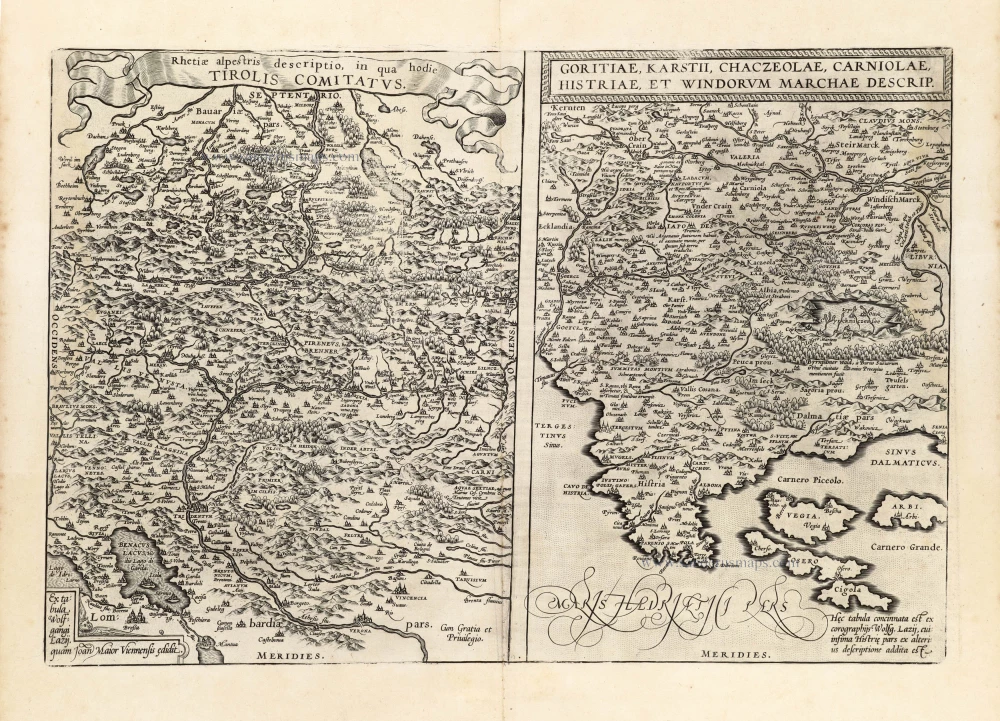
Rhetiae alpestris descriptio in qua hodie Tirolis Comitatus. - Goritiae, Karstii, Chaczeolae, Carniolae, Histriae, et Windorum Marchae descrip. 1601
Tirol - Friuli, Carniola, and Istria by Abraham Ortelius.
[Item number: 13144]

Tiburtum vulgo Tivoli. 1588
Tivoli by Braun and Hogenberg.
[Item number: 20609]

Urbis Romae Situs cum ils quae adhuc Conspiciuntur Veter. Monumet Reliquiis Pyrrho Ligorio Neap. Invent. Romae M.D.LXX 1623
Ancient Rome by Braun and Hogenberg.
[Item number: 22409]

Puteoli - Baiae 1623
Pozzuoli and Baia, by Georg Braun and Frans Hogenberg.
[Item number: 22411]

Nurnberga Florentissimum Germaniae Emporium, ... [on sheet with] Ulma Imperialis in Suevia [and] Saltzburg Urbis Salisburgensis Genvina Descriptio [and] Lindaw - Lindoia, Oppidum Imperij insulare, ... 1599
Nürnberg, Ulm, Salzburg, and Lindau, by Georg Braun and Frans Hogenberg.
[Item number: 23926]

Roma. 1599
Rome by Braun and Hogenberg.
[Item number: 23941]

Magnifica Illa Civitas Verona [on sheet with] Colonia Augusta Verona Nova Galieniana Verona, Celeberrima, Amplissimaque Cenomanorum Urbs, Ptolemaeo 1599
Verona, by Braun and Hogenberg.
[Item number: 24064]
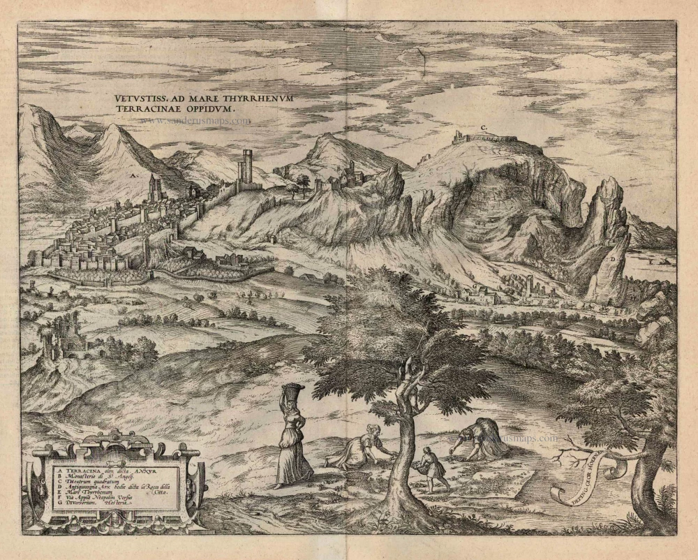
Vetustiss. Ad Mare Thyrrhenum Terracinae Oppidum. 1599
Terracina by Braun and Hogenberg.
[Item number: 24069]

Mirabilium Sulphureorum Motium Apud Puteolos campos. 1599
The Phlegraean Fields (Campi Flegrei), by Braun and Hogenberg.
[Item number: 24073]
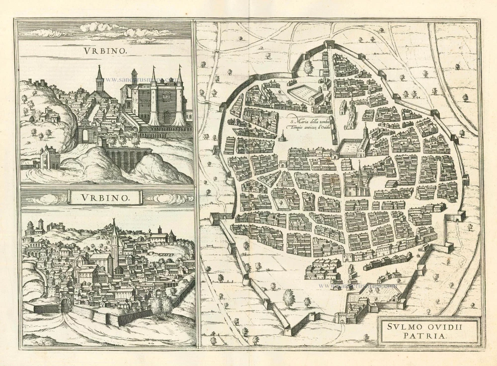
Urbino - Sulmo Ovidii Patria 1599
Urbino and Sulmona, by Braun and Hogenberg.
[Item number: 24126]

Nocerra In Appennino monte [on sheet with] Castel Novo 1596
Nocerra Umbra and Castelnuovo di Porto, by Georg Braun and Frans Hogenberg.
[Item number: 24196]

Calatia vulgo Caiazo, perantiquum Campaniae foelicis oppidum. 1596
Caiazzo by Braun and Hogenberg.
[Item number: 24198]
Brixen - Brixia Tyrolis [on sheet with] Laugingen - Laubinga Sueviae Opp. Alberti Magni Patria. c. 1593
Bressanone (Brixen) & Lauingen, by Georg Braun and Frans Hogenberg.
[Item number: 24575]

Sueviae et Bavariae Descriptio. 1550
Southern Germany (Schwaben & Bayern), by Sebastian Münster.
[Item number: 29302]

Comitatus Tirolensis. 1653
Tirol by Johannes Janssonius.
[Item number: 30389]

Comitatus Tirolis, Episcopatus et Comitatus Tridentinus, Episcopatus Brixensis. 1696-1713
Tirol - Trier, and Brixen by Cornelius Danckerts.
[Item number: 32527]