
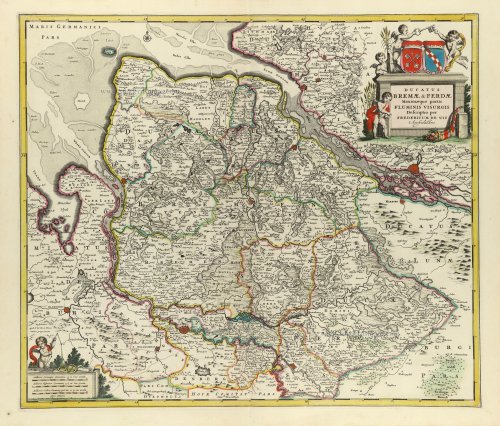
The Duchies of Bremen and Verden, including Oldenburg and Hamburg on the River Elbe, by Frederick De Wit. 1682-88

Frederick de Wit (1630-1706)
The engraver and map-seller, Frederick de Wit, was born in Gouda (Netherlands) in 1630 as a son of Hendrick Fredericksz de Wit. Through his marriage with Maria van der Waag of Amsterdam in 1661, he obtained citizenship of the city where he had been working since 1648 and where he became one of the most famous engravers of maps of the second half of the 17th century. Although De Wit was a Catholic, which meant that he was not favoured at the time by the city council, he was awarded the honour of being listed as one of the "excellent citizens" on the roll of the city council in the years 1694-1704. However, his name was not written in the Guild of St. Luke book before 1664. At that time, he lived on the Kalverstraat "in de Witte Pascaert", where he stayed until his death in 1706. His earliest dates on maps engraved are 1659 (Regni Daniae) and 1660 (World map).
Frederick de Wit published several world atlases, a sea atlas, and an atlas of the Netherlands.
The dating of the maps is difficult. However, as a privilege was granted in 1689, the annotation 'cum privilegio' marks an edition after 1688.
Around 1700, Frederick de Wit entered the market with a town atlas. He produced two volumes with a total of 260 plans and views. Most were printed from plates used for Janssonius and Blaeu town atlases.
After he died in 1706, his widow continued the shop until 1709. The plates and stock of De Wit's atlas were sold to Covens & Mortier in 1710, who sold the atlas for an extended period.
Ducatus Bremae & Ferdae Maximaeque partis Fluminis Visurgis.
Item Number: 32635 Authenticity Guarantee
Category: Antique maps > Europe > Germany
The Duchies of Bremen and Verden, including Oldenburg and Hamburg on the River Elbe, by Frederick De Wit.
Title: Ducatus Bremae & Ferdae Maximaeque partis Fluminis Visurgis.
Descriptio per Fredericum de Wit Amstelodami.
Cartographer: F. de Wit.
Date of the first edition: c. 1680.
Date of this map: 1682-88.
Copper engraving, printed on paper.
Image size: 490 x 570mm (19¼ x 22½ inches).
Sheet size: 530 x 625mm (20¾ x 24½ inches).
Verso: Blank.
Condition: Original coloured, excellent.
Condition Rating: A+.
From: Atlas. Amsterdam, Frederick de Wit, 1682-88. (Carhart, p. 146 A100b)
Frederick de Wit (1630-1706)
The engraver and map-seller, Frederick de Wit, was born in Gouda (Netherlands) in 1630 as a son of Hendrick Fredericksz de Wit. Through his marriage with Maria van der Waag of Amsterdam in 1661, he obtained citizenship of the city where he had been working since 1648 and where he became one of the most famous engravers of maps of the second half of the 17th century. Although De Wit was a Catholic, which meant that he was not favoured at the time by the city council, he was awarded the honour of being listed as one of the "excellent citizens" on the roll of the city council in the years 1694-1704. However, his name was not written in the Guild of St. Luke book before 1664. At that time, he lived on the Kalverstraat "in de Witte Pascaert", where he stayed until his death in 1706. His earliest dates on maps engraved are 1659 (Regni Daniae) and 1660 (World map).
Frederick de Wit published several world atlases, a sea atlas, and an atlas of the Netherlands.
The dating of the maps is difficult. However, as a privilege was granted in 1689, the annotation 'cum privilegio' marks an edition after 1688.
Around 1700, Frederick de Wit entered the market with a town atlas. He produced two volumes with a total of 260 plans and views. Most were printed from plates used for Janssonius and Blaeu town atlases.
After he died in 1706, his widow continued the shop until 1709. The plates and stock of De Wit's atlas were sold to Covens & Mortier in 1710, who sold the atlas for an extended period.
Related items
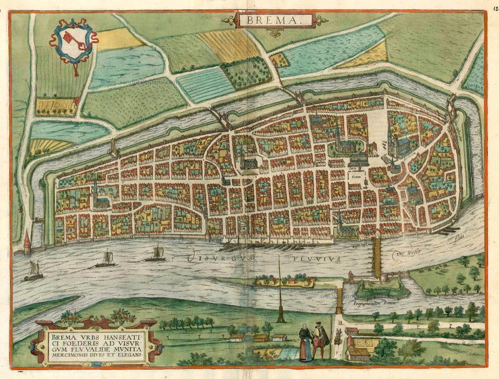
Brema. c. 1610
Bremen, by Georg Braun and Frans Hogenberg.
[Item number: 16673]

Celeberrimi Fluvii Albis nova delineatio 1642-43
Elbe River - Hamburg by Blaeu W.
[Item number: 18728]

Westfalia Cum Dioecesi Bremensi 1595
Ost-Friesland, Oldenburg, and Bremen by Gerard Mercator.
[Item number: 19091]

Brunopolis vulgo Brunsvicum, ... [on sheet with] Luneburgum, Nobilis Saxoniae Urbs, ... [and] Brema [and] Aldenburgum Holsatiae. 1572
Braunschweig, Luneburg, Bremen, and Stade, by Georg Braun and Frans Hogenberg.
[Item number: 21609]

Ducatus Bremae et Ferdae, Maximaeque partis Ducatus Stormariae, Comitatus Oldenburgi, Albis, Visurgisque Fluminum Novissima Descriptio. c. 1670
The Duchies of Bremen and Verden by Nicolaes Visscher I.
[Item number: 28547]

Brunopolis vulgo Brunsvicum, ... [on sheet with] Luneburgum, Nobilis Saxoniae Urbs, ... [and] Brema [and] Aldenburgum Holsatiae 1582
Braunschweig, Luneburg, Bremen, and Stade, by Georg Braun and Frans Hogenberg.
[Item number: 28938]

Episcopatus Bremensis cum Adiacentibus. 1653
Ost-Friesland, Oldenburg, and Bremen by Johannes Janssonius after Gerard Mercator.
[Item number: 30374]

Bremen. 1686
Bremen by Christoph Riegel.
[Item number: 31515]
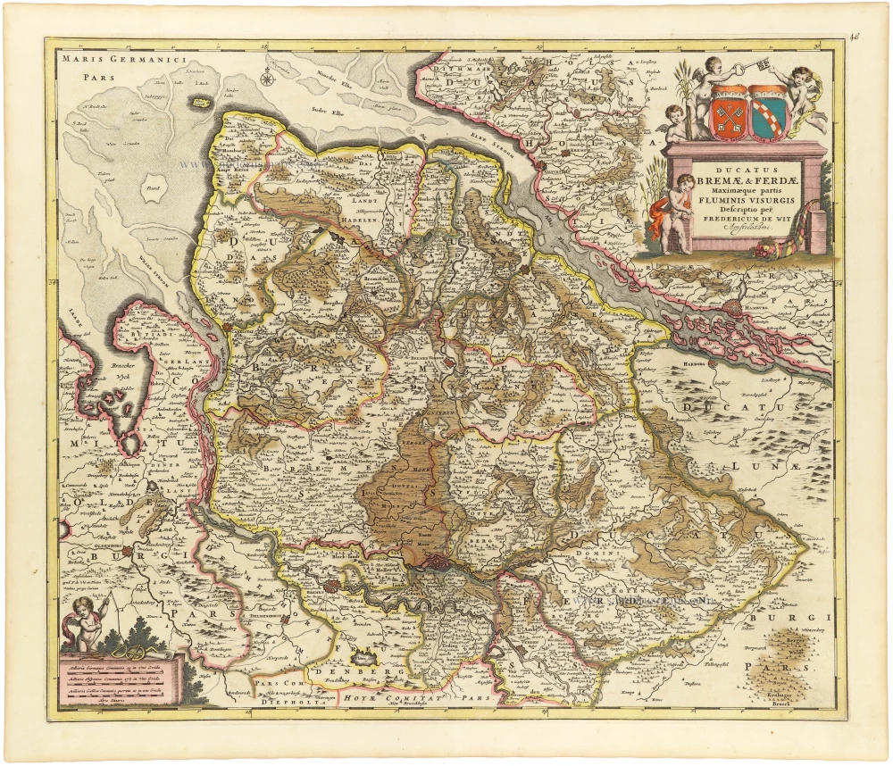
Ducatus Bremae & Ferdae Maximaeque partis Fluminis Visurgis. 1682-88
The Duchies of Bremen and Verden, including Oldenburg and Hamburg on the River Elbe, by Frederick De Wit.
[Item number: 33166]

Oldenburg Comitatus. c. 1630-1650
Oldenburg by Henricus Hondius.
[Item number: 33275]
new
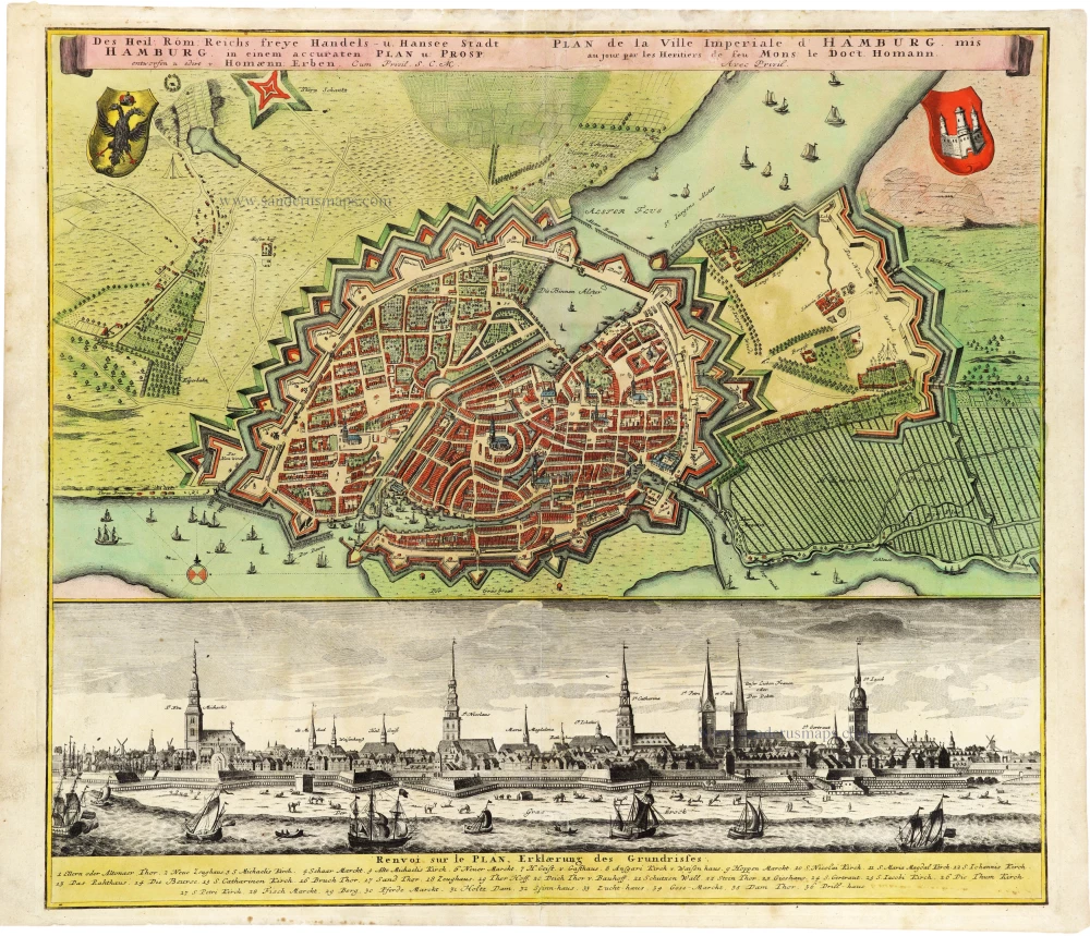
Des Heil: Rom: Reichs freye Handels- u. Hansee Stadt Hamburg in einem accuraten Plan u: Prosp: entworfen u: edirt v: Homaenn: Erben. After c. 1730
Plan and panoramic view of Hamburg, by Homann Heirs.
[Item number: 33278]
new

Westfalia Cum Dioecesi Bremensi c. 1620-1650
Ost-Friesland, Oldenburg, and Bremen by Gerard Mercator, published by Henricus Hondius
[Item number: 33282]
new
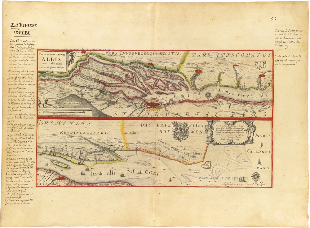
Celeberrimi Fluvii Albis nova delineatio c. 1620-1650
Elbe River - Hamburg by Blaeu W.
[Item number: 33286]
new