
Ost-Friesland, Oldenburg, and Bremen by Gerard Mercator, published by Henricus Hondius c. 1620-1650

Gerard Mercator (1512 – 1594)
Gerard Mercator was born Gerard de Cremere in Rupelmonde (near Antwerp) on 5 March 1512.
Young Gerard learned what Latin he could in Rupelmonde, and when he was about fifteen, his uncle sent him to s'Hertogenbosch to study at a school run by the Brothers of the Common Life. One of Mercator’s teachers was the celebrated humanist Macropedius. After three and a half years with the brothers, Gerard went to Louvain, where he enrolled in the university in 1530 as one of the poor students at Castle College.
By this time, he had Latinized his name to Mercator. He studied philosophy and took his master’s degree in 1532. The problems of the creation of the Universe and the Earth interested him in particular, and this is reflected in his works written in later years.
After spending a few years in Antwerp, he returned to Louvain in c. 1535, where he took courses in mathematics under Gemma Frisius. Soon, he was recognised as an expert on the construction of mathematical instruments, as a land surveyor and, after 1537, as a cartographer. He drew his income from these activities after his marriage on August 3, 1536. He also qualified himself as a copper engraver, the first to introduce italic handwriting to this trade. The first maps, drawn and engraved by Gerard Mercator, are Palestine, 1537; the World in double heart-shaped projection, 1538; and Flanders, 1540.
In 1544, Mercator came into great danger: he was arrested on the accusation of heresy and put into jail. Thanks to the intervention of the University of Louvain, he was released after four months. In 1552, he moved with his family to Duisburg (Germany). In 1560, Mercator became a cosmographer in service of the Duke of Jülich-Cleve-Berge, and in 1563, he became a lecturer at the Grammar School of the new University in Duisburg. During this period, he made wall maps of Europe, 1554; of Loraine, 1564; the British Isles, 1564; and the famous world map with increasing latitudes, 1569. About this time, Mercator was also working on the project for a complete description of the creation, the Heavens, Earth, Sea and world history. This resulted in his Atlas, sive cosmographicae meditationes de fabrica mundi et fabricati figura. He also worked on an edition of Ptolemy’s Geographia in 1578. The first part of his book, which contains modern maps (France, Germany, and the Netherlands), appeared in 1585.
Shortly after the publication of the second part of his map book (not yet called Atlas) with the maps of Italy (1589), he had a stroke that ended his highly significant productivity. The great man passed away on 2 December 1594, leaving the responsibility of finishing the map book to his son Rumold. The final part of it appeared in 1595. Its title is Pars Altera, and it constitutes an essential part of what was then called Mercator’s Atlas.
The map of Europe and the world map in the Atlas are by Rumold Mercator. After Rumold died in 1599, the Atlas was reissued in 1602.
The plates of the maps, both of the Ptolemy edition and the Atlas, were sold in 1604 to Jodocus Hondius of Amsterdam. The following year, Hondius managed to bring out Ptolemy’s Geographia. In 1606, the first Amsterdam edition of the Mercator Atlas appeared in the next year. From then to 1638, the Atlas saw many enlarged editions in various languages.
Westfalia Cum Dioecesi Bremensi
Item Number: 33282 new Authenticity Guarantee
Category: Antique maps > Europe > Germany
Ost-Friesland, Oldenburg, and Bremen by Gerard Mercator, published by Henricus Hondius.
Title: Westfalia Cum Dioecesi Bremensi
Cartographer: Gerard Mercator.
Date of the first edition: 1585 State 1.
Date of this map: c. 1620-1650.
Copper engraving, printed on paper.
Image size: 355 x 455mm (14 x 18 inches).
Sheet size: 505 x 690mm (20 x 27¼ inches).
Verso: Blank.
Condition: Ost-Friesland, Oldenburg, and Bremen.
Condition Rating: A+.
Separate publication - from a French Composite Atlas, c. 1620-1650.
Gerard Mercator (1512 – 1594)
Gerard Mercator was born Gerard de Cremere in Rupelmonde (near Antwerp) on 5 March 1512.
Young Gerard learned what Latin he could in Rupelmonde, and when he was about fifteen, his uncle sent him to s'Hertogenbosch to study at a school run by the Brothers of the Common Life. One of Mercator’s teachers was the celebrated humanist Macropedius. After three and a half years with the brothers, Gerard went to Louvain, where he enrolled in the university in 1530 as one of the poor students at Castle College.
By this time, he had Latinized his name to Mercator. He studied philosophy and took his master’s degree in 1532. The problems of the creation of the Universe and the Earth interested him in particular, and this is reflected in his works written in later years.
After spending a few years in Antwerp, he returned to Louvain in c. 1535, where he took courses in mathematics under Gemma Frisius. Soon, he was recognised as an expert on the construction of mathematical instruments, as a land surveyor and, after 1537, as a cartographer. He drew his income from these activities after his marriage on August 3, 1536. He also qualified himself as a copper engraver, the first to introduce italic handwriting to this trade. The first maps, drawn and engraved by Gerard Mercator, are Palestine, 1537; the World in double heart-shaped projection, 1538; and Flanders, 1540.
In 1544, Mercator came into great danger: he was arrested on the accusation of heresy and put into jail. Thanks to the intervention of the University of Louvain, he was released after four months. In 1552, he moved with his family to Duisburg (Germany). In 1560, Mercator became a cosmographer in service of the Duke of Jülich-Cleve-Berge, and in 1563, he became a lecturer at the Grammar School of the new University in Duisburg. During this period, he made wall maps of Europe, 1554; of Loraine, 1564; the British Isles, 1564; and the famous world map with increasing latitudes, 1569. About this time, Mercator was also working on the project for a complete description of the creation, the Heavens, Earth, Sea and world history. This resulted in his Atlas, sive cosmographicae meditationes de fabrica mundi et fabricati figura. He also worked on an edition of Ptolemy’s Geographia in 1578. The first part of his book, which contains modern maps (France, Germany, and the Netherlands), appeared in 1585.
Shortly after the publication of the second part of his map book (not yet called Atlas) with the maps of Italy (1589), he had a stroke that ended his highly significant productivity. The great man passed away on 2 December 1594, leaving the responsibility of finishing the map book to his son Rumold. The final part of it appeared in 1595. Its title is Pars Altera, and it constitutes an essential part of what was then called Mercator’s Atlas.
The map of Europe and the world map in the Atlas are by Rumold Mercator. After Rumold died in 1599, the Atlas was reissued in 1602.
The plates of the maps, both of the Ptolemy edition and the Atlas, were sold in 1604 to Jodocus Hondius of Amsterdam. The following year, Hondius managed to bring out Ptolemy’s Geographia. In 1606, the first Amsterdam edition of the Mercator Atlas appeared in the next year. From then to 1638, the Atlas saw many enlarged editions in various languages.
Related items

Oldenburg Comitatus c. 1680
Oldenburg, by F. de Wit.
[Item number: 13774]
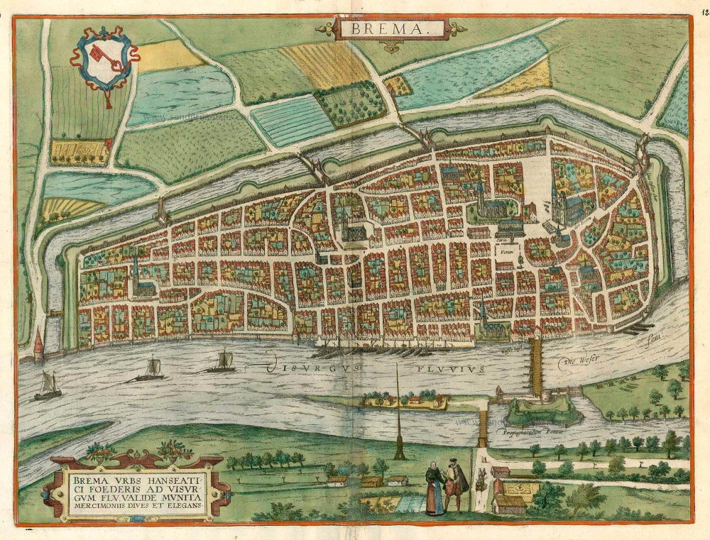
Brema. c. 1610
Bremen, by Georg Braun and Frans Hogenberg.
[Item number: 16673]

Thietmarsiae, Holsaticae Regionis Partis Typus. - Oldenburg Comit. 1612
Dithmarschen - Oldenburg, by Abraham Ortelius.
[Item number: 18704]
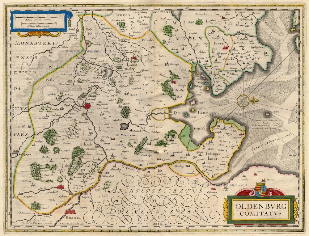
Oldenburg Comitatus. 1647-50
Oldenburg, by Blaeu W.
[Item number: 18909]

Westfalia Cum Dioecesi Bremensi 1595
Ost-Friesland, Oldenburg, and Bremen by Gerard Mercator.
[Item number: 19091]

Brunopolis vulgo Brunsvicum, ... [on sheet with] Luneburgum, Nobilis Saxoniae Urbs, ... [and] Brema [and] Aldenburgum Holsatiae. 1572
Braunschweig, Luneburg, Bremen, and Stade, by Georg Braun and Frans Hogenberg.
[Item number: 21609]

Frisia Orientalis [With inset:] Rideriae Portionis. 1612
Ost-Friesland by Ortelius A.
[Item number: 22948]

Thietmarsiae, Holsaticae Regionis Partis Typus. - Oldenburg Comit. 1612
Dithmarschen - Oldenburg by Ortelius A.
[Item number: 23001]

Frisia Orientalis [With inset:] Rideriae Portionis. 1612
Ost-Friesland by Abraham Ortelius.
[Item number: 23047]
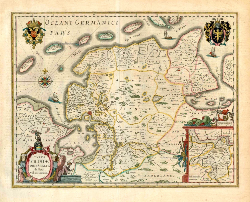
Typus Frisiae Orientalis. 1643
Ost-Friesland, by Willem Blaeu.
[Item number: 27110]

Emden & Oldenborch Comit. 1623
Emden - Oldenburg, by Gerard Mercator.
[Item number: 28134]
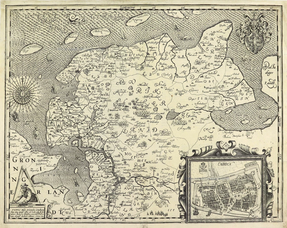
TYPUS Frisiae Orientalis à Dullarto sinu, atq. amasi ostio ad Iada usq fl. singulari studio ac industria concinat et ad vivum expressus. 1622
Ost-Friesland by Petrus Kaerius (Pieter Van den Keere).
[Item number: 28212]
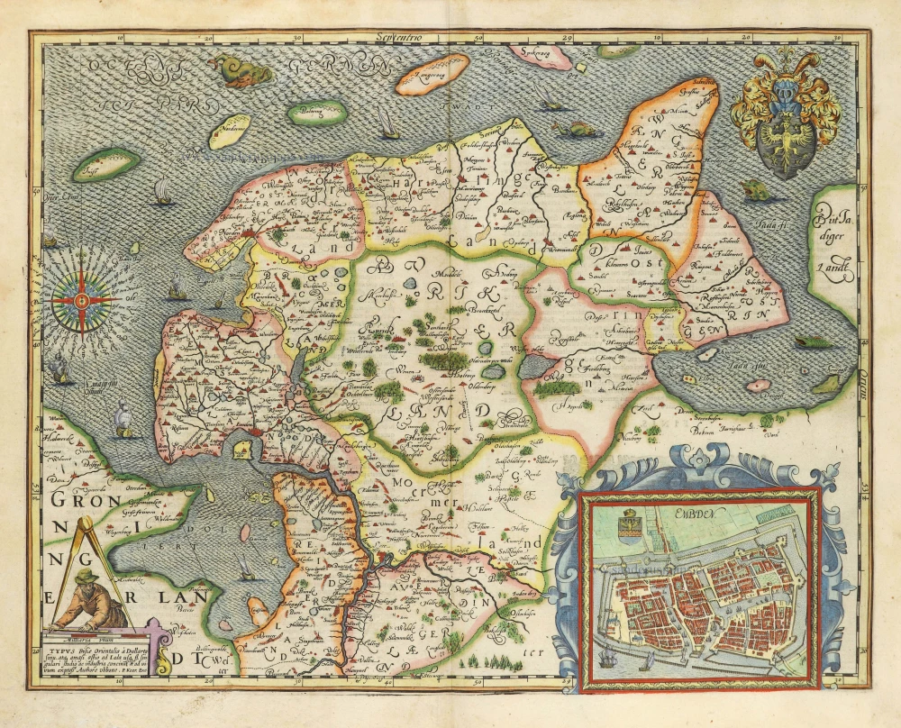
TYPUS Frisiae Orientalis à Dullarto sinu, atq. amasi ostio ad Iada usq fl. singulari studio ac industria concinat et ad vivum expressus. 1622
Ost-Friesland by Petrus Kaerius (Pieter Van den Keere).
[Item number: 28531]

Ducatus Bremae et Ferdae, Maximaeque partis Ducatus Stormariae, Comitatus Oldenburgi, Albis, Visurgisque Fluminum Novissima Descriptio. c. 1670
The Duchies of Bremen and Verden by Nicolaes Visscher I.
[Item number: 28547]

Brunopolis vulgo Brunsvicum, ... [on sheet with] Luneburgum, Nobilis Saxoniae Urbs, ... [and] Brema [and] Aldenburgum Holsatiae 1582
Braunschweig, Luneburg, Bremen, and Stade, by Georg Braun and Frans Hogenberg.
[Item number: 28938]

Oldenburg Comitatus. 1653
Oldenburg by Johannes Janssonius.
[Item number: 30373]

Episcopatus Bremensis cum Adiacentibus. 1653
Ost-Friesland, Oldenburg, and Bremen by Johannes Janssonius after Gerard Mercator.
[Item number: 30374]
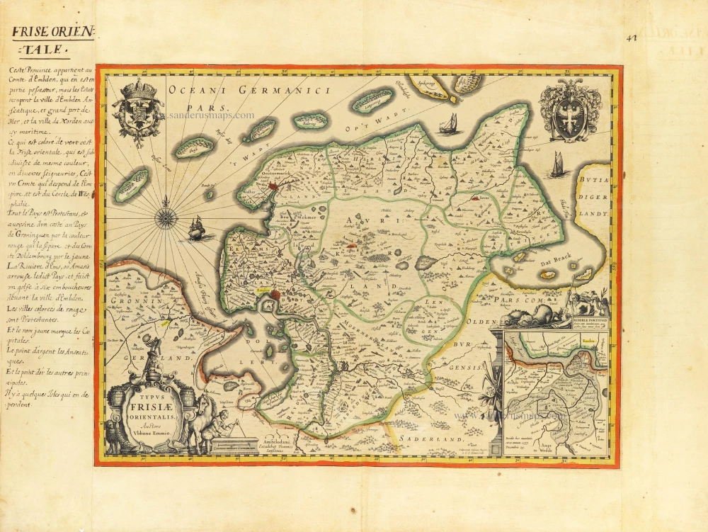
Typus Frisiae Orientalis. c. 1610-1650
Antique map of Ost-Friesland by J. Janssonius.
[Item number: 31218]

Bremen. 1686
Bremen by Christoph Riegel.
[Item number: 31515]

La Frise Orientale. 1633
Ost-Friesland by C. Tassin.
[Item number: 31757]

Ducatus Bremae & Ferdae Maximaeque partis Fluminis Visurgis. 1682-88
The Duchies of Bremen and Verden, including Oldenburg and Hamburg on the River Elbe, by Frederick De Wit.
[Item number: 32635]

Frisiae Orientalis nova et exacta descriptio 1593
Ost-Friesland by Gerard de Jode
[Item number: 32893]

Oldenburg Comitatus. c. 1630-1650
Oldenburg by Henricus Hondius.
[Item number: 33275]
new