
Greece, by Gerard de Jode 1578


In 1578 Gerard de Jode published his Speculum Orbis Terrarum, an atlas aimed at competing with the Theatrum of Ortelius. However, the latter had first been issued in 1570 and had already built a commanding market presence, and so despite de Jode's longer standing reputation the atlas did not sell very well. Only a dozen or so examples have survived. Undeterred, he made plans for another expanded edition, and upon his death in 1591 it was taken on by his son Cornelis. The Speculum Orbis Terrae of 1593 likewise did not sell well and was never reissued. Although more examples than the first edition have survived, it too is very scarce. Many of de Jode's maps are judged to be superior to those of Ortelius, both in detail and style.
Gerard and Cornelis de Jode
Gerard de Jode (Judaeus) (1508(?)-1591), a native of Nijmegen, began his career as a printer and engraver in Antwerp about 1550. He lived near the Bourse on the Catelijne Veste, or on "de Catte". He was in regular contact with Christoffel Plantin, to whom he sold many prints and maps. De Jode's business, which must have been a major one among Antwerp's many booksellers and printers, was represented at the Frankfurt fair, where de Jode bought maps that he later copied or re-sold. Most of the maps sold by De Jode have prototypes of Italian or German origin. Apart from his many separately published maps, Gerard de Jode is known for his atlas, Speculum Orbis Terrarum, published in 1578. Part of the engraving was done by himself, and part by brothers Jan and Lucas van Doetecum.
Gerard de Jode and Abraham Ortelius, who partly lived as map sellers, were competitors and only sometimes on good terms.
After the death of Gerard de Jode in 1591, the business was carried on by his widow, Pascale van Gelder and his son, Cornelis (1568-1600). More a publisher than an engraver, the latter reissued the Speculum in 1593, adding new maps and revising others.
Despite all its deficiencies, the Speculum must have had a good reputation. It is mentioned alongside Mercator's Atlas and Ortelius's Theatrum in Petrus Montanus's preface to the Germania Inferior of Pieter van den Keere.
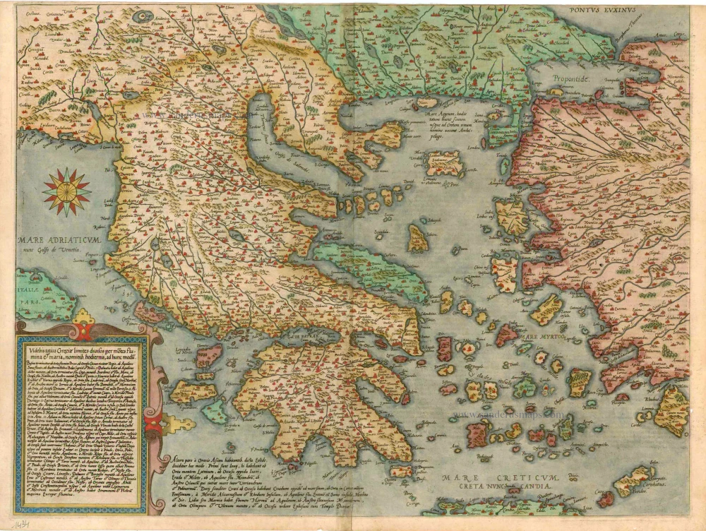
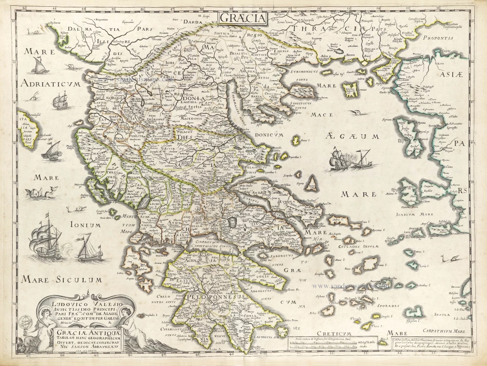
Videbis Totius Grecia Limites Divisos per Motes Flumina & Maria ...
Item Number: 1434 Authenticity Guarantee
Category: Antique maps > Europe > Greece & Greek Islands
Old, antique map of Greece, by Gerard de Jode.
Title: Videbis Totius Grecia Limites Divisos per Motes Flumina & Maria ...
Cartographer: Pirro Ligorio.
Date of the first edition: 1578.
Date of this map: 1578.
Copper engraving, printed on paper.
Size (not including margins): 390 x 510mm (15.35 x 20.08 inches).
Verso: Latin text.
Condition: Contemporary old coloured, upper margin trimmed to neatline.
Condition Rating: A.
From: Speculum Orbis Terrae. Antwerp, G. De Jode, 1578. (Van der Krogt 3, 32:01)
In 1578 Gerard de Jode published his Speculum Orbis Terrarum, an atlas aimed at competing with the Theatrum of Ortelius. However, the latter had first been issued in 1570 and had already built a commanding market presence, and so despite de Jode's longer standing reputation the atlas did not sell very well. Only a dozen or so examples have survived. Undeterred, he made plans for another expanded edition, and upon his death in 1591 it was taken on by his son Cornelis. The Speculum Orbis Terrae of 1593 likewise did not sell well and was never reissued. Although more examples than the first edition have survived, it too is very scarce. Many of de Jode's maps are judged to be superior to those of Ortelius, both in detail and style.
Gerard and Cornelis de Jode
Gerard de Jode (Judaeus) (1508(?)-1591), a native of Nijmegen, began his career as a printer and engraver in Antwerp about 1550. He lived near the Bourse on the Catelijne Veste, or on "de Catte". He was in regular contact with Christoffel Plantin, to whom he sold many prints and maps. De Jode's business, which must have been a major one among Antwerp's many booksellers and printers, was represented at the Frankfurt fair, where de Jode bought maps that he later copied or re-sold. Most of the maps sold by De Jode have prototypes of Italian or German origin. Apart from his many separately published maps, Gerard de Jode is known for his atlas, Speculum Orbis Terrarum, published in 1578. Part of the engraving was done by himself, and part by brothers Jan and Lucas van Doetecum.
Gerard de Jode and Abraham Ortelius, who partly lived as map sellers, were competitors and only sometimes on good terms.
After the death of Gerard de Jode in 1591, the business was carried on by his widow, Pascale van Gelder and his son, Cornelis (1568-1600). More a publisher than an engraver, the latter reissued the Speculum in 1593, adding new maps and revising others.
Despite all its deficiencies, the Speculum must have had a good reputation. It is mentioned alongside Mercator's Atlas and Ortelius's Theatrum in Petrus Montanus's preface to the Germania Inferior of Pieter van den Keere.
Related items
Rare
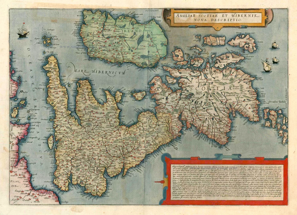
Angliae Scotiae et Hibernie Nova Descriptio 1593
British Isles, by de G. Jode.
[Item number: 11236]
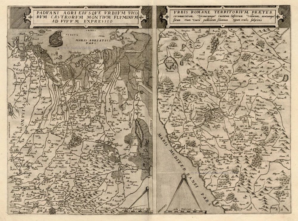
Paduani Agri Eiusque Urbium Vicorum Castorum Montium Fluminum ad Vivum Expressio [on sheet with] Urbis Romane Territorium Praeter Circumacentium ... 1593
Padua and Venice - the vicinity of Rome, by G. de Jode.
[Item number: 12133]

Graeciae Universae Secundum Hodiernum Situm Neoterica Descriptio. Jacobo Castaldo Pedemontano Autore. 1608
Greece, by Matthias Quad.
[Item number: 18856]
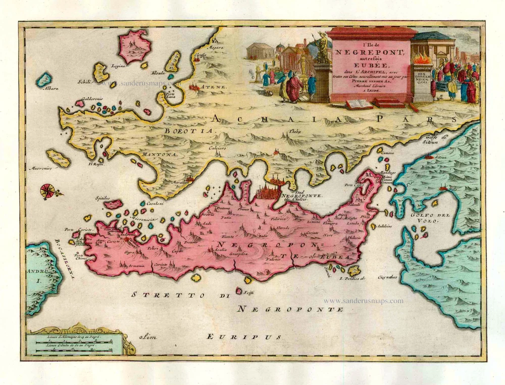
L'Ile de Negrepont, autrefois Eubée, dans l'Archipel, avec toutes ses Côtes. 1713
Euboea, by Pieter van der Aa.
[Item number: 26073]

Turquie en Europe. 1713
Greece, by P. Van der Aa.
[Item number: 26076]
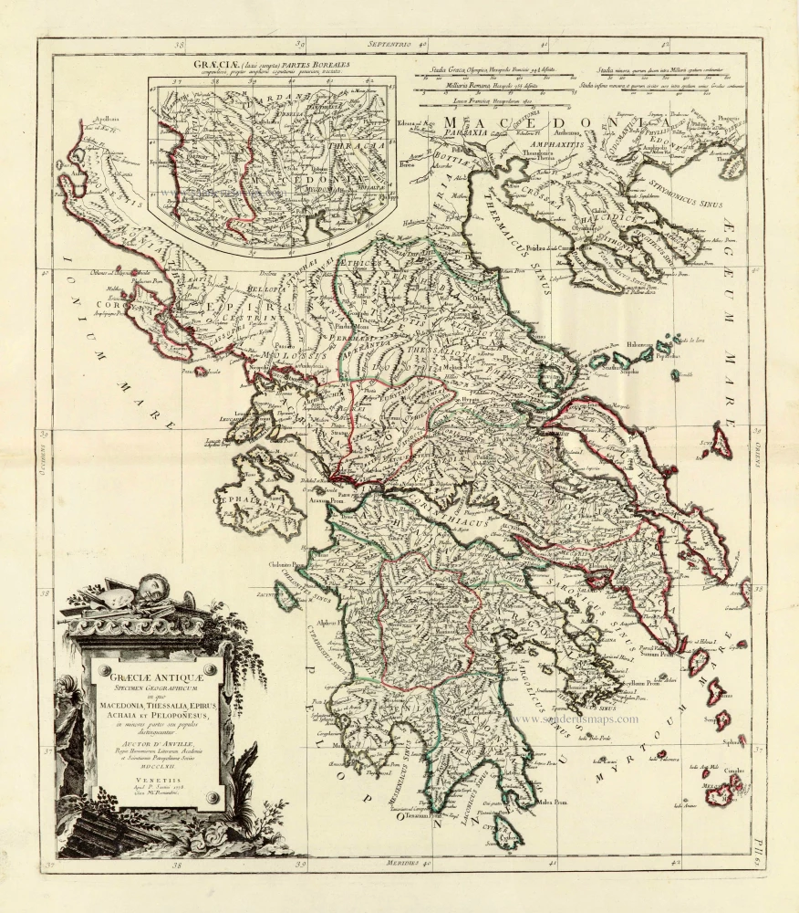
Graeciae Antiquae 1776-79
Ancient Greece, by Paolo Santini, after Jean-Baptiste Bourguignon d'Anville.
[Item number: 28108]
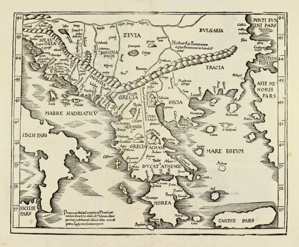
Ta Moder Bossinae, Serviae, Graeciae, et Sclavoniae. [From verso] 1525
Greece (Balkan), by Lorenz Fries after Martin Waldseemüller.
[Item number: 28117]
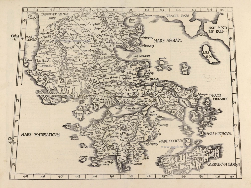
Tabula .X. Europae. [Title on verso] 1525
Ptolemy map of Greece by Lorenz Fries, after Martin Waldseemüller.
[Item number: 28196]
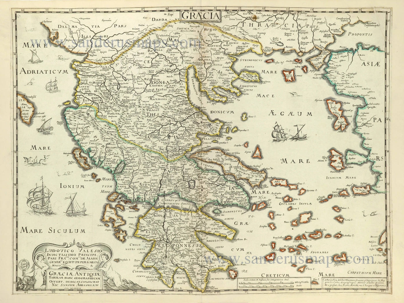
Graecia. 1658
Greece by Nicolas Sanson.
[Item number: 28498]
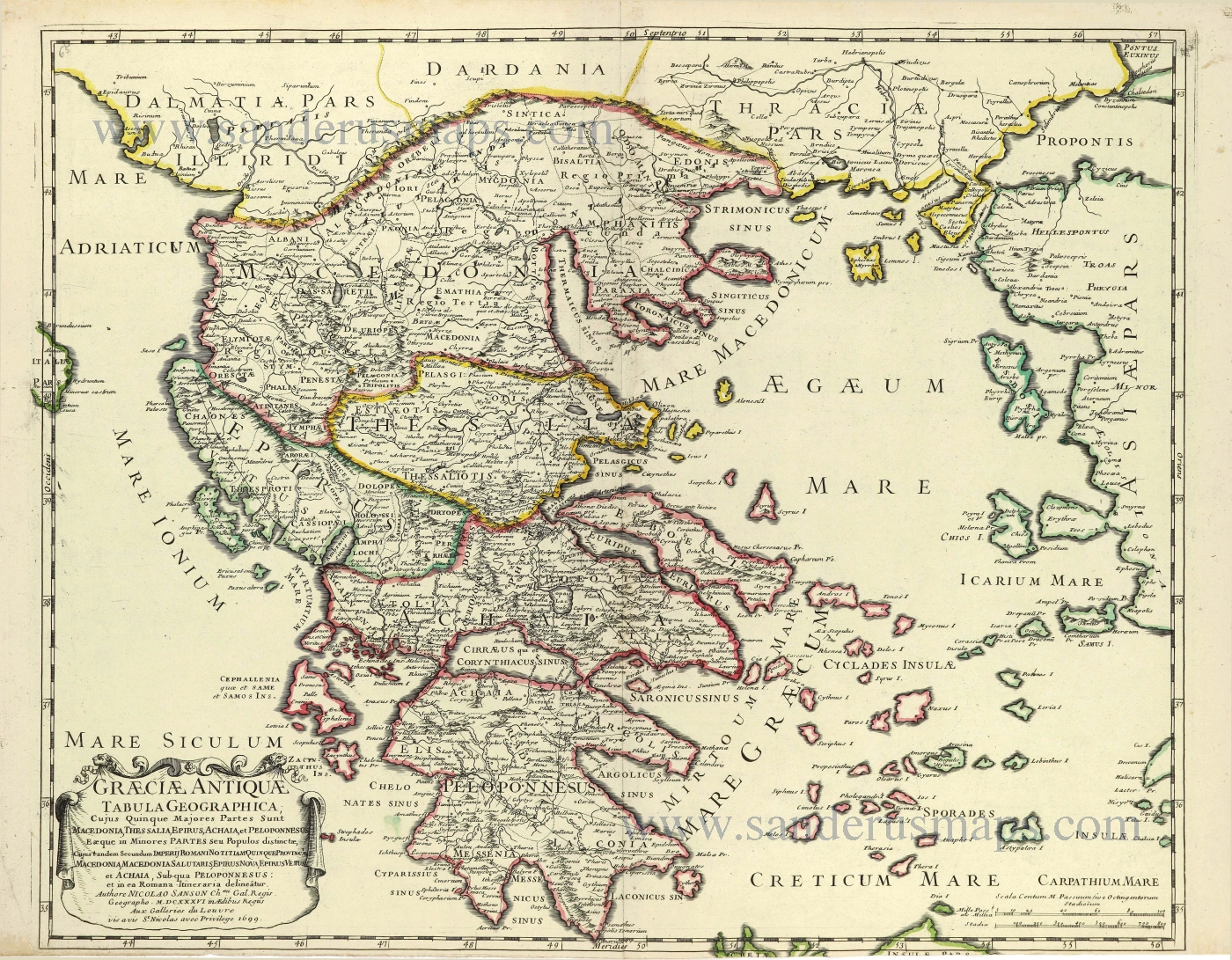
Graeciae Antique Tabula Geographica; 1699-1710
Greece by Nicolas & Guillaume Sanson.
[Item number: 28575]
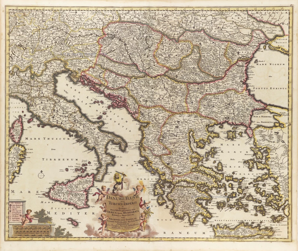
Danubii Fluvii Sive Turcici Imperii in Europa. c. 1705
Danube and European Ottoman Empire, by Frederick de Wit.
[Item number: 29279]
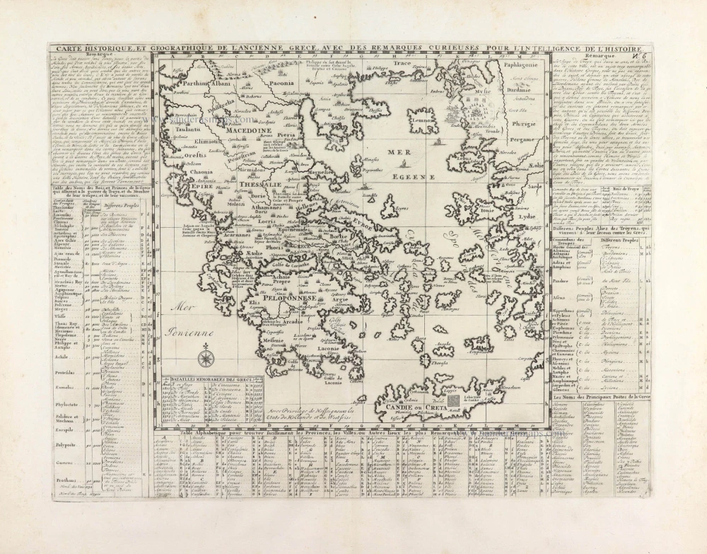
Carte Historique et Géographique de l'ancienne Grèce, avec les remarques Cursieuses pour l'intelligence de l'Histoire. 1713
Greece by Zacharias Châtelain.
[Item number: 29553]
Graecia - Graeciae Antiquae Tabulam. 1652
Ancient Greece by Nicolas Sanson.
[Item number: 29693]

Arcipelago - [Above map :] Descrittione dell'Arcipelago. 1590
Greece by Thomaso Porcacchi.
[Item number: 29769]