
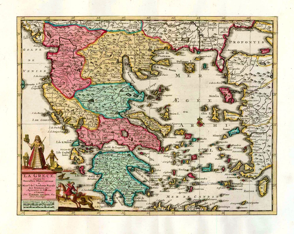
Greece, by Pieter van der Aa. 1713
Pieter van der Aa (Leiden, 1659-1733)
Pieter van der Aa was already in 1682 owner of a bookshop and auction house. During his life, he has published an enormous amount of printed material.
After 1700, van der Aa increasingly specialised in books on geography and travel.
He published composite atlases, a series of geographical descriptions of European countries, and some very spectacular works. Between 1706 and 1708 he published the Naauweurige versameling der gedenkwaardigste zee- en land-reysen, in 28 volumes.
Many of Van der Aa’s publications are richly illustrated with maps and plates. He took over many copperplates and prints from other publishers such as Carel Allard and Frederik De Wit. The composite atlases that appeared from his workshop contain a curious mixture of his own material, copies of maps from other publishers, and reprints made from old copper plates, now with his own imprint.
The Galérie agréable du monde, was completed in 1729, and comprised 66 parts, bound in 27 volumes. Van der Aa presented it as a good investment; after publication, the antiquarian value of the work would double, the more so since it was printed in a limited edition of only one hundred copies.
La Grece.
Item Number: 26075 Authenticity Guarantee
Category: Antique maps > Europe > Greece & Greek Islands
Old, antique map of Greece by P. Van der Aa.
Cartographer: I. Meurs
Date of the first edition: 1713
Date of this map: 1713
Copper engraving, printed on paper.
Size (not including margins): 22.5 x 29cm (8.8 x 11.3 inches)
Verso: Blank
Condition: Original coloured, trimmed to neatline and mounted on heavy paper at an early time.
Condition Rating: A
References: Van der Krogt 4, 46:.3; Zacharakis, #5.
From: Nouvel Atlas, très exact et fort commode pour toutes sortes de personnes, Contenant Les Principales cartes géographiques. Leiden, P. Van der Aa, n.d. (1713) (Koeman, Aa7).
Van der Aa maps are rarely found in original colouring.
Pieter van der Aa (Leiden, 1659-1733)
Pieter van der Aa was already in 1682 owner of a bookshop and auction house. During his life, he has published an enormous amount of printed material.
After 1700, van der Aa increasingly specialised in books on geography and travel.
He published composite atlases, a series of geographical descriptions of European countries, and some very spectacular works. Between 1706 and 1708 he published the Naauweurige versameling der gedenkwaardigste zee- en land-reysen, in 28 volumes.
Many of Van der Aa’s publications are richly illustrated with maps and plates. He took over many copperplates and prints from other publishers such as Carel Allard and Frederik De Wit. The composite atlases that appeared from his workshop contain a curious mixture of his own material, copies of maps from other publishers, and reprints made from old copper plates, now with his own imprint.
The Galérie agréable du monde, was completed in 1729, and comprised 66 parts, bound in 27 volumes. Van der Aa presented it as a good investment; after publication, the antiquarian value of the work would double, the more so since it was printed in a limited edition of only one hundred copies.
Related items
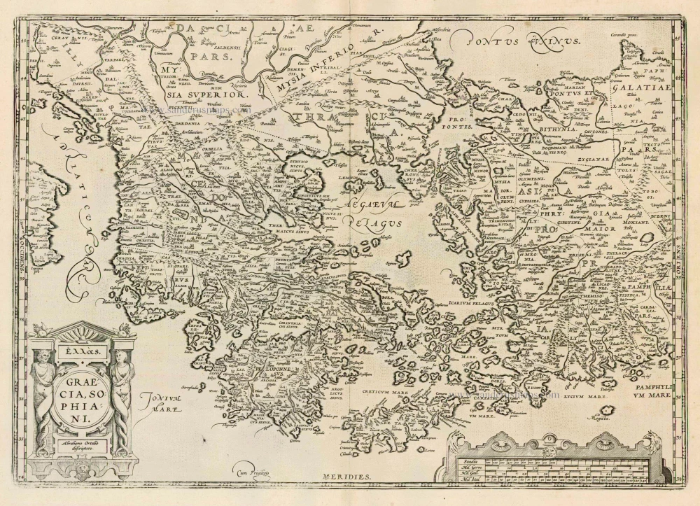
Parergon map
Graecia, Sophiani. 1624
Greece, by Ortelius A.
[Item number: 2050]
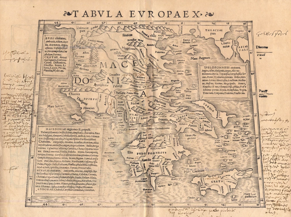
Tabula Europae X 1542
Greece, by Sebastian Münster.
[Item number: 14704]
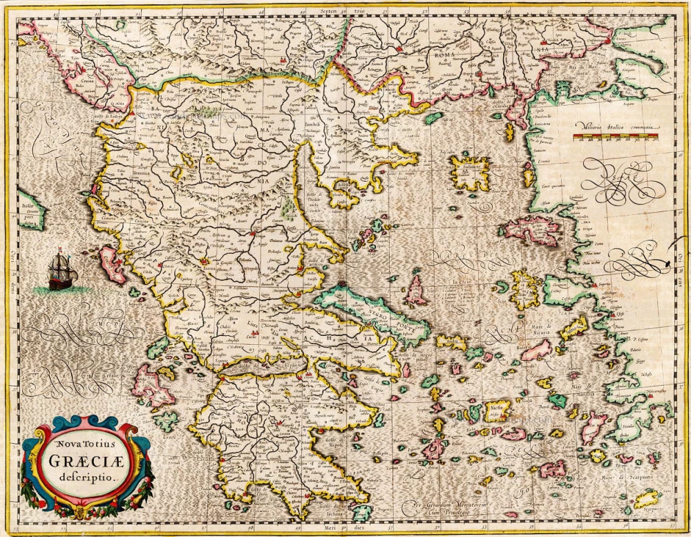
Nova Totius Graeciae descriptio. 1638
Greece, by J. Janssonius.
[Item number: 15357]
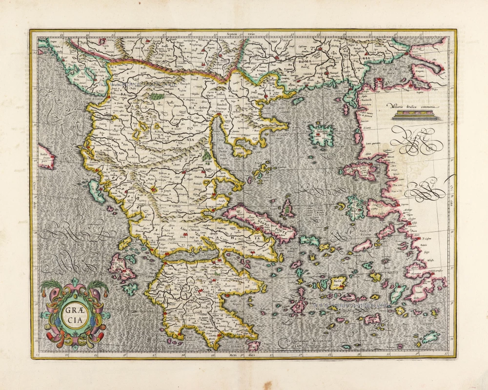
Graecia. 1633
Greece, by Gerard Mercator.
[Item number: 16999]

Graeciae Universae Secundum Hodiernum Situm Neoterica Descriptio. Jacobo Castaldo Pedemontano Autore. 1608
Greece, by Matthias Quad.
[Item number: 18856]
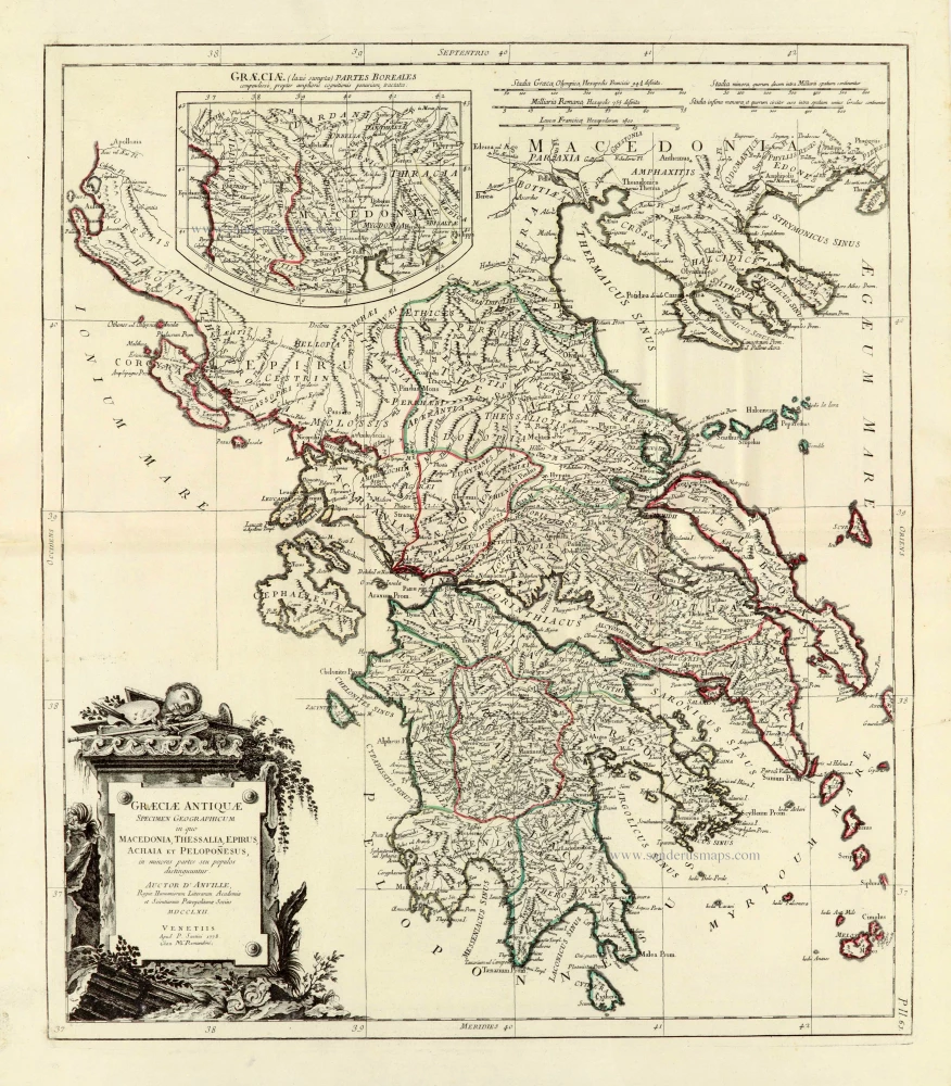
Graeciae Antiquae 1776-79
Ancient Greece, by Paolo Santini, after Jean-Baptiste Bourguignon d'Anville.
[Item number: 28108]
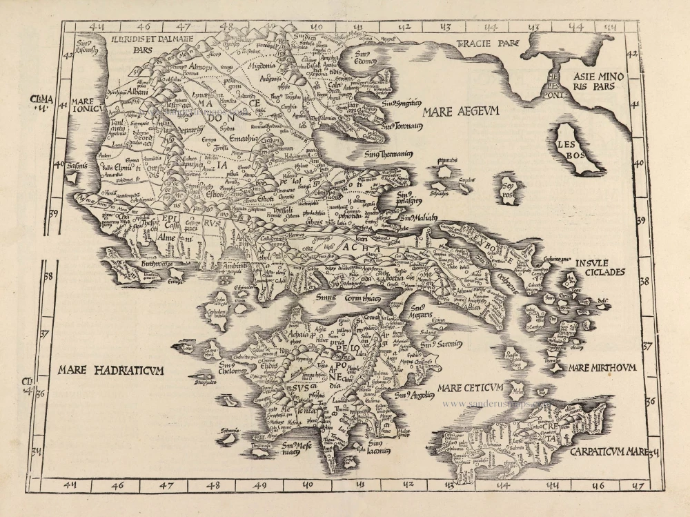
Tabula .X. Europae. [Title on verso] 1525
Ptolemy map of Greece by Lorenz Fries, after Martin Waldseemüller.
[Item number: 28196]
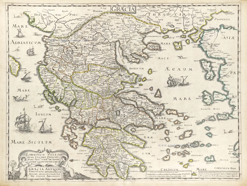
Graecia. 1658
Greece by Nicolas Sanson.
[Item number: 28498]
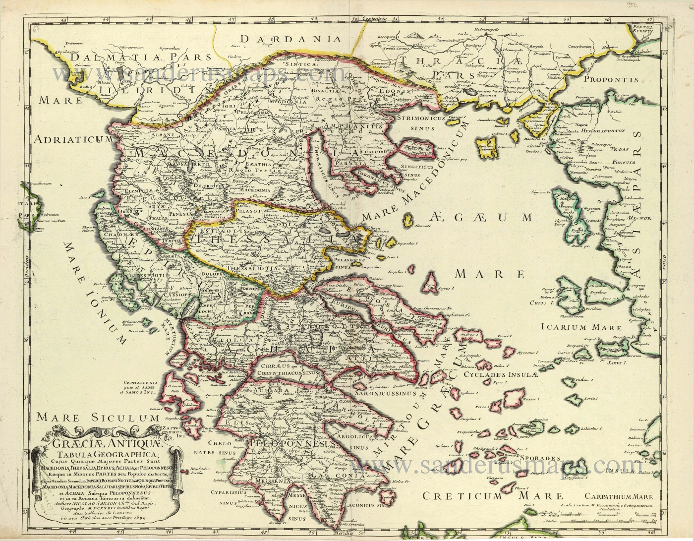
Graeciae Antique Tabula Geographica; 1699-1710
Greece by Nicolas & Guillaume Sanson.
[Item number: 28575]
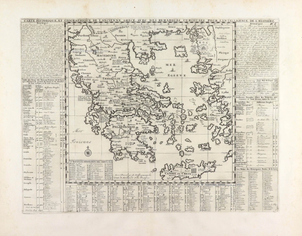
Carte Historique et Géographique de l'ancienne Grèce, avec les remarques Cursieuses pour l'intelligence de l'Histoire. 1713
Greece by Zacharias Châtelain.
[Item number: 29553]
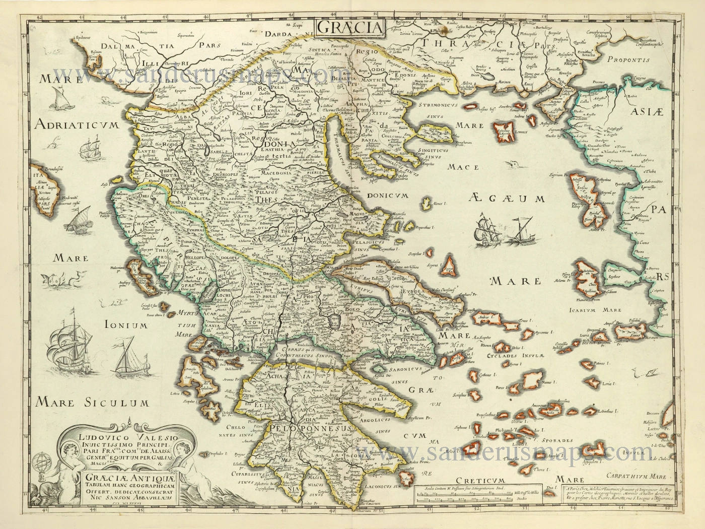
Graecia - Graeciae Antiquae Tabulam. 1652
Ancient Greece by Nicolas Sanson.
[Item number: 29693]

Arcipelago - [Above map :] Descrittione dell'Arcipelago. 1590
Greece by Thomaso Porcacchi.
[Item number: 29769]
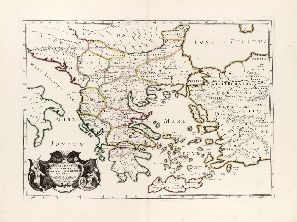
Antiquorum Illyrici Orientalis Episcopatuum Geographica Descriptio. 1679
Ancient Greece by Melchior Tavernier.
[Item number: 30036]
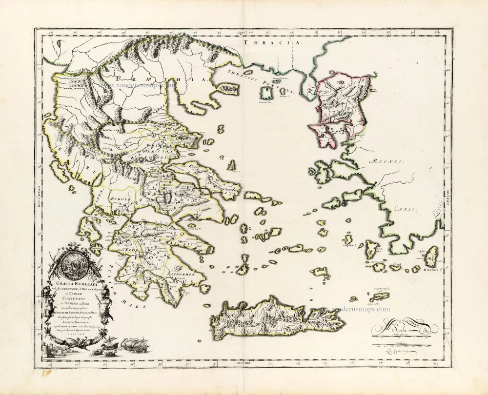
Graecia foederata sub Agamemnone, ob Helenae raptum in Troiam Coniurans ex Homero collecta. 1665
Ancient Greece by Guillaume Sanson.
[Item number: 30039]