
Bologna by Braun and Hogenberg. 1588-97
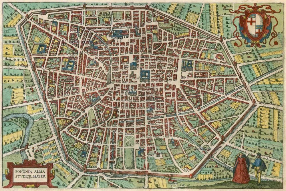
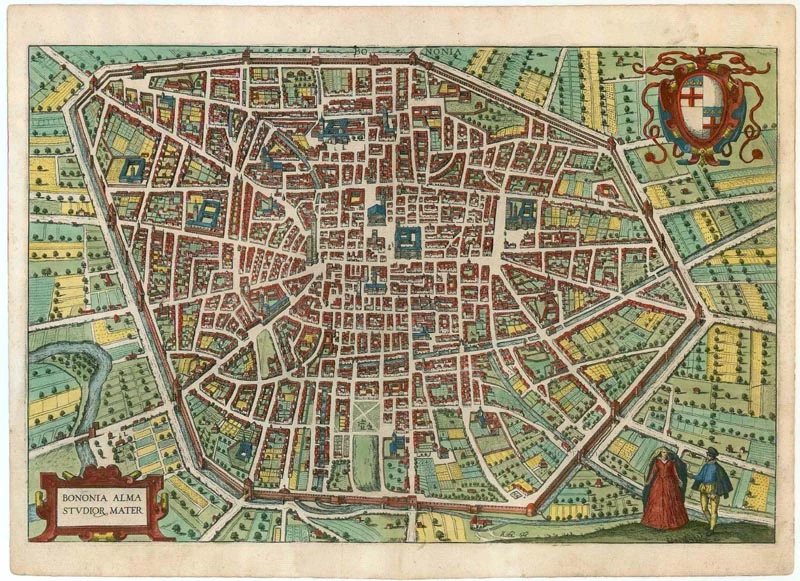
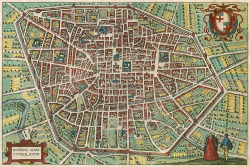

CARTOUCHE: Bologna, the seat of the sciences.
COMMENTARY BY BRAUN (on verso): "As for the other famous buildings, the town hall of Bologna is uncontestedly one of the most splendid buildings in all of Europe when one considers its beauty and size alone, without taking its age into account, especially since it is built of fired brick. In addition, there are many patrician houses here, which are handsome beyond compare and are described by Leander in his history of Bologna, for which there is not enough space here to do justice to them in a few words. The city boasts many tall towers, and the above-mentioned Asinelli tower is one of the highest in Europe. [...] Bologna was also presented with a particular adornment by Theodosius II. After his father had destroyed the city, he rebuilt it in AD 433 and granted important privileges to the university there."
Fortified with moats and walls, the city is seen from the north in this high bird's-eye view. At the centre, family towers, of which there were 180 in the Middle Ages, can still be seen. The largest building on the Pïazza Maggiore is the Palazzo Comunale, with its three inner courtyards intermittently under construction from 1287. The massive principal church, San Petronio, appears above the right. The vast university complex is discernible in a 16th-century palazzo between two arterial streets. Settled in prehistoric times, Bologna was one of the most important Roman cities from the 2nd century BC. Power struggles in the Middle Ages between the leading patrician families hurt the city, which was destroyed several times. From the early 12th century, Bologna was celebrated for its university and outstanding legal scholars. It rivalled Florence as a centre of humanism. (Taschen)
This plate was made after a copper engraving by Claudio Duchetti in 1582.
Braun G. & Hogenberg F. and the Civitates Orbis Terrarum.
The Civitates Orbis Terrarum, also known as the 'Braun & Hogenberg', is a six-volume town atlas and the most excellent book of town views and plans ever published: 363 engravings, sometimes beautifully coloured. It was one of the best-selling works in the last quarter of the 16th century. Georg Braun, a skilled writer, wrote the text accompanying the plans and views on the verso. Many plates were engraved after the original drawings of a professional artist, Joris Hoefnagel (1542-1600). The first volume was published in Latin in 1572 and the sixth in 1617. Frans Hogenberg, a talented engraver, created the tables for volumes I through IV, and Simon van den Neuwel made those for volumes V and VI. Other contributors were cartographers Daniel Freese and Heinrich Rantzau, who provided valuable geographical information. Works by Jacob van Deventer, Sebastian Münster, and Johannes Stumpf were also used as references. Translations appeared in German and French, making the atlas accessible to a broader audience.
Since its original publication of volume 1 in 1572, the Civitates Orbis Terrarum has left an indelible mark on the history of cartography. Seven more editions followed the first volume in 1575, 1577, 1582, 1588, 1593, 1599, and 1612. Vol.2, initially released in 1575, saw subsequent editions in 1597 and 1612. The subsequent volumes, each a treasure trove of historical insights, graced the world in 1581, 1588, 1593, 1599, and 1606. The German translation of the first volume, a testament to its widespread appeal, debuted in 1574, followed by the French edition in 1575.
Several printers were involved: Theodor Graminaeus, Heinrich von Aich, Gottfried von Kempen, Johannis Sinniger, Bertram Buchholtz, and Peter von Brachel, all of whom worked in Cologne.
Georg Braun (1541-1622)
Georg Braun, the author of the text accompanying the plans and views in the Civitates Orbis Terrarum, was born in Cologne in 1541. After his studies in Cologne, he entered the Jesuit Order as a novice, indicating his commitment to learning and intellectual pursuits. In 1561, he obtained his bachelor's degree; in 1562, he received his Magister Artium, further demonstrating his academic achievements. Although he left the Jesuit Order, he continued his studies in theology, gaining a licentiate in theology. His theological background likely influenced the content and tone of the text in the Civitates Orbis Terrarum, adding a unique perspective to the work.
Frans Hogenberg (1535-1590)
Frans Hogenberg was a Flemish and German painter, engraver, and mapmaker. He was born in Mechelen as the son of Nicolaas Hogenberg.
By the end of the 1560s, Frans Hogenberg was employed upon Abraham Ortelius's Theatrum Orbis Terrarum, published in 1570; he is named an engraver of numerous maps. In 1568, he was banned from Antwerp by the Duke of Alva and travelled to London, where he stayed a few years before emigrating to Cologne. He immediately embarked on his two most important works, the Civitates, published in 1572 and the Geschichtsblätter, which appeared in several series from 1569 until about 1587.
Thanks to large-scale projects like the Geschichtsblätter and the Civitates, Hogenberg's social circumstances improved with each passing year. He died as a wealthy man in Cologne in 1590.
Bononia Alma Studior Mater
Item Number: 22602 Authenticity Guarantee
Category: Antique maps > Europe > Italy - Cities
Antique map - bird's-eye view plan of Bologna by Braun and Hogenberg.
Title: Bononia Alma Studior Mater.
Date of the first edition: 1588.
Date of this map: 1588-97.
Copper engraving, printed on paper.
Size (not including margins): 330 x 498mm (12.99 x 19.61 inches).
Verso: Latin text.
Condition: Original coloured, excellent.
Condition Rating: A+.
From: Liber quartus Urbium Praecipuarum totius Mundi. Cologne, 1588-97. (Koeman, B&H4, Van der Krogt 4, 41:1.4)
CARTOUCHE: Bologna, the seat of the sciences.
COMMENTARY BY BRAUN (on verso): "As for the other famous buildings, the town hall of Bologna is uncontestedly one of the most splendid buildings in all of Europe when one considers its beauty and size alone, without taking its age into account, especially since it is built of fired brick. In addition, there are many patrician houses here, which are handsome beyond compare and are described by Leander in his history of Bologna, for which there is not enough space here to do justice to them in a few words. The city boasts many tall towers, and the above-mentioned Asinelli tower is one of the highest in Europe. [...] Bologna was also presented with a particular adornment by Theodosius II. After his father had destroyed the city, he rebuilt it in AD 433 and granted important privileges to the university there."
Fortified with moats and walls, the city is seen from the north in this high bird's-eye view. At the centre, family towers, of which there were 180 in the Middle Ages, can still be seen. The largest building on the Pïazza Maggiore is the Palazzo Comunale, with its three inner courtyards intermittently under construction from 1287. The massive principal church, San Petronio, appears above the right. The vast university complex is discernible in a 16th-century palazzo between two arterial streets. Settled in prehistoric times, Bologna was one of the most important Roman cities from the 2nd century BC. Power struggles in the Middle Ages between the leading patrician families hurt the city, which was destroyed several times. From the early 12th century, Bologna was celebrated for its university and outstanding legal scholars. It rivalled Florence as a centre of humanism. (Taschen)
This plate was made after a copper engraving by Claudio Duchetti in 1582.
Braun G. & Hogenberg F. and the Civitates Orbis Terrarum.
The Civitates Orbis Terrarum, also known as the 'Braun & Hogenberg', is a six-volume town atlas and the most excellent book of town views and plans ever published: 363 engravings, sometimes beautifully coloured. It was one of the best-selling works in the last quarter of the 16th century. Georg Braun, a skilled writer, wrote the text accompanying the plans and views on the verso. Many plates were engraved after the original drawings of a professional artist, Joris Hoefnagel (1542-1600). The first volume was published in Latin in 1572 and the sixth in 1617. Frans Hogenberg, a talented engraver, created the tables for volumes I through IV, and Simon van den Neuwel made those for volumes V and VI. Other contributors were cartographers Daniel Freese and Heinrich Rantzau, who provided valuable geographical information. Works by Jacob van Deventer, Sebastian Münster, and Johannes Stumpf were also used as references. Translations appeared in German and French, making the atlas accessible to a broader audience.
Since its original publication of volume 1 in 1572, the Civitates Orbis Terrarum has left an indelible mark on the history of cartography. Seven more editions followed the first volume in 1575, 1577, 1582, 1588, 1593, 1599, and 1612. Vol.2, initially released in 1575, saw subsequent editions in 1597 and 1612. The subsequent volumes, each a treasure trove of historical insights, graced the world in 1581, 1588, 1593, 1599, and 1606. The German translation of the first volume, a testament to its widespread appeal, debuted in 1574, followed by the French edition in 1575.
Several printers were involved: Theodor Graminaeus, Heinrich von Aich, Gottfried von Kempen, Johannis Sinniger, Bertram Buchholtz, and Peter von Brachel, all of whom worked in Cologne.
Georg Braun (1541-1622)
Georg Braun, the author of the text accompanying the plans and views in the Civitates Orbis Terrarum, was born in Cologne in 1541. After his studies in Cologne, he entered the Jesuit Order as a novice, indicating his commitment to learning and intellectual pursuits. In 1561, he obtained his bachelor's degree; in 1562, he received his Magister Artium, further demonstrating his academic achievements. Although he left the Jesuit Order, he continued his studies in theology, gaining a licentiate in theology. His theological background likely influenced the content and tone of the text in the Civitates Orbis Terrarum, adding a unique perspective to the work.
Frans Hogenberg (1535-1590)
Frans Hogenberg was a Flemish and German painter, engraver, and mapmaker. He was born in Mechelen as the son of Nicolaas Hogenberg.
By the end of the 1560s, Frans Hogenberg was employed upon Abraham Ortelius's Theatrum Orbis Terrarum, published in 1570; he is named an engraver of numerous maps. In 1568, he was banned from Antwerp by the Duke of Alva and travelled to London, where he stayed a few years before emigrating to Cologne. He immediately embarked on his two most important works, the Civitates, published in 1572 and the Geschichtsblätter, which appeared in several series from 1569 until about 1587.
Thanks to large-scale projects like the Geschichtsblätter and the Civitates, Hogenberg's social circumstances improved with each passing year. He died as a wealthy man in Cologne in 1590.
Related items
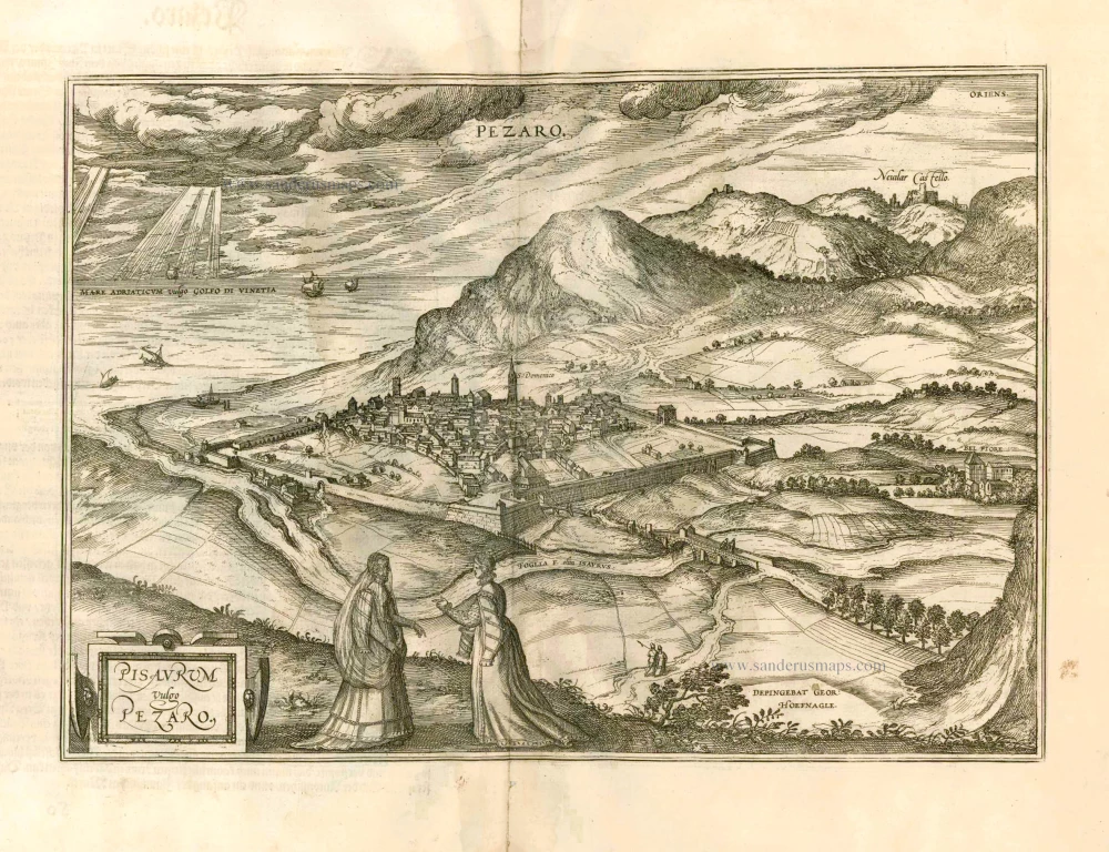
Pisaurum Vulgo Pezaro. 1582
Pesaro by Braun & Hogenberg.
[Item number: 14164]
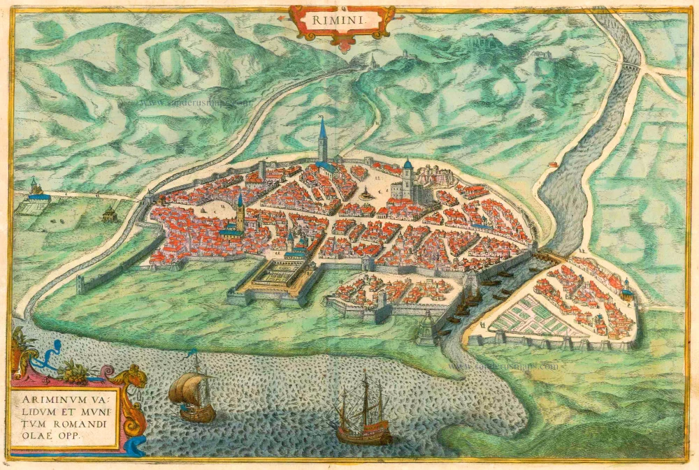
Rimini - Ariminum validum et munitum romandi olae opp. 1612
Rimini, by Braun & Hogenberg.
[Item number: 16426]
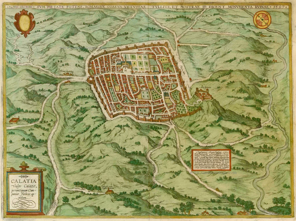
Calatia vulgo Caiazo, perantiquum Campaniae foelicis oppidum. 1596
Caiazzo, by Braun & Hogenberg.
[Item number: 22118]

Vetustiss. Ad Mare Thyrrhenum Terracinae Oppidum 1623
Terracina by Braun and Hogenberg after G. Hoefnagel.
[Item number: 23334]
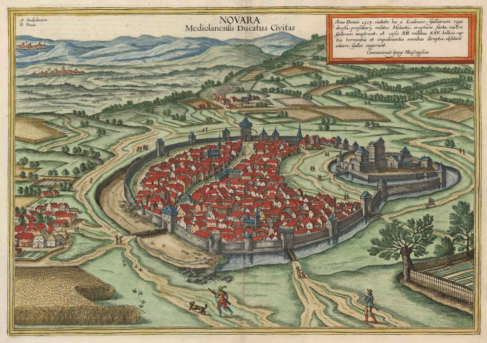
Novara Mediolanensis Ducatus Civitas c. 1625
Novara by Braun and Hogenberg.
[Item number: 24530]
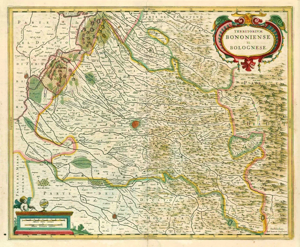
Territorium Bononiense Il Bolognese. 1641
Bologna, by Johannes Janssonius.
[Item number: 26398]