
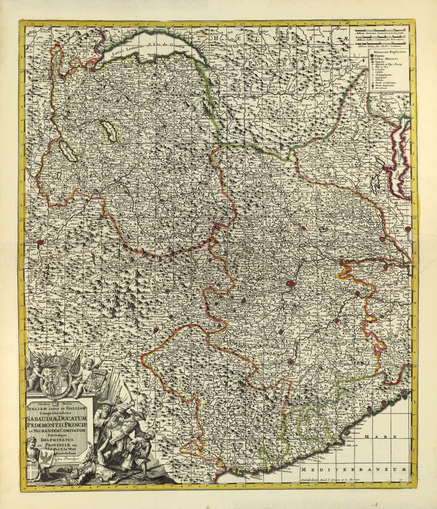
Duchy of Savoie and Piemonte by Frederick de Wit. c. 1690

Frederick de Wit (1630-1706)
The engraver and map-seller, Frederick de Wit, was born in Gouda (Netherlands) in 1630 as a son of Hendrick Fredericksz de Wit. Through his marriage with Maria van der Waag of Amsterdam in 1661, he obtained citizenship of the city where he had been working since 1648 and where he became one of the most famous engravers of maps of the second half of the 17th century. Although De Wit was a Catholic, which meant that he was not favoured at the time by the city council, he was awarded the honour of being listed as one of the "excellent citizens" on the roll of the city council in the years 1694-1704. However, his name was not written in the Guild of St. Luke book before 1664. At that time, he lived on the Kalverstraat "in de Witte Pascaert", where he stayed until his death in 1706. His earliest dates on maps engraved are 1659 (Regni Daniae) and 1660 (World map).
Frederick de Wit published several world atlases, a sea atlas, and an atlas of the Netherlands.
The dating of the maps is difficult. However, as a privilege was granted in 1689, the annotation 'cum privilegio' marks an edition after 1688.
Around 1700, Frederick de Wit entered the market with a town atlas. He produced two volumes with a total of 260 plans and views. Most were printed from plates used for Janssonius and Blaeu town atlases.
After he died in 1706, his widow continued the shop until 1709. The plates and stock of De Wit's atlas were sold to Covens & Mortier in 1710, who sold the atlas for an extended period.
Illustrissimo Celsissimoque Principi Carolo Emanueli D.G. Sabaudiae Duci, Pedemontii Principi etc. Hanc accuratam Status Sabaudici Tabulam in Ducatum Sabaudiae, Principatum Pedemontii, Comitatum Nicaeensem et caeteras Partes Minores exacte divisam.
Item Number: 28790 Authenticity Guarantee
Category: Antique maps > Europe > Italy
Old, antique map of the Duchy of Savoie and Piemonte by Frederick de Wit.
Title: Illustrissimo Celsissimoque Principi Carolo Emanueli D.G. Sabaudiae Duci, Pedemontii Principi etc. Hanc accuratam Status Sabaudici Tabulam in Ducatum Sabaudiae, Principatum Pedemontii, Comitatum Nicaeensem et caeteras Partes Minores exacte divisam.
D.D.D. Fredericus De Wit Amstelodami.
Amstelodami ex officina F. de Wit cum Priv. Potentiß. D.D. Ordinum Hollandiae et Westfrisiae.
and are to be sold at London by John Overton at the White Horse without Newgate.
Date: c. 1690.
Copper engraving, printed on paper.
Map size: 570 x 485mm (22.44 x 19.09 inches).
Sheet size: 630 x 535mm (24.8 x 21.06 inches).
Condition: Original coloured.
Condition Rating: A.
From: Atlas. Amsterdam, Frederick de Wit, after 1688. (Koeman, III p. 202, Wit16)
Frederick de Wit (1630-1706)
The engraver and map-seller, Frederick de Wit, was born in Gouda (Netherlands) in 1630 as a son of Hendrick Fredericksz de Wit. Through his marriage with Maria van der Waag of Amsterdam in 1661, he obtained citizenship of the city where he had been working since 1648 and where he became one of the most famous engravers of maps of the second half of the 17th century. Although De Wit was a Catholic, which meant that he was not favoured at the time by the city council, he was awarded the honour of being listed as one of the "excellent citizens" on the roll of the city council in the years 1694-1704. However, his name was not written in the Guild of St. Luke book before 1664. At that time, he lived on the Kalverstraat "in de Witte Pascaert", where he stayed until his death in 1706. His earliest dates on maps engraved are 1659 (Regni Daniae) and 1660 (World map).
Frederick de Wit published several world atlases, a sea atlas, and an atlas of the Netherlands.
The dating of the maps is difficult. However, as a privilege was granted in 1689, the annotation 'cum privilegio' marks an edition after 1688.
Around 1700, Frederick de Wit entered the market with a town atlas. He produced two volumes with a total of 260 plans and views. Most were printed from plates used for Janssonius and Blaeu town atlases.
After he died in 1706, his widow continued the shop until 1709. The plates and stock of De Wit's atlas were sold to Covens & Mortier in 1710, who sold the atlas for an extended period.
Related items
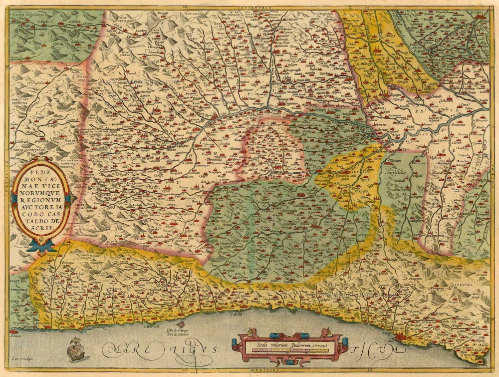
Pedemontanae Vicinorumquae Regionum. 1601
Piemonte, by Abraham Ortelius.
[Item number: 21259]
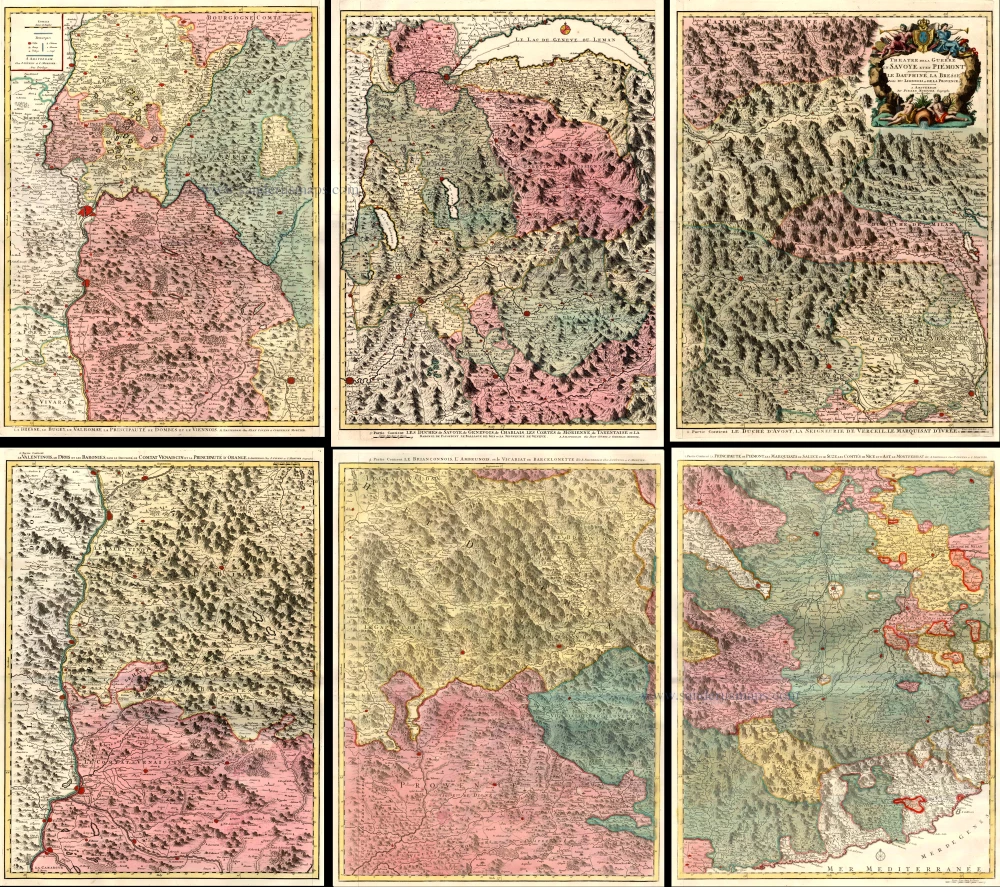
Theatre de la Guerre en Savoie et en Piémont - Le Dauphiné, La Bresse - Partie du Lionnois et de la Provence. 1721-41
Piedmont (Piemonte) and Savoy, by Covens & Mortier.
[Item number: 23544]
Status Belli Italiam inter et Galliam Comprehendens Sabaudiae Ducatum Pedemontii Princip. et Nicaeensem Comitatum Partemque Delphinatus et Provinciae etc. after 1721
Piemonte & Valle d'Aosta by Frederik de Wit, published by Covens & Mortier.
[Item number: 28324]
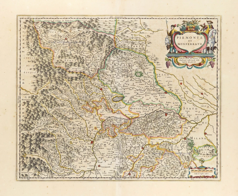
Piemonte et Monferrato. 1649-50
Piemonte, by Joan Blaeu.
[Item number: 28894]
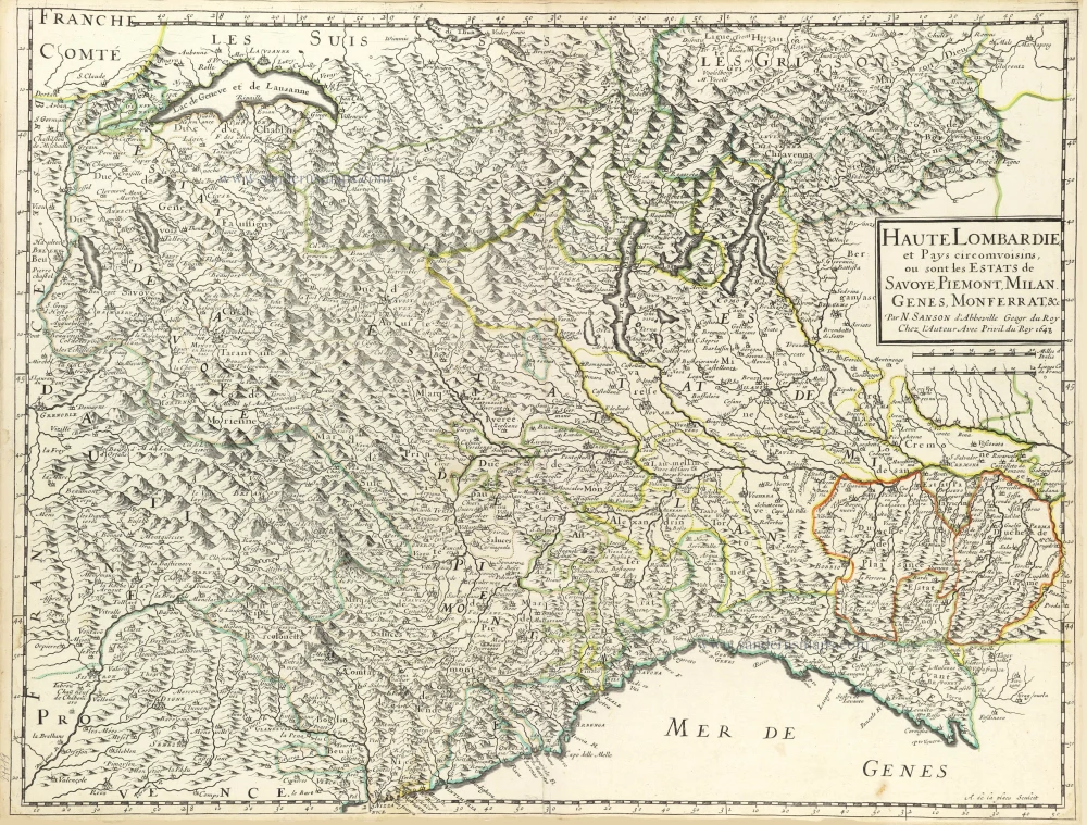
Haute Lombardie et Pays Circomvoisins, ou sont les Estats de Savoye, Piemont, Milan, Genes, Monferrat, &c. 1652
Northwest Italy by Nicolas Sanson.
[Item number: 29719]
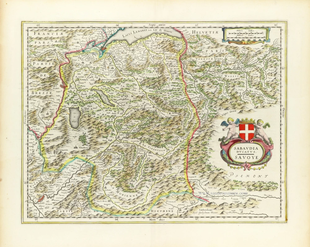
Sabaudia Ducatus. Savoye. 1640
Savoie, by Willem & Joan Blaeu.
[Item number: 30241]
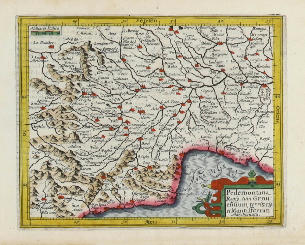
Pedemontana Regio, cum Genuensium territorio et Montifferrati Marchionatu. 1607
Piemonte, Liguria, and Monferrato by Gerard Mercator, published by Jodocus Hondius.
[Item number: 31458]

Piemont. 1618
Piemonte by Petrus Bertius, published by Jodocus Hondius II.
[Item number: 31635]
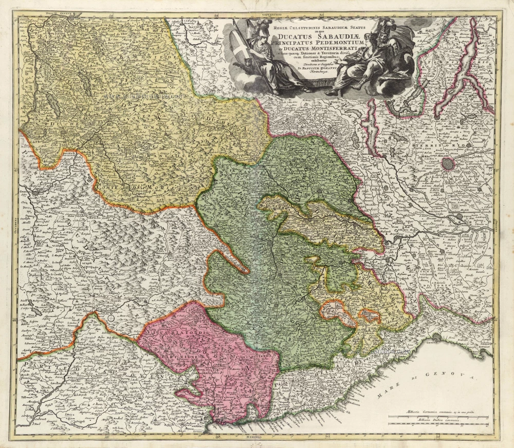
Regiae Celsitudinis Sabaudicae Status in quo Ducatus Sabaudiae Principatus Pedemontium et Ducatus Montisferrati in suas quasq. Ditiones & Territoria divisi cum finitimis Regionibus exhibentur. c. 1720
Piemonte, Liguria, and Monferrato, by J.B. Homann.
[Item number: 32276]